Toka Biv
Ruahine Forest Park
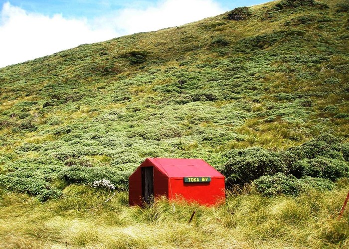
Toka Biv (2 bunk, tarn water) is a small dog-box bivvy on a small plateau on the Pohongina Valley side of the Ngamoko Range. The hut is the normal 2-mattress-on-the-floor, could sleep 3 if requried variety. It features a window, and is tall enough to sit up in, which is a bonus. The tarns providing the water contain a tasty mixture of peat and algae. A trickle of a stream also may be present dropping into the basin behind the hut.
The hut is 200m down from the Ngamoko ridgeline on the eastern side. A steep descent down a fragmented spur. The turnoff is marked with a cairn - and occasional cairns mark the route down - easy to get the wrong spur in the fog. The biv is tucked at the back of a basin off the north side of the spur.
There is mobile coverage - which implies there is probably a good view - if you can see anything through the mist!
|
Owner
|
Owner: DOC |
|---|---|
|
Category
|
Basic Hut/Bivvy |
|
Sleeps
|
Sleeps 2
2
|
|
Facilities
|
None |
|
Water supply
|
Tap or tank water |
|
Getting there
|
Limestone Rd: 9km, track/route. Knights track from Limestone Rd to Toka highpoint. Ridgeline route north 1km to peak above the biv, descend as above Leon Kinvig: 5km, track/route. Cut track climbs from Leon Kinvig to Toka Highpoint. Route from there to biv as above South: scrubby route sth along Ngamoko Range to pt1350, tracks descend to Ngamoko and Piripiri huts - 11km, 3-6hrs North: Ngamoko Range nth gives easy access to Heritage Hut, Top Gorge Hut and beyond |
|---|---|
|
Unlocked
|
This hut is unlocked and open to access. |
|
Bookings
|
No bookings — open access
No — open access
|
|
Altitude
|
1,340m |
|---|---|
|
Mobile phone coverage
|
No coverage |
|
Maps
|
NZTopo50-BL36
|
|
Link
|
www.doc.govt.nz/p...http://www.doc.govt.nz/parks-and-recreation/places-to-stay/backcountry-huts-by-region/manawatu-whanganui/manawatu/toka-bivvy/ |