Mangakirikiri Hut
Raukumara Forest Park
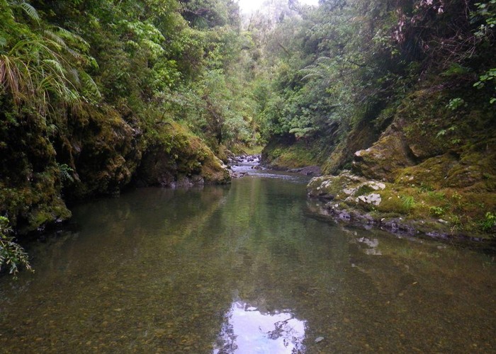
A tidy 6-bunk hut on a high terrace above the Motu - Mangakirikiri confluence. The hut has tank water and an open fire.
The hut is accessed by a short, steep track which climbs the south side of the Mangakirikiri stream 200m upstream from the confluence with the Motu. The track was well cut & marked (2014).
The main users are hunters and rafters on the Motu river. The latter put in at Motu or the Otipi roadend and raft to the coast. The hut is also one of the 2 remainuing huts on the east-west Raukumara traverse - the other being Oronui.
Companies in Motu / Opotiki advertise dropoffs up to Motu Road to the Pakihi track and may be willing to drop you to the Whitikau campsite, 12km off the main Motu Road, or at a worse case at the Motu Rd turnoff.
|
Owner
|
Owner: DOC |
|---|---|
|
Category
|
Basic Hut/Bivvy |
|
Sleeps
|
Sleeps 6
6
|
|
Facilities
|
Toilet, Open fireplace |
|
Water supply
|
Tap or tank water |
|
Getting there
|
Foot access from the west is either via Otipi road (1 day) down the Motu - big river, many deep crossings;or from the Takaputahi Road, up Pukeiahonoa Rd (foot/bike/ATV) dropping into the Mangamate down the ridge 500m NE of pt 630, and thence down the Mangakirikiri (1-2 days). Camping is available at the DOC Whitikau campsite at the junction of the Otiki Rd and Takaputahi Road. From the east it's a scrubby, hard 2-3 days to Oronui hut, and a further 4-8 hours to the Mt Hikurangi roaden |
|---|---|
|
Unlocked
|
This hut is unlocked and open to access. |
|
Bookings
|
No bookings — open access
No — open access
|
|
Altitude
|
200m |
|---|---|
|
Mobile phone coverage
|
No coverage |
|
Maps
|
NZTopo50-BE42
|
|
Link
|
www.doc.govt.nz/p...http://www.doc.govt.nz/parks-and-recreation/places-to-stay/backcountry-huts-by-region/east-coast/east-cape/mangakirikiri-hut/ |