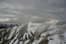
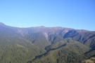
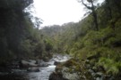
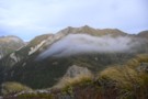
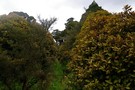
Nearby
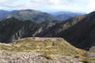
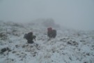
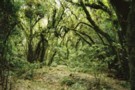
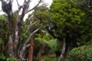
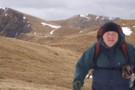
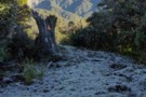
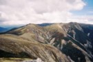
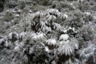
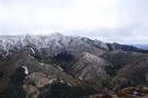
Walking the length of the Ruahines

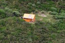
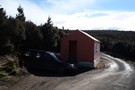
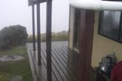
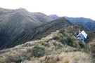
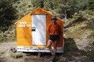
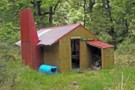
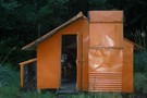
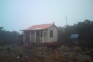
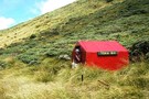
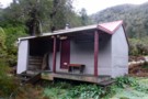
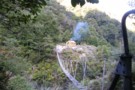
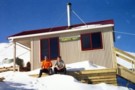
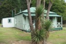
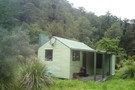
Comet Hut appears to have a new name...
Photograph
•
Distance: less than 100m away
Not sure of background story here. The start of a nationwide renaming program perhaps?
More ▶︎
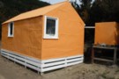
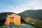
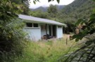
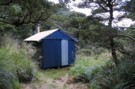
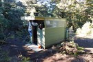
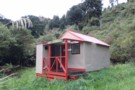
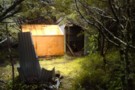
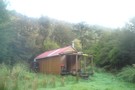
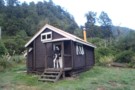
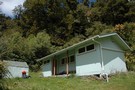
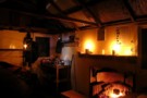
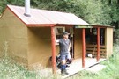
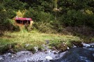
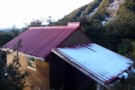
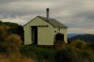
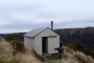
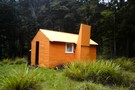
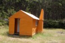
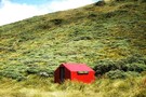
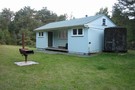
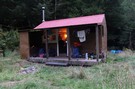
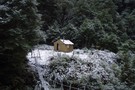
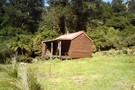
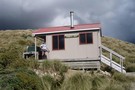
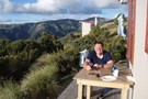
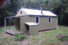
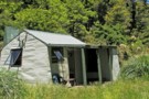
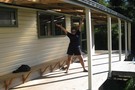
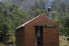
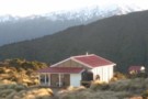
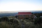
Comet Hut - still there and looking good.
Photograph
•
Distance: less than 100m away
Despite being slated for removal several years ago hut seems well maintained and in good order. Change of heart from ...
More ▶︎
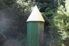
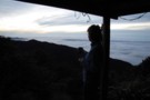
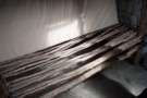
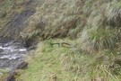
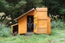
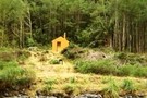
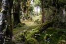
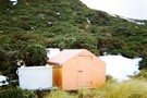
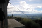
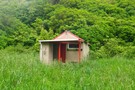
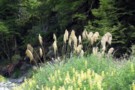
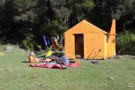
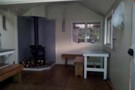
Waikamaka Hut loo
Photograph
•
Distance: less than 100m away
Waikamaka hut has a loo like a rocket ship.
More ▶︎
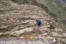
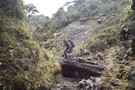
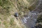
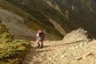
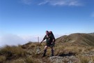
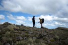
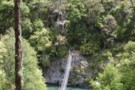
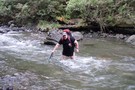
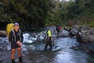
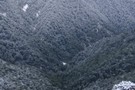
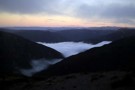
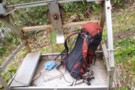
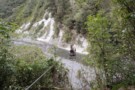
Ikawetea Forks Hut to Sentry Box Roadend: Musings on hypothermia.
Article
•
Distance: less than 100m away
A trip up Apias Creek in less than ideal conditions. Day two of a weekend trip to Ruahine Corner and ...
More ▶︎
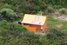
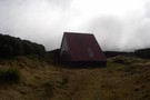
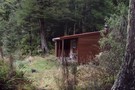
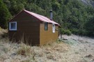
Aranga Hut
Photograph
•
Distance: less than 100m away
A handy hut on the saddle at the head of the Makaroro in the Ruahines. Slowly falling down, stranded 100m ...
More ▶︎
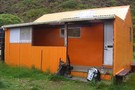
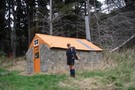
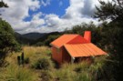
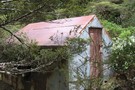
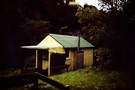
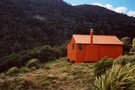
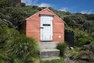
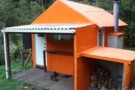
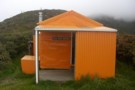
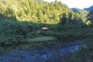
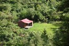
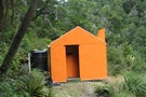
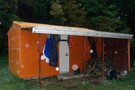
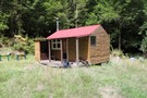
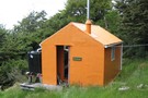
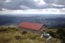
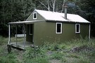
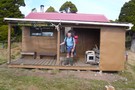
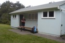
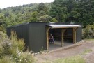
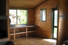
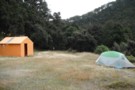
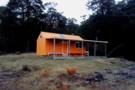
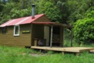
Cattle Creek Hut
Photograph
•
Distance: less than 100m away
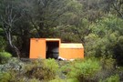
A tidy 8 bunk platform style hut fully resplendent in its updated NZFS orange colour scheme.
More ▶︎
Cattle Creek Hut
Photograph
•
Distance: less than 100m away
A tidy 8 bunk platform style hut resplendent in forest service orange.
More ▶︎
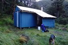
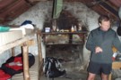
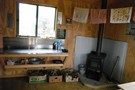
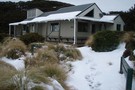
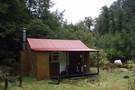
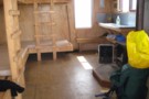
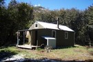
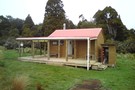
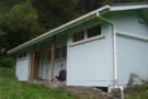
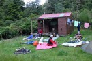
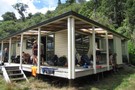
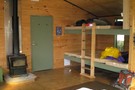
Waikamaka Hut ( Herataunga TC)
Photograph
•
Distance: less than 100m away
A good tidy hut with Approx 8 bunk accommodation, enclosed wood burner and good wood supply available. A welcome refuge ...
More ▶︎
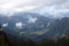
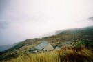
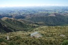
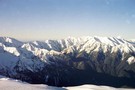
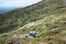
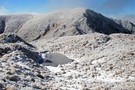
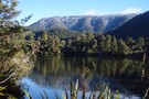
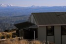
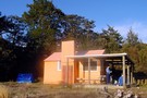
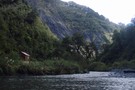
Kuripapango
Photograph
•
Distance: less than 100m away
Kuripapango and the Ngaruroro from Kuripapango Peak
More ▶︎
Comet Hut
Hut
•
Basic Hut/Bivvy (DOC). Capacity: 4.
•
Distance: less than 100m away
Comet hut (sleeps 4, tank water) is classed as a basic hut / biv, but is comfortable and of a ...
More ▶︎
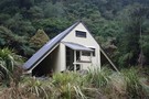
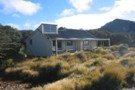
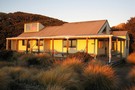
Diane's Hut
Hut
•
Standard Hut (DOC). Capacity: 6.
•
Distance: less than 100m away
Diane's Hut (sleeps 6, wood burning stove, firewood available in locality, stream water) is located on a stony bench just ...
More ▶︎
Aranga Hut (dilapidated)
Hut
•
Private hut (PVT). Capacity: 4.
•
Distance: less than 100m away
The Aranga hut (4 beds, wood-burning stove, stream water) is located on the saddle at the head of the Makaroro ...
More ▶︎
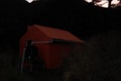
Sparrowhawk Bivouac
Photograph
•
Distance: less than 100m away
Sparrowhawk Bivouac (Ruahine Ranges)
More ▶︎
Sparrowhawk Bivouac
Hut
•
Basic Hut/Bivvy (DOC). Capacity: 3.
•
Distance: less than 100m away
Sparrowhawk Biviouac (sleeps 2-3, tank water) is one of the nicer biv's in the Ruahine's. The biv is a typical ...
More ▶︎
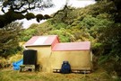
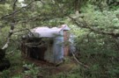
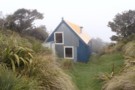
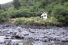
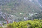
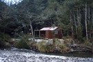
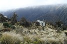
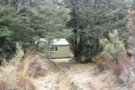
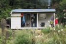
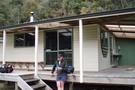
Waikamaka Hut
Photograph
•
Distance: less than 100m away
Waikamaka Hut (It's there in the trees, honest - surely someone's got a better picture to replace this!)
More ▶︎
Waikamaka Hut
Hut
•
Standard Hut (Heretaunga Tramping Club). Capacity: 8.
•
Distance: less than 100m away
Waikamaka Hut sits in the headwaters of the Waikamaka Stream, 1.5km below the Waipawa Saddle, and below the pyramidical Te ...
More ▶︎
Cattle Creek Hut
Hut
•
Standard Hut (DOC). Capacity: 6.
•
Distance: less than 100m away
On river flats in the upper reaches of Cattle Creek lies Cattle Creek Hut (6 beds, wood-burning stove, firewood available ...
More ▶︎
Keretaki Hut
Photograph
•
Distance: less than 100m away
Keretaki Hut / Kiritaki Hut / Seamac Motel
More ▶︎
Kiritaki Hut / Keretaki Hut / Seamac Motel
Hut
•
Standard Hut (DOC). Capacity: 6.
•
Distance: less than 100m away
Kiritaki hut (6 beds, wood-burning stove, firewood available in locality, roof-fed water tank). One of many excellent huts in the ...
More ▶︎
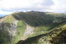
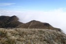
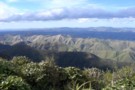
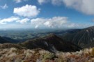
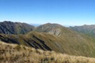
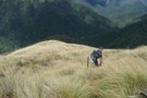
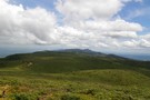
Ruahine Spectacular
Article
•
Distance: less than 100m away
A Committing Bush and Tops Trip in the Northern Ruahines, with Stunning Scenic Rewards
More ▶︎
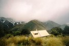
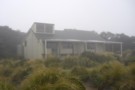
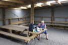
Longview Hut
Hut
•
Serviced Hut (DOC). Capacity: 12.
•
Distance: less than 100m away
Longview hut (12 bed platforms, firewood, tank water,non-flush toilet) provided a view of nothing but mist on the occasion I ...
More ▶︎
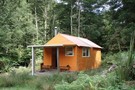
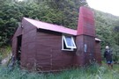
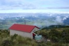
Comet Hut
Photograph
•
Distance: less than 100m away
A small hut in the Southern Kawekas. Can be driven to, but is also on the track between Shutes Hut ...
More ▶︎
Keretaki Hut Via Loveday road / Rapawapawai Stream
Article
•
Distance: less than 100m away
Day Trip To Keretaki Hut
More ▶︎
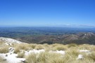
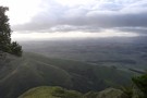
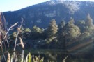
Longview track
Photograph
•
Distance: less than 100m away
Looking out towards napier/coast around about 1280 metres asl along the daphne-longview track just before the last climb to the ...
More ▶︎
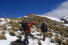
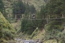
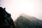
Trampers on route to Longview Hut
Photograph
•
Distance: less than 100m away
Photo is taken just out of the bush from the daphne hut track,Was a very windy day though. Snow up ...
More ▶︎
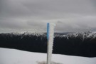
Longview Track
Photograph
•
Distance: less than 100m away
Very exposed track that can become dangerous, at the very least, unpleasant due to high winds.
More ▶︎
Longview Track
Photograph
•
Distance: less than 100m away
Very exposed track that can become dangerous, at the very least, unpleasant due to high winds.
More ▶︎
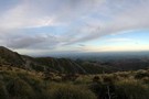
Longview Pano
Photograph
•
Distance: less than 100m away
Panorama of Central Hawke's Bay from Longview Hut.
More ▶︎
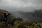
View from longview hut-or lack of
Photograph
•
Distance: less than 100m away
View from the hut with about50-150m visibility, really bad weather for tramping but still enjoyable
More ▶︎
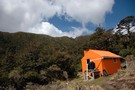
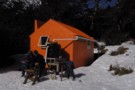
Shutes Hut
Hut
•
Standard Hut (DOC). Capacity: 4.
•
Distance: less than 100m away
Set in a large clearing, this 1920’s stone-built hut is the best of the Ruahines. Built and inhabited for many ...
More ▶︎
Longview Makaretu Awatere Circuit
Track
•
2 days. Easy/medium. Loop track.
•
Distance: less than 100m away
2 Day circuit in the Ruahine Forrest park from Moorcock Saddle 3 huts some tops bush and river travel.
More ▶︎
Longview Howletts Daphne Circuit
GPX file
•
Distance: less than 100m away
A circuit in the Ruahines taking in three well equiped huts
More ▶︎
Longview Howletts Daphne Circuit
Track
•
2 – 3 days. Medium. Loop track with a road section.
•
Distance: less than 100m away
A circuit in the Ruahines taking in three well equiped huts
More ▶︎
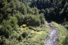
Waikamaka Bivouac 2012
Photograph
•
Distance: less than 100m away
February 2012. Still dry inside but very overgrown and gloomy
More ▶︎
Waipawa Forks Hut 2012
Photograph
•
Distance: less than 100m away
Situated on a River Terrace about 50 minutes walk from the road end. No track, river travel all the way
More ▶︎
Top Maropea Hut 2012
Photograph
•
Distance: less than 100m away
Nice old four bunk hut in the Ruahine Range. In very good condition. About 25 minutes down a good track ...
More ▶︎
Waikamaka Hut 2012
Photograph
•
Distance: less than 100m away
Waikamaka Hut on a small terrace above the Waikamaka River 40 minutes downstream from Waipawa Saddle
More ▶︎
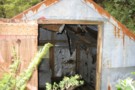
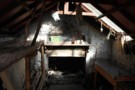
Waikamaka Bivouac interior
Photograph
•
Distance: less than 100m away
Waikamaka biv interior. taken 02-Jan-2010
More ▶︎
Waikamaka Bivouac
Photograph
•
Distance: less than 100m away
Waikamaka biv. Taken 02-Jan-2010
More ▶︎
Waikamaka Bivouac (derelict)
Hut
•
Basic Hut/Bivvy (DOC).
•
Distance: less than 100m away
Waikamaka biv is derelict and overgrown, but it is still standing. Just across the stream from Waikamaka Hut.
More ▶︎
Sparrowhawk Biv Barlow hut loop
Track
•
2 – 3 days. Medium. Loop track.
•
Distance: 115m away
A good solid Ruahine climb to a 3 person biv well situated with a great views, Tops travel then a ...
More ▶︎
Howletts Hut
Hut
•
Standard Hut (Heretaunga Tramping Club). Capacity: 8.
•
Distance: 238m away
Howletts Hut is located below the 1682m Taumatamekura Peak and the last rest heading north before the infamous Sawtooth Ridge.
The ...
More ▶︎
Waiting for the sunrise at Howletts
Photograph
•
Distance: 238m away
Howletts is ideally positioned to view the sun rising over Hawkes Bay
More ▶︎
Howletts Hut
Photograph
•
Distance: 238m away
Howletts is in an idylic spot, in a hollow on the ridge top
More ▶︎
Howletts Hut
Photograph
•
Distance: 239m away
Tucked into a fold in the ridge a welcome site on a bad day
More ▶︎
Standfield Hut
Hut
•
Standard Hut (DOC). Capacity: 6.
•
Distance: 572m away
Standfield (Stanfield) Hut (6 bunks, woodburing stove, tank water, firewood available in locality) is a comfortable riverside hut on the ...
More ▶︎
Shute's Hut (Ruahines) interior
Photograph
•
Distance: 583m away
In great condition for an old girl, and the hut books make fascinating reading. Shame about the assorted rubbish left ...
More ▶︎
Manuka Slat beds
Photograph
•
Distance: 583m away
Inside shutes hut these are just about more comfortable than the new age slat beds we use today
More ▶︎
Shutes Hut
Photograph
•
Distance: 583m away
4 bunk hut in the Northern Ruahines built in 1920 comming up to 100 years old very comfy Manuka poled ...
More ▶︎
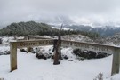
Waipawa Saddle
Photograph
•
Distance: 585m away
Moments before stepping over the lip onto the saddle and getting hammered by 100km/hr gusts very unpleasant
More ▶︎
Southern Crossing of the Ruahines
Track
•
2 – 3 days. Easy/medium. One way.
•
Distance: 647m away
A track and river route crossing of the Lower Ruahine Forest park
More ▶︎
Cattle Creek Hut
Photograph
•
Distance: 647m away
Cattle Creek hut in the southern Ruahine Range
More ▶︎
The route from Longview Hut to Howletts Hut
Photograph
•
Distance: 756m away
This photo is taken from Daphne Ridge on the way to Howletts Hut. Longview is behind the higest point on ...
More ▶︎
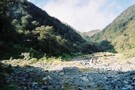
Pohangina scramble
Photograph
•
Distance: 774m away
Not deep enough to swim but small enough to to give you the idea you can avoid getting wet feet. ...
More ▶︎
Upper Pohangina
Photograph
•
Distance: 811m away
River route to Mid Pohangina Hut from Cattle creek
More ▶︎
Taruarau Valley
Photograph
•
Distance: 823m away
Taruarau Valley from pt 1183 (ridgeline above Diane's Hut)
More ▶︎
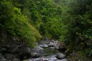
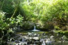
The beautiful Taruarau River
Photograph
•
Distance: 892m away
The Taruarau runs through the northern Ruahines before joining the Ngaruroro. Great fishing, swimming and the clearest river water I've ...
More ▶︎
Walking the length of the Ruahines
Track
•
10 – 25 days. Medium/hard. One way.
•
Distance: 1.1km away
A 10+ day trip down to backbone of the Ruahine Range from Wharite (Palmerston Sth) to the Napier Taihape (Gentle ...
More ▶︎
Circumnavigating the Kiwi
Track
•
4 – 5 days. Medium. Loop track.
•
Distance: 1.1km away
About a 4 day trip in the Kaweka Forest Park. I called it this because the route travels around the ...
More ▶︎
Circumnavigating the Kiwi
GPX file
•
Distance: 1.1km away
A 4-5 day trip in the Kaweka Forest Park
More ▶︎
Ruahine Forest Park
Place
•
Conservation Park. 932.60km2.
•
Distance: 1.4km away
A slim park running along the Ruahine Range from the Manawatu Gorge to the southernmost point of Kaweka Forest Park ...
More ▶︎
Madpom's Kaimanawa-Kaweka NS traverse
GPX file
•
Distance: 1.5km away
A north-south trip down the main range through the Kaimanawas and Kawekas.
See the associated route guide (track) for details
This GPX ...
More ▶︎
Kaweka Main Ridge - NS Traverse
GPX file
•
Distance: 1.5km away
A north-south trip down the main divide through the Kaimanawas and Kawekas.
The east-west watershed actually runs through private land to ...
More ▶︎
The Kaweka Main Range - a NS traverse
Track
•
5 – 10 days. Easy/medium. One way.
•
Distance: 1.8km away
A Kaimanawa-Kaweka traverse from Rangataiki to the Gentle Annie (Napier-Taihape) summit.
5-10 days of good track-tramping through the beech & manuka ...
More ▶︎
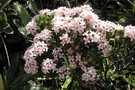
2 ice flowers
Photograph
•
Distance: 1.8km away
2 ice flowers near Mt Te Atuaoparapara. April 2009
More ▶︎

3 ice flowers
Photograph
•
Distance: 1.9km away
3 ice flowers near Mt Te Atuaoparapara. April 2009.
More ▶︎
Te Atuaoparapara, Ruahine Forest Park
Photograph
•
Distance: 1.9km away
What a day for tops travel! There are views over the Hikurangi Range, the Waikamaka Valley, Hawkers Bay, the Tongariro ...
More ▶︎
Te Atuaoparapara
Photograph
•
Distance: 1.9km away
Te Atuaoparapara, south ridge (Ruahine Ranges)
More ▶︎
Te Atuaoparapara
Photograph
•
Distance: 1.9km away
Ruahine Range. The Highest point between Sunrise Hut and Waipawa Saddle (1687 metres)The route between the saddle and Sunrise Hut ...
More ▶︎
Longview to Howletts
Photograph
•
Distance: 1.9km away
Moments before the clag decended the rest of the weekend was wet and misty
More ▶︎
Long view to Howletts
Photograph
•
Distance: 2.0km away
Started out a beautiful day but rapidly closed in Looking North towards the Daphne Howletts turn off
More ▶︎
Daphne Hut
Hut
•
Standard Hut (DOC). Capacity: 8.
•
Distance: 2.0km away
8 to 10 person hut.It's in a stunning spot where the northern and western branches of the Tukituki converge. Note, ...
More ▶︎
Daphne Hut
Photograph
•
Distance: 2.0km away
Showing Daphne Hut's location on the river bank
More ▶︎
Mid Pohangina Hut
Hut
•
Standard Hut (DOC). Capacity: 4.
•
Distance: 2.1km away
Mid Pohangina Hut sits on a pleasant grassy flat just above the Pohangina River north of its confluence with Cattle ...
More ▶︎
Mid Pohangina Hut 15 minutes
Photograph
•
Distance: 2.1km away
After wandering down the river you arrive cold and wet (on an off day) at this sign which points at ...
More ▶︎
Pohangina crossing
Photograph
•
Distance: 2.2km away
Swing bridge below Mid Pohangina hut and the start of the ubiquitous sidle track. Why does the term sidle always ...
More ▶︎
Top Gorge Hut
Hut
•
Basic Hut/Bivvy (DOC). Capacity: 2.
•
Distance: 2.4km away
Top Gorge Hut (2 bunks, 3 mattresses, open fire with ample firewood available, river water) is a small, basic hut ...
More ▶︎
Top Gorge hut
Photograph
•
Distance: 2.4km away
Top Gorge Hut in the head waters of the Pohangina River in the Ruahines. Can be reached from Longview Hut, ...
More ▶︎
Forks Hut, Diggers Hut and Te Ekaou Hut access
Track
•
1 – 2 days. Medium. One way.
•
Distance: 2.5km away
Several public and private access routes into these huts in the southern Ruahines and suggested round and though trips.
More ▶︎
Mistake Biv
Photograph
•
Distance: 2.5km away
A dog-box bivvy in the upper reaches of Apias Creek, with a full-size shelter attached. No longer DoC owned, and ...
More ▶︎
Mistake Biv
Hut
•
Basic Hut/Bivvy (PVT). Capacity: 4.
•
Distance: 2.5km away
A dog-box biv above grassy flats in the upper Apias Creek, with a full height shelter tacked on. The biv ...
More ▶︎
Waterfall Hut (Ruahine Ranges)
Hut
•
Standard Hut (DOC). Capacity: 6.
•
Distance: 2.6km away
An older hut in the head of the Kawhatau River in the heart of the Ruahines
More ▶︎
Waterfall Hut
Photograph
•
Distance: 2.6km away
An older hut in the heart of the Ruahines at the head of the Kawhatau River
More ▶︎
Awatere Hut
Hut
•
Basic Hut/Bivvy (DOC). Capacity: 3.
•
Distance: 2.6km away
Nice 3 bunk hutin the ruahines built in 1957, nice ridge travel over from Kashmir rd.
Mainly used by hunters.
Also 10 ...
More ▶︎
Tarn Bivvy
Hut
•
Basic Hut/Bivvy (DOC). Capacity: 2.
•
Distance: 2.9km away
Tarn biv, near the tarn on Black Ridge.
More ▶︎
Gold Creek Hut
Hut
•
Basic Hut/Bivvy (DOC). Capacity: 4.
•
Distance: 2.9km away
Gold Creek Hut
More ▶︎
Kuripapango to Poronui
Track
•
5 – 6 days. Medium/hard. One way.
•
Distance: 3.0km away
This 5 day walk goes from the Southern Kawekas up over Mt Meany and through the Harkness Valley to the ...
More ▶︎
Rockslide Hut rockslide!
Photograph
•
Distance: 3.0km away
The rockslide giving Rockslide Hut it's name. Apias creek, Ruahine Ranges.
More ▶︎
Rockslide Hut / Biv
Photograph
•
Distance: 3.0km away
A 2-bed dog-box bivvy with a two-bunk shelter tacked on. Interesting spot on gravel flats in Apias Creek, opposite the ...
More ▶︎
Rockslide Hut / Biv
Hut
•
Basic Hut/Bivvy (DOC). Capacity: 4.
•
Distance: 3.0km away
A dog-box bivvy on Apias creek, with a full height shelter tacked on the door gable-end wall. The bivvy sleeps ...
More ▶︎
Takapari A Frame Hut / Travers Hut / Traverse Hut (Ruahine)
Hut
•
Basic Hut/Bivvy (DOC). Capacity: 6.
•
Distance: 3.1km away
Travers (6 bunks, no matresses) is a very basic A-frame hut on the Takapari Road in the Southern Ruahines. There's ...
More ▶︎
Copper Mine Loop Track
Track
•
Easy/medium. Loop track.
•
Distance: 3.2km away
Loop track just out the back of Woodville.
2 hours all up with a 350 metre climb/decent through farm, bush and ...
More ▶︎
Sawtooth Ridge
Photograph
•
Distance: 3.2km away
Looking south along the Sawtooth towards Tiraha (Ruahine Ranges)
More ▶︎
Duck Pond Hut
Photograph
•
Distance: 3.3km away
A private 2-bunk hut, tucked into the headwaters of the Ngamoko catchment in the Ruahines.
More ▶︎
Duck Pond Hut
Hut
•
Private hut (PVT). Capacity: 2.
•
Distance: 3.3km away
A 2-bunk hut on private land, just outside the Ruahine forest park. This hut lies in the upper reaches of ...
More ▶︎
Stanfield Hut
Photograph
•
Distance: 3.3km away
nice 2 and a half hour walk via holmes ridge, Perfect for a little day trip or for a 1st ...
More ▶︎
A-Frame track looking down onto holmes ridge
Photograph
•
Distance: 3.3km away
Steady climb for about 2 and a half hours, views definitly paid off, weather isnt to good to be on ...
More ▶︎
A-Frame hut (Traverse hut)
Photograph
•
Distance: 3.3km away
Very basic htu, was a very welcome sight to see takapari road after a pretty much 2 and a half ...
More ▶︎
Looking down onto Cattle Creek Hut from ridge
Photograph
•
Distance: 3.3km away
Looking down onto the hut from the ridge just above it, quite a steep drop strait down to hut, easier ...
More ▶︎
Ngamoko Hut
Photograph
•
Distance: 3.4km away
A pleasant 6-bunk hut looking across the mid reaches of the Pohongina to a large grassy slip. An hour or ...
More ▶︎
Ngamoko Hut
Hut
•
Standard Hut (DOC). Capacity: 6.
•
Distance: 3.4km away
Ngamoko Hut (6 bunks, stove, river water) is a pleasent hut located in scrub on the western bank of the ...
More ▶︎
Kiritaki Hut
Photograph
•
Distance: 3.7km away
Nice little hut, 2 hours or so rock hopping then turn left up the hill for 40 mins, good walk ...
More ▶︎
Maropea Forks Hut
Hut
•
Standard Hut (DOC). Capacity: 6.
•
Distance: 3.7km away
Maropea Forks Hut is a typical forestry style 6-bunker on flats near the forks of the North and South Maropea ...
More ▶︎
Barlow Hut
Hut
•
Standard Hut (DOC). Capacity: 8.
•
Distance: 3.8km away
In 1983, Barrie Atkins of the NZFS had $50000 to spend in three weeks. So he purchased two huts from ...
More ▶︎

Green and Golden Bell frog?
Photograph
•
Distance: 3.8km away
Found a small colony outside the front door of Barlow hut Ruahine forest park
More ▶︎
Waipawa Forks Hut
Hut
•
Standard Hut (DOC). Capacity: 12.
•
Distance: 3.8km away
A bit rough considering it's a newer DOC hut - vandalism in the bunkroom on the right. 5 minutes up ...
More ▶︎

Benifits of Walking Friday
Photograph
•
Distance: 3.8km away
When there's nobody else around you can use as many mattresses as it takes to get a comfy bed.
More ▶︎
Waipawa Forks Hut
Photograph
•
Distance: 3.8km away
Nestled above the river on the true right side, this hut is a bit rough and has been vandalized to ...
More ▶︎
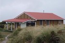
Sunrise Hut
Hut
•
Serviced Hut (DOC). Capacity: 20.
•
Distance: 3.8km away
Popular day trip and weekend hut with great views over Hawkes Bay. Located in Buttercup Hollow on the Ruahine Range. ...
More ▶︎
Sunrise hut
Photograph
•
Distance: 3.8km away
Sunrise hut in the early morning sun. April 2009
More ▶︎
Barlow Hut
Photograph
•
Distance: 3.8km away
Barlow Hut is in the Ruahine Range about 2 - 3 hrs up the Makaroro River from the Waikamaka roadend
More ▶︎
Shelter from the storm; a celebration of the six-bunker
Photograph
•
Distance: 3.9km away
Where would be without all those NZ Forest Service six-bunk huts in the Tararuas & Ruahines? Maybe that deer explosion ...
More ▶︎
Sunrise from Sunrise hut
Photograph
•
Distance: 3.9km away
Sunrise from Sunrise hut. taken April 2009
More ▶︎
Buttercup Hollow, Ruahine FP
Photograph
•
Distance: 4.0km away
Looking north up the range from Sunrise Hut on a crisp Winter's day.
More ▶︎
Purity Mangaweka Kelly Night loop
Track
•
2 days. Medium. Loop track.
•
Distance: 4.0km away
Two huts, open tops, fantastic views on a fine day typical Ruahine travel.
More ▶︎
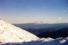
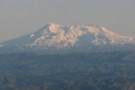
Armstrong saddle
Photograph
•
Distance: 4.1km away
Armstrong saddle with Ruapehu in the background. April 2009.
More ▶︎
Rangiwahia Triangle Iron gate Alice Nash Memorial
GPX file
•
Distance: 4.1km away
Typical Ruahine weekend tramp 4 huts, open tops,river travel and some great bush.
More ▶︎
A Freezing River Trip in Winter
Photograph
•
Distance: 4.2km away
A winters's river trip in the Ruahines - attempting to keep the circulation going!
More ▶︎
Triangle Hut
Hut
•
Basic Hut/Bivvy (DOC). Capacity: 6.
•
Distance: 4.2km away
6 bunk hut in the Oroua river catchment. On a raised terrace above the river. Water from the river, pot ...
More ▶︎
Triangle Hut
Photograph
•
Distance: 4.2km away
6 bunk hut situated on a bench above the river very pleasant
More ▶︎
Triangle Hut
Photograph
•
Distance: 4.2km away
Triangle Hut in The Western Ruahine Range. can be reached via Rangiwahia Hut and over the tops. River route downstream ...
More ▶︎

Ruahines, looking West from Armstrong Saddle
Photograph
•
Distance: 4.3km away
Great views to be had from the saddle at any time of year (assuming you can get to it, the ...
More ▶︎
Top Maropea Hut
Photograph
•
Distance: 4.3km away
Lovely old NZFS hut built for deer cullers in the 60s or 70s, it has been repainted, however remains cold ...
More ▶︎
Top Maropea Hut
Photograph
•
Distance: 4.3km away
Top maropea hut August 2009 on fine day after recent snow
More ▶︎
Top Maropea Hut at dawn
Photograph
•
Distance: 4.3km away
Very tidy little 4 bunk historic hut in Ruahine FP. Excellent camping spot just a few metres away.
More ▶︎
Rangiwahia Triangle Iron gate Alice Nash Memorial
Track
•
2 – 3 days. Medium. One way.
•
Distance: 4.4km away
Typical Ruahine weekend tramp 4 huts, open tops,river travel and some great bush.
More ▶︎


Armstrong Saddle
Photograph
•
Distance: 4.4km away
Above Armstrong Saddle looking down onto Sunrise Hut and Central Hawke's Bay. Even Tomato Hill by Havelock North can be ...
More ▶︎
Armstrong Saddle
Photograph
•
Distance: 4.4km away
Above Armstrong Saddle looking down onto Sunrise Hut and Central Hawke's Bay. Even Tomato Hill by Havelock North can be ...
More ▶︎
Cordyline Banksii ?
Photograph
•
Distance: 4.4km away
In Damp bush there where a couple of impressive specimens is the discription right
More ▶︎
Turn off to Pourangaki
Photograph
•
Distance: 4.4km away
Signpost marking the spur down to Pourangaki Hut off the ridge running SE from Mangaweka (Ruahine Ranges).
More ▶︎
Tarn - Armstrong Saddle, Ruahine FP
Photograph
•
Distance: 4.5km away
A beautiful walk (when the wind permits) across Armstrong Saddle takes you down to Top Maropea or over the tops ...
More ▶︎
Piripiri Hut
Hut
•
Basic Hut/Bivvy (DOC). Capacity: 2.
•
Distance: 4.5km away
Piripiri Hut is a comfortably spacious 2-bunk hut in the western Ruahine Ranges. Water is from a small creek 20m ...
More ▶︎
Top Maropea Hut
Hut
•
Standard Hut (DOC). Capacity: 4.
•
Distance: 4.5km away
A gem of an old NZFS hut built in the 60s or 70s for deer cullers, this hut is a ...
More ▶︎
Wakelings Hut
Hut
•
Standard Hut (DOC). Capacity: 4.
•
Distance: 4.6km away
Wakelings Hut sits in beech forest on the south side of the Wakamaka River in the Ruahine Ranges. It's an ...
More ▶︎
Wakelings Hut
Photograph
•
Distance: 4.6km away
Wakelings Hut, by the Waikamaka River, Ruahine Ranges
More ▶︎
Sentry Box Hut
Hut
•
Standard Hut (DOC). Capacity: 4.
•
Distance: 4.6km away
A typical Ruahine 4-bunker forestry hut 5 mins form the bushedge on the Mangleton Road. The short walk from the ...
More ▶︎
Broken Ridge, Ruahine
Photograph
•
Distance: 4.7km away
On Broken Ridge, above Hinerua hut. taken Dec 2009
More ▶︎
Walking out.
Photograph
•
Distance: 4.7km away
This is taken the day after my first photo i added. If we walked in that day I dont think ...
More ▶︎
McKinnon Hut
Hut
•
Standard Hut (DOC). Capacity: 6.
•
Distance: 4.7km away
Start with a novelty cable car ride across the river and then straight in to a hard uphill slog. Track ...
More ▶︎
McKinnon Hut
Photograph
•
Distance: 4.7km away
Perched at 1400m on the side of the Hikurangi Range in the northern Ruahines, McKinnon Hut is a 1960's 6 ...
More ▶︎
Parks Peak hut
Photograph
•
Distance: 4.8km away
A tidy new hut on the ridgeline above the Makaroro and Ohara Valleys, overlooking the Hawkes Bay and Guarvas. A ...
More ▶︎
Parks Peak Hut
Hut
•
Standard Hut (DOC). Capacity: 6.
•
Distance: 4.8km away
Parks Peak Hut (6 bunk, stove, tank water) is a new DoC hut on a cleared flat on the ridgeline ...
More ▶︎
Track from Takapari Rd down to Diggers Hut
Photograph
•
Distance: 5.0km away
Track from Takapari Rd down to Diggers Hut, southern Ruahines. About 5km down this broad but sometimes boggy track, then ...
More ▶︎
Ikawetea Forks Hut
Hut
•
Standard Hut (DOC). Capacity: 7.
•
Distance: 5.0km away
Ikawetea (Ikawatea) Forks Hut has become one of the remotest huts in the Ruahines. Land to its east has been ...
More ▶︎
Swing Bridge near Cameron Hut
Photograph
•
Distance: 5.0km away
I would almost say this swing bridge is to no where considering the lack of maintenance of the track on ...
More ▶︎
Cameron Hut (Kaweka)
Hut
•
Standard Hut (DOC). Capacity: 6.
•
Distance: 5.0km away
Typical orange hut found in the Kaweka Ranges. 6 bunks with a fireplace and water from the river. Lots of ...
More ▶︎

Ruahine tops on a fine day Magic
Photograph
•
Distance: 5.1km away
Sign post to Mckinnon with a perfect backdrop
More ▶︎
And then it turned cold and windy
Photograph
•
Distance: 5.1km away
Above Mckinnon hut perfect one day and blustery the next the only thing the photo dosnt show is the horizontal ...
More ▶︎
Smiths Stream Hut
Hut
•
Standard Hut (DOC). Capacity: 4.
•
Distance: 5.1km away
On Smith Stream, Ruahine Forest Park. This is a good example of NZFS 4-bunk hut in original condition.
More ▶︎
Towards Mangaweka Trig in July
Photograph
•
Distance: 5.2km away
Late July 2008, photo taken from Wooden Peg, had planned to walk out to the trig but I was not ...
More ▶︎
Happy Daze Hut
Hut
•
Basic Hut/Bivvy (DOC). Capacity: 4.
•
Distance: 5.4km away
Small, with ample camping. Seems to be some dispute over naming, with Happi Daze being (somewhat forcefully) pushed by some.
More ▶︎
Ruahine Frost
Photograph
•
Distance: 5.4km away
Heading down the track to Pourangaki River, looking across to the Pourangaki tops. Heavy frost on the ground all day ...
More ▶︎
Descent to Triangle Hut
Photograph
•
Distance: 5.4km away
About 800 metrs the descent into pleasant bush is welcome on a hot day
More ▶︎
Toka Biv
Photograph
•
Distance: 5.6km away
Toka Biv in the Ruahine Range Between Toka and Tunopo. Used to be called Ngamoko Biv. It sits on a ...
More ▶︎
Toka Biv
Photograph
•
Distance: 5.6km away
Toka Biv in the Ruahine Range Between Toka and Tunopo. Used to be called Ngamoko Biv. It sits on a ...
More ▶︎
Ikawetea Forks Hut
Photograph
•
Distance: 5.6km away
Ikawetea Forks Hut. A remote 6-bunk hut in the northern Ruahines on Apias Creek. Interesting creek travel upriver, and diverse ...
More ▶︎
Toka Biv
Hut
•
Basic Hut/Bivvy (DOC). Capacity: 2.
•
Distance: 5.6km away
Toka Biv (2 bunk, tarn water) is a small dog-box bivvy on a small plateau on the Pohongina Valley side ...
More ▶︎
Upper Makaroro Hut, Eastern Ruahine Forest Park
Photograph
•
Distance: 5.6km away
This hut has 4 bunks and can be reached via Makaroro Roadend track via Parks Peak Hut (15km, 5-10 hrs) ...
More ▶︎
Upper Makaroro Hut
Hut
•
Standard Hut (DOC). Capacity: 4.
•
Distance: 5.6km away
Upper Makaroro Hut (sleeps 4, wood-burning stove), lies adjacent to the Makaroro River in its upper reaches. It is a ...
More ▶︎
Makaretu Hut
Photograph
•
Distance: 5.8km away
8 bunk hut on the southern branch of the Makaretu river
More ▶︎
Makaretu
Hut
•
Standard Hut (DOC). Capacity: 8.
•
Distance: 5.8km away
8 Bunk hut Southern branch Makaretuu river. Visit as part of a circuit from moorcock saddle including Longview and Awatere ...
More ▶︎
Triple X hut
Hut
•
Standard Hut (DOC). Capacity: 12.
•
Distance: 5.8km away
Nice hut for camps, families etc
Only 15 min from road end with alot of space for camping etc
More ▶︎
Kawekas in spring!
Photograph
•
Distance: 5.9km away
The Cameron Hut / Kuripapango - Kiwi Saddle junction in late November 2006
More ▶︎
Iron Gate Hut
Photograph
•
Distance: 6.0km away
A damp morning at Iron Gate Hut in the Western Ruahine Ranges.
More ▶︎
Iron Gate Hut
Photograph
•
Distance: 6.0km away
Iron Gate Hut on the Oroua River western Ruahines
More ▶︎
Great inventions
Photograph
•
Distance: 6.1km away
I wouldnt be without my walking pole anymore
More ▶︎
The long drop...
Photograph
•
Distance: 6.1km away
....down the spur to Cameron Hut. Clearing the hut sits in can be seen (just!) adjacent to the rapids. Climbing ...
More ▶︎
Longview hut on ridge
Photograph
•
Distance: 6.2km away
The small white dot on the rige is longview hut from the ridge on the way to awatere hut
More ▶︎
Awatere Hut
Photograph
•
Distance: 6.2km away
Nice walk over ridge from kashmir road end, road is abit dodgy now that they have run a grader over ...
More ▶︎
Pourangaki Hut
Photograph
•
Distance: 6.2km away
Last day of Autumn, with frost on the ground all day.
Cosy little hut in the Ruahines, although the toilet can ...
More ▶︎
Ruahine Bush
Photograph
•
Distance: 6.2km away
Just below the bush line from Wooden peg to Kelly Knight Hut.
More ▶︎
Pourangaki River
Photograph
•
Distance: 6.3km away
Heading down the Pourangaki River from the swingbridge to Kelly Knight Hut. This was one of the first of 44 ...
More ▶︎
Crow Hut from the Mokai Patea
Photograph
•
Distance: 6.5km away
Crow Hut from the bushline ascending to the Mokai Patea. Ruahine Ranges
More ▶︎
Crow Hut (Ruahine Ranges)
Photograph
•
Distance: 6.5km away
Crow Hut on the Kawhatau River in the western Ruahine Ranges.
More ▶︎
Crow Hut (Ruahine Ranges)
Hut
•
Standard Hut (DOC). Capacity: 6.
•
Distance: 6.5km away
Crow Hut (6 bunk, Pioneer stove, river water) is a standard forestry hut in the western Ruahine Ranges. The hut ...
More ▶︎
Pourangaki Hut
Photograph
•
Distance: 6.6km away
Pourangaki Hut from the Porangaki - Hikurangi track
More ▶︎
Pourangaki Hut
Photograph
•
Distance: 6.6km away
A warm sheltered hut in the upper Pourangaki valley in the Ruahine Ranges
More ▶︎
Pourangaki Hut
Hut
•
Standard Hut (DOC). Capacity: 8.
•
Distance: 6.6km away
Pouragaki Hut (8-bunk, stove, tank water) is a warm, sheltered hut in a north-facing grassy basin above the Pourangaki River, ...
More ▶︎
Kylie Bivouac
Hut
•
Standard Hut (DOC). Capacity: 3.
•
Distance: 6.7km away
Kylie Bivouac (sleeps 2-3, tank water) may one day save someone's life on the exposed tops of the Ruahine Ranges ...
More ▶︎
Iron Gate Hut
Hut
•
Standard Hut (DOC). Capacity: 8.
•
Distance: 6.7km away
Iron Gate Hut (sleeps 8, stove, stream water) sits on the beech-forested banks of the Oroua River. It's a comfortable ...
More ▶︎
Above Rangiwahia Hut, looking towards Maungahuia
Photograph
•
Distance: 6.7km away
Looking towards Maungahuia (1583m) Part of the Rangiwahia - Deadmans Ridge circuit. July 2012
More ▶︎
Pimelea near Toka
Photograph
•
Distance: 6.7km away
Pimelea in flower near Toka Trig, Ngamoko Range in the western Ruahines (Poss P. Buxifolia)
More ▶︎
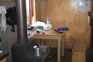
Inside
Photograph
•
Distance: 6.7km away
Inside Purity Hut, nice little cast iron fire, set of cards and some magazines!
More ▶︎


New Purity Hut
Photograph
•
Distance: 6.7km away
New Hut, wow how flash is this!! Sooo warm in here too, had to open windows!
More ▶︎
Purity Hut and View
Photograph
•
Distance: 6.7km away
In good weather Purity Hut has the most magnificent View
More ▶︎
Purity Hut
Hut
•
Standard Hut (DOC). Capacity: 6.
•
Distance: 6.7km away
The new Purity Hut (6 bunk, tank water, wood burning stove, limited firewood available in locality) is loated on the ...
More ▶︎
Purity hut
Photograph
•
Distance: 6.7km away
Glad we walked up thursday night the view was stupendouse
More ▶︎
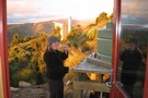
Hmmmm....work or Tramping
Photograph
•
Distance: 6.7km away
Thursday night fine clear and hot fine dining on the verandah at Purity hut
More ▶︎
Leatherleaf expanses of the Southern Ruahines
Photograph
•
Distance: 6.7km away
Leatherleaf expanses of the Southern Ruahines from Takapari Road
More ▶︎
The New Purity Hut, Western Ruahine
Photograph
•
Distance: 6.7km away
A poled route from Mangakokeke Roadend, where there is a car park and toilet, will take you across some steep ...
More ▶︎
Ruahines from Purity Hut
Photograph
•
Distance: 6.7km away
The Ruahine Ranges (Whanahuia Range) from Purity Hut
More ▶︎
Maungahuia
Photograph
•
Distance: 6.8km away
Frozen tarn and Maungahuia (1583m), above Rangiwahia Hut. Part of the Rangi - Deadmans Ridge Circuit. July 2012
More ▶︎
Kaweka
Photograph
•
Distance: 7.0km away
Kawekas, walking along ridge from Kiwi Saddle back to Lakes carpark April 2003
More ▶︎
Robsons Lodge
Photograph
•
Distance: 7.0km away
Beautiful Kuripaponga, Robsons Lodge March 2010
More ▶︎
Kiwi Saddle Hut (Kaweka Range)
Hut
•
Standard Hut (Heretaunga Tramping Club). Capacity: 8.
•
Distance: 7.0km away
Kiwi Saddle Hut is located on the ridge 3km west of Kuripapango and some 700m above the Ngaruroro river. The ...
More ▶︎
Kiwi Saddle Hut
Photograph
•
Distance: 7.0km away
Northern approach shortly after dropping off tops
More ▶︎
Ruahine Corner Hut
Hut
•
Standard Hut (DOC). Capacity: 6.
•
Distance: 7.0km away
A six bunk, typical forestry style hut in the northern Ruahine Ranges, surrounded by a huge verandah, and an absolutely ...
More ▶︎
Pohongina River at Leon Kinvig hut
Photograph
•
Distance: 7.0km away
Grassy faces and scattered beech predominate on the Pohongina valleysides above Leon Kinvig
More ▶︎
Leon Kinvig Hut
Photograph
•
Distance: 7.0km away
A tidy 8-bunk hut in the mid-reaches of the Pohongina Valley. Tracks climb both ranges to the east and west, ...
More ▶︎
Leon Kinvig Hut
Hut
•
Standard Hut (DOC). Capacity: 8.
•
Distance: 7.0km away
Leon Kinvig Hut sleeps 8 on 2 platforms. There's a good open fire, plenty of wood around, and water from ...
More ▶︎
Leon Kinvig Hut
Photograph
•
Distance: 7.1km away
Leon Kinvig Hut is in the middle reaches of the Pohangina River in the Ruahines and can be reached from ...
More ▶︎
Waipawa Forks Hut
Photograph
•
Distance: 7.2km away
Nice hut just 5 min climb from waipawa river. Abit of grafitti but other then that its ok. completed the ...
More ▶︎
Triple X hut
Photograph
•
Distance: 7.2km away
Nice hut good for school camps etc only a short walk in with 12 bunks
More ▶︎
Te Atuaoparapara
Photograph
•
Distance: 7.2km away
Nice day for a walk over to Top Maropea hut with wiew up to
Te Atuaoparapara
More ▶︎
Sunrise Hut
Photograph
•
Distance: 7.2km away
Very nice hut/house, just happened to go on the one rainy day all last week, still enjoyable though
More ▶︎
Diggers Hut
Photograph
•
Distance: 7.3km away
Diggers Hut in the Ruahines. A spacious 4-bunk hut at the back of a flat of waist-high grass in the ...
More ▶︎
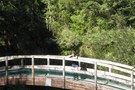
Diggers Hut
Hut
•
Standard Hut (DOC). Capacity: 4.
•
Distance: 7.4km away
Diggers Hut has been washed away.
Diggers Hut in the Ruahines. A spacious 4-bunk hut at the back of a flat ...
More ▶︎
Makawakawa Stream below Diggers Hut
Photograph
•
Distance: 7.4km away
Makawakawa Stream below Diggers Hut in the Ruahines. The riverbed route into the hut from Pohongina Valley East Rd.
More ▶︎
Track from Takapari Rd to Forks Hut
Photograph
•
Distance: 7.5km away
Cut track from leatherwood and scrub from Takapari Roadend down the ridge to the north of Forks Hut. Track starts ...
More ▶︎
Inside the Blowhard Shelter
Photograph
•
Distance: 7.7km away
Basic shelter for a large group in rain
More ▶︎
Blowhard Shelter
Photograph
•
Distance: 7.7km away
No bunks. Just a trodden earth floor, some wooden seats and a table. However would be a welcome shelter for ...
More ▶︎
Blowhard Shelter
Hut
•
Shelter (PVT).
•
Distance: 7.7km away
Driving over the Napier-Taihape Rd we found this shelter a few hundred metres off the main road down a side ...
More ▶︎
River travel above Forks Hut
Photograph
•
Distance: 8.0km away
River travel above Forks Hut in the Ruahines. The northern fork of the creek from the hut, combined with a ...
More ▶︎
Unknown Campsite
Campsite
•
Private Hut (DOC).
•
Distance: 8.0km away
Clearing next to a creek near Lake Colenso.
More ▶︎
Kelly Knight Hut from above
Photograph
•
Distance: 8.1km away
Approaching Kelly Knight Hut, this is the first view that you get. It is only 10 minutes more and after ...
More ▶︎
Kelly Knight Hut
Photograph
•
Distance: 8.1km away
Situated in a pleasant clearing on a terrace above the Pourangaki river
More ▶︎
Kelly Knight Hut
Hut
•
Standard Hut (DOC). Capacity: 8.
•
Distance: 8.1km away
Quite close to the park boundary in the Pourangaki River. Situated in a lovely clearing on a terrace above the ...
More ▶︎
Lake Colenso via Mokai Station
GPX file
•
Distance: 8.2km away
Note: If you use this route then you MUST get permission from Mokai Station to cross the section of private ...
More ▶︎

Mangatera River at Colenso Hut
Photograph
•
Distance: 8.3km away
Mangatera River from the veranda at Colenso Hut - looking upriver towards Te Atu Mahuru on the main range.
More ▶︎
Colenso Hut
Hut
•
Standard Hut (DOC). Capacity: 8.
•
Distance: 8.3km away
Colenso Hut lies not at its namesake, Lake Colenso, but 5 minutes away on the terraces of the Mangatera River ...
More ▶︎
Sentry Box Hut
Photograph
•
Distance: 8.3km away
Dodgy little 4 bunker hut located 10 minutes from the Mangleton road end in the Ruahine`s marked for removal in ...
More ▶︎
Lupins and toetoe near Colenso hut
Photograph
•
Distance: 8.4km away
Mangatera river bed near Colenso hut. The lupins were planted deliberately to help control erosion, but are now a pest. ...
More ▶︎
Lake Colenso
Photograph
•
Distance: 8.5km away
A pristine natural lake in a podocarp basin in the middle of the Ruahine Ranges
More ▶︎
Lake Colenso
Photograph
•
Distance: 8.5km away
A pristine natural lake in a podocarp basin in the middle of the Ruahine Ranges.
More ▶︎
Lake Colenso
Place
•
Place.
•
Distance: 8.5km away
A pristine natural lake in a podocarp basin in the middle of the Ruahine Ranges
More ▶︎

Lake Colenso
Photograph
•
Distance: 8.5km away
An idyllic lake only accessible from this one place. Also a noticable abundance of bird life in this area.
More ▶︎
Forks Hut (Ruahine)
Hut
•
Standard Hut (DOC). Capacity: 6.
•
Distance: 8.5km away
A 6 bunker in regenrating bush in the Southern Ruahines. Wood burner and stream water.
Not so widely visited - ...
More ▶︎
Forks Hut (Ruahine Ranges)
Photograph
•
Distance: 8.5km away
Forks Hut in the southern Ruahines. A riverside hut at the base of a steep gorge on the southern fork ...
More ▶︎
Kawekas from Mackintosh
Photograph
•
Distance: 8.5km away
Kaweka Range from Mackintosh plateau
More ▶︎
Loking down onto Ballance bridge from Manawatu Gorge track
Photograph
•
Distance: 8.7km away
Good track, sign says it will take 4 hours but can do it within 3 hours fairly easily. The track ...
More ▶︎
The Tits, Kaweka FP
Photograph
•
Distance: 8.7km away
First in an occasional series of Amusingly Named Topographical Features
More ▶︎
Te Ekaou Hut
Hut
•
Standard Hut (DOC). Capacity: 6.
•
Distance: 8.8km away
Te Ekaou Hut in the southern Ruahines - one of few surviving bushedge huts in the Ruahines. Accessed across private ...
More ▶︎
Ruahine travel
Photograph
•
Distance: 8.9km away
The ridge from Rangiwahia Hut to the top of the whanahuia range. An easy stroll well marked by the passage ...
More ▶︎
Alice Nash Memorial Lodge
Photograph
•
Distance: 8.9km away
NZ Deer stalkers hut Ruahine forest park 30 mins from the road end popular with families its more like a ...
More ▶︎
Alice Nash Memorial Heritage Lodge
Photograph
•
Distance: 8.9km away
Half an hour from the road end, this is a well appointed sort of place, thanks to NZDA
More ▶︎
Fireplace and Bunks
Photograph
•
Distance: 8.9km away
in the Hut, got absolutely boiling in there with that fire!
More ▶︎
Otukota Hut
Hut
•
Standard Hut (DOC). Capacity: 6.
•
Distance: 9.0km away
Otukota Hut sits on a small shelf 50m above the Maropea River. It's an older forestry-style hut in tatty condition ...
More ▶︎
Kiwi Mouth Hut
Photograph
•
Distance: 9.0km away
Kiwi Mouth Hut sits in a grassy clearing at the junction of the Kiwi Stream and the Ngaruroro River
More ▶︎
Kiwi Mouth hut
Photograph
•
Distance: 9.0km away
Perfect camping spot right by the stream (and the best appointed long drop in the Kaweka FP - I counted ...
More ▶︎
Descent to Kiwi Mouth via Kiwi Saddle
Photograph
•
Distance: 9.0km away
This would be hours of fun if wet...
More ▶︎
Kiwi Mouth Hut
Hut
•
Standard Hut (DOC). Capacity: 4.
•
Distance: 9.0km away
Kiwi Mouth Hut sits on grassy flats / clearing beside Kiwi Creek shortly before it enters the Ngaruroro. It's a ...
More ▶︎
Inside Mackintosh Hut
Photograph
•
Distance: 9.0km away
A cozy and well designed 8-bunk hut at the foot of the Kaweka Range
More ▶︎
Mackintosh Hut
Photograph
•
Distance: 9.0km away
A cozy hut at the foot of the Kaweka Range. Only 2 hrs from Lawrence roadend, and less from The ...
More ▶︎
Mackintosh hut
Hut
•
Standard Hut (DOC). Capacity: 6.
•
Distance: 9.0km away
6 bunk hut. Visit as part of a loop from Markahu Saddle, Mackintosh Spur, Studholme Saddle Hut and Kaweka J. ...
More ▶︎
Te Ekaou Hut
Photograph
•
Distance: 9.0km away
Te Ekaou Hut in the southern Ruahines. One of few surviving bushedge huts in the Ruahines. Accessed across private land, ...
More ▶︎
Bridge to Heritage Lodge
Photograph
•
Distance: 9.1km away
Wooden arched bridge on the track to Heritage, Ruahines
More ▶︎
Rangiwahia Hut and Central Plateau
Photograph
•
Distance: 9.1km away
Ragiwahia Hut and Mts Ruapehu and Ngauruhoe on a fine mid winters day.
More ▶︎
Rangiwahia Hut
Photograph
•
Distance: 9.1km away
14 bunks gase heater could sleep double that number on the floor
More ▶︎
Rangi Hut
Photograph
•
Distance: 9.1km away
Rangi Hut from up on the little hill just next to it!!
More ▶︎
Ruapehu from Rangi Hut
Photograph
•
Distance: 9.1km away
Mount Ruapehu from the rangi hut sept 06, 2008, approx 6:30am in the morning
More ▶︎
Rangiwahia Hut
Hut
•
Serviced Hut (DOC). Capacity: 13.
•
Distance: 9.1km away
A tidy popular hut. Great views.
Good camping on the tops about 40 minutes further along track.
More ▶︎
Rangiwahia Hut
Photograph
•
Distance: 9.1km away
Located on the western side of the Ruahine Rangers it is accessibly by tramping for approximately 3 hours up a ...
More ▶︎
Manawatu Gorge Track
Track
•
Easy/medium. One way.
•
Distance: 9.2km away
Graveled, benched walking track through thick native forest near Palmerston North.
More ▶︎
A Total Tararua Traverse
Track
•
8 – 16 days. Medium. One way.
•
Distance: 9.2km away
The length of the Tararuas via the pointy bits, from the Manawatu Gorge at Woodville to the Rimutaka Hill Road ...
More ▶︎
Te Ekaou Stream
Photograph
•
Distance: 9.3km away
Te Ekaou Stream - marginal strip access to Te Ekaou Hut and Forks Hut in the southern Ruahines
More ▶︎
Bridge to Heritage Lodge
Photograph
•
Distance: 9.4km away
Wooden arched bridge on the track to Heritage, Ruahines
More ▶︎
Mokai Patea Range, Ruahine
Photograph
•
Distance: 9.4km away
Looking east over the Mokai Patea range. taken Jan 2010
More ▶︎
Umutoi bridge snow
Photograph
•
Distance: 9.5km away
Snow on the track to Alice Nash Heritage Lodge, at the bridge over Umutoi stream. May 2009.
More ▶︎
Umutoi ferns snow
Photograph
•
Distance: 9.5km away
Snow on tree ferns at Umutoi stream on the track to Alice Nash Heritage Lodge. May 2009.
More ▶︎
An eastern Kaweka circuit: never trust the weatherman
Article
•
Distance: 9.6km away
or 'it cost me the same as a trip to Fiji, but it was much more fun'.
A good weather variant ...
More ▶︎
Kawhatau Cage
Photograph
•
Distance: 9.8km away
Just enough room for me and a quick journey across the Kawhatau river
More ▶︎
A bit of light entertainment at the start of a walk
Photograph
•
Distance: 9.8km away
Cage over the Kawhatau river
More ▶︎
Kaweka Ranges
Photograph
•
Distance: 9.8km away
Looking at the Main Kaweka range from the south. The high point in the middle is Mad Dog Hill with ...
More ▶︎
Iron Bark Hut
Photograph
•
Distance: 9.9km away
Iron Bark Hut, Maropea River, Ruahine Ranges
More ▶︎
Iron Bark Hut
Photograph
•
Distance: 9.9km away
Iron Bark Hut, Maropea River, Ruahine Ranges
More ▶︎
Iron Bark Hut
Hut
•
Standard Hut (DOC). Capacity: 6.
•
Distance: 9.9km away
Iron Bark Hut sits on the western bank of the Maropea River in the Ruahine Ranges. It's a standard 6-bunk ...
More ▶︎