Comments
-
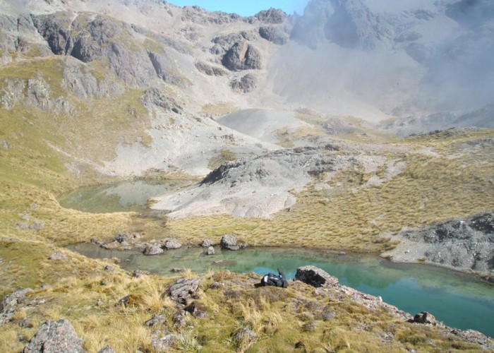
BillyTramper Yep it rained the night before and left about 7.30am from the junction of the two upper Steam where the big patch of bush is and there is a waterfall coming down from the true right hand side upper stream. We went up the upper valley on the true left hand stream. Albeit we started in the bush soon made the decision to cross over to walk up the valley walk on the true left which was pretty nice and then up the little gut where the creek runs down through the steeper patch and then onto the second to last basin. The fog cleared just when we arrived at the top basin with the tarns in front of us. Even with a GPS and fog we still mistook the lower basin for the higher one. We headed over the most prominent saddle just to the left of the tarns and and an easy but long walk out down Coldwater stream. I highly recommend the round trip rather than returning down the rocky Lees Creek. It really adds another dimension in covering new country.
Billy
8 March 2011
-
 Honora Hi Billy
This photo brings back magic memories of a crossing on a cloudy day with intermittent sunlight creating glistening effects on the rocks. Did you approach the tarns via that rocky staircase in the gully? We camped in the first patch of bush in Coldwater Creek, as we had started late due to rain keeping us at Lee Creek hut until after lunch.
7 March 2011
ID 6502
About this photograph
License
All rights reserved
64 views in the past year (5 per month).
