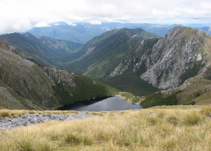
Mt Glasgow 1424m
- 6 hr – 8 hr return by the same track
- Medium
A superb day walk in behind the sleepy village of Seddonville.
2 members favourited
|
Walking time
|
1 – 2 days
6 hr – 8 hr
|
|---|---|
|
Type
|
Return by the same track
|
|
Grade
|
Medium |
|
Bookings
|
No bookings — open access
No — open access
|
|
Starts
|
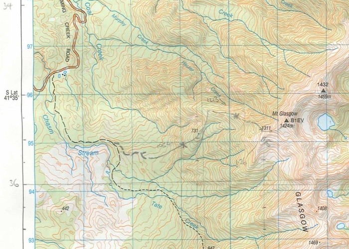
Off Charming Creek road. In dry conditions side road off Charming Creek road is 2WD driveable for 3km |
|---|---|
|
Ends
|
Return the same way |
|
Maps
|
NZTopo50-BR22
|
|
Altitude
|
1,424m |
April 2023: current Topo50 map shows track line incorrectly from 960m contour (bush edge). Topo shows track to continue due East to 1200m contour, whereas the actual pole-marked track turns ESE and goes back into bush. Once in bush track is marked again with regular triangles plus occasional flagging tape.
ID 6286
About this track
242 views in the past year (20 per month).