Gillespie Pass Circuit
- 4 days loop track
- Medium
This is a 3-4 day track that is located near Makarora at the head of Lake Wanaka. Being a loop track it can be tramped in either direction, but most parties start at the Young River valley and go over Gillespie Pass into the Siberia valley and then return to Makarora via the Wilkin valley. Jetboats operate on the Wilkin and Makarora and can be hired for those not wanting to walk or unable to cross due to high water levels, and scenic flights also operate from Makarora to an airstrip in the Siberia valley. A crossing of the unbridged Makarora River is required to both access and leave the track, so often jetboats are hired for this purpose. DoC has now built a 7km link track from the Blue Pools track to join the Young river if the Makarora is unfordable. Highlight of the circuit is Crucible Lake reached via daytrip from Siberia Hut (or a very long day from Young Hut).
|
Walking time
|
4 days |
|---|---|
|
Distance
|
68.0km |
|
Type
|
Loop track
|
|
Grade
|
Medium |
|
Bookings
|
No bookings — open access
No — open access
|
|
Starts
|
About 4km from Makarora |
|---|---|
|
Ends
|
At Makarora |
|
Maps
|
NZTopo50-BZ12
|
|
Altitude
|
300m
–
1,629m
Altitude change 1,329m
|
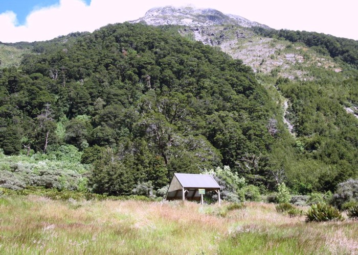
[[Siberia Hut]]
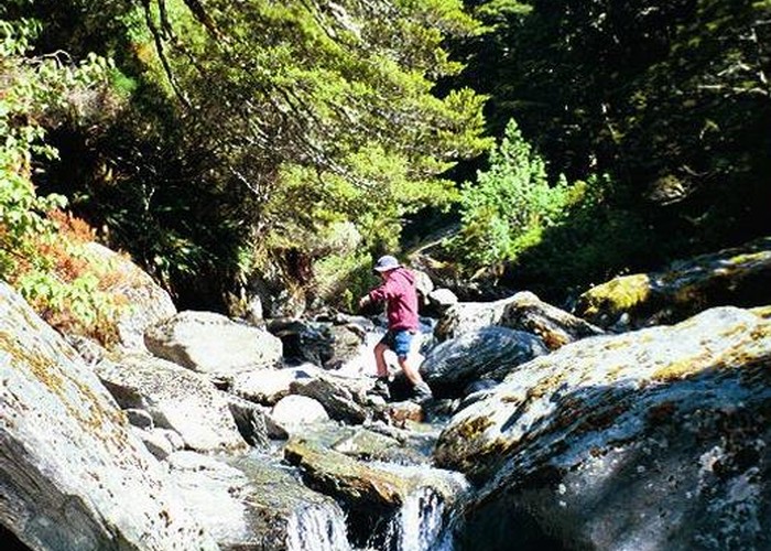
Upon reaching the Young River and after fording/jetboating the Makarora, the track heads up valley on the Youngs true left through forest and river flats. The confluence with the Young North branch is reached after about 3 hours and a swingbridge is crossed. Theres a DoC campsite here. The track continues up the South branch, a rocky slip is crossed and the track climbs up past a gorge to eventually reach the new Young Hut (relocated at F38 974 628). Start of track to Young hut about 5 hours.
The track continues climbing and clears the bush and the head of the Young valley becomes visible. A footbridge is crossed and the last part of the valley is climbed on the True Right. The track vears sharply to the West and climbs steeply up a grassspur for about 500 verticle metres. The Gillespie Pass is at the top and offers great views. A further climb to the South takes you to the highest point on the track at 1629m, then there is a long decent down into the bush of the Siberia valley, the last part zigzagging down to the valley floor. Its about a furthur hours easy walk down the Siberia valley flats to Siberia hut. Those with gass still left in the tank and daylight hours to use may wish to head imediately to Crucible Lake by fording the Gillespie Stream then dropping their packs off before crossing the Siberia stream. Cruicible Lake can be reached after about an hour from first ariving in the Siberia, and thus saving a 4hour round trip from Siberia hut. Young hut to Siberia hut about 7 hours. Young hut to Siberia hut via Crucible Lake about 9 hours.
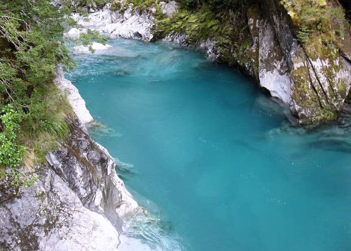
The route up to Crucible Lake climbs almost vertically beside the Crucible Stream to negoatiate a waterfall then steadily heads up valley. The stream has to be forded part way up which can be tricky after rain. The bushline is then reached and a clear view of the head of the valley and the Morrain wall is obtained. A further 20 minutes scramble gets you up the valley and ontop of the Morrain where Crucible Lake can be seen. Head round to the Western end of the Morrain to truely appreciate how Crucible Lake gets its name. Crucible Lake from Siberia hut about 4 hours return.
From the 20 bunk Siberia hut, the track heads South and leaves the Siberia Flats. It climbs up above a massive gorge before descending down a series of zigzags. The confluence of the Siberia stream and Wilkins river is reached after about 2 hours at Kerin Forks. Jetboats can be caught from here and can take you back to Makarora for about $80pp. Parties continuing up the Wilkins need to ford here (impassible if in flood) though the jetboats may ferry trampers across for a small fee. The track continues South down the true left of the Wilkins following river flats and bush though parties may find travel quicker by fording the Wilkins and heading down the True Right. Upon reaching the Wilkins/Makarora confluence the track basically ends but parties have to find a place to cross the Makarora and return to the township. Again, the jetboat may be the only way across if the river is up. Kerin Forks to Makarora about 20 minutes in the jetboat, or 6-8 hours on foot.