
The first miners arrived with tents in 1862 after gold had been found in the Arrow late that year. Arrowtown (originally Fox's) was established at the same time. Near 2000 miners were involved in the rush, but most disappeared to the new West Coast fields soon after. Reef mining sustained a smaller settlement through the turn of the century, and the road was completed in 1884. The last mining ceased in the 1930s.
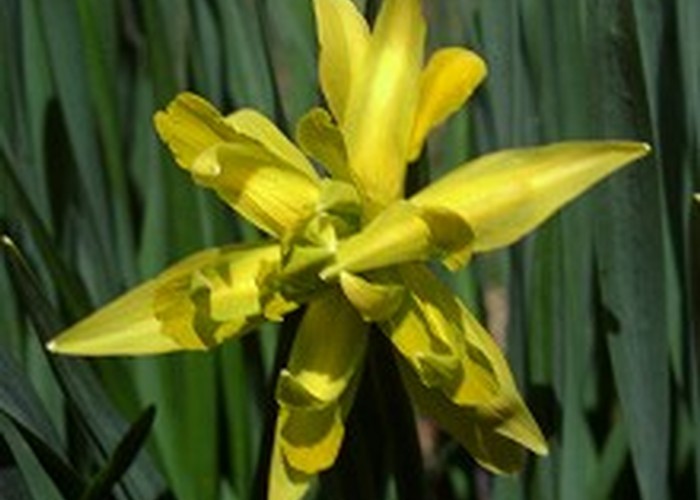
Now secured as a pocket of reserve on private land, Macetown is visited regularly by trampers, mountain bikers, horse parties, and 4WD vehicles. Most of the buildings have gone from Macetown, but the trees the miners planted have matured, leaving a living memorial. Today Macetown is a block of English parkland tucked between rolling golden hills. There are a few fruit trees looking sick and old, but the daffodils appear every spring in ghostly shapes that delineate long lost gardens and paths. There is ample to explore in the Macetown area, and an extra day could easily be spent visiting old mines, batteries, and ruins further up the valley.
Access
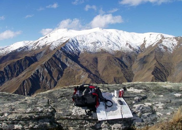
Access to Macetown is from Arrowtown over the Big Hill Track or along the Macetown Road. The road, described here, is a smooth dirt 4WD track following the Arrow River. There are some major river crossings. Numbered pegs mark points of interest along the road, and these are detailed in the DOC booklet, which is an essential guide for exploring the area.
The Big Hill Track crosses private land and may be closed at times for mustering. The Macetown Road, however, is a public road and is always open.
Arrowtown-Macetown: 3 hr, easy + river crossing
From Butler Park at the end of Buckingham Street (by the entrance to the Arrowtown Chinese Settlement), follow the vehicle track that fords Bush Creek to the north or locate the small footbridge. Follow the Sawpit Gully Track rather than the road, which fords the Arrow River several times. The track follows the Arrow Irrigation Scheme pipeline for a while before climbing above the river. Beyond a small bridge and the first native scrub a junction is encountered as the track enters the foot of Sawpit Gully (0:20). Another track zigzags down to the river and road. Follow this down to the dangerous (and closed) pipeline bridge. You can cross this at your own risk or ford the river. This is the deepest ford on the track, becoming impassable with rain. In dry weather it is typically knee-deep, but as it is not shared with vehicles the bottom is rocky and rough.
From here the road is followed the entire way to Macetown, with occasional foot detours where it resorts to the river-bed. The irrigation pipeline stays nearby.
The road remains close to the river, edging around greenschist outcrops and over hillsides of matagouri, rose, willow, beech, hawthorn, broom, and flowering currant. As the road climbs above the river, Britannia Terrace is reached (0:40, peg 4). The vertical pressure release on the pipeline is obvious, sitting like an old chimney amongst the ruined stone cottages and hand-stacked tailings. A road leads down to the river, although there is a view from here of Scoles Tunnel, where the Arrow River was diverted so that miners could work the river-bed. A grassy area a few minutes farther provides a better view (peg 6).
A small hut visible on the terrace opposite belonged to Opium Bob, a European miner (0:55, peg 7). Soon after, the track is crossed by the steep cascade of the Bracken River tumbling into the Arrow below. There is only a shallow ford here.
Where an ancient slip has blocked the valley, the Arrow is turned into a long, white cataract -- the Arrow Falls. Above the Falls, the river runs over a weir which marks the intake for the Arrow Irrigation Scheme. A collapsed stone building stands here, at a pleasant bend in the more subdued river (1:10, peg 10). Nearby, the Hayes Creek Track branches off to the left.
Past the Soho Mining Syndicate ruins and mullock heap, the road passes through a small planting of larches, radiata and oregon pines. Soho Creek is nearby, a shallow ford where the Arrow bends sharply to the northwest. The private 4WD road through to Glendhu Bay branches off and up to the right here. Macetown Road crosses to the true right at a wide, sandy ford (1:30). Through a gate, the road climbs gently above the river, with a narrow view of Vanguard Peak in the Harris Mountains ahead.
Passing extensive workings and abandoned water races on the opposite bank, the road meets the Hayes Creek / Shamrock Claim track on the left (2:00). Soon, the road drops back to the river, which bends leftward onto farmland (2:15). While the road fords the river, a foot track sidles upstream to rejoin the road at the next ford. Past a private hut and bridge, the road comes to the site of the old Mt Soho homestead. The colourful stone chimney stands, surrounded by a garden of daffodils, lupins, and grape hyacinths.
The willows finally disappear from the river-side as the road fords a couple of times around Eight Mile Creek. The Big Hill Track leads in here from the left. Three more fords lead past Nine Mile Creek, then another three before the track climbs onto an easy terrace and into the Macetown Historic Reserve (3:00).
Macetown
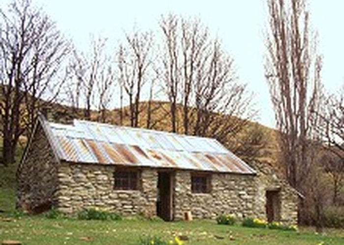
A large spruce tree and an old weatherboard building stand to welcome you, along with rows of daffodils marking out garden paths. The houses are long gone, but these garden ghosts are thriving. Stone ruins are scattered along the road to the northwest and the main township site, once called Twelve Mile, is another kilometre or two.
A little further, Needham's Cottage stands below the road, surrounded by ancient fruit trees and more daffodils. Trees in the distance mark the township site, and over a small rise it comes into view. An interpretive plaque describes the view down High Street, and a toilet is located in the trees across the road. The restored bakehouse is nearby, but surprisingly little else remains of the stone buildings. The town had a school, public hall, telegraph office, and two hotels. Foundations and concrete slabs may be picked out on the ground, along with the occasional stone wall or chimney. Otherwise, most of the building material appears to have been removed. What remains is an eerie woodland ghost town, with cropped grass, skinks, blackbirds, and rabbits. The English trees -- sycamores, cottonwood, poplar, hawthorn -- along High Street have had time to mature. A tall spruce 250m in the distance marks the junction with Boyne Street, which once run along a shallow gully. Several houses stood on the terrace above High Street amongst the mullock heaps. At another spruce a further 100m along High Street, the road drops quickly off the terrace down to the Rich Burn. The remains of the Twelve Apostles' huts are here by the river. The road divides, with the left branch leading up the Rich Burn while the right passes a pleasant camping area, fords the Rich Burn and climbs onto the terrace between the rivers.
The terrace opposite the camping area was the site of the cemetary, and is known as Graveyard Terrace. A church was also located there. All that remain are the ubiquitous mullock heaps, although there is a great view of the Macetown terrace with its parklike landscape.
Rich Burn
While most of the gold extracted from Central Otago was alluvial, some reef mining took place. Three quartz reefs in this area were mined. One was high on Advance Peak, while the other two ran to the northwest along the true right bank of the Rich Burn. Following the road up the Rich Burn and fording several times, you soon (¼ hr) come to Scanlan's Creek. The road ends here at the site of the standing Anderson's Battery. A foot track leads up the creek past the Tipperary Battery site to the Anderson adit and mine office. Another hour's walk from the road end leads to the Homeward Bound Battery and, in Sawyer's Gully, to the Maryborough or Premier Battery. Here, a cyanide process was employed to extract the gold.