Nearby
Haast Hut
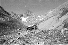
Plateau Hut
Hut
•
Serviced Alpine Hut (DOC). Capacity: 33.
•
Distance: 1.1km away
Alpine hut on the Grand Plateau beneath Aoraki / Mount Cook.
More ▶︎
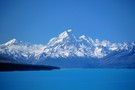
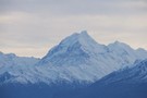
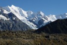
Aoraki / Mount Cook National Park
Place
•
National Park. 706.96km2.
•
Distance: 4.7km away
A climbers' park surrounding New Zealand's highest peak, Aoraki / Mount Cook, at 3724m. Mount Cook National Park is part ...
More ▶︎
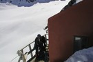
![Ball Shelter [Removed 2009]](http://tramper.nz/imgcache/1/1108-mini.jpg)
Ball Shelter [Removed 2009]
Hut
•
Removed!
•
Distance: 4.9km away
Perched on the edge of the Tasman Glacier moraine wall. Although this hut is only about 5km from the summit ...
More ▶︎
Ball Shelter
Track
•
1 – 2 days. Easy/medium. Return via same track.
•
Distance: 4.9km away
Follow the old Ball Hut Road from the Blue Lakes car park along the moraine wall of the Tasman Glacier ...
More ▶︎
Ball Hut
Hut
•
Standard Hut (DOC). Capacity: 3.
•
Distance: 4.9km away
Small Hut on the moraine next to the Tasman Glacier, just south of the Ball Glacier.
The first hut was ...
More ▶︎
New Years on the glaciers -2003
Article
•
Distance: 5.4km away
Part of a four day traverse of Fox and Franz Josef glaciers starting at Pioneer hut on Fox and making ...
More ▶︎
Caroline Hut
Hut
•
Private hut (Private).
•
Distance: 5.5km away
Private, locked hut on the Ball Ridge. This hut is used by guided parties on the Ball Pass route.
For ...
More ▶︎
Pioneer Hut
Hut
•
Serviced Alpine Hut (NZAC). Capacity: 16.
•
Distance: 5.9km away
New Zealand Alpine Club hut perched on the rocky Pioneer Ridge over the Fox Glacier névé. The Pioneer Hut looks ...
More ▶︎
Mt Egmont/ Mt Taranaki
Photograph
•
Distance: 5.9km away
Summit in Summer. Still a bit chilly.
More ▶︎
Copeland Pass
Photograph
•
Distance: 5.9km away
Looking West down to the West Coast from Copeland Pass. 1995
More ▶︎
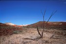
Coober Pedey
Photograph
•
Distance: 5.9km away
Landscape outside Coober Pedy, Central Australia.
More ▶︎
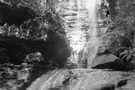
Blue Mounatins
Photograph
•
Distance: 5.9km away
Waterfall in Upper Blue Mountains, Sydney 1999
More ▶︎
Beetham Hut
Photograph
•
Distance: 5.9km away
Beetham Hut, Tasman Glacier, Mt Cook. 1995
Demolished soon after by avalanche :-(
More ▶︎
Empress Hut
Hut
•
Serviced Alpine Hut (DOC). Capacity: 12.
•
Distance: 6.3km away
New Zealand's second highest hut, located at 2500m on the Earl Ridge west of Aoraki / Mount Cook.
This hut ...
More ▶︎
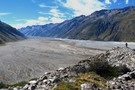
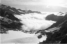
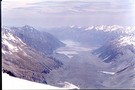
Murchison valley from Tasman moraine
Photograph
•
Distance: 7.2km away
This picture was taken from the eastern Tasman moraine where the Murchison glacier once met the Tasman glacier.
The size is ...
More ▶︎
Ball Pass
Track
•
2 – 3 days. Hard. One way.
•
Distance: 7.7km away
A challenging crossing of the Kirikirikatata / Mount Cook Range between the Hooker and Tasman Glaciers just 5km south of ...
More ▶︎
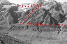
Ball pass route 1996
Photograph
•
Distance: 7.7km away
The route over Ball Pass looking across the Hooker Glacier.
May have changed somewhat considering the date taken.
More ▶︎
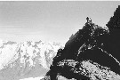
Aiguilles Rouge
Photograph
•
Distance: 8.0km away
Aiguilles Rouge summit looking West. Mt Cook National Park 1996
More ▶︎
Centennial Hut
Hut
•
Serviced Alpine Hut (DOC). Capacity: 20.
•
Distance: 8.5km away
Located on Tusk Rock, Franz Josef névé, and named for the centennial of the New Zealand Alpine Club (established 1891).
More ▶︎
Tasman Valley from the Murchinson
Photograph
•
Distance: 8.9km away
Views across the Tasman to Mt.s Cook and Tasman from the Murchinson
More ▶︎
Graham Saddle from the Franz Josef side.
Photograph
•
Distance: 9.2km away
Our other rope team begins the descent from Graham Saddle back down to our packs on Franz Josef glacier.
More ▶︎
View of the Tasman Glacier from Graham Saddle
Photograph
•
Distance: 9.2km away
Whilst returning to Centennial Hut from Alma Hut on Franz Josef Glacier we made a worthwhile side trip to Graham ...
More ▶︎
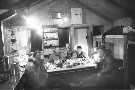
Onslow Hut (Steffan Memorial Hut)
Hut
•
Basic Hut/Bivvy (NZDA). Capacity: 4.
•
Distance: 9.3km away
NZDA hut located on the Murchison River just below the glacier lake.
More ▶︎