Nearby
Toaroha/Zit Saddle/Kokatahi/Lathrop Saddle/Styx River Route
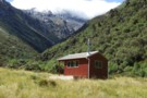
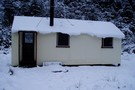
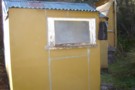
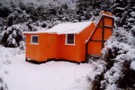
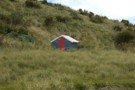
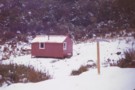
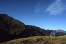
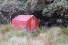
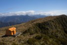
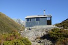
Crawford Junction hut Feb 2012
Photograph
•
Distance: less than 100m away
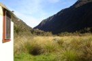
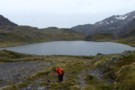
This hut sits near the edge of a low terrace on the TL of the Crawford River and overlooks the ...
More ▶︎
Crawford Junction Hut
Hut
•
Basic Hut/Bivvy (DOC). Capacity: 6.
•
Distance: less than 100m away
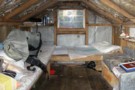
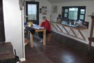
Crawford Junction Hut (6 bunks, matresses, tank water, stove) is by far the nicest hut in the valley. It's of ...
More ▶︎
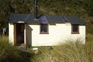
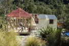
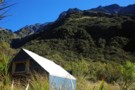
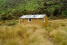
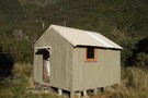
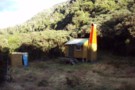
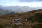
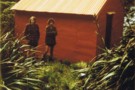
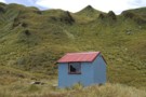
"New" Top Kokatahi hut April 2008
Photograph
•
Distance: less than 100m away
This pic is of Top Kokatahi hut after the upgrade at the new site.
(just a stones throw from where Top ...
More ▶︎
Top Crawford Hut
Photograph
•
Distance: less than 100m away
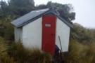
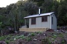
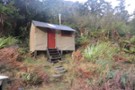
Near old Top Crawford Biv site, this 4 bunk forest service hut was refurbished and relocated in February 2011. It ...
More ▶︎
Picton to Aspiring
GPX file
•
Distance: less than 100m away
An aborted alpine traverse. Picton to West Cape, but aborted at Aspiring due to real world emergencies back home. Posted ...
More ▶︎
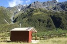
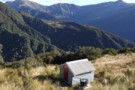
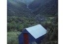
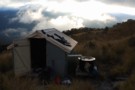
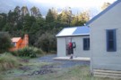
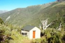
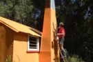
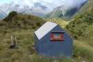
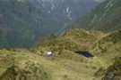
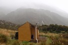
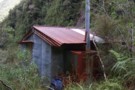
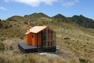
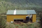
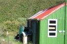
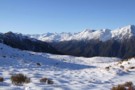
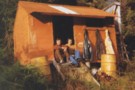
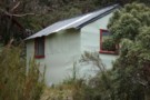
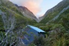
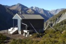
Rear view of "New" Top Crawford hut
Photograph
•
Distance: less than 100m away
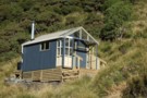
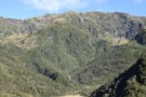
Here is a rear view of the hut. The perspective is looking NNW past the hut and over the two ...
More ▶︎
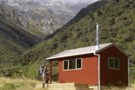
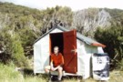
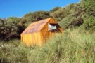
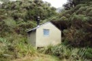
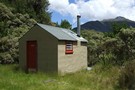
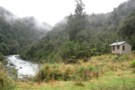
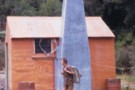
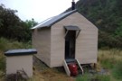
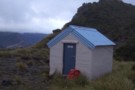
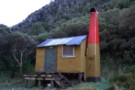
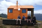
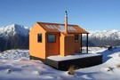
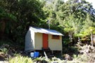
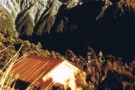
"New" Top Crawford hut Feb 2012
Photograph
•
Distance: less than 100m away
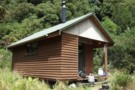
This photo is of the "new" Top Crawford hut which is an hour walk up the valley from the location ...
More ▶︎
Top Crawford Hut (New)
Hut
•
Standard Hut (DOC). Capacity: 4.
•
Distance: less than 100m away
This entry is for the "new" Top Crawford hut which is an hour walk up the valley from the location ...
More ▶︎
Cedar Flat Hut
Hut
•
Standard Hut (DOC). Capacity: 12.
•
Distance: less than 100m away
Double hut at the edge of a frost flat beneath the Toaroha Range. Used to be a six bunker. A ...
More ▶︎
Cedar Flat Hut August 2008
Photograph
•
Distance: less than 100m away
Cedar Flat Hut during the big snowfall, August 2008
More ▶︎
Building extensions Cedar Flat hut 9.03.12
Photograph
•
Distance: less than 100m away
This pic shows the progress on the extensions to the newer of the two Cedar Flat huts. The DOC building ...
More ▶︎

Route Guide: Otira to Mt Cook Village (pt 2)
Track
•
12 – 21 days. Hard. One way.
•
Distance: less than 100m away
One possible route down the main divide from Otira on the Arthur's Pass road to Mt Cook Village.
Otira Hotel ...
More ▶︎

Route Guide: Otira to Mt Cook Village (pt 1)
Track
•
12 – 21 days. Hard. One way.
•
Distance: less than 100m away
One possible route down the main divide from Otira on the Arthur's Pass road to Mt Cook Village.
Otira Hotel to ...
More ▶︎
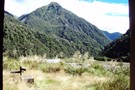
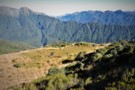
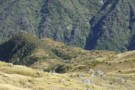
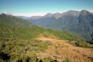
Grassy Flats
Photograph
•
Distance: less than 100m away
Grassy Flats, in the upper Styx Valley (Westland). Taken fron Browning Range Biv, 600m above.
More ▶︎
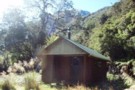
Browning Range Bivouac
Hut
•
Basic Hut/Bivvy (DOC). Capacity: 2.
•
Distance: less than 100m away
'If you're just about buggered, you're just about at Browning Biv'. The sign below the biv says it all: it's ...
More ▶︎
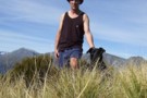
Browning Range Biv - almost ...
Photograph
•
Distance: less than 100m away
Browning Range Biv - almost there ...
More ▶︎
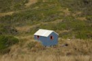
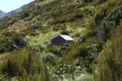
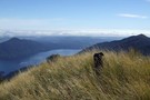
Browning Range Bivouac
Photograph
•
Distance: less than 100m away
Browning Range Bivouac, on the bush-line in the Browning Range - the hut overlooks the Styx Valley and Grassy Flat, ...
More ▶︎
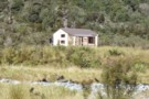
Crawford Junction Hut
Photograph
•
Distance: less than 100m away
Crawford Junction Hut, at the confluence of Crawford Creek and Kokatahi River in Westland
More ▶︎
Crawford Junction
Photograph
•
Distance: less than 100m away
Crawford Junction, the confluence of Crawford Creek and Kokatahi River in Westland. Photo taken from the doorway of Crawford Junction ...
More ▶︎
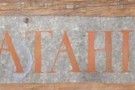
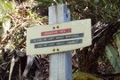
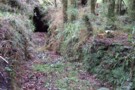
Biv sign
Photograph
•
Distance: 103m away
Gone but not forgotten!
Bits of this biv were salvaged from the Hokitika rubbish dump. An aquaintance made a sculpture ...
More ▶︎
Kokatahi Bivouac
Photograph
•
Distance: 103m away
No - the camera's not on an angle - it's the Biv that's leaning. The dilapidated Kokatahi Bivouac below Zit ...
More ▶︎
Kokatahi Bivouac (removed)
Hut
•
Removed!
•
Distance: 103m away
Hut removed 2008.
Kokatahi Bivouac (dilapidated) was once a typical 2-bed apline bivouac, located on a grassy face above the upper ...
More ▶︎
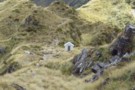
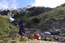
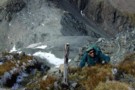
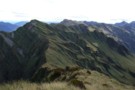
Looking SW from Adventure Ridge April 2008
Photograph
•
Distance: 106m away
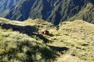
In the foreground is the Adventure Ridge biv.
Next ridge back is Yeats Ridge with a white dot in the tussocky ...
More ▶︎
Adventure Ridge Biv
Hut
•
Basic Hut/Bivvy (DOC). Capacity: 2.
•
Distance: 106m away
A great little bivvy with it's own water tank.
Built by the NZFS in 1964.
More ▶︎
Cedar Flat Hut (Historic)
Hut
•
Basic Hut/Bivvy (DOC). Capacity: 2.
•
Distance: 141m away
Older hut at Cedar Flat now adjacent to the newer hut. This hut features hand-adzed timber. It was constructed in ...
More ▶︎
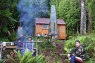
Top Crawford Bivouac
Photograph
•
Distance: 158m away
Top Crawford Bivouac, Crawford Valley, Westland
More ▶︎
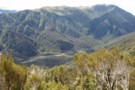
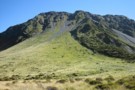
Mount Learmont
Photograph
•
Distance: 158m away
Mount Learmont and the upper Crawford Valley, Westland
More ▶︎
Top Crawford Bivouac (Removed)
Hut
•
Removed!
•
Distance: 158m away
The Top Crawford Bivouac (2 bunks, no matresses, stream water 100m distant, no fire) is a typical alpine Biv, with ...
More ▶︎
Adventure Biv
Photograph
•
Distance: 191m away
Perhaps this is the ADD-VENTURE behind all adventures...
'Out there with his people he forgets himself,
He forgets himself with his people,
He ...
More ▶︎
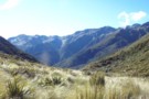
View East from Top Crawford biv Dec 2010
Photograph
•
Distance: 216m away
This pic was taken from the biv & shows the basin immediately East of the biv. Thought the ribbonwoods looked ...
More ▶︎
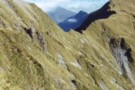
Crawford Biv looking up Lathrop saddle
Photograph
•
Distance: 263m away
Lathrop saddle is off to the right, the spur to it is center above biv.
More ▶︎
Mt Brown hut & Newton Range April 2013
Photograph
•
Distance: 412m away
This photo shows how the popular Mt Brown hut sits in relation to the Newton Range.
As well as tramps to ...
More ▶︎
Grassy Flat Hut
Hut
•
Standard Hut (DOC). Capacity: 12.
•
Distance: 412m away
Grassy Flat Hut (sleeps 12 on 2 platforms, matresses, water, stove) is a modern tramping hut with a large covered ...
More ▶︎
Cedar Flat Historic Hut
Photograph
•
Distance: 441m away
The Cedar Flat Historic hut after renovations and the picture taken during the big snow of August 2008.
More ▶︎
Cedar Flat
Track
•
2 days. Easy/medium. Return via same track.
•
Distance: 441m away
An easy and pleasant walk into a secluded valley near Hokitika. Rudimentary hot pools.
More ▶︎
Historic Cedar Flats Hut
Photograph
•
Distance: 442m away
A well maintained old hut. 2 bunks
More ▶︎
Cedar Flats Hot Springs
Photograph
•
Distance: 442m away
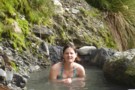
Perfect hot springs in a secluded hokitika valley. Holds upto 6 people.
More ▶︎
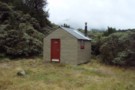
Grassy Flats Hut
Photograph
•
Distance: 449m away
Grassy Flats Hut in the upper Styx Valley, Westland. The hut lies on the easy, benched Arahura-Styx track, and is ...
More ▶︎
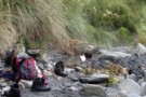
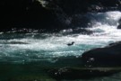
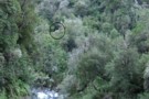
Blue Ducks
Photograph
•
Distance: 507m away
Blue Ducks on Crawford Creek, Westland. Between Top Crawford Hut and Top Crawford Bivouac
More ▶︎
Southern descent of Mt.Browns Tops
Photograph
•
Distance: 939m away
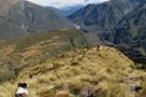
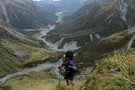
Moving through a boggy section of the Mt.Browns Tops route just before dropping over the edge into the creek.
That's ...
More ▶︎
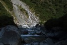
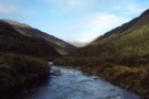
Crawford Creek
Photograph
•
Distance: 988m away
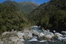
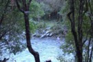
Crawford Creek, Westland. Between Top Crawford Hut and Crawford Junction Hut.
More ▶︎
Zit Saddle
Photograph
•
Distance: 1.0km away
Zit Saddle, between the Kokatahi and Toaroha valleys
More ▶︎
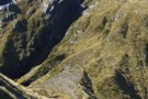
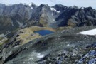
Lathrop Saddle
Photograph
•
Distance: 1.1km away
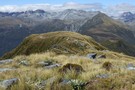
Lathrop Saddle - a hanging valley cutting through the Browning Range between the Styx and Crawford valleys. A marked track ...
More ▶︎
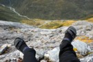
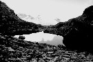
Lathrop Saddle feet dangle
Photograph
•
Distance: 1.4km away
Sitting on the edge of Lathrop. Spot the biv. Descent far right on the tussock spur. Dangling feet highly recommended.
More ▶︎
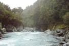
Kokatahi River
Photograph
•
Distance: 1.6km away
Boulder hopping down the upper Kokatahi, between Top Koktahi Hut and Crawford Junction Hut.
More ▶︎
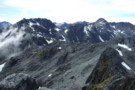
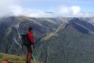
Browning Range
Photograph
•
Distance: 1.6km away
From the Browning Bivvy on the bushline above the Styx River we climbed in the dark to reach the top ...
More ▶︎
Crossing Lathrop Saddle
Photograph
•
Distance: 1.6km away
Crossing Lathrop Saddle from the Crawford towards Browning Biv
More ▶︎
Upper Kokatahi River
Photograph
•
Distance: 1.7km away
Kokatahi River, above Top Kokatahi Hut. The track to Zit Saddle crosses this river several times, and will not be ...
More ▶︎
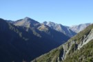
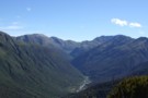
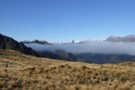
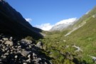
Upper Styx valley
Photograph
•
Distance: 1.8km away
Upper Styx valley and Grassy Flats, from the track over Styx Saddle.
More ▶︎
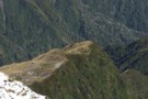
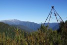
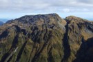
Commodore Ridge etc Feb 2012
Photograph
•
Distance: 1.9km away
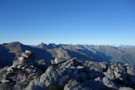
This photo was taken from Point 1809m on the Toaroha Range NW of Mt Chamberlin and looks eastward toward the ...
More ▶︎
Top Kokatahi Hut
Hut
•
Basic Hut/Bivvy (DOC). Capacity: 4.
•
Distance: 1.9km away
The Top Kokatahi Hut (4 bunks, matresses, tank water, stove) is a forestry-style hut. It is perched above the confluence ...
More ▶︎
Top Kokatahi Hut
Photograph
•
Distance: 1.9km away
Top Kokatahi Hut, Westland
Note: this hut has since been relocated to the former site of Kokatahi Biv, some 5km upriver
More ▶︎
Top Crawford Hut (Removed)
Hut
•
Removed!
•
Distance: 1.9km away
Top Crawford Hut (4-bunks, matresses, tank water, no fire) is a typical forestry-style hut. It's located on a small terrace ...
More ▶︎
Top Crawford Hut
Photograph
•
Distance: 1.9km away
Top Crawford Hut, Crawford Creek, Westland.
More ▶︎
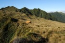
Yeats Ridge hut April 2008
Photograph
•
Distance: 1.9km away
This hut is located on a flattish area of moss & tussock amidst the scrub zone of the Toaroha catchment. ...
More ▶︎
Yeats Ridge hut
Hut
•
Basic Hut/Bivvy (DOC). Capacity: 4.
•
Distance: 1.9km away
This hut is located on a flattish area of moss & tussock amidst the scrub zone of the Toaroha catchment. ...
More ▶︎
Route between Yeates Hut & Crystal Biv
GPX file
•
Distance: 2.0km away
This file traces the route up from Yeates Hut to the 1300m contour, then descends to Crystal Biv. If going ...
More ▶︎
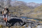
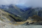
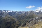
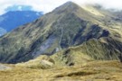
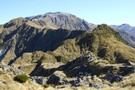
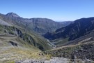
Looking SW from Mt Lathrop March 2017
Photograph
•
Distance: 2.0km away
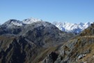
This is the view looking out over the Crawford and Kokatahi Rivers in a south westerly direction. The Bracken snowfield ...
More ▶︎
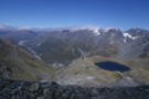
View of Mt Lathrop etc. and further east
Photograph
•
Distance: 2.0km away
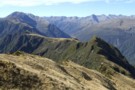
This photo looks east along the Browning Range. Lathrop Saddle crosses this scene in front of the prominent Mt Lathrop ...
More ▶︎
Yeats Ridge, Toaroha
Photograph
•
Distance: 2.1km away
Climbing the Yeats ridge just beyond the monkey scrub belt. In the background is the Toaroha River and the Yeats ...
More ▶︎
Styx Saddle
Photograph
•
Distance: 2.1km away
Styx Saddle - between the Styx and Arahura valleys in Westland. The Campbell Range forms a backdrop beyond the upper ...
More ▶︎
Looking eastward along the Newton Range April 2012
Photograph
•
Distance: 2.2km away
This picture was taken from a spot on the range a bit over an hour west of the bivvy. The ...
More ▶︎
Newton Range biv
Hut
•
Basic Hut/Bivvy (DOC). Capacity: 2.
•
Distance: 2.2km away
This NZFS biv built in 1962 is perched near the crest of the Newton Range. This range seperates the Arahura ...
More ▶︎
Kokatahi River
Photograph
•
Distance: 2.2km away
Kokatahi River, between Crawford Junction Hut and Top Kokatahi Hut.
More ▶︎
Newton Range biv Jan 2008
Photograph
•
Distance: 2.3km away
This biv is perched near the crest of the Newton Range. This range seperates the Arahura River to the north ...
More ▶︎
View from un-named Campbell Range saddle
Photograph
•
Distance: 2.3km away
This April 2013 photo was taken from the un-named Campbell Range Saddle at 1600m that is on the direct route ...
More ▶︎
Jumble Tops Traverse
Photograph
•
Distance: 2.5km away
A GPS track of Doug Forster's traverse of Jumble Tops in pink. 3 of us did a more direct version ...
More ▶︎
Lake Kaniere - Otira
GPX file
•
Distance: 2.6km away
from the north end of Lake Kaniere, along the west shore to the Styx river. East along the Styx to ...
More ▶︎
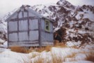
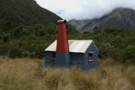
Mid Styx Hut painting March 2014
Photograph
•
Distance: 2.6km away
Volunteers have prepared & painted the hut exterior. This is just the second paint job this 1960 built hut has ...
More ▶︎
Browning Pass etc from Mt Browning Nov 2017
Photograph
•
Distance: 2.7km away
Looking toward Browning Pass etc from high on Mt Browning.
I climbed up from the Styx Saddle and enjoyed great ...
More ▶︎
Track to Mid Styx Hut
Track
•
Easy. Loop track.
•
Distance: 2.7km away
Recently recut 40 minute track to this front country hut renovated by volunteers from the Permolat on-line community.
More ▶︎
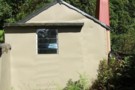
Mid Styx Hut
Article
•
Distance: 2.7km away
Our trip in to check out this hut restored by the Permolat Community
More ▶︎
Mid Styx Hut
Hut
•
Basic Hut/Bivvy (NA). Capacity: 4.
•
Distance: 2.7km away
4 person ex-NZFS hut with open fireplace on north facing terrace high above the Styx River. Renovated extensively and maintained ...
More ▶︎
Mid Styx hut Feb 2009
Photograph
•
Distance: 2.7km away
This photo of Mid Styx hut was taken during a "Permolat" working bee when a group of volunteers worked on ...
More ▶︎
Short cut to Mid Styx hut
Photograph
•
Distance: 2.7km away
This photo shows the turnoff to Mid Styx hut as described below.
Easiest access to Mid Styx hut is the Styx ...
More ▶︎
Jumbletop
Photograph
•
Distance: 2.8km away
Near the summit of Mt Jumbletop at sunrise. View to Mt Evans and Sentinal
More ▶︎
Crystal Biv Track
GPX file
•
Distance: 2.9km away
Track to Crystal Biv from the valley floor in the Toaroha, Westland. This track has just been reopened by volunteers ...
More ▶︎
Descending to Crystal biv April 2008
Photograph
•
Distance: 2.9km away
This pic shows part of the route you would take if descending from Yeats Ridge to Crystal biv.
More ▶︎
Crystal Biv
Hut
•
Basic Hut/Bivvy (DOC). Capacity: 2.
•
Distance: 2.9km away
Standard 2 person biv located in the Toaroha Valley, located on a spur between Pretty and Crystal Creeks. Set beside ...
More ▶︎
Blue Duck Bivvy Setting Feb 2016
Photograph
•
Distance: 3.0km away
Blue Duck Bivvy is a derelict B-49 style NZ Forest Service hunters bivvy that was built in the late 1950's ...
More ▶︎
Blue Duck Bivvy
Hut
•
Basic Hut/Bivvy (DOC).
•
Distance: 3.0km away
A derelict B-49 NZ Forest Service hunters bivvy that was built in the late 1950's and is still on site. ...
More ▶︎
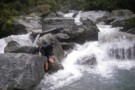
West Coast Streams
Photograph
•
Distance: 3.4km away
En-route from Harman Hut to Grassy Flat Hut. Be mindful that during heavy rain in the New Zealand bush, small ...
More ▶︎
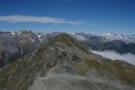
Main Range of the Southern Alps from Mt. Bannatyne
Photograph
•
Distance: 3.5km away
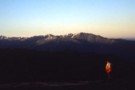
Main Range of the Southern Alps from Mt. Bannatyne, a trampable ridgeline from Kokatahi Bivouac to Toaroha Bivouac.
More ▶︎
Genoa Peak March 2009
Photograph
•
Distance: 3.9km away
This pic is of the eastern side of Genoa Peak and was taken from just above Pinnacle biv on the ...
More ▶︎
Pinnacle biv (aka Crinkle Top biv) March 2009
Photograph
•
Distance: 3.9km away
A survivor from the deer culling days before helicopters! This biv gave shooters access to hundreds of hectares of tussock ...
More ▶︎
Harman hut August 1975
Photograph
•
Distance: 3.9km away
This pic was taken after having come down from Browning Pass. Shortly after I snapped the pic it started snowing ...
More ▶︎
Harman Hut
Hut
•
Standard Hut (DOC). Capacity: 6.
•
Distance: 3.9km away
Standard DOC hut at the confluence of the Harman & Arahura rivers. This hut is on the popular "3 passes" ...
More ▶︎
Pinnacle biv (aka Crinkle Top biv)
Hut
•
Basic Hut/Bivvy (DOC). Capacity: 2.
•
Distance: 3.9km away
An old late 1950's NZFS cullers biv situated up in the tussock near the top of Mt Crinkle Top. This ...
More ▶︎
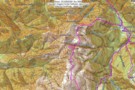
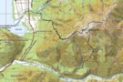
Map of Toaroha Valley to Pinnacle Biv via Adventure Ridge routes
Photograph
•
Distance: 3.9km away
This map is to illustrate the route info provided under the Comments section of the Pinnacle biv hut page.
The ...
More ▶︎
Setting of Pinnacle biv (aka Crinkle Top biv) March 2012
Photograph
•
Distance: 3.9km away
This pic shows the replacement biv which was moved to this site in 2011. It is the same design & ...
More ▶︎
Gerhardt Spur
Photograph
•
Distance: 4.0km away
A crystal clear morning at Gerhardt Spur Bivvy
More ▶︎
Harman Hut
Photograph
•
Distance: 4.0km away
Harman Hut on a typical West Coast summer day. Pretty basic hut that comes with its own family of weka!
More ▶︎
Lower Arahura Hut
Photograph
•
Distance: 4.0km away
A nice new 6 bunk hut in the Arahura valley.
More ▶︎
"New" Lower Arahura hut June 2010
Photograph
•
Distance: 4.0km away
A replacement DOC 6 bunk hut for the old NZFS 4 bunk hut that used to sit 30m to the ...
More ▶︎
Lower Arahura hut
Hut
•
Standard Hut (DOC). Capacity: 6.
•
Distance: 4.0km away
A new DOC 6 bunk hut that replaces the old 4 bunk NZFS hut. The new hut is 30m east ...
More ▶︎
"Old" Lower Arahura hut (removed)
Photograph
•
Distance: 4.0km away
This photo shows the "old" Lower Arahura hut as it was in January 1976 when it had recently received a ...
More ▶︎
Mullins Basin April 2008
Photograph
•
Distance: 4.1km away
This pic shows the huts location in the basin and shows part of the imposing Diedrich Range behind.
More ▶︎
Mullins Basin hut April 2008
Photograph
•
Distance: 4.1km away
Mullins Basin hut is a four bunk hut situated in the head basin of Mullins Creek a TL tributary of ...
More ▶︎
Mullins Basin hut
Hut
•
Basic Hut/Bivvy (DOC). Capacity: 4.
•
Distance: 4.1km away
A four bunk hut situated in the head basin of Mullins Creek a TL tributary of the Toaroha River. The ...
More ▶︎
"New" Gerhardt Spur biv June 1975
Photograph
•
Distance: 4.1km away
This pic shows DH at the then fairly new Gerhardt Spur biv on Queens Birthday weekend 1975. Mt Jumble Top ...
More ▶︎
Looking down at Gerhardt Spur biv from Jumble Top May 2009
Photograph
•
Distance: 4.1km away
Gerhardt Spur biv is an early/mid 1970's era NZFS biv located in the tussock high on Gerhardt Spur which is ...
More ▶︎
Gerhardt Spur biv
Hut
•
Basic Hut/Bivvy (DOC). Capacity: 2.
•
Distance: 4.1km away
An early/mid 1970's era NZFS biv located in the tussock high on Gerhardt Spur which is on the western side ...
More ▶︎
Top Toaroha hut Jan 2009
Photograph
•
Distance: 4.4km away
This hut is located on the Bannatyne Flats towards the head of the Toaroha River. It is on the main ...
More ▶︎
Top Toaroha hut
Hut
•
Standard Hut (DOC). Capacity: 6.
•
Distance: 4.4km away
This hut is located on the Bannatyne Flats towards the head of the Toaroha River. It is on the main ...
More ▶︎
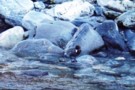
Blue Duck at the Tyndall / Styx confluence
Photograph
•
Distance: 4.5km away
Blue Duck at the Tyndall / Styx confluence
More ▶︎
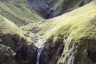
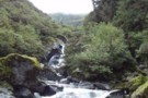
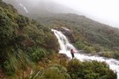
Waterfall in the upper Toaroha
Photograph
•
Distance: 4.6km away
The waterfall in the upper Toaroha river. From Toaroha Saddle - 500m east of Toaroha Bivouac
More ▶︎
Boo Boo hut & woodshed March 2009
Photograph
•
Distance: 4.6km away
TL of the Kokatahi valley. High on a ridge well above the river gorges.
More ▶︎
Boo Boo Hut
Hut
•
Basic Hut/Bivvy (DOC). Capacity: 4.
•
Distance: 4.6km away
Located on the Kokatahi River track just south of where a branch leads up onto the Toaroha Range.
More ▶︎
Toaroaha Saddle-Frew Saddle Circuit
Track
•
4 – 6 days. Medium. One way.
•
Distance: 4.8km away
A great tramp in a remote location, crosses two alpine saddles, ice-axes and crampons needed in winter. More information on ...
More ▶︎

Mungo River and Brunswick Creek April 2011
Photograph
•
Distance: 4.8km away
This pic shows part of the Mungo River and its tributary Brunswick Creek. It was taken from near the true ...
More ▶︎
Mungo Valley & Park Stream April 2011
Photograph
•
Distance: 4.8km away
This pic looks up the Mungo River. On the left (TR) you can see tributaries Saddle Creek & Park Stream. ...
More ▶︎
Looking SW from Mt Diedrichs May 2013
Photograph
•
Distance: 4.8km away
This photo taken from beside the trig beacon on the summit of Mt Diedrichs 1084m looks SW over the Hokitika ...
More ▶︎
Mungo hut
Hut
•
Basic Hut/Bivvy (DOC). Capacity: 4.
•
Distance: 4.8km away
The Mungo is a tributary of the Hokitika River. The hut is situated on a terrace between the Mungo River ...
More ▶︎
Mungo hut Feb 2012
Photograph
•
Distance: 4.8km away
The Mungo is a tributary of the Hokitika River. The hut is situated on a terrace between the Mungo River ...
More ▶︎
Toaroha Saddle April 2011
Photograph
•
Distance: 4.8km away
This is the saddle joining the Diedrich and Toaroha Ranges. It is approx 450 metres to the east of the ...
More ▶︎
Toaroha Saddle biv & Diedrich Range April 2011
Photograph
•
Distance: 4.9km away
This pic was taken from east of the biv on the knob back toward the true saddle. It looks west ...
More ▶︎
Toaroha Bivouac
Photograph
•
Distance: 4.9km away
Toaroha Bivouac - on the saddle between the Toaroha Valley and Mungo /Hokitika valley
More ▶︎
Toaroha Bivouac
Hut
•
Basic Hut/Bivvy (DOC). Capacity: 2.
•
Distance: 4.9km away
Toaroha Bivouac (2 bunks, matresses, tarn water 50m distant) is a typical alpine bivouac on the saddle of the track ...
More ▶︎
Toaroha Saddle biv 2009
Photograph
•
Distance: 4.9km away
Here is a close up shot of the biv taken just after day break as we were about to leave ...
More ▶︎
Old Water Race below Lower Arahura hut
Photograph
•
Distance: 5.0km away
Here is a photo of a remnant section of the water race that runs roughly parallel with the current track ...
More ▶︎
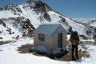
Toaroha Saddle Bivvy
Hut
•
Basic Hut/Bivvy (DOC). Capacity: 2.
•
Distance: 5.0km away
Hut on the saddle between the Mungo and Toaroha Rivers.
More ▶︎
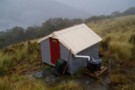
Toaroha Saddle Bivvy
Photograph
•
Distance: 5.0km away
We woke up after a windy night in the bivvy to half a meter of fresh snow. The weather didn't ...
More ▶︎
Jade Prospectors hut at Olderog/Jade Ck confluence Feb 2009
Photograph
•
Distance: 5.2km away
This hut is known by the names of both the creeks it is at the confluence of. We used to ...
More ▶︎
Looking down the Arahura River from near Campbell biv Feb 2009
Photograph
•
Distance: 5.3km away
This pic shows the Arahura River as far as the "big bend" where it goes out of sight then it ...
More ▶︎
Campbell biv Feb 2009
Photograph
•
Distance: 5.3km away
A 1950's vintage cullers biv located on a west facing spur of the Campbell Range. From the biv there are ...
More ▶︎
Campbell biv
Hut
•
Basic Hut/Bivvy (DOC). Capacity: 2.
•
Distance: 5.3km away
A 1950's vintage cullers biv located on a west facing spur of the Campbell Range. From the biv there are ...
More ▶︎
Tops SW of Lake Browning April 2013
Photograph
•
Distance: 5.5km away
I'm sharing this photo of the area near Browning Pass. I guess it must be one of my favoured areas ...
More ▶︎
Browning Pass zig-zag
Photograph
•
Distance: 5.7km away
The zig-zag trail going up to Browning Pass on the 3 passes route. taken February 2007
More ▶︎
Three Passes
Track
•
4 – 5 days. Medium/hard. One way.
•
Distance: 5.9km away
A classic trip from Arthur's Pass across Browning, Whitehorn and Harman Passes, emerging near Lake Kaniere on the West Coast.
More ▶︎
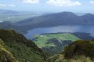
Lake Browning
Photograph
•
Distance: 5.9km away
Lake Browning, behind Browning Pass. Officially the West Coast after crossing Browning Pass, now the rain starts.
More ▶︎
Climbing Browning Pass
Photograph
•
Distance: 5.9km away
Ascending the zig-zag tracked part of Browning Pass. It's a steep scramble up the scree at the top, probably better ...
More ▶︎
View of McArthur Crags from the Newton Range Jan 2008
Photograph
•
Distance: 6.1km away
This picture was taken from just north of the Newton Range biv. I took it to show the band of ...
More ▶︎
Route down off McArthur Crags to Lower Olderog biv Jan 2010
Photograph
•
Distance: 6.1km away
This pic shows the SE leading spur off the top of Mt McArthur that leads down to Lower Olderog biv. ...
More ▶︎
Lower Olderog biv (aka Jade biv) Feb 2009
Photograph
•
Distance: 6.1km away
This biv is located on a bench well above the creek bed in the headwaters of Jade Creek. It is ...
More ▶︎
Lower Olderog biv (aka Jade biv)
Hut
•
Basic Hut/Bivvy (DOC). Capacity: 2.
•
Distance: 6.1km away
This NZFS biv dating from 1957 is located on a bench well above the creek bed in the headwaters of ...
More ▶︎
Mt Brown Hut
Track
•
1 – 2 days. Medium. Loop track with a road section.
•
Distance: 6.3km away
A circuit in the foothills behind Hokitika. Excellent views and a nice little hut.
More ▶︎
Tracks to the "New" Mt Brown hut
GPX file
•
Distance: 6.3km away
Here is a gpx file. It shows the new huts location & the routes to the hut from the Geologists ...
More ▶︎
Poet Hut
Photograph
•
Distance: 6.4km away
Poet Hut, a riverside hut in the Mungo / Hokitika valley.
More ▶︎
Poet Hut
Hut
•
Standard Hut (DOC). Capacity: 4.
•
Distance: 6.4km away
Poet Hut (4 bunks, matresses, fireplace, river water) is a timber built hut in a small clearing in the Mungo ...
More ▶︎
Poet hut April 2011
Photograph
•
Distance: 6.4km away
This hut is a 1950's NZFS cullers hut located on the TR of the Mungo River a tributary of the ...
More ▶︎
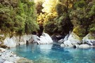
Mungo River pools above Poet Hut
Photograph
•
Distance: 6.4km away
Mungo River pools 200m upstream of Poet Hut
More ▶︎
Mudflats Hut
Photograph
•
Distance: 6.5km away
Mudflats Hut, in the Arahura Valley, Westland.
More ▶︎
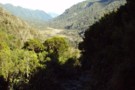
Arahura Valley
Photograph
•
Distance: 6.5km away
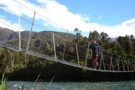
The Arahura Valley from the Mudflats swingbridge.
More ▶︎
Mudflats Hut
Hut
•
Standard Hut (DOC). Capacity: 6.
•
Distance: 6.5km away
Mudflats Hut (6 bunks, matresses, tank water, stove, firewood available) lies in the mid-reaches of the Arahura Valley in Westland. ...
More ▶︎
Park Morpeth Hut
Hut
•
Standard Hut (DOC). Capacity: 6.
•
Distance: 6.6km away
This is a Canterbury Mountaineering Club Hut, and it appears in DOC's hut list. On the classic Three Passes route.
More ▶︎
Western flanks of Mt Ross
Photograph
•
Distance: 6.6km away
This pic was taken when MM & I stopped to boil the billy having descended from Mt Ross(1770m) en route ...
More ▶︎
Arahura Valley from Mt Harman
Photograph
•
Distance: 6.7km away
Arahura Valley from Mt Harman
More ▶︎
Pope-Browning Pass - looking down the Wilberforce
Photograph
•
Distance: 6.7km away
Pope-Browning Pass on the snowfields on the SE face of Mt Harman. Looking over Lake Browning and down the Wilberforce
More ▶︎
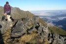
glennj & Elle dog on summit of Mt Brown April 2011
Photograph
•
Distance: 6.7km away
Summit of Mt Brown. It is the Browning Range in the background.
Yesterday was such good weather I decided to head ...
More ▶︎
Lake Kaniere etc from top of Mt Brown April 2011
Photograph
•
Distance: 6.7km away
This pic shows Elle dog on Mt Brown with views out to the coast behind. The Lake is Kaniere and ...
More ▶︎
Leaving Mt.Browns Tops
Photograph
•
Distance: 7.1km away
A good stretch of the legs. Everyone else we saw on this walk and there were a few, was staying ...
More ▶︎
Looking up the Styx from near the New Mt Brown hut
Photograph
•
Distance: 7.2km away
This pic taken yesterday was snapped from the tussock section below the hut whilst heading for the start of the ...
More ▶︎
Mount Brown Hut
Photograph
•
Distance: 7.3km away
Perched on a cliff overlooking Lake Kaniere.
More ▶︎
Mt Brown summit & circuit routes March 2011
Photograph
•
Distance: 7.3km away
This map shows the actual track/routes overlayed in solid black lines on a Topo 50 map. The "old" Mt Brown ...
More ▶︎
The Mt Brown ridge construction site May 2010
Photograph
•
Distance: 7.3km away
Looking SW from Mt Brown ridge over top of the early stages of construction of the "new" hut.
The "old" Lower ...
More ▶︎
View out to coast from Mt Brown hut
Photograph
•
Distance: 7.3km away
This view is taken just a few steps from Mt Brown hut and looks back toward the track start and ...
More ▶︎
Lunch time at Mt Brown hut Dec 2010
Photograph
•
Distance: 7.3km away
The four younger members of the group of five of us that walked up to check out the new hut.
The ...
More ▶︎
Mt Brown hut & beyond Dec 2010
Photograph
•
Distance: 7.3km away
This hut replaces, but on a different site, the old Mt Brown hut which was removed by DOC about five ...
More ▶︎
Mt Brown Hut
Hut
•
Basic Hut/Bivvy (Mt Brown Community Hut Project). Capacity: 4.
•
Distance: 7.3km away
This hut replaces the old Mt Brown hut which was removed by DOC in 2006. The hut is in a ...
More ▶︎
View up Styx valley from Mt Brown hut June 2012
Photograph
•
Distance: 7.3km away
This photo looks up the Styx valley and was taken from outside Mt Brown hut. If you look closely you ...
More ▶︎
Mt Brown hut June 2012
Photograph
•
Distance: 7.3km away
Here is a winter time pic of the hut.
More ▶︎
Popes Pass
Photograph
•
Distance: 7.4km away
This picture shows "Alpine" climbing up the start of the ridge leading to Mt Harman with Popes Pass below.
We went ...
More ▶︎
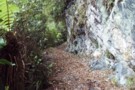
Arahura-Styx track
Photograph
•
Distance: 7.6km away
The Arahura - Styx track: a benched historic pack-horse track through the Arahura and Styx valleys in Westland. An easy ...
More ▶︎
Southern Alps from Homeward Ridge
Photograph
•
Distance: 7.6km away
Southern Alps from Homeward Ridge - opposite Poet Hut, above the Mungo / Hokitika valley.
More ▶︎
Newton Creek Hut from Arahura Pack track
Track
•
1 day. Hard. One way.
•
Distance: 7.6km away
Former forest service track that was left to overgrow and suffered further damage from snow loading in winter of 2008.
Fortunately ...
More ▶︎
Serpentine Hut March 2015
Photograph
•
Distance: 7.6km away
Here is a recent photo of this survivor built in 1957 for deer culler accomodation. Andrew Buglass and "Permolat" helpers ...
More ▶︎
Serpentine Hut 1977
Photograph
•
Distance: 7.6km away
This photo of Serpentine hut was taken summer time 1977 by friend & sometimes tramping companion Neil Bradley.
The access route ...
More ▶︎
View SE along the Meta Range March 2011
Photograph
•
Distance: 7.6km away
This picture was taken from near the summit of Mt Inframeta & looks along the Meta Range toward the Southern ...
More ▶︎
Serpentine hut setting March 2011
Photograph
•
Distance: 7.6km away
This picture from approx 300 metres away across the Hoki River shows Serpentine huts location on an overgrowing clearing on ...
More ▶︎
Serpentine hut
Hut
•
Basic Hut/Bivvy (DOC). Capacity: 4.
•
Distance: 7.6km away
This hut is located on a small bush terrace on the TR of the Hokitika River and the TL of ...
More ▶︎
serpentine hut
Photograph
•
Distance: 7.7km away
Flew into hut to drop a group of 6 off they were going to stay the night and walk out
More ▶︎
Arahura River & swingbridge
Photograph
•
Distance: 7.8km away
The swingbridge over the Arahura on the track to Newton Creek Hut.
More ▶︎
Frisco hut Jan 2009
Photograph
•
Distance: 8.0km away
Frisco hut is on the TR of the Hokitika River less than 2kms below the junction with the Mungo River. ...
More ▶︎
Frisco hut
Hut
•
Basic Hut/Bivvy (DOC). Capacity: 4.
•
Distance: 8.0km away
Frisco hut is on the TR of the Hokitika River less than 2kms below the junction with the Mungo River. ...
More ▶︎
Upper Taipo Forks - Pope's Pass & Mt Harman
Photograph
•
Distance: 8.2km away
Upper Taipo Forks - Pope's Pass to right with Mt Harman snowfield (route to Browning Pass) just visible below the ...
More ▶︎
Mt Kerr
Photograph
•
Distance: 8.3km away
Exploring the exposed tops above the Arahura RIver just before a front rolls in. Reached by an old NZFS track ...
More ▶︎
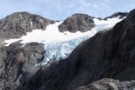
Cronin Glacier
Photograph
•
Distance: 8.5km away
Cronin valley and glacier on the 3 passes route. taken in perfect weather, February 2007.
More ▶︎
"Old" Bluff Hut (has been relocated & upgraded)
Hut
•
Removed!
•
Distance: 8.6km away
Ex NZFS 4 person hut. Shifted by DOC in 2009 further upvalley. Following notes are historical.
The water supply is currently ...
More ▶︎
"Old" Bluff hut (Removed) 1974
Photograph
•
Distance: 8.6km away
This is the "old" Bluff hut that has been shifted to the new site & upgraded. We will visit the ...
More ▶︎
Sir Robert Hut 2012
Photograph
•
Distance: 8.7km away
One of the more remote, seldom visited huts in Westland. The log book with barely half a dozen pages goes ...
More ▶︎
Sir Robert hut 1974
Photograph
•
Distance: 8.7km away
This hut is located on the TL near the stream in the head basin of Sir Robert Creek. The hut ...
More ▶︎
Sir Robert hut
Hut
•
Basic Hut/Bivvy (DOC). Capacity: 4.
•
Distance: 8.7km away
This hut is located on the TL near the stream in the head basin of Sir Robert Creek. The hut ...
More ▶︎
"New" Bluff Hut
Hut
•
Standard Hut (DOC). Capacity: 6.
•
Distance: 8.7km away
The old Bluff hut was dismantled and moved about 150 metres in 2010. At the same time it got a ...
More ▶︎
"New" Bluff hut April 2011
Photograph
•
Distance: 8.7km away
This square on shot of the new hut is from the perspective of looking up the TL of the Hokitika ...
More ▶︎
"New" Bluff hut & Mungo valley April 2011
Photograph
•
Distance: 8.7km away
The old Bluff hut was dismantled and moved about 150 metres in 2010. At the same time it got a ...
More ▶︎
The bluff on the upper Hokitika River just above the Mungo confluence
Photograph
•
Distance: 8.7km away
This pic taken in 2009 before Bluff hut was shifted and upgraded shows the setting of the hut from the ...
More ▶︎
Tops route between Lower & Top Olderog bivs Jan 2010
Photograph
•
Distance: 8.8km away
This pic was taken from the summit of the McArthur Crags. The ridge running NE away from the viewers eye ...
More ▶︎
Top Olderog biv Jan 2010
Photograph
•
Distance: 8.8km away
This biv is located on the TR in the headwaters of the main branch of Olderog Creek. It is well ...
More ▶︎
Top Olderog biv
Hut
•
Basic Hut/Bivvy (DOC). Capacity: 2.
•
Distance: 8.8km away
This biv was built by the NZFS in 1971. It is located on the TR in the headwaters of the ...
More ▶︎
Cronin Icefall
Photograph
•
Distance: 8.8km away
Seen from Whitehorn Pass, the spectacular icefall coming off the Cronin Glacier. Whitehorn Pass is the highest point on the ...
More ▶︎
Upper Taipo towards Pope Pass
Photograph
•
Distance: 9.1km away
Upper Taipo towards Pope Pass - boulderfields through the last of the scrub-layer
More ▶︎
Newton Creek Hut from Arahura Pack track
Article
•
Distance: 9.1km away
Formerly overgrown forest service track that could have led to underuse of lovely hut in magical setting.
More ▶︎
Newton Creek hut Dec 2011
Photograph
•
Distance: 9.1km away
This view of the hut looks SW. The hill in the background is Mt Newton which is on the opposite ...
More ▶︎
Newton Creek Hut
Hut
•
Basic Hut/Bivvy (DOC). Capacity: 4.
•
Distance: 9.1km away
Newton Creek Hut (4 bunk, mattresses, stove, firewood, water) is a pleasant forestry hut beside Newton creek. It's drier and ...
More ▶︎
Faultline on Mt Olson May 2013
Photograph
•
Distance: 9.6km away
This picture shows a fault line on the eastern side of Mt Olson (1603m)
Mt Olson is a hill in ...
More ▶︎
snow ghost
Photograph
•
Distance: 9.6km away
snow ghost, taken from Whitehorn pass Feb 2007.
More ▶︎