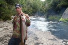
Nearby
Blue Mushroom
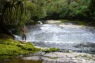
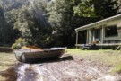
Pool in the Kopuapounamu Stream
Photograph
•
Distance: less than 100m away
We camped next to this pretty pool in the Kopuapounamu stream, upper Ruakituri catchment.
More ▶︎
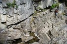
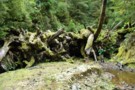
Ruakituri Sump Gorge
Photograph
•
Distance: less than 100m away
Most of the upper ruakituri river disappears underground, leaving a trickle to vanish down a deep jagged limestone gorge.
More ▶︎
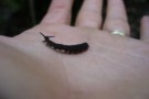
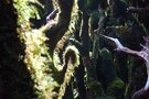
Peripatus
Photograph
•
Distance: less than 100m away
Found this cool peripatus in a rotten log in the Kopuapounamu basin, upper Ruakituri catchment, Ureweras.
More ▶︎
Ruakituri Wilderness Area
Place
•
Place. 235.50km2.
•
Distance: less than 100m away
Wilderness area located on the Huiarau Range in Te Urewera.
More ▶︎
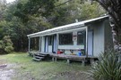
Manuoha Hut
Photograph
•
Distance: 4.1km away
6 Berth hut 5 mins from summit of Manuoha the highest point in Te Urewera national park.
More ▶︎
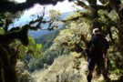
Manuoha Ridge
Photograph
•
Distance: 4.1km away
Menno roaring up a deer from the ruakituri side of manuoha.
More ▶︎
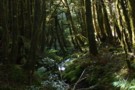
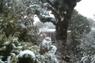
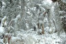
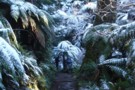
Mossy Creek on Manuoha
Photograph
•
Distance: 4.1km away
Mossy creek on the ruakituri side of manuoha.
More ▶︎
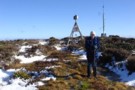
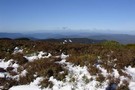
The summit of Manuoha
Photograph
•
Distance: 4.1km away
A trig and radio antenna mark the summit
More ▶︎
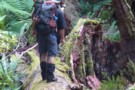
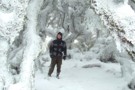
Navigating in the Bush
Photograph
•
Distance: 4.1km away
Trying to get where you're going in untracked bush full of windfalls from last years snow storm requires lots of ...
More ▶︎
Manuoha Hut
Hut
•
Standard Hut (DOC). Capacity: 6.
•
Distance: 4.1km away
A small basic hut more commonly frequented by hunters then trampers. Situated 5 minutes past the trig. It has 6 ...
More ▶︎
Manuoha - Waikareiti Circut
Track
•
3 days. Easy/medium. Loop track with a road section.
•
Distance: 4.1km away
A three day circut in Urewera National Park. Mt Manuoha is the highest point in the Park and offers great ...
More ▶︎
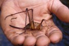
Whopper Cave Weta
Photograph
•
Distance: 4.8km away
This one was on a river bank, she got a fright and jumped into the water so we rescued her.
More ▶︎
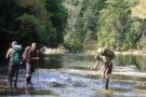
Ruakituri River Crossing
Photograph
•
Distance: 4.8km away
The Upper Ruakituri meanders over tilted papa slabs, allowing wide, shallow but very slippery crossings.
More ▶︎
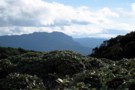
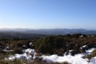
View SE from Te Rangaakapua
Photograph
•
Distance: 5.8km away
View SE from Te Rangaakapua hut, looking at point 1368 which is part of Maungapohatu. taken Feb 2010
More ▶︎
A Waioeka - Urewera crossing: Redpaths Road to SH38
Track
•
4 – 7 days. Medium. One way.
•
Distance: 5.9km away
Continuing my traverse of the North Island's Main Range, this trip crosses the Waioeka Conservation and (former) Urewera National Park, ...
More ▶︎
Good Camping on the track
Photograph
•
Distance: 6.7km away
There is a good campsite where the track comes down to the Kaipo lagoons from Pukepuke
More ▶︎
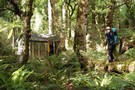
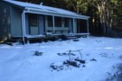
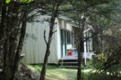
Tui Flat Hut
Hut
•
Basic Hut/Bivvy (NA). Capacity: 2.
•
Distance: 7.1km away
Unofficial but kind-of-official hut in the Ruakituri Wilderness Area, Te Urewera. Has a hut book, axe, billys, fireplace, a history ...
More ▶︎
Anini-Ruakituri Junction
Photograph
•
Distance: 7.3km away
This place is crawling with trout. Pity it's two big days walk from anywhere.
More ▶︎
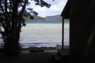
Sandy Bay Hut
Hut
•
Serviced Hut (DOC). Capacity: 18.Bookings required.
•
Distance: 8.7km away
An excellent hut nestled on the edge of Lake Waikareiti. A perfect alternative if you can't find space on the ...
More ▶︎
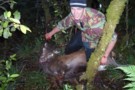
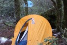
Meat's Back on the Menu Boys!
Photograph
•
Distance: 8.9km away
...As the orcs would say! Venison for tea in the bush is always a great way to supplement the freeze-dri!
More ▶︎
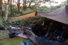
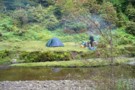
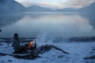
Anini clearing fly camp
Photograph
•
Distance: 9.4km away
Fly camp at the anini clearing, trout and venison for tea!
More ▶︎
A Waioeka - Urewera Tarverse
GPX file
•
Distance: 9.6km away
A trip shadowing the main divide through the Waioeka Conservation Area and Urewera National Park.
See related track for a route ...
More ▶︎