Nearby
Thirteen Mile Bush
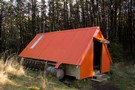
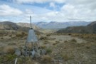
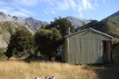
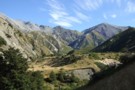
Benmore Hut
GPX file
•
Distance: 1.4km away
Short walk to a deerstalkers' hut in Thirteen Mile Bush.
More ▶︎
Benmore
Article
•
Distance: 1.5km away
A seldom used track to a cosy hut in the Benmore range
More ▶︎
Benmore Hut
Hut
•
Basic Hut/Bivvy (DOC). Capacity: 3.
•
Distance: 1.5km away
3 person little hut installed by Malvern Deerstalkers in 1975.
More ▶︎
Annavale Circuit from Benmore Hut
Article
•
Distance: 1.6km away
A new track enabling a circuit as a day trip or an easy weekend trip. Plenty of tracks to explore ...
More ▶︎
Dry Acheron Track
Track
•
1 day. Easy/medium. Return by the same track.
•
Distance: 5.3km away
Follow the Dry Acheron Stream to the summit of Big Ben (1416m).
More ▶︎
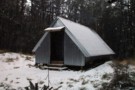
Inchs' Hut
Hut
•
Private hut (PVT). Capacity: 4.Bookings required.
•
Distance: 6.9km away
Rustic beech framed hut with tin cladding and roof built in 1973 I think by Gordon, Harold and one other ...
More ▶︎
Castle Hill Peak
GPX file
•
Distance: 7.3km away
Straightforward alpine walk with great views.
More ▶︎
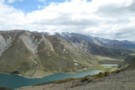
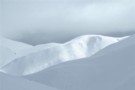
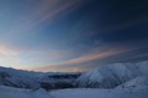
Lake Lyndon from Trig M
Photograph
•
Distance: 7.3km away
Beyond is Mount Lyndon and the Craigieburn Range.
More ▶︎
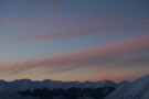
Red Hill from Trig M
Photograph
•
Distance: 7.3km away
Red Hill (1641m) is the highest peak to the right. The Lyndon Road winds past Lake Lyndon to Lake Coleridge ...
More ▶︎
Trig M
Track
•
Easy. Return via same track.
•
Distance: 7.3km away
An easy climb through subalpine scrub to a windy summit.
More ▶︎
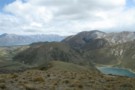
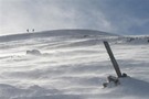
Red Hill (1641m)
Photograph
•
Distance: 7.4km away
This hill just east of Lake Coleridge is a good day walk. Viewed from near Trig M, Porter's Pass.
More ▶︎
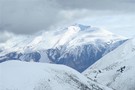
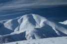
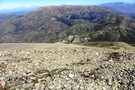
Black Hill (2067m)
Photograph
•
Distance: 7.4km away
Just south of Lake Coleridge. Viewed from Trig M near Porter's Pass.
More ▶︎
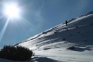
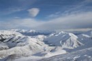
Foggy Peak
Photograph
•
Distance: 7.4km away
The climb up Foggy Peak follows Foggy Peak Ridge from the Porter's Pass road summit (visible lower right) to a ...
More ▶︎
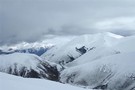
Foggy Peak
Photograph
•
Distance: 7.5km away
From near point 1170, Porter's Pass, July 2009.
More ▶︎
Korowai/Torlesse Tussocklands Park
Place
•
Conservation Park. 210.00km2.
•
Distance: 8.0km away
This park incorporates the Torlesse and Big Ben Ranges either side of Porter's Pass. The Torlesse Gap is a prominent ...
More ▶︎
Mt Lyndon
Track
•
0 – 1 day. Easy/medium. Return by the same track.
•
Distance: 8.5km away
Day trip of moderate ascent of 650 m hill overlooking Lake Lyndon near Porters Pass. Route goes via low open ...
More ▶︎
Red Hill
Track
•
1 day. Medium. Loop track.
•
Distance: 8.6km away
A largely untracked route up Red Hill (1,641m), with magnificent views of Lake Coleridge, and the surrounding foothills. This loop ...
More ▶︎
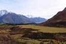
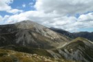
The Big Ben Range from Foggy Pk
Photograph
•
Distance: 9.0km away
Looking across Porters Pass in the Canterbury high country.
Kowai Forest is a very accessible point from which to explore the ...
More ▶︎
Foggy Peak
Track
•
Easy/medium. Return via same track.
•
Distance: 9.0km away
A short walk from Porter's Pass to a peak with good views at the southern end of the Torlesse Range.
More ▶︎
John Hayward Memorial Hut Feb 2014
Photograph
•
Distance: 9.1km away
Also known as Kowai hut but not to be confused with Kowhai hut in the Kaikoura area near Mt Fyffe. ...
More ▶︎
Torlesse Range Feb 2014
Photograph
•
Distance: 9.1km away
This photo is taken from slightly uphill of & beside the John Hayward Memorial Hut (Kowai Hut) in the Kowai ...
More ▶︎
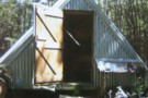
John Hayward Memorial Hut
Hut
•
Private hut (NA). Capacity: 6.
•
Distance: 9.1km away
Also known as Kowai hut but not to be confused with Kowhai hut in the Kaikoura area near Mt Fyffe. ...
More ▶︎