Nearby
Lake Sumner Conservation Park

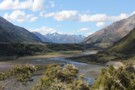
Arthur's Pass National Park
Place
•
National Park. 1145.00km2.
•
Distance: less than 100m away
This alpine park straddles the Main Divide of the Southern Alps, with dry beech forests in the east and damp ...
More ▶︎
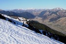
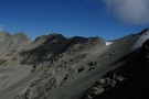
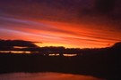
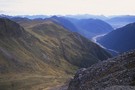
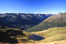
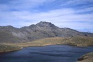
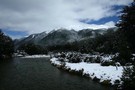
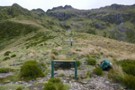
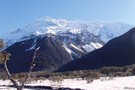
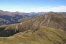
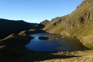
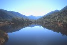
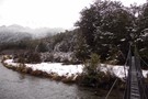
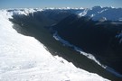
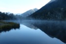
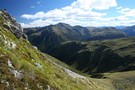
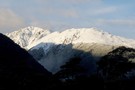
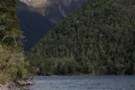
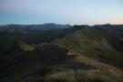
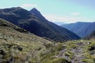
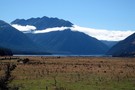
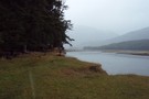
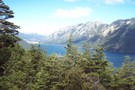
Magdalen Valley
Photograph
•
Distance: less than 100m away
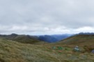
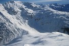
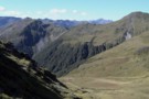
View east over Magdalen Valley to Waiau from Faust
More ▶︎
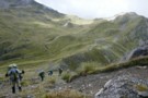
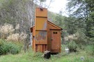
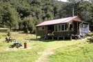
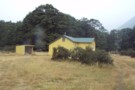
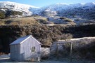
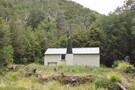
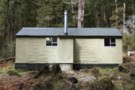
Boyle Village - Mt Faust - Boyle Hut
Track
•
1 day. Medium. One way.
•
Distance: less than 100m away
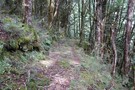
A great trip over the top of Mt Faust and down a spur to Boyle Hut on the St James ...
More ▶︎
Hanmer Forest Conservation Park
Place
•
Conservation Park. 130.00km2.
•
Distance: less than 100m away
This park surrounding Hanmer Springs is popular with families, offering easy walking and biking through both exotic and indigenous forests.
More ▶︎
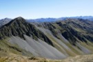
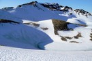
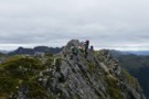
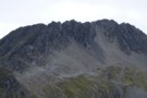
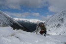
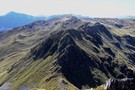
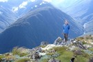
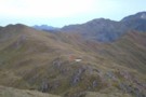
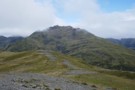
Mephistopheles
Photograph
•
Distance: 967m away
One of the named peaks along the Libretto Range, which runs from Lewis Pass to Boyle Village.
The ridge to Faust ...
More ▶︎
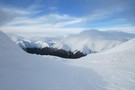
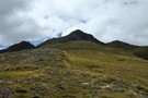
Plata Col / Balaclava Saddle
Photograph
•
Distance: 997m away
Plata Col from Balaclava Saddle. Balaclava saddle is a good route from the Havelock into the McCauley. To the south, ...
More ▶︎
Harper Pass - Kiwi Saddle
Track
•
5 – 7 days. Medium. One way.
•
Distance: 1.2km away
A classic crossing of the Main Divide, following the deep valleys of the Hope Fault from the Arthur's Pass road ...
More ▶︎
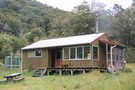
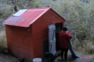
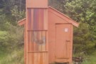
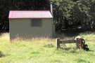
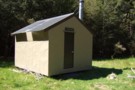
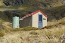
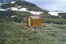
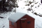
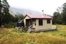
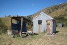
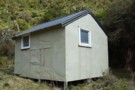
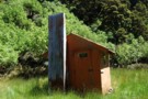
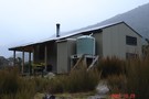
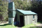
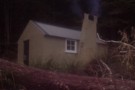
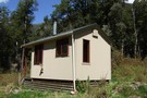
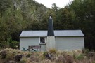
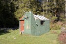
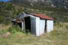
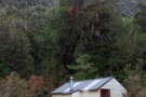
Harper Pass Biv
Hut
•
Basic Hut/Bivvy (DOC). Capacity: 2.
•
Distance: 1.2km away
Harpers Pass Biv (2 bed, matresses, stream water, no fire) is a small bivvy 1.5km below the Harper Pass. Weather-tight ...
More ▶︎
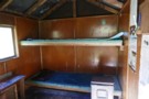
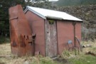
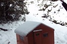
Harper Pass Bivouac
Photograph
•
Distance: 1.2km away
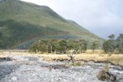
Harper Pass Bivouac, in the upper Hurunui valley
More ▶︎
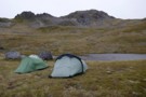
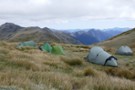
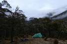
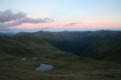
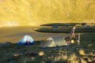
Apprentice tarns
Photograph
•
Distance: 1.4km away
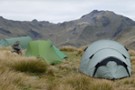
our camp under the Apprentice - hoping for some shelter from the approaching cyclone Gita but it was a restless ...
More ▶︎
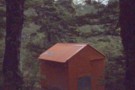
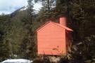
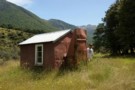
Lake Man Bivouac
Hut
•
Basic Hut/Bivvy (DOC). Capacity: 2.
•
Distance: 1.4km away
Lake Man Bivouac (2 bunk, no fire, stream water) is a basic bivouac 50m below the bushline near the head ...
More ▶︎
Picton to Aspiring
GPX file
•
Distance: 1.5km away
An aborted alpine traverse. Picton to West Cape, but aborted at Aspiring due to real world emergencies back home. Posted ...
More ▶︎
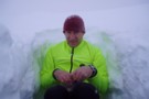
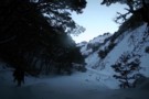
Snow hole lunch
Photograph
•
Distance: 1.6km away
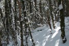
Taking refuge in a snow hole for lunch during a white out on the Lewis Tops, Lewis Pass.
More ▶︎
Lake Man biv
Photograph
•
Distance: 1.6km away
located in the trees about 1 hr from the lake.
More ▶︎
Lucretia
Photograph
•
Distance: 1.6km away
with cyclone Gita approaching (blowing from right to left and just able to stand against it), we were taking it ...
More ▶︎
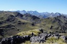
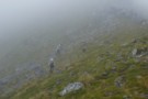
Lewis tops
Photograph
•
Distance: 1.6km away
climbing up to the tops with Mt Technical (left) and the Apprentice (right) behind - Feb 2018
More ▶︎
Circuit of Sth Hurunui, Bull Creek & Ant Stream Huts, Dampier-Crossley Range, Sth Hurunui
Article
•
Distance: 1.8km away
4 day circuit passing through Roche Pass and Dampier Corner.
More ▶︎
Lucretia Hut Route
Track
•
1 day. Easy/medium. Return by the same track.
•
Distance: 2.1km away
Lucretia biv via Nina Valley
More ▶︎
Lucretia Hut
Hut
•
Basic Hut/Bivvy (DOC). Capacity: 2.
•
Distance: 2.1km away
Very basic 2 bunk hut with open fire in the head of Lucretia Stream, Lewis Pass area
More ▶︎
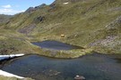
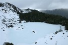
Tarn on south side of Roche Pass
Photograph
•
Distance: 2.1km away
Magic spot. I'd love to go back and camp on that wee grassy beach at the head.
More ▶︎
Lucretia biv
Photograph
•
Distance: 2.1km away
inside the biv - basic but welcome in bad weather - Feb 2018
More ▶︎
Lucretia biv
Photograph
•
Distance: 2.1km away
a good lunch stop on the route to the tops - Feb 2018
More ▶︎
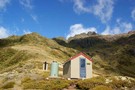
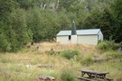
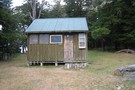
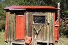
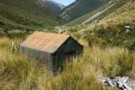
Rokeby Hut
Hut
•
Basic Hut/Bivvy (DOC). Capacity: 3.
•
Distance: 2.1km away
Hidden on a high bench above the Boyle River. Three canvas bunks, 2 cute seats and a woodstove make for ...
More ▶︎

St James Conservation Area
Place
•
Place. 781.96km2.
•
Distance: 2.1km away
A large new recreational area featuring tussock grasslands, and including the headwaters of the Waiau and Clarence Rivers.
More ▶︎
Rokeby Hut
Photograph
•
Distance: 2.1km away
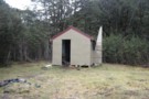
Rokeby Hut is an old cullers hut about 1 hour upstream from the Boyle Flats Hut. Three canvas bunks and ...
More ▶︎
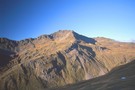
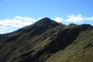
Mt Technical
Photograph
•
Distance: 2.2km away
south-west face, from the saddle SW of Lucretia - Feb 2018
More ▶︎
Hut bagging Stony Stream Biv
Article
•
Distance: 2.2km away
A weekend trip into the Hamner Conservation Area to visit a wee biv in good condition. A much appreciated track ...
More ▶︎
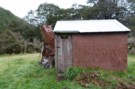
Stony Stream Bivvy
Photograph
•
Distance: 2.2km away
A nice bivvy in an area that has been invaded by broom.
More ▶︎
Stony Stream Bivvy
Hut
•
Basic Hut/Bivvy (DOC). Capacity: 2.
•
Distance: 2.2km away
Small biv on lower terrace above true left of Stony Stream.
More ▶︎
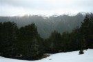
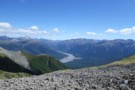
The Maruia Valley from the Lewis Tops
Photograph
•
Distance: 2.3km away
Springs Junction and Mount Haast in the distance
More ▶︎
Doubtful Hut
Hut
•
Basic Hut/Bivvy (DOC). Capacity: 2.
•
Distance: 2.7km away
This hut sits just outside of Lake Sumner Conservation Park in the Doubtful River valley. Rather old and unappealing. Plenty ...
More ▶︎
Doubtful Hut
Photograph
•
Distance: 2.7km away
A good spot for a snack on the way up to Lake Man!
More ▶︎
Mid Trent hut Nov 2010
Photograph
•
Distance: 2.9km away
A tidy four bunker on the TR of the Trent River. As the name suggests it is in the middle ...
More ▶︎
Mid Trent hut
Hut
•
Standard Hut (DOC). Capacity: 4.
•
Distance: 2.9km away
A tidy four bunker on the TR of the Trent River. As the name suggests it is in the middle ...
More ▶︎
Lewis Tops camping 2
Photograph
•
Distance: 2.9km away
2 small tarns and a shallow gully to provide good shelter make for a good campsite, after reaching the Lewis ...
More ▶︎
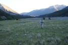
Nina River
Track
•
2 days. Easy. Return by the same track.
•
Distance: 3.0km away
Easy tramping up a pretty river valley near Lewis Pass.
More ▶︎
Lewis Tops camping 3
Photograph
•
Distance: 3.0km away
Panorama with Mt Technical & the Apprentice as backdrop to the Lewis Tops - just past pt 1561, 2 small ...
More ▶︎
Lewis Tops camping
Photograph
•
Distance: 3.0km away
2 small tarns and a shallow gully to provide good shelter make for a good campsite, after reaching the Lewis ...
More ▶︎
Upper South Branch Hurunui Hut
Hut
•
Basic Hut/Bivvy (DOC). Capacity: 3.
•
Distance: 3.1km away
Old hut on the Hurunui River South Branch beneath the Dampier and Crawford Ranges.
More ▶︎
McArthur Track
GPX file
•
Distance: 3.1km away
Scotties Camp Hut to Pool Hut, St James Conservation Area.
More ▶︎
Lewis tops
Photograph
•
Distance: 3.1km away
Panorama (click to see the whole pic) from near SH1535, looking along the tops to the descent to Lewis Pass.
The ...
More ▶︎
Doubtless Hut
Hut
•
Standard Hut (DOC). Capacity: 6.
•
Distance: 3.1km away
Doubtless Hut. In the Doubtful River valley, further up from Doubtful hut.
More ▶︎
Orchid growing behind Sth Branch Hut
Photograph
•
Distance: 3.1km away
I'll try to get a name for this wee beastie.
More ▶︎
Lewis River
Photograph
•
Distance: 3.1km away
Lewis River near Palmer Lodge at the start of the Nina Valley Track, October 2009.
More ▶︎
Hurunui Sth Branch Hut
Photograph
•
Distance: 3.1km away
Needs TLC. Perhaps the Mainland Island researchers can step up to the plate?
More ▶︎
Sylvia Flats
Track
•
Easy. Return via same track.
•
Distance: 3.1km away
Roadside hot pools near Lewis Pass
More ▶︎
Sylvia Flats
Campsite
•
Private Hut (Not applicable).
•
Distance: 3.1km away
A marked rest area on SH7 near Lewis Pass, with ample space to stop and camp as well as hot ...
More ▶︎
New Devils Den Bivvy Location
GPX file
•
Distance: 3.1km away
A GPX file of the new bivvy located on Devilskin Saddle.
The old Devils Den Bivvy has been removed.
More ▶︎
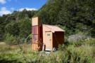
Devils Den Bivouac
Photograph
•
Distance: 3.2km away
Built in 2007 to replace the old version which was below Devilskin Saddle by the bushline. This new, sparkly version ...
More ▶︎
Devils Den Bivouac above Devilskin Pass
Photograph
•
Distance: 3.2km away
Built in 2008, this is, perhaps, the bestest and newest little hut in NZ.
More ▶︎
Devilskin Saddle
Photograph
•
Distance: 3.2km away
from the saddle, the new biv is 50m west towards the Devils Rampart. (photo taken Feb 2018)
More ▶︎
Glenrae Bivvy
Hut
•
Standard Hut (DOC). Capacity: 2.
•
Distance: 3.3km away
Small dishevelled hut on the Glenrae River underneath the Glynn Wye Range. Canvas bunks.
More ▶︎
Tarns and Brass Monkey biv Dec 2011
Photograph
•
Distance: 3.3km away
This pic shows a couple of the tarns near the biv. The biv, an ex NZFS one, is in a ...
More ▶︎
Upper Nina Biv
Hut
•
Basic Hut/Bivvy (DOC). Capacity: 2.
•
Distance: 3.3km away
Small hut on the Nina River. Two canvas bunks.
More ▶︎
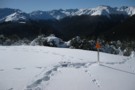
Lewis Tops
Track
•
1 – 2 days. Medium. Return by the same track.
•
Distance: 3.4km away
A short climb onto the tops at Lewis Pass, providing panoramic views of the area. With camping on the valley ...
More ▶︎
Brass Monkey Bivouac
Hut
•
Basic Hut/Bivvy (DOC). Capacity: 2.
•
Distance: 3.4km away
A basic 2 bunk bivvy on the Lewis Tops
More ▶︎
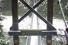
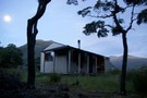
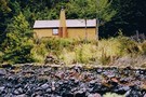
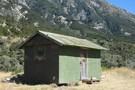
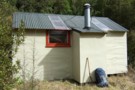
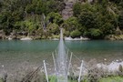
Boyle Flats Hut
Photograph
•
Distance: 3.4km away
Perched high on a river terrace, accessed from a swingbridge 'on the Boyle'.
More ▶︎
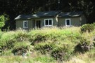
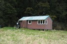
Boyle Flats Hut
Hut
•
Serviced Hut (DOC). Capacity: 20.
•
Distance: 3.4km away
Perched high above the river on a grassy bench, Boyle Flats Hut is accessed via a swingbridge over the Boyle.
More ▶︎
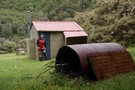
Ada Cullers Hut
Photograph
•
Distance: 3.4km away
Tidy old shack provides shelter and shade from the elements. No mattresses or water supply.
More ▶︎
St James Walkway June 2009
Photograph
•
Distance: 3.4km away
Gloriana and the Faerie Queene, on a brilliant winter's day.
More ▶︎
St James Walkway
Track
•
5 days. Easy/medium. One way.
•
Distance: 3.4km away
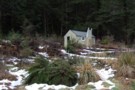
A long and easy walk on St James Station near Lewis Pass. Beech forest, mountain scenery, farmland, wild horses, mud.
More ▶︎
Devilskin Saddle
Photograph
•
Distance: 3.5km away
Devilskin Saddle between the Nina and Doubtful Valleys off the Lewis Pass. March 2007.
More ▶︎
Deer Valley Campsite
Campsite
•
Informal campsite (DOC). 10 spaces.
•
Distance: 3.6km away
A minimal roadside camping area near Lewis Pass. Water is available from the nearby stream. Foleys Creek and Rolleston Pack ...
More ▶︎
Boyle Flat Hut
Photograph
•
Distance: 3.6km away
Boyle Flats Hut is the last hut on the Saint James Walkway (north to south)
More ▶︎
Libretto Range
Photograph
•
Distance: 3.7km away
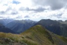
View south along Libretto Range from Travers Peak
More ▶︎
Trovatore Peak
Photograph
•
Distance: 3.7km away
The ridge to Trovatore Peak from Travers peak
More ▶︎
Foleys Creek Track - Travers Peak
Track
•
1 day. Medium. Return via same track.
•
Distance: 3.7km away
A poled route to the summit of Travers Peak near Lewis Pass
More ▶︎
Top of Travers Peak
Photograph
•
Distance: 3.7km away
View north from Travers Peak towards Gloriana Peak and the Fairie Queen
More ▶︎
Travers Peak - Trovatore - Henry Saddle
Track
•
2 days. Medium. Loop track.
•
Distance: 3.7km away
An interesting circuit exploring the alpine tops around Lewis Pass.
More ▶︎
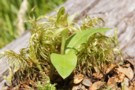
canada goose eggs
Photograph
•
Distance: 3.7km away
Canada goose eggs. Pussy stream, just inside the trees. She left in a hurry when I stumbled across her. Photo ...
More ▶︎
Lewis Pass National Reserve
Place
•
Reserve. 182.95km2.
•
Distance: 3.7km away
A small park occupying the forested valleys around Lewis Pass and bordering Lake Sumner and Victoria Forest Parks as well ...
More ▶︎
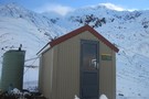
Steyning Hut
Hut
•
Basic Hut/Bivvy (DOC). Capacity: 6.
•
Distance: 3.7km away
Hut located on the edge of Lake Sumner Forest Park.
More ▶︎
Scree traverse
Photograph
•
Distance: 3.7km away
a long traverse on virgin scree high above Devilskin saddle - Feb 2018
More ▶︎
Devils Den Bivouac
Photograph
•
Distance: 3.8km away
Devils Den Bivouac, below Devilskin Saddle between the Nina and Doubtful valleys. March 2007 - 3 feet of snow on ...
More ▶︎
Doubtful Hut
Photograph
•
Distance: 3.8km away
Old timer shack with 3-4 bunks near the Doubtful River, Northern Canterbury.
More ▶︎
Devils Den Bivouac
Hut
•
Basic Hut/Bivvy (DOC). Capacity: 2.
•
Distance: 3.8km away
Devils Den / Devilskin bivouac (2 beds) is a brand new bivouac ABOVE Devilskin Pass. Built in 2008, this new ...
More ▶︎
Snow, old Devil's Den Hut site
Photograph
•
Distance: 3.8km away
The old hut site was at the treeline east of Devilskin Saddle. After an avalanche, a new hut was built ...
More ▶︎
Climbing above Devilskin Saddle
Photograph
•
Distance: 3.8km away
day triping up from the Devilskin Saddle Hut June 2010. (lewis pass)
See hut and toilet on the saddle below.
Also see ...
More ▶︎
Old track near Amuri Pass
Photograph
•
Distance: 3.8km away
Amuri Pass was once a walking and stock droving route between Canterbury and the West Coast. It was first walked ...
More ▶︎
Hope River / Pussy Stream confluence
Photograph
•
Distance: 3.9km away
Hope River / Pussy Stream confluence, St Jacob's Flat
More ▶︎
Ant Biv
Hut
•
Basic Hut/Bivvy (DOC). Capacity: 2.
•
Distance: 3.9km away
Seldom visited NZFS dog-box style biv. Accessed from Dampier Corner. The fireplace had never been used until Robert Porte visited ...
More ▶︎
North Esk Hut
Hut
•
Basic Hut/Bivvy (DOC). Capacity: 3.
•
Distance: 4.0km away
Dilapidated hut on the North Esk River.
More ▶︎
Near Devilskin Saddle
Photograph
•
Distance: 4.1km away
Fresh snow in the beech forest northeast of Devilskin Saddle. October 2009.
More ▶︎
Rolleston Pack Track
Track
•
Easy. One way.
•
Distance: 4.1km away
An old pack track near Lewis Pass. This is a pleasant forest walk, and an alternative to walking along the ...
More ▶︎
Magdalen Hut 2011
Photograph
•
Distance: 4.2km away
Magdalen Hut is on the Boyle River. 15 to 20 minutes downstream from the swingbridge between Boyle Flats Hut and ...
More ▶︎
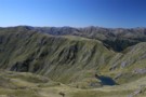
McMillan tarn
Photograph
•
Distance: 4.2km away
Tarn on the saddle between McMillan stream and Three Mile stream. taken Feb 2009.
More ▶︎
Magdalen Hut
Hut
•
Standard Hut (DOC). Capacity: 6.
•
Distance: 4.3km away
Magdalen Hut is the 3rd incarnation on this paddock. Built in 2008, it's sparky and shiny, with 6 bunks.
More ▶︎
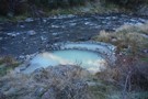
hot spring
Photograph
•
Distance: 4.4km away
Hot spring in the aptly named Hot Spring Stream. A pleasant side trip from Top Hope hut. Note that the ...
More ▶︎
Three Mile Stream Track
GPX file
•
Distance: 4.5km away
Route up McMillan Stream to Three Mile Stream Hut.
More ▶︎
Nina River First Swing Bridge ~ Snowy
Photograph
•
Distance: 4.5km away
The first swing bridge, in winter, gorgeous
More ▶︎
Jones Stream
Photograph
•
Distance: 4.6km away
Jervois Hut is situated about 2.5km up the valley. Viewed across the Waiau Uwha River from the McArthur Track.
More ▶︎
Camerons Hut (Lake Sumner)
Hut
•
Basic Hut/Bivvy (DOC). Capacity: 4.
•
Distance: 4.7km away
A draughty tin hut with an open fire and concrete floor - but homely.
More ▶︎

Te Araroa Trail
Track
•
95 days. Medium. One way.
•
Distance: 4.8km away
Te Araroa is a walking trail running the entire length of the North and South Islands. The trail opened 3 ...
More ▶︎
St Arnaud to Lewis Pass
Track
•
5 – 9 days. Medium/hard. One way.
•
Distance: 4.9km away
A 5-9 day north-south route from St Arnaud to the Lewis Pass, via Travers Pass, Waiau Pass, Thompson Pass and ...
More ▶︎
No. 3 Hut / Number Three Hut
Hut
•
Standard Hut (DOC). Capacity: 16.
•
Distance: 5.0km away
No. 3 Hut (16 beds in 2 rooms, wood-burning stove, tank/creek water) is a lovely historic hut on flats in ...
More ▶︎
No. 3 Hut / Number Three hut
Photograph
•
Distance: 5.0km away
No. 3 Hut in the Hurunui Valley
More ▶︎
Three Mile Stream Route
GPX file
•
Distance: 5.0km away
Route down Three Mile Stream from the hut.
More ▶︎
Three Mile Stream Hut
Hut
•
Standard Hut (DOC). Capacity: 7.
•
Distance: 5.0km away
Nice hut with two sleeping areas of three bunks each on a terrace above Three Mile Stream. This hut doesn't ...
More ▶︎
Edwards River Track
GPX file
•
Distance: 5.0km away
Tophouse Road to Scotties Camp Hut, in the St James Conservation Area.
More ▶︎
Scotties Hut - Edwards River Valley
Photograph
•
Distance: 5.0km away
Scotties Hut located in the Edwards River Valley on the 4WD track/St James Cycle Trail
More ▶︎
Scotties Camp Hut
Hut
•
Basic Hut/Bivvy (DOC). Capacity: 4.
•
Distance: 5.0km away
Former musterers' hut on St James Station down by the Edwards River. Now part of the DOC estate in the ...
More ▶︎
Signs on Top Trent hut
Photograph
•
Distance: 5.0km away
"Give up hope all ye who enter"
Thought I'd record the quirky sign on the hut.
I've a strong idea on ...
More ▶︎
Top Trent aka Lagoon hut
Hut
•
Basic Hut/Bivvy (DOC). Capacity: 4.
•
Distance: 5.0km away
An old Forest Service four bunker in the head of the Trent River. The hut is getting minimal maintenance from ...
More ▶︎
Top Trent aka Lagoon hut Nov 2010
Photograph
•
Distance: 5.0km away
An old Forest Service four bunker in the head of the Trent River. The hut is getting minimal maintenance from ...
More ▶︎

Profile : St Arnaud - Lewis Pass
Photograph
•
Distance: 5.0km away
A useful profile of the 100km tramp - with a couple of bad weather alternatives :
1. low route past Speargrass ...
More ▶︎

St Arnaud - Lewis Pass
Article
•
Distance: 5.0km away
A 9-day 100km tramp via the Thompson, D'Urville and 3 Tarns Passes
Feb 2013
More ▶︎
Three Mile Stream Hut
Photograph
•
Distance: 5.0km away
Three Mile Stream hut. taken 05-Feb-2009
More ▶︎
Lewis Pass tops
Photograph
•
Distance: 5.0km away
Looking toward Cannibal Gorge and the St James.
More ▶︎
Lewis Pass Tops
Track
•
Medium. Return by the same track.
•
Distance: 5.0km away
A superb track which provides quick access to the open tops of the Lewis Pass.
Allow around 1.5 hours to reach ...
More ▶︎
Pell Stream
Track
•
2 – 3 days. Medium. Loop track with a road section.
•
Distance: 5.0km away
This highly recommended valley not far from the highway west of the Lewis pass, is accessible to most people with ...
More ▶︎
Robinson Saddle
Track
•
3 days. Easy/medium. One way.
•
Distance: 5.1km away
Forest and tops walk in Victoria Forest Park, visiting Lake Christabel.
More ▶︎
Alpine Tarn
Photograph
•
Distance: 5.1km away
early morning at Lewis Pass (start of the St James Walkway)
Feb 2013
More ▶︎
Mackenzie Bivvy
Hut
•
Basic Hut/Bivvy (DOC). Capacity: 2.
•
Distance: 5.1km away
Located in the East Branch of Mackenzie Stream, north of the Hurunui River. Canvas bunks.
More ▶︎
Mueller Tarn Track
Track
•
Easy/medium. Return via same track.
•
Distance: 5.1km away
A steep but easy climb to a pretty alpine tarn near Lewis Pass
More ▶︎
Mackenzie Bivvy
Photograph
•
Distance: 5.1km away
A lovely seldom visited bivvy in a nice spot on the TR of the East Branch of Mackenzie Stream. In ...
More ▶︎
Sylvia tops
Photograph
•
Distance: 5.2km away
on the Sylvia tops and in the clag as we contoured around the north side of SH1662 - Feb 2018
More ▶︎
Lonely camper
Photograph
•
Distance: 5.2km away
The hut became rather full with a boy's school excursion. A (clever) tutor decided the nightlife outside may be quieter.
More ▶︎
Lewis Pass Tops
Photograph
•
Distance: 5.2km away
View of the Maruia River and Cannibal Gorge from Lewis Pass Tops
More ▶︎

Route Guide: St Arnaud to Lewis Pass
Article
•
Distance: 5.2km away
A 5-7 day north-south route from St Arnaud to the Lewis Pass, via Travers Pass, Waiau Pass, Thompson Pass and ...
More ▶︎
Tarn Nature Walk
Track
•
Easy. loop track.
•
Distance: 5.2km away
A nature trail exploring the wetland plants on Lewis Pass
More ▶︎
Exploring Lewis Pass
Article
•
Distance: 5.2km away
There is a good range of tracks and routes around Lewis Pass to suit all abilities. Here is a selection ...
More ▶︎

Lake Thompson
Photograph
•
Distance: 5.2km away
A view of the beautiful Lake Thompson, a short distance from Thompson Pass
More ▶︎
Cannibal Gorge, Ada Pass
Track
•
2 days. Easy. Return via same track.
•
Distance: 5.2km away
An easy overnighter through the pretty bush of Cannibal Gorge and on to the alpine views of Ada Pass.
More ▶︎
Lewis Tops
Article
•
Distance: 5.2km away
A light hearted trip report up onto the Lewis Tops, Lewis Pass in winter.
More ▶︎
Lewis Pass Lookout
Track
•
Easy. loop track.
•
Distance: 5.2km away
A loop track at Lewis Pass leading to a good view of the Cannibal Gorge.
More ▶︎
Mueller Tarn
Photograph
•
Distance: 5.3km away
A snowy tarn just above the treeline near Maruia Springs.
More ▶︎
Lewis Tops from Mueller Tarn
Photograph
•
Distance: 5.3km away
This is the view south across the valley.
More ▶︎
Jollie Brook - Gabriel Stream
Track
•
2 days. Easy/medium. Loop track.
•
Distance: 5.3km away
An easy circuit on the eastern side of Lake Sumner. Tussock flats, beech forest, flat walking.
More ▶︎
Above Robinson Saddle Sept 2010
Photograph
•
Distance: 5.6km away
This pic shows tramping mate JH heading up through snow on the Robinson side of the saddle whilst travelling from ...
More ▶︎
Locke Stream (No. 4) Hut
Hut
•
Serviced Hut (DOC). Capacity: 18.
•
Distance: 5.6km away
Once known as No. 4 Hut, this hut was build in 1939 as a tourist hut for the Harper Pass ...
More ▶︎
Lewis Tops from Travers Peak
Photograph
•
Distance: 5.6km away
Lewis Tops and Mount Technical are in the distance. The spur southwest of Trovatore is closer, and the northern slopes ...
More ▶︎
Jervois Hut
Hut
•
Basic Hut/Bivvy (DOC). Capacity: 3.
•
Distance: 5.8km away
An old forest service hut with canvas bunks on Jervois Stream. Built around the late 50's. Mainly visited by hunters ...
More ▶︎
Camp above Rough Creek
Photograph
•
Distance: 6.2km away
Superb camp site by a small tarn only 100m from the Rough Creek saddle on the way to Lake Christabel
More ▶︎
Nina Hut
Hut
•
Standard Hut (DOC). Capacity: 10.
•
Distance: 6.3km away
Replacing the old hut down by the river, this hut is located in an elevated clearing with good mountain views. ...
More ▶︎
Mackenzie Hut
Hut
•
Basic Hut/Bivvy (DOC). Capacity: 6.
•
Distance: 6.3km away
Located near the head of Mackenzie Stream north of the Hurunui River.
More ▶︎
Lewis Tops from from Nina Hut
Photograph
•
Distance: 6.3km away
The view north from Nina Hut, March 2007
More ▶︎
Nina Hut at Night
Photograph
•
Distance: 6.3km away
This hut is situated in a superb location, with wide views up all the valleys around it. A good move, ...
More ▶︎
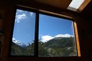
Nina Hut Views
Photograph
•
Distance: 6.3km away
Windows in the new Nina Hut are well set up for admiring the views.
More ▶︎
Freyberg Range, Pell Stream
Article
•
Distance: 6.3km away
A 3 day trip, climbing up onto the range to go over Mt Mueller and camp. Followed by a descent ...
More ▶︎
Tutaekuri hut
Hut
•
Standard Hut (DOC). Capacity: 6.
•
Distance: 6.6km away
A replacement for the old Tutaekuri Junction hut. Recently built in 2008. (the junction hut has been removed)
This hut is ...
More ▶︎
Tutaekuri hut 2010
Photograph
•
Distance: 6.6km away
A replacement for the old Tutaekuri Junction hut. Recently built in 2008. (the junction hut has been removed) This hut ...
More ▶︎
St. Jacobs Hut
Hut
•
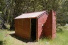
Standard Hut (DOC). Capacity: 6.
•
Distance: 6.7km away
St Jacob's Hut (6 bunks, matresses, stove, river water) is a standard DOC hut on grassy river flats in the ...
More ▶︎
Lake Christabel Hut
Hut
•
Standard Hut (DOC). Capacity: 8.
•
Distance: 6.7km away
A tidy hut situated on the TL bank of the Blue Grey River about 20 minutes above Lake Christabel near ...
More ▶︎
Head of Lake Christabel August 2010
Photograph
•
Distance: 6.8km away
Lake Christabel is a large boomerang shaped lake approx 3km long. The lake was caused centuries ago by a slip ...
More ▶︎
Lake Christabel hut August 2010
Photograph
•
Distance: 6.8km away
A tidy hut situated on the TL bank of the Blue Grey River about 20 minutes above Lake Christabel near ...
More ▶︎
Glenrae Hut
Hut
•
Basic Hut/Bivvy (DOC). Capacity: 6.
•
Distance: 6.8km away
Simple iron hut on river flats near where the Glenrae River enters forest. Generally used by hunters.
From here, the ...
More ▶︎
Devils Rampart
Photograph
•
Distance: 6.8km away
from the Sylvia tops, the Devils Rampart is slowly revealed as the mists begin to lift - Feb 2018
More ▶︎
Travers Peak from Trovatore
Photograph
•
Distance: 6.8km away
The ridgeline between Travers and Trovatore is rough.
More ▶︎
Tarn, Trovatore
Photograph
•
Distance: 6.8km away
Comfortable camping just east of Trovatore.
More ▶︎
Top Robinson hut Sept 2010
Photograph
•
Distance: 6.8km away
An extended Forest Service hut quite similar to the nearby Lake Christabel hut. This hut is located in a man ...
More ▶︎
Top Robinson hut
Hut
•
Standard Hut (DOC). Capacity: 8.
•
Distance: 6.8km away
An extended Forest Service hut quite similar to the nearby Lake Christabel hut. This hut is located in a man ...
More ▶︎
Ant Stream Hut awaiting extensive renovations
Photograph
•
Distance: 6.9km away
Identical to Andersons Hut but that one had a raised concrete pad so has fared better. The Nth Canterbury deerstalkers ...
More ▶︎
Rough Creek track
Photograph
•
Distance: 6.9km away
Rough Creek track on one of the steeper parts
More ▶︎
Rough Creek Tops
Photograph
•
Distance: 6.9km away
2010 in the hanging basin at the head of Rough Creek
More ▶︎
Rough Creek tops, view east
Photograph
•
Distance: 6.9km away
View down Rough Creek from slightly north of the track
More ▶︎
Rough Creek Track
Track
•
Medium. Return via same track.
•
Distance: 6.9km away
The track leads up to Rough Creek Saddle from where there is a great view on Lake Christabel and the ...
More ▶︎
Hope-Kiwi Lodge
Track
•
2 days. Easy. Return via same track.
•
Distance: 6.9km away
Easy but dull walking along the Hope River, following the line of the Hope Fault. From the spacious hut, you ...
More ▶︎
Ant Stream Hut
Hut
•
Basic Hut/Bivvy (DOC). Capacity: 2.
•
Distance: 6.9km away
Hut on Ant Stream, Lochinvar Forest, in the Dampier Ranges.
More ▶︎
Trent Saddle Nov 2010
Photograph
•
Distance: 7.0km away
This pic shows Trent Saddle looking from the Haupiri side through to the Trent side. JH is in the pic. ...
More ▶︎
Hope Halfway Hut
Hut
•
Basic Hut/Bivvy (DOC). Capacity: 6.
•
Distance: 7.0km away
Hope Halfway hut is halfway up the Hope valley from the Lewis Pass road to Hope-Kiwi lodge. It's pretty rough, ...
More ▶︎
Penny Pass
Track
•
3 – 4 days. Medium. Loop track.
•
Distance: 7.3km away
3 day trip from upper Poulter River over Penny Pass between Minchin and Thompson Streams.
More ▶︎
Location of Cow Stream Hot Pool
Photograph
•
Distance: 7.3km away
Just down the terrace from the isolated escarpment which can be accessed by 4WD.
More ▶︎
Cow Stream Hot Pool
Article
•
Distance: 7.3km away
A spacious, pleasant hot pool that can even be accessed by 4WD in the new St James Conservation Area.
More ▶︎
Nola Ogle memorial
Photograph
•
Distance: 7.3km away
Memorial to Nola Ogle. In the Hurunui valley between No. 3 hut and the hot spring. Nola was a NSTC ...
More ▶︎
Old Bridge Hut
Hut
•
Basic Hut/Bivvy (DOC).
•
Distance: 7.4km away
Old hut located by Pool Hut and the McArthur Bridge on the Waiau River. This hut is of historic interest ...
More ▶︎
Walking down the Cox in the evening
Photograph
•
Distance: 7.5km away
Stunning florabunda gentians on broad river flats
More ▶︎
Zampa Lake
Photograph
•
Distance: 7.6km away
2 hectare lake under Zampa Peak.Idyllic campsite at 1450m
More ▶︎
Zampa Kampas
Photograph
•
Distance: 7.6km away
a campsite beside Zampa Lake.300m under & east of Zampa herself.
More ▶︎
Head of the Henry River
Photograph
•
Distance: 7.6km away
Between Trovatore and Henry Saddle.
More ▶︎
Lake Sumner short walk
GPX file
•
Distance: 7.7km away
Walk to east end of Lake Sumner via Gabriel Hut 10km (3hrs)
Note: starting point slightly further along Lake Sumner Rd, ...
More ▶︎
Pool Hut
Hut
•
Basic Hut/Bivvy (DOC). Capacity: 7.
•
Distance: 7.7km away
Stucco (roughcast) and partially lined hut taken over by DoC as part of their stewardship of the St James Conservation ...
More ▶︎
McArthur Track
GPX file
•
Distance: 7.7km away
Pool Hut to Lake Guyon junction, St James Conservation Area.
More ▶︎
Hope Kiwi Track
GPX file
•
Distance: 8.0km away
A short section of the track near Lake Sumner.
More ▶︎
Cold Stream Hut
Photograph
•
Distance: 8.2km away
Lake Sumner FP, 6 Bunks. Access is via. Jollie Brook and Cold Stream itself.
More ▶︎
Cold Stream Hut
Hut
•
Standard Hut (DOC). Capacity: 6.
•
Distance: 8.4km away
A 6-7 bunk hut reached by walking up the jollybrook and taking cold stream tribuary. Good facilities and water close ...
More ▶︎
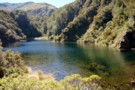
Lake Sumner
Photograph
•
Distance: 8.5km away
Lake Sumner and Mt Longfellow. taken Feb 2009.
More ▶︎
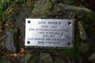
Dick Morris plaque
Photograph
•
Distance: 8.5km away
I suppose many younger trampers, even Canterbury ones, will not have heard of Dick Morris? Dick was a well known ...
More ▶︎
Peak a chamois - Townsend Tops
Photograph
•
Distance: 8.8km away
Occasionally when walking between Townsend hut and Minchin pass you may play peak a boo with the wildlife.
More ▶︎
Source of the springs
Photograph
•
Distance: 8.9km away
The source of the Hurunui Hot Springs on a bank above the river.
More ▶︎
Hurunui Hot Springs
Track
•
2 – 3 days. Easy. Return via same track.
•
Distance: 8.9km away
An overnight trip to a good hot pool near Lake Sumner.
More ▶︎
Slaty Creek Hut
Hut
•
Basic Hut/Bivvy (DOC). Capacity: 4.
•
Distance: 9.0km away
An old hunters hut on the TL of the Waiheke River near the confluence with Slaty Creek.
Restored a few ...
More ▶︎
Slaty Creek hut Sept 2008
Photograph
•
Distance: 9.0km away
An historic hunters hut that is being maintained by DOC.
More ▶︎
Carlyle Hut
Hut
•
Basic Hut/Bivvy (DOC). Capacity: 8.
•
Distance: 9.0km away
Hut on Carlyle Stream, an obscure corner of Lake Sumner Conservation Park beneath the Poplars Range. Generally visited by hunters.
More ▶︎
Hurunui river valley flats
Photograph
•
Distance: 9.0km away
Hurunui river valley flats, above Hurunui Hut
More ▶︎
Gunnera densiflora
Photograph
•
Distance: 9.2km away
Growing on old river flats near the hot springs.
More ▶︎
Hurunui Hut
Hut
•
Standard Hut (DOC). Capacity: 15.
•
Distance: 9.2km away
Large tramping hut on river terrace above the Hurunui valley. The hut is near the roadend, and as such convenient ...
More ▶︎
Hurunui Hut
Photograph
•
Distance: 9.2km away
Hurunui Hut in the Hurunui Valley just above Lake Sumner
More ▶︎
Lake Taylor to Hurunui Hut
GPX file
•
Distance: 9.2km away
Following a 4WD track initially to the Hurunui Swingbridge then continuing on a foot track to the hut.
This recording ...
More ▶︎
Elizabeth hut
Hut
•
Standard Hut (DOC). Capacity: 6.
•
Distance: 9.2km away
A tidy hut in the headwaters of the Haupiri River a couple of km's below Trent Saddle. Built by the ...
More ▶︎
Elizabeth hut Aug 2010
Photograph
•
Distance: 9.2km away
Tidy six bunker in the headwaters of the Haupiri River.
More ▶︎
Hurunui Swingbridge
Photograph
•
Distance: 9.2km away
Gateway to adventure, near Hurunui Hut.
More ▶︎
Elizabeth Hut
Photograph
•
Distance: 9.2km away
Located in the upper reaches of the Haupiri River.
(6 Bunks.)
More ▶︎
Remains of bath at Haupiri hot springs Feb 2010
Photograph
•
Distance: 9.2km away
These springs became a tourist attraction in the early 1900's. They were one of NZ's remotest developed hot springs. The ...
More ▶︎
Minchin Bivvy Feb 2016
Photograph
•
Distance: 9.3km away
The photo is of Minchin Biv & is taken looking down Minchin Stream. It was built by the NZFS (New ...
More ▶︎
Pell Stream hut August 2011
Photograph
•
Distance: 9.4km away
Neil B & I recently visited this hut. There have been some track improvements since I was last there. Hut ...
More ▶︎
Pell Stream hut Dec 2008
Photograph
•
Distance: 9.4km away
We visited this hut as a day trip from the Marble Hill camping area.
It seemed a good comfortable hut with ...
More ▶︎
Pell Stream Hut
Hut
•
Basic Hut/Bivvy (DOC). Capacity: 4.
•
Distance: 9.4km away
Small hut at the end of the Pell Stream Track.
More ▶︎
Pell Stream
Photograph
•
Distance: 9.5km away
open travel just above the second gorge section (going up)
More ▶︎
Hope - Kiwi Lodge
Hut
•
Serviced Hut (DOC). Capacity: 20.
•
Distance: 9.5km away
Hope Kiwi Lodge (sleeps 20, matresses, stove, tank water) is a large modern tramping hut on the grassy flats of ...
More ▶︎
Tutu Hut
Hut
•
Standard Hut (DOC). Capacity: 4.
•
Distance: 9.5km away
Hut on Tutu Stream beneath the Hanmer Range. Canvas bunks.
More ▶︎
The West Poulter
Photograph
•
Distance: 9.6km away
The West Poulter - Worsley Pass in the far distance
More ▶︎
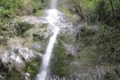
waterfall
Photograph
•
Distance: 9.8km away
nice walk but some of the track missing at the moment due to slip
More ▶︎
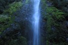
Five Mile Creek Falls
Track
•
Easy. Return via same track.
•
Distance: 9.8km away
Short track to precipitous 40m falls
More ▶︎
Anderson's Hut
Hut
•
Basic Hut/Bivvy (DOC). Capacity: 2.
•
Distance: 9.9km away
Musterers' hut located on pastoral lease land at the junction of Anderson Stream and the Esk River.
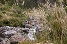
More ▶︎