Related
Waipakihi Thunderbolt Loop
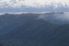
A 3 day loop in the Kaimanawas with a lot of enjoyable tops travel
More ▶︎
Urchin-Umukarikari
This is a new track, it has only just been cut through the bush between Urchin and Umukarikari. It is passable with only a 120m section of rough stuff in the middle. This track should be completed this summer. DOC ...
More ▶︎

Email from doc Turangi re the East Taupo Lands Block
An email received from Terry Slee at DOC Turangi regarding their negotiations with the East Taupo Lands Trust regarding access
More ▶︎

Oamaru to Cascade Hut via Maungaorangi GPX
A GPX file of the route from Oamaru Hut to Cascade Hut via Maungaorangi. This route avoids the private land leased by Air Charter Taupo that you require a permit for
More ▶︎

Kaimanawa Forest Park - East Taupo Lands Trust Boundary
I like to have this track loaded into my GPS whenever I am in the Kaimanawas because the boundary is not easily defined on the ground. The boundary is made up of lines drawn between the peaks on the map.
The ...
More ▶︎

Tauranga-Taupo Falls - GPX
A GPX file of the trip to these magnificent falls. There are some multipath errors in this track around the falls because it is in a confined gorge and the satellite reception was not good.
More ▶︎
Oamaru & Cascade Huts via the Kaipo - GPX
GPX file of a 3 day trip taking in Oamaru and Cascade Huts via the Kaipo Stream
More ▶︎

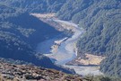
Lower Waipakihi Valley
The route down the lower Waipakihi just follows the river. You can cut off about 5 minutes at the point "loop" where the river doubles back on itself.
More ▶︎