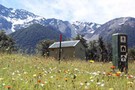
Nearby
Picton to Aspiring
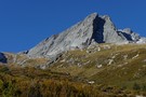
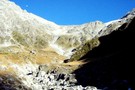
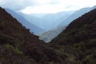
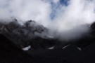
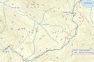
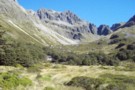
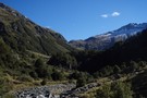
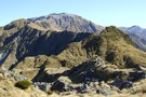
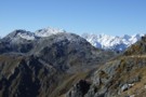
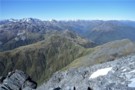
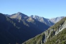
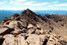
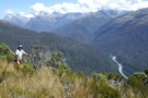
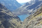
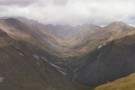
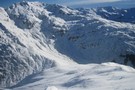
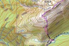
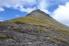
Red Hills Ridge Traverse
GPX file
•
Distance: less than 100m away
Traverse of the Red Hills Ridge beginning from the Red Hills car park, returning via Mt Ellis, Hunters Hut, Porters ...
More ▶︎

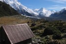
Route Guide: Otira to Mt Cook Village (pt 2)
Track
•
12 – 21 days. Hard. One way.
•
Distance: less than 100m away
One possible route down the main divide from Otira on the Arthur's Pass road to Mt Cook Village.
Otira Hotel ...
More ▶︎

Route Guide: Otira to Mt Cook Village (pt 1)
Track
•
12 – 21 days. Hard. One way.
•
Distance: less than 100m away
One possible route down the main divide from Otira on the Arthur's Pass road to Mt Cook Village.
Otira Hotel to ...
More ▶︎
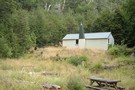
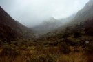
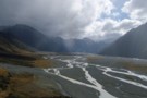
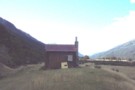
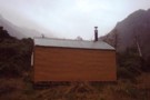
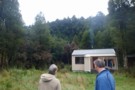
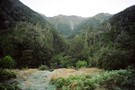
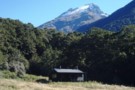
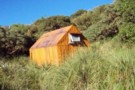
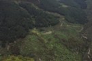
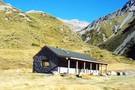
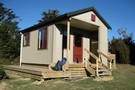
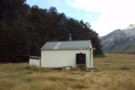
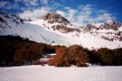
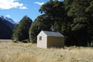
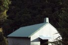
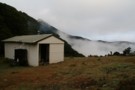
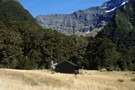
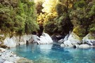
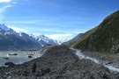
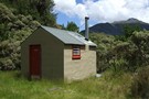
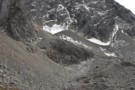
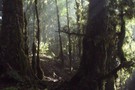
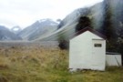
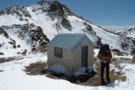
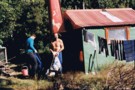
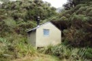
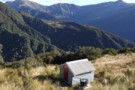
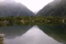
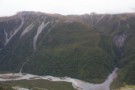
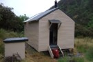
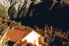
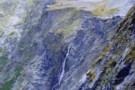
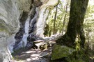
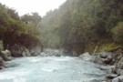
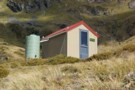
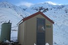
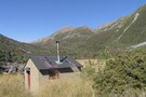
Reischek Hut
Photograph
•
Distance: less than 100m away
Reischek Hut, in the Raikaia valley below Butler Saddle.
More ▶︎
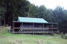
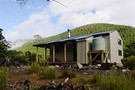
Reischek Hut
Hut
•
Basic Hut/Bivvy (NZDA). Capacity: 6.
•
Distance: less than 100m away
Reischek Hut (6-bunk, mattresses, stove, firewood, tank water, mountain radio) is a New Zealand Deer Stalkers Association (NZDA) hut on ...
More ▶︎
Whitcombe Pass
Track
•
5 – 7 days. Medium/hard. One way.
•
Distance: less than 100m away
This route follows the famous journey by John Henry Whitcombe and the Swiss guide Jakob Lauper across the Main Divide ...
More ▶︎
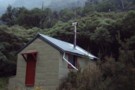
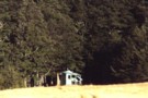
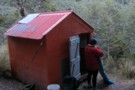
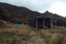
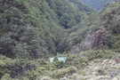
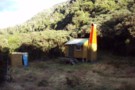
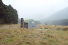
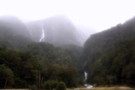
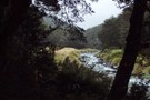
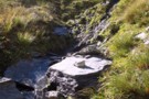
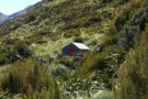
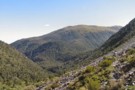
Dunns Creek Hut
Photograph
•
Distance: less than 100m away
The marshes in the mid-reaches of Dunns Creek. Dunns Creek Hut is visi ble on the right: a wet spot!
More ▶︎
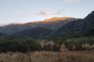
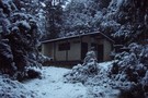
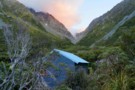
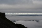
View from Dunns Creek Hut
Photograph
•
Distance: less than 100m away
View from Dunns Creek Hut, early evening in April.
More ▶︎
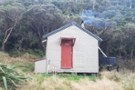
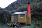
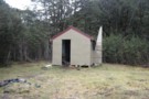
Dunns Creek Hut
Photograph
•
Distance: less than 100m away
Dunns Creek Hut, early evening in April.
More ▶︎
Mid Taipo Hut to Dunns Creek Hut
Track
•
Medium. Return by the same track.
•
Distance: less than 100m away
The more direct route from Mid Taipo to Dunns Creek, the alternative to heading all the way up Dunns Ck ...
More ▶︎

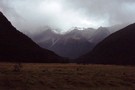
Haast to The Divide
GPX file
•
Distance: less than 100m away
Andrew Barker's traverse 2009. From Pleasant Flat in the Haast to The Divide via Mt Aspiring National Park.
More ▶︎
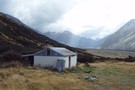
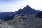
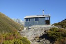
Growler Hut
Hut
•
Standard Hut (DOC). Capacity: 8.
•
Distance: less than 100m away
Growler Hut is located on the south side of the Havelock River valley, just upriver of the Growler Stream. It's ...
More ▶︎
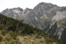
Crawford Biv looking up Lathrop saddle
Photograph
•
Distance: less than 100m away
Lathrop saddle is off to the right, the spur to it is center above biv.
More ▶︎
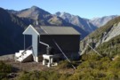
Growler Hut
Photograph
•
Distance: less than 100m away
A new DOC Hut in the Havelock Valley (formally privately owned). Located on the true right of the Havelock just ...
More ▶︎
Te Kahui Kaupeka Conservation Park
Place
•
Conservation Park. 938.00km2.
•
Distance: less than 100m away
Canterbury high country park including the Two Thumb Range and large portions of Mesopotamia Station.
More ▶︎
Havelock River to MacAuley River
GPX file
•
Distance: less than 100m away
route taken from Growler Hut, Havelock River to MacAuley Hut, Macauley River via Growler Creek, Balaclava Col, Plata Col & ...
More ▶︎
Dasler Pinnacles
Photograph
•
Distance: less than 100m away
Dasler Pinnacles (2315m) from track through scrub above Dasler Biv.
More ▶︎
Dasler Pinnacles
Track
•
2 days. Medium/hard. Return via same track.
•
Distance: less than 100m away
This trail leads from the flat valley floor steeply up to Dasler Biv and beyond the the Pinnacles themselves.
More ▶︎
Mt Richmond Alpine Route
Track
•
5 days. Medium. One way.
•
Distance: less than 100m away
Long route above the bushline in Mt Richmond Forest Park near Nelson.
More ▶︎
W Matakitaki - Ada Pass Hut
GPX file
•
Distance: less than 100m away
Treeline in West Matakitaki Valley to Ada Pass Hut, via 3 Tarns Pass
An actual, recorded, gpx – the only thing ...
More ▶︎
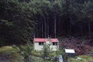
"New" Top Kokatahi hut April 2008
Photograph
•
Distance: less than 100m away
This pic is of Top Kokatahi hut after the upgrade at the new site.
(just a stones throw from where Top ...
More ▶︎
Scrubby Hut
Photograph
•
Distance: less than 100m away
Scrubby Hut: a private Hunter Valley Station hut in the Hunter Valley, open for public use
More ▶︎
Scrubby Hut
Hut
•
Standard Hut (PVT). Capacity: 4.
•
Distance: less than 100m away
Scrubby Hut (4 bunk, matresses, tank/stream water, fireplace, limited scrubby firewood) is a private station hut on a small mound ...
More ▶︎
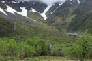
View East from Top Crawford biv Dec 2010
Photograph
•
Distance: less than 100m away
This pic was taken from the biv & shows the basin immediately East of the biv. Thought the ribbonwoods looked ...
More ▶︎
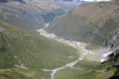
Wilkin Valley Track
Track
•
2 – 5 days. Easy/medium. Return by the same track.
•
Distance: less than 100m away
This stunning track is commonly tramped in conjunction with the Gillespie Pass Circuit or with the Rabbit Pass/East Matukituki traverse, ...
More ▶︎
Where do rivers come from?
Photograph
•
Distance: less than 100m away
Wilkin North Branch toward upper lakes
More ▶︎
Track to North Branch lakes
Photograph
•
Distance: less than 100m away
Shortly before reaching the Disappearing Tarn
More ▶︎
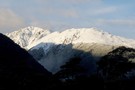
Mount Evans
Photograph
•
Distance: less than 100m away
Mt Evans, from Neave Hut in the upper Whitcombe Valley of Westland.
More ▶︎
Neave Hut
Photograph
•
Distance: less than 100m away
Neave Hut, in the upper Whitcombe, Westland. The hut lies just 5km below the Whitcombe Pass intot he Raikaia.
More ▶︎
Neave Hut
Hut
•
Standard Hut (DOC). Capacity: 6.
•
Distance: less than 100m away
Neave Hut (6 bunks, matresses, stream water, stove, limited firewood) is a comfortable forestry-style hut in the upper Whitcombe Valley, ...
More ▶︎
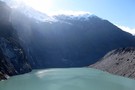
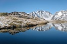
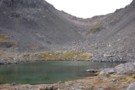
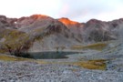
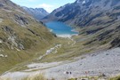
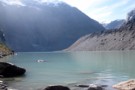
Lake Thompson Panorama
Photograph
•
Distance: less than 100m away
Making dinner at Lake Thompson, alpine upper Waiau River.
Just outside of Nelson Lakes National Park
More ▶︎
Waiau Pass towards Thompson Pass
Photograph
•
Distance: less than 100m away
Looking nearly due south towards Lake Thompson (blue horizontal strip above my head), a very prominent fault to its right ...
More ▶︎
Descent from Lake Thompson
Photograph
•
Distance: less than 100m away
This is the route we took from our camp at the outlet of Lake Thompson down to the Waiau Valley ...
More ▶︎
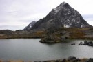
Lake Thompson, Nelson Lakes
Photograph
•
Distance: less than 100m away
A good summer camping spot at Lake Thompson in the Nelson Lakes. This lake is at 1700m, at the head ...
More ▶︎

Lake Thompson, Nelson Lakes
Photograph
•
Distance: less than 100m away
A good summer camping spot at Lake Thompson in the Nelson Lakes. This lake is at 1700m, at the head ...
More ▶︎
Toaroha/Zit Saddle/Kokatahi/Lathrop Saddle/Styx River Route
Track
•
3 – 5 days. Medium/hard. Loop track with a road section.
•
Distance: less than 100m away
Loop track across 2 Westland saddles, taking in some remote huts
More ▶︎
Fosters Hut
Hut
•
Standard Hut (DOC). Capacity: 4.
•
Distance: less than 100m away
Fosters Hut (4 bunks, matresses, stove, tank water) is a typical 4-bed forestry hut. It sits in a clearing on ...
More ▶︎
Frews Hut
Photograph
•
Distance: less than 100m away
8/10 bunker,like the Hilton after Frews Bivvy.Overlooks the Whitcombe River & 200m west of Frews
Creek.We saw a pair of ...
More ▶︎
Lake Taylor to Hurunui Hut
GPX file
•
Distance: less than 100m away
Following a 4WD track initially to the Hurunui Swingbridge then continuing on a foot track to the hut.
This recording ...
More ▶︎
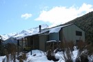
Shamrock Hut (Ahuriri)
Photograph
•
Distance: less than 100m away
Shamrock Hut in the Ahuriri - an old but comfortable 2-bunk station hut overlooking river flats and a small lake.
More ▶︎
Shamrock Hut (Ahuriri)
Hut
•
Basic Hut/Bivvy (DOC). Capacity: 2.
•
Distance: less than 100m away
Shamrock Hut (2 bunks, matreses, fireplace, firewood avail., stream water) is an old station hut in the mid-reaches of the ...
More ▶︎
Rabbit Pass - Wilkin to East Matukituki
Track
•
1 day. Hard. One way.
•
Distance: less than 100m away
A fair weather route linking the upper Wilkin valley to the head of the East Matukituki. Two dangerous climbs are ...
More ▶︎
Readon Hut / Reardon Hut
Hut
•
Basic Hut/Bivvy (DOC). Capacity: 2.
•
Distance: less than 100m away
Rea(r)don Hut (2 bunks, matresses, tank water, no fire) is a large bivvy / small hut near the head of ...
More ▶︎
Rankin Hut
Photograph
•
Distance: less than 100m away
Rankin Hut- a private station hut in the Godley Valley
More ▶︎
Rankin Hut
Hut
•
Private hut (PVT). Capacity: 6.
•
Distance: less than 100m away
Rankin Hut (private, 6 bunks. mattresses, wood-burning cooking stove, firewood available, stream water) is a station hut on the flats ...
More ▶︎
Mudflats Hut
Photograph
•
Distance: less than 100m away
Mudflats Hut, in the Arahura Valley, Westland.
More ▶︎
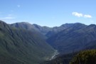
Arahura Valley
Photograph
•
Distance: less than 100m away
The Arahura Valley from the Mudflats swingbridge.
More ▶︎
Mudflats Hut
Hut
•
Standard Hut (DOC). Capacity: 6.
•
Distance: less than 100m away
Mudflats Hut (6 bunks, matresses, tank water, stove, firewood available) lies in the mid-reaches of the Arahura Valley in Westland. ...
More ▶︎
Makarora River headwaters August 2015
Photograph
•
Distance: less than 100m away
This photo was taken after emerging from the gorge. It was nice to see some sun after having been in ...
More ▶︎
Hurunui Hut
Hut
•
Standard Hut (DOC). Capacity: 15.
•
Distance: less than 100m away
Large tramping hut on river terrace above the Hurunui valley. The hut is near the roadend, and as such convenient ...
More ▶︎
Harper Pass - Kiwi Saddle
Track
•
5 – 7 days. Medium. One way.
•
Distance: less than 100m away
A classic crossing of the Main Divide, following the deep valleys of the Hope Fault from the Arthur's Pass road ...
More ▶︎
Hurunui Hut
Photograph
•
Distance: less than 100m away
Hurunui Hut in the Hurunui Valley just above Lake Sumner
More ▶︎
Hurunui Hot Springs
Track
•
2 – 3 days. Easy. Return via same track.
•
Distance: less than 100m away
An overnight trip to a good hot pool near Lake Sumner.
More ▶︎
Locke Stream (No. 4) Hut
Hut
•
Serviced Hut (DOC). Capacity: 18.
•
Distance: less than 100m away
Once known as No. 4 Hut, this hut was build in 1939 as a tourist hut for the Harper Pass ...
More ▶︎
Mount Fishtail
Track
•
1 day. Easy/medium. Return by the same track.
•
Distance: less than 100m away
A moderate day hike to the summit of Mount Fishtail a prominent peak in the Richmond Range. Great views can ...
More ▶︎
Lake Thompson
Photograph
•
Distance: less than 100m away
Lake Thompson, just below the Thompson Pass in the Nelson Lakes
More ▶︎
Kerin Forks Hut
Hut
•
Serviced Hut (DOC). Capacity: 10.
•
Distance: less than 100m away
Kerin Forks Hut (10 bunks, wood-burning stove, firewood avail., tank water) is a spacious, comfortable hut at the back of ...
More ▶︎
Top Wairoa Hut March 2014
Photograph
•
Distance: less than 100m away
This photo shows the hut after its fairly recent maintenance. A paint job & clearance of scrub from around the ...
More ▶︎
Lake Man biv
Photograph
•
Distance: less than 100m away
located in the trees about 1 hr from the lake.
More ▶︎
Kokatahi Bivouac
Photograph
•
Distance: less than 100m away
No - the camera's not on an angle - it's the Biv that's leaning. The dilapidated Kokatahi Bivouac below Zit ...
More ▶︎
Kokatahi Bivouac (removed)
Hut
•
Removed!
•
Distance: less than 100m away
Hut removed 2008.
Kokatahi Bivouac (dilapidated) was once a typical 2-bed apline bivouac, located on a grassy face above the upper ...
More ▶︎
Biv sign
Photograph
•
Distance: less than 100m away
Gone but not forgotten!
Bits of this biv were salvaged from the Hokitika rubbish dump. An aquaintance made a sculpture ...
More ▶︎
Le Crens Hut / L. A. Crens Hut
Hut
•
Private hut (PVT). Capacity: 4.
•
Distance: less than 100m away
L.A. Crens Hut (private?, 4 bunk, fireplace, stream water) is a historic station hut on Glen Lyon Station land in ...
More ▶︎
Cullen Creek Hut
Photograph
•
Distance: less than 100m away
Cullen Creek Hut on the Waikakaho - Cullen Creek Track, Eastern Richmond Ranges. Note, this is a locked, private hut.
More ▶︎
Cullen Creek Hut, Eastern Richmond Ranges
Photograph
•
Distance: less than 100m away
The Cullen Creek valley and Cullen Creek Hut on the Waikakaho - Cullen Creek Track in the Eastern Richmond Ranges. ...
More ▶︎
Cullen Creek Hut
Hut
•
Private hut (Private). Capacity: 4.Bookings required.
•
Distance: less than 100m away
This private 4-bunk hut is the only hut in the eastern Richmond Ranges. Sadly it is locked.
Camping spots exist ...
More ▶︎
Nina River
Track
•
2 days. Easy. Return by the same track.
•
Distance: less than 100m away
Easy tramping up a pretty river valley near Lewis Pass.
More ▶︎
Nina Hut
Hut
•
Standard Hut (DOC). Capacity: 10.
•
Distance: less than 100m away
Replacing the old hut down by the river, this hut is located in an elevated clearing with good mountain views. ...
More ▶︎
Top Crawford Bivouac
Photograph
•
Distance: less than 100m away
Top Crawford Bivouac, Crawford Valley, Westland
More ▶︎
Mount Learmont
Photograph
•
Distance: less than 100m away
Mount Learmont and the upper Crawford Valley, Westland
More ▶︎
Top Crawford Bivouac (Removed)
Hut
•
Removed!
•
Distance: less than 100m away
The Top Crawford Bivouac (2 bunks, no matresses, stream water 100m distant, no fire) is a typical alpine Biv, with ...
More ▶︎
Macauley Hut
Photograph
•
Distance: less than 100m away
Macauley Hut, a luxurious public hut in the Macauly valley.
More ▶︎
Upper Macauley Valley
Photograph
•
Distance: less than 100m away
Upper Macauley Valley from Macauley Hut.
More ▶︎

Macaulay Hut
Hut
•
Serviced Hut (Mackenzie Alpine Trust). Capacity: 14.
•
Distance: less than 100m away
Macaulay Hut (14 bunks, matresses, stove, firewood provided, water, bath, mountain radio, gas cookers, lighting) is a luxury option for ...
More ▶︎
Mount Rintoul Hut
Photograph
•
Distance: less than 100m away
Mount Rintoul Hut in the Richmond Ranges with Nelson and the bay beyond.
More ▶︎
Mount Rintoul Hut
Hut
•
Standard Hut (DOC). Capacity: 6.
•
Distance: less than 100m away
Rintoul Hut / Mount Rintoul Hut (6 beds, matresses, stove, tank water) lies on the Alpine Route, 100m below the ...
More ▶︎
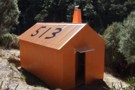
New Porters Creek Hut
Photograph
•
Distance: less than 100m away
moved to spot from right branch wairoa.
has beenlovingly restored with a new lick of 'rescue orange' paint and sports a ...
More ▶︎
Route Guide: Richmond Ranges (west) main ridge
Article
•
Distance: less than 100m away
The main ridge of the western Richmond Ranges from Mt Riley, near Okamario on SH6 to the Red Hills above ...
More ▶︎
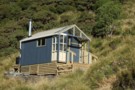
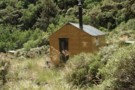
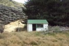
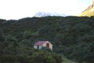
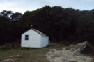
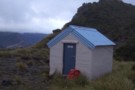
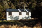
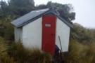
Red Hills Hut
Hut
•
Basic Hut/Bivvy (DOC). Capacity: 6.
•
Distance: less than 100m away
The Red Hills Hut sits on the saddle between the Motueka (right branch) and the Wairau, and at the base ...
More ▶︎
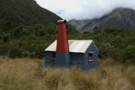
Red Hills Hut (replaced)
Photograph
•
Distance: less than 100m away
Red Hills Hut, Richmond Ranges
More ▶︎
Lawrence Hut
Photograph
•
Distance: less than 100m away
Lawrence Hut, in the Lawrence River valley, Canterbury
More ▶︎
Lawrence Hut
Hut
•
Standard Hut (DOC). Capacity: 6.
•
Distance: less than 100m away
Lawrence Hut (6 bunks, matresses, stove, tank water) is a pleasent forestry-style hut on river terraces in the lower reaches ...
More ▶︎
Crossing the Clyde and Havelock - brushes with the Canterbury Death
Article
•
Distance: less than 100m away
High rivers ... lessons learnt.
Day 11 of the Otira to Mt Cook leg of my Southern Traverse
More ▶︎
Whitcombe Pass & Butler Saddle
Article
•
Distance: less than 100m away
route guide attached by for Hokitika Gorge to Erewhon via Whitcombe Pass & Butler Saddle. The guide was written by ...
More ▶︎
Mt Fishtail
Photograph
•
Distance: less than 100m away
Mount Fishtail, Richmond Ranges. The ridge in the foreground leads to Mt Fell, and is steep in places... where it's ...
More ▶︎
Wairau valley from Fishtail Hut
Photograph
•
Distance: less than 100m away
Wairau valley from Fishtail Hut
More ▶︎
Fishtail Hut from Mt Fishtail
Photograph
•
Distance: less than 100m away
Fishtail Hut from Mt Fishtail
More ▶︎
Fishtail Hut
Hut
•
Standard Hut (DOC). Capacity: 4.
•
Distance: less than 100m away
Fishtail hut (4 bunk, matresses, tank water, no fire) is located on a plateau half way up the scree face ...
More ▶︎
Goat Creek track to Mt Barron
Track
•
0 – 1 day. Hard. Loop track with a road section.
•
Distance: less than 100m away
Overgrown and line is destroyed by recent slips.
More ▶︎
Upper Whitcombe River at Neave Hut
Photograph
•
Distance: less than 100m away
The upper Whitcombe River at Neave Hut, just 5km from its headwaters at the Whitcombe Pass. The track to the ...
More ▶︎
Mt Travers
Photograph
•
Distance: less than 100m away
Mt Travers from Upper Travers Hut - 2338m - Apr 2011
More ▶︎
Upper Travers Basin
Photograph
•
Distance: less than 100m away
The pot belly stove in the new hut at Upper Travers got a strong workout in the winter of 2004. ...
More ▶︎
Upper Travers Hut
Hut
•
Serviced Hut (DOC). Capacity: 24.
•
Distance: less than 100m away
The original hut has been replaced by a larger hut. The new hut is in the shelter of the trees ...
More ▶︎
Monument Hut
Photograph
•
Distance: 101m away
Monument Hut, in the Hopkins - a handy evening walk in for those heading up the Hopkins or Huxley the ...
More ▶︎
Monument Hut
Hut
•
Standard Hut (DOC). Capacity: 6.
•
Distance: 101m away
Monument Hut (6 bunks, matresses, stove, firewood, river water) is a forestry style hut in the Hopkins. Its located just ...
More ▶︎
Hopkins Valley
Track
•
3 – 4 days. Easy/medium. Return via same track.
•
Distance: 101m away
A very long, straightforward valley at the head of Lake Ohau.
More ▶︎
Huxley Valley
Track
•
2 days. Easy/medium. Return via same track.
•
Distance: 101m away
Easy walking at the head of Lake Ohau.
More ▶︎
Growler Hut
Photograph
•
Distance: 101m away
Growler Hut, a private hut on the south side of the Havelock.
More ▶︎
Readon Hut
Photograph
•
Distance: 102m away
Readon Hut, in the upper Dobson., Despite being only 8km from Mt Cook Village, this hut is most commonly accessed ...
More ▶︎

Profile : St Arnaud - Lewis Pass
Photograph
•
Distance: 103m away
A useful profile of the 100km tramp - with a couple of bad weather alternatives :
1. low route past Speargrass ...
More ▶︎

St Arnaud - Lewis Pass
Article
•
Distance: 103m away
A 9-day 100km tramp via the Thompson, D'Urville and 3 Tarns Passes
Feb 2013
More ▶︎
Liebig Hut
Hut
•
Standard Hut (DOC). Capacity: 6.
•
Distance: 103m away
Liebig Hut (6 bunk, matresses, no fire, water at 200m, mountain radio) is a DOC hut on the south side ...
More ▶︎
Mt Sefton from Liebig Hut
Photograph
•
Distance: 103m away
Sunrise catches Mt Sefton. From the Liebig Hut, in the Murchinson.
More ▶︎
Liebig Hut
Photograph
•
Distance: 103m away
Liebig Hut, in the Murchinson Valley. Access to the valley is by boat over the Tasman Glacier Lake - tourist ...
More ▶︎
Makarora Valley flats
Photograph
•
Distance: 105m away
Morning mist over flats in the upper Makarora Valley, below Makarora Hut
More ▶︎
Makarora Hut
Hut
•
Standard Hut (DOC). Capacity: 4.
•
Distance: 105m away
Makarora Hut (4 bunks, matresses, stove, firewood available, river water) is a simple but comfortable forestry-style hut on flats in ...
More ▶︎
Blue Lake Hut - Bobs Hut
GPX file
•
Distance: 107m away
Blue Lake campsite to Bob’s Hut, via Lake Thompson and D’Urville Pass
An actual, recorded, gpx – the high route section ...
More ▶︎
Bob's Hut
Photograph
•
Distance: 108m away
First view of Bob's Hut across the grassy flat (in the middle of the photo at the treeline - it ...
More ▶︎
Top Wairoa Hut
Photograph
•
Distance: 115m away
Top Wairoa Hut, from the ascent to Mt Elliss / Red Hill
More ▶︎
Ascent to Red Hill / Ellis Peak from Top Wairoa.
Photograph
•
Distance: 115m away
Ascent to Red Hill / Ellis Peak from Top Wairoa.
More ▶︎
Top Wairoa Hut
Hut
•
Standard Hut (DOC). Capacity: 6.
•
Distance: 115m away
Top Wairoa hut (6 bunks, matresses, fire - limited scrubby firewood, river water) huddles amidst Manuka scrub above the north ...
More ▶︎
Top Forks Hut (Wilkin)
Hut
•
Standard Hut (DOC). Capacity: 16.
•
Distance: 125m away
There are two huts at Top Forks (total 16 bunks, stove / fireplace, firewood available, tank water). The smaller is ...
More ▶︎
North Wilkin from Top Forks Hut
Photograph
•
Distance: 125m away
Wilkin River north branch, from the verandah at Top Forks Hut
More ▶︎
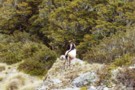
Richmond Range - country fit for mountain goats!
Photograph
•
Distance: 125m away
Goats rule on the main Richmond Range from Richmond Saddle to Ada Flats.
More ▶︎
Richmond Saddle Hut
Hut
•
Standard Hut (DOC). Capacity: 6.
•
Distance: 125m away
Hut near Mt. Richmond, on the saddle, nice view to Nelson Bay, and Abel Tasman. Beautiful sunset.
More ▶︎
Seaward Kaikouras from Fosters Hut
Photograph
•
Distance: 133m away
Seaward Kaikouras from Fosters Hut, Richmond Ranges
More ▶︎
Wairau Valley from Fosters Hut
Photograph
•
Distance: 133m away
Wairau Valley from Fosters Hut
More ▶︎
Wairau Valley from Fosters Hut
Photograph
•
Distance: 133m away
Blenheim and the Wairau Valley from Fosters Hut
More ▶︎
Top Forks Hut (Wilkin)
Photograph
•
Distance: 139m away
Top Forks Hut, in the Wilkin Valley. The last hut north of the infamous rabbit pass.
More ▶︎
Wilkins - Young (Gillespie Pass) Circuit
Track
•
3 – 4 days. Medium. One way.
•
Distance: 144m away
Crossing the Makarora river on foot to the Young valley. Ascending to Young Hut in the first day. 2nd Day ...
More ▶︎

Lake Thompson
Photograph
•
Distance: 145m away
A view of the beautiful Lake Thompson, a short distance from Thompson Pass
More ▶︎

Route Guide: St Arnaud to Lewis Pass
Article
•
Distance: 145m away
A 5-7 day north-south route from St Arnaud to the Lewis Pass, via Travers Pass, Waiau Pass, Thompson Pass and ...
More ▶︎
Whitcombe River from Frew Hut
Photograph
•
Distance: 146m away
Whitcombe River from Frew Hut, Westland
More ▶︎
Frew Hut
Hut
•
Standard Hut (DOC). Capacity: 10.
•
Distance: 146m away
Frew Hut (sleeps 10 on 2 platforms, matresses, tank & creek water, stove) is a modern tramping hut on river ...
More ▶︎
Lake Man Bivouac
Hut
•
Basic Hut/Bivvy (DOC). Capacity: 2.
•
Distance: 156m away
Lake Man Bivouac (2 bunk, no fire, stream water) is a basic bivouac 50m below the bushline near the head ...
More ▶︎
Nelson Lakes double figure eight with a reverse twist
Article
•
Distance: 156m away
January 2008.
A seven day epic up and over Lake Angelus from Speargrass Hut, then up the Sabine River, over Waiau ...
More ▶︎
Mungo River pools above Poet Hut
Photograph
•
Distance: 162m away
Mungo River pools 200m upstream of Poet Hut
More ▶︎
Black Valley Walk
Track
•
Easy. One way.
•
Distance: 166m away
Link track between St Arnaud village and the campground.
More ▶︎
Bob's Hut
Hut
•
Standard Hut (DOC). Capacity: 8.
•
Distance: 166m away
Bob was to be absent when I arrived - though a cross outside hints at possible reasons. Hut book entries ...
More ▶︎
Bob's Hut
Photograph
•
Distance: 166m away
Bob's Hut, located in wide valley flats on the west branch of the Matakitaki River.
More ▶︎
The Growler (creek)
Photograph
•
Distance: 186m away
The Growler (creek), from the confluence with the Havelock, near Growler Hut.
More ▶︎
Lake Tasman and Murchison river
Photograph
•
Distance: 198m away
A very interesting situation here: The eastern lateral moraine of the Tasman glacier forces the Murchison river into a narrow ...
More ▶︎
Poet Hut
Hut
•
Standard Hut (DOC). Capacity: 4.
•
Distance: 212m away
Poet Hut (4 bunks, matresses, fireplace, river water) is a timber built hut in a small clearing in the Mungo ...
More ▶︎
Poet Hut
Photograph
•
Distance: 212m away
Poet Hut, a riverside hut in the Mungo / Hokitika valley.
More ▶︎
Poet hut April 2011
Photograph
•
Distance: 212m away
This hut is a 1950's NZFS cullers hut located on the TR of the Mungo River a tributary of the ...
More ▶︎
Lewis Pass National Reserve
Place
•
Reserve. 182.95km2.
•
Distance: 212m away
A small park occupying the forested valleys around Lewis Pass and bordering Lake Sumner and Victoria Forest Parks as well ...
More ▶︎
Ada Pass Hut
Hut
•
Serviced Hut (DOC). Capacity: 20.
•
Distance: 213m away
Ada Pass Hut (sleeps 14 on platform beds, matresses, stove, tank & river water) is a large, comfortable two-room hut ...
More ▶︎

Cannibal Gorge, Ada Pass
Track
•
2 days. Easy. Return via same track.
•
Distance: 213m away
An easy overnighter through the pretty bush of Cannibal Gorge and on to the alpine views of Ada Pass.
More ▶︎
Ada Pass Hut
Photograph
•
Distance: 213m away
20-bunker nested into the bush edge with excellent sub-apline vista from the balcony.
More ▶︎
Top Crawford Hut
Photograph
•
Distance: 220m away
Near old Top Crawford Biv site, this 4 bunk forest service hut was refurbished and relocated in February 2011. It ...
More ▶︎
Gibbs Walk
Track
•
Easy. One way.
•
Distance: 243m away
Short link track betweem St Arnaud village and campground.
More ▶︎
Sibbald Range
Photograph
•
Distance: 246m away
Sibbald Range from Plata Col. This is an alpine route between the Havelock and Macauley via either Camp Creek, or ...
More ▶︎
Lake Kaniere - Otira
GPX file
•
Distance: 263m away
from the north end of Lake Kaniere, along the west shore to the Styx river. East along the Styx to ...
More ▶︎
Main Range of the Southern Alps from Mt. Bannatyne
Photograph
•
Distance: 268m away
Main Range of the Southern Alps from Mt. Bannatyne, a trampable ridgeline from Kokatahi Bivouac to Toaroha Bivouac.
More ▶︎
Rear view of "New" Top Crawford hut
Photograph
•
Distance: 277m away
Here is a rear view of the hut. The perspective is looking NNW past the hut and over the two ...
More ▶︎
"New" Top Crawford hut Feb 2012
Photograph
•
Distance: 277m away
This photo is of the "new" Top Crawford hut which is an hour walk up the valley from the location ...
More ▶︎
Top Crawford Hut (New)
Hut
•
Standard Hut (DOC). Capacity: 4.
•
Distance: 277m away
This entry is for the "new" Top Crawford hut which is an hour walk up the valley from the location ...
More ▶︎
East Cape to West Cape - the length of NZ's main divide
Track
•
125 – 300 days. Hard. One way.
•
Distance: 298m away
A guide to my route from East Cape to West Cape, the length of NZ's main divide.
More ▶︎
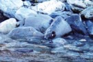
Blue Ducks
Photograph
•
Distance: 324m away
Blue Ducks on Crawford Creek, Westland. Between Top Crawford Hut and Top Crawford Bivouac
More ▶︎
Kerin Forks
Photograph
•
Distance: 347m away
Taken from the True Right side of the Wilkin River and looking up at the Siberia/Wilkin confluence. Kerin Forks hut ...
More ▶︎
St James Walkway
Track
•
5 days. Easy/medium. One way.
•
Distance: 349m away
A long and easy walk on St James Station near Lewis Pass. Beech forest, mountain scenery, farmland, wild horses, mud.
More ▶︎
St James Walkway June 2009
Photograph
•
Distance: 349m away
Gloriana and the Faerie Queene, on a brilliant winter's day.
More ▶︎
St James Conservation Area
Place
•
Place. 781.96km2.
•
Distance: 349m away
A large new recreational area featuring tussock grasslands, and including the headwaters of the Waiau and Clarence Rivers.
More ▶︎
Boyle Flats Hut
Photograph
•
Distance: 349m away
Perched high on a river terrace, accessed from a swingbridge 'on the Boyle'.
More ▶︎
Ada Cullers Hut
Photograph
•
Distance: 349m away
Tidy old shack provides shelter and shade from the elements. No mattresses or water supply.
More ▶︎
Travers-Sabine Saddle
Photograph
•
Distance: 352m away
Going over the saddle looking west towards the Sabine Valley - April 2010.
More ▶︎
Travers-Sabine
Track
•
4 – 7 days. Medium. Loop track with a road section.
•
Distance: 352m away
Two river valleys linked by a straightforward alpine saddle at 1800m
More ▶︎
Saint Arnaud
Place
•
Place.
•
Distance: 352m away
An alpine village on the shore of Lake Rotoiti in Nelson Lakes National Park.
More ▶︎

Te Araroa Trail
Track
•
95 days. Medium. One way.
•
Distance: 352m away
Te Araroa is a walking trail running the entire length of the North and South Islands. The trail opened 3 ...
More ▶︎
St Arnaud to Lewis Pass
Track
•
5 – 9 days. Medium/hard. One way.
•
Distance: 358m away
A 5-9 day north-south route from St Arnaud to the Lewis Pass, via Travers Pass, Waiau Pass, Thompson Pass and ...
More ▶︎
Dunns Creek
Photograph
•
Distance: 372m away
Dunns Creek, rough scrub on the ascent to Newton Saddle
More ▶︎
Thompson Pass & Sth Island Alpine Fault line
Photograph
•
Distance: 380m away
A view from Waiau Pass which clearly shows the alpine fault line as it heads south through Thompson Pass.
More ▶︎
Looking south from Sysiphus Peak
Photograph
•
Distance: 387m away
The Matukituki East Branch winds its way down to meet the West Branch, where we started this walk yesterday. It's ...
More ▶︎
Aspiring Flat and Sisyphus Peak
Track
•
3 days. Medium. Return via same track.
•
Distance: 387m away
A one and two-half day tramp up the East Matukituki to overnight in Aspiring Flats, with a day trip up ...
More ▶︎
Ball Shelter
Track
•
1 – 2 days. Easy/medium. Return via same track.
•
Distance: 445m away
Follow the old Ball Hut Road from the Blue Lakes car park along the moraine wall of the Tasman Glacier ...
More ▶︎
Nina Hut at Night
Photograph
•
Distance: 466m away
This hut is situated in a superb location, with wide views up all the valleys around it. A good move, ...
More ▶︎
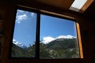
Nina Hut Views
Photograph
•
Distance: 466m away
Windows in the new Nina Hut are well set up for admiring the views.
More ▶︎
Lewis Tops from from Nina Hut
Photograph
•
Distance: 466m away
The view north from Nina Hut, March 2007
More ▶︎
Camerons Hut (Lake Sumner)
Hut
•
Basic Hut/Bivvy (DOC). Capacity: 4.
•
Distance: 479m away
A draughty tin hut with an open fire and concrete floor - but homely.
More ▶︎
Kerr Bay campsite
Campsite
•
Basic Campsite (DOC). 21 spaces.
•
Distance: 494m away
Grassy lakeside camping surrounded by a wealth of walking options, from short walks to alpine tops trips and multi-day tramps. ...
More ▶︎
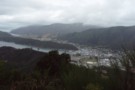
Tirohanga Walkway
Track
•
Easy. Return via same track or along streets.
•
Distance: 502m away
Short walk with panoramic views over Picton Harbour
More ▶︎
Dunns Creek Hut
Hut
•
Standard Hut (DOC). Capacity: 4.
•
Distance: 516m away
Dunns Creek Hut (4 bunks, stove, limited dry firewood, tank & creek water, mattresses). The hut sits at the back ...
More ▶︎
Thompson - D'Urville sidle
Photograph
•
Distance: 527m away
Cyan shows our actual route from Thompson Pass to D'Urville Pass. Red is Skiveoff's GPX route (downloadable from this website).
In ...
More ▶︎
Wilkinson Glaciers
Photograph
•
Distance: 551m away
Glaciers descend from the Bracken Snowfield accross the valley from the track from Prices Flat to Neave Hut in the ...
More ▶︎
Lake Rotoiti
Photograph
•
Distance: 578m away
from the shore of St Arnaud, looking to the head of the lake and up the Travers Valley - Apr ...
More ▶︎
Mt Baldy
Track
•
Easy/medium. Return by the same track.
•
Distance: 581m away
A walk to the summit of Mt Baldy, the first half of the tramp follows the Wakamarina track to Fosters ...
More ▶︎
Wakamarina
Track
•
1 – 2 days. Easy. One way.
•
Distance: 581m away
An old goldminer's trail crossing the Richmond Range from Wairau Valley to the Wakamarina Valley.
This is an easy 2-day walk ...
More ▶︎
Walking the length of the Richmond Ranges
Track
•
7 – 14 days. Medium/hard. One way.
•
Distance: 585m away
A 7-14 day walk along the spine of the Richmond Ranges. Alpine tops, crumbling ridgelines, untracked bush & scrub, boulders ...
More ▶︎
Nelson Lakes - Lakehead, Angelus and Speargrass Circuit
GPX file
•
Distance: 623m away
From St Arnaud along Lake Rotoiti to Lakehead Hut, then crossing the Travers River and via the Cascade Track to ...
More ▶︎
Travers Pass
Photograph
•
Distance: 625m away
beginning of the climb to Travers Pass, looking down the Travers Valley - Apr 2011
More ▶︎
Loop Track, Lake Rotoiti
Track
•
Easy. Loop track.
•
Distance: 640m away
A short walk through the Rotoiti Nature Recovery Project at St Arnaud. Lakeside beech forest.
More ▶︎
Honeydew Walk, Lake Rotoiti
Track
•
Easy. Loop track.
•
Distance: 640m away
This short loop leads into the edges of the Rotoiti Nature Recovery Project area, a "mainland island" with pest numbers ...
More ▶︎
Rabbit Pass is up there
Photograph
•
Distance: 720m away
View from the East Branch Matukituki River of the descent from Rabbit Pass
More ▶︎
Southern descent of Mt.Browns Tops
Photograph
•
Distance: 781m away
Moving through a boggy section of the Mt.Browns Tops route just before dropping over the edge into the creek.
That's ...
More ▶︎
Upper Travers Hut
Photograph
•
Distance: 784m away
Upper Travers Hut with Travers Pass beyond, Nelson Lakes
More ▶︎
Ascent to Dunns Creek Hut
Photograph
•
Distance: 807m away
On reaching the waterfalls in Dunns Creek, this slip on the true left must be climbed for 100m or-so before ...
More ▶︎
Tramp from the Haast to the Blue
Article
•
Distance: 836m away
Tramping the Burke, Howe, Okuru and the Blue rivers via the Douglas and Maori saddles.
More ▶︎
Zit Saddle
Photograph
•
Distance: 841m away
Zit Saddle, between the Kokatahi and Toaroha valleys
More ▶︎
Mt Brewster / Makarora valley head
Photograph
•
Distance: 884m away
Mt Brewster and the head of the Makarora valley. Taken from the col between Scrubby Flart Creek (Hunter) and the ...
More ▶︎
Kaipupu Wildlife Sanctuary
GPX file
•
Distance: 899m away
Short loop track exploring the predator-fenced reserve.
More ▶︎
Cave Camp
Rock bivouac
•
Distance: 1.0km away
Located on the Whitcombe Track, on river flats just beneath the confluence with the Wilkinson River. The biv affords a ...
More ▶︎
Hurunui river valley flats
Photograph
•
Distance: 1.0km away
Hurunui river valley flats, above Hurunui Hut
More ▶︎
Lathrop Saddle feet dangle
Photograph
•
Distance: 1.2km away
Sitting on the edge of Lathrop. Spot the biv. Descent far right on the tussock spur. Dangling feet highly recommended.
More ▶︎
Travers Pass
Photograph
•
Distance: 1.2km away
final ascent to Travers Pass - Mt Travers in the background - Apr 2011
More ▶︎
Commodore Ridge etc Feb 2012
Photograph
•
Distance: 1.2km away
This photo was taken from Point 1809m on the Toaroha Range NW of Mt Chamberlin and looks eastward toward the ...
More ▶︎
Southern Alps from Homeward Ridge
Photograph
•
Distance: 1.2km away
Southern Alps from Homeward Ridge - opposite Poet Hut, above the Mungo / Hokitika valley.
More ▶︎

Upper Waiau Uwha River
Photograph
•
Distance: 1.2km away
Having descended from Waiau Pass, the photo is looking upstream to the start of the climb up the fault line ...
More ▶︎
Route Guide: Richmond Ranges (east)
Article
•
Distance: 1.3km away
Tramping in the eastern Richmond Ranges between Picton and Okaramio (SH6)
More ▶︎
Hurunui Swingbridge
Photograph
•
Distance: 1.3km away
Gateway to adventure, near Hurunui Hut.
More ▶︎
Mount Butler
Photograph
•
Distance: 1.3km away
Mount Butler from the Raikaia near Louper Biv / Reischek Hut
More ▶︎
Raikaia River flats
Photograph
•
Distance: 1.3km away
Raikaia River flats between Louper Biv and Reischek hut
More ▶︎
Louper Bivouac
Photograph
•
Distance: 1.3km away
Louper Bivvy in the Raikai below the Whitcombe Pass
More ▶︎
Louper Bivouac
Hut
•
Basic Hut/Bivvy (DOC). Capacity: 2.
•
Distance: 1.3km away
Louper Bivouac (2 beds, matresses, tank water) is a basic bivvy on the flats of the north bank of the ...
More ▶︎
Ruth Flat Bivy
Photograph
•
Distance: 1.3km away
Found at the North End of Ruth Flat this bivy provides easy accomodation for those not wanting to carry on ...
More ▶︎
Frosty Morning in the East Matukituki
Photograph
•
Distance: 1.3km away
Taken from near the rock biv at the top of Ruth Flats looking North towards Rabbit Pass in the clouds.
More ▶︎
Scrubby Flat Creek and pass
Photograph
•
Distance: 1.3km away
Scrubby Flat Creek, and the low pass to the Makarora. This is an easy, sub-alpine route from the Hunter (Scrubby ...
More ▶︎
Three Mile Stream Track
GPX file
•
Distance: 1.3km away
Route up McMillan Stream to Three Mile Stream Hut.
More ▶︎
Hope Kiwi Track
GPX file
•
Distance: 1.3km away
A short section of the track near Lake Sumner.
More ▶︎
Waterfall in the upper Toaroha
Photograph
•
Distance: 1.4km away
The waterfall in the upper Toaroha river. From Toaroha Saddle - 500m east of Toaroha Bivouac
More ▶︎
Phil and Lori at Travers Saddle
Photograph
•
Distance: 1.4km away
A couple of American trampers I met back in 06. Soon after this crossing we got hit by a bit ...
More ▶︎
Phil and Lori at Travers Saddle
Photograph
•
Distance: 1.4km away
A couple of American trampers I met back in 06. Soon after this crossing we got hit by a bit ...
More ▶︎
Upper D'Urville valley
Photograph
•
Distance: 1.4km away
Upper D'Urville valley, descending from Thompson Pass towards D'Urville Hut. Nelson Lakes.
More ▶︎
North Ruth Flat Rock Bivvy
Rock bivouac
•
Distance: 1.4km away
Good rock bivvy formed by an overhanging rock cliff located north of Ruth Flat in the East Matukituki. On topo ...
More ▶︎
Snowbridge Gorge
Photograph
•
Distance: 1.4km away
Permanent snow remains in the gorge that the South branch of the Wilkin river flows.
More ▶︎
Snow Bridge Gorge
Photograph
•
Distance: 1.4km away
One of a couple of snow bridges that remain year round in here.
More ▶︎
Mt Sunday / Mt Riley Track
Track
•
1 – 2 days. Medium. Loop track.
•
Distance: 1.5km away
A circuit track on the Richmond Range, visiting two forested summits.
More ▶︎
Lake Sumner Conservation Park
Place
•
Conservation Park. 1057.71km2.
•
Distance: 1.5km away
Lakes and forested hills in this sprawling park provide good tramping, and contrast with the rugged alpine environment of Arthur's ...
More ▶︎

Taipo River
Photograph
•
Distance: 1.5km away
Lower Taipo river valley from the Kelly Range above Dillons Hut
More ▶︎
Taipo River above Dillons Hut
Photograph
•
Distance: 1.5km away
Taipo River above Dillons Hut, Westland
More ▶︎
Dillons Hut
Hut
•
Standard Hut (DOC). Capacity: 10.
•
Distance: 1.5km away
The New Dillons Hut (sleeps 10, stove, tank water) lies in the middle reaches of the Taipo valley, 10 minutes ...
More ▶︎
Crossing Lathrop Saddle
Photograph
•
Distance: 1.5km away
Crossing Lathrop Saddle from the Crawford towards Browning Biv
More ▶︎
Plata Col from Balaclava Saddle
Photograph
•
Distance: 1.5km away
The sidle to Plata Col from the Balaclava saddle at the head of the Growler.
More ▶︎
Balaclava Saddle
Photograph
•
Distance: 1.5km away
The ascent to Balaclava Saddle between The Growler (Havelock) and NE Gorge Creek (McCauley). The saddle is a good alpine ...
More ▶︎
Rainbow Pass
Photograph
•
Distance: 1.5km away
looking across the tarn, the climb to the top of the pass is steeper than it looks in this photo ...
More ▶︎
Rainbow Tarn
Photograph
•
Distance: 1.5km away
the tarn below Rainbow Pass, looking to Mt Travers - Apr 2011
More ▶︎
Kokatahi River
Photograph
•
Distance: 1.6km away
Boulder hopping down the upper Kokatahi, between Top Koktahi Hut and Crawford Junction Hut.
More ▶︎
Toaroha Saddle Bivvy
Hut
•
Basic Hut/Bivvy (DOC). Capacity: 2.
•
Distance: 1.6km away
Hut on the saddle between the Mungo and Toaroha Rivers.
More ▶︎
Toaroha Saddle Bivvy
Photograph
•
Distance: 1.6km away
We woke up after a windy night in the bivvy to half a meter of fresh snow. The weather didn't ...
More ▶︎
Travers Pass
Photograph
•
Distance: 1.6km away
Looking down onto Travers Pass from Rainbow Pass. The main track is on the far side.
More ▶︎
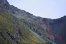
Rainbow Pass from the south
Photograph
•
Distance: 1.6km away
Rainbow Pass: a steep, tricky pass with serious exposure. I took the green route shown ... the red may, or ...
More ▶︎
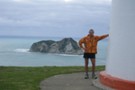
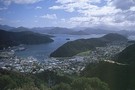
Picton Harbour and Queen Charlotte Sound from the Tirohanga Walkway
Photograph
•
Distance: 1.6km away
A good view of inner Queen Charlotte Sound.
More ▶︎
Snout Track
GPX file
•
Distance: 1.6km away
A short walk near Picton with good views of Tōtaranui / Queen Charlotte Sound.
More ▶︎
Toaroaha Saddle-Frew Saddle Circuit
Track
•
4 – 6 days. Medium. One way.
•
Distance: 1.6km away
A great tramp in a remote location, crosses two alpine saddles, ice-axes and crampons needed in winter. More information on ...
More ▶︎
Browning Range
Photograph
•
Distance: 1.7km away
From the Browning Bivvy on the bushline above the Styx River we climbed in the dark to reach the top ...
More ▶︎
Toaroha Saddle biv & Diedrich Range April 2011
Photograph
•
Distance: 1.7km away
This pic was taken from east of the biv on the knob back toward the true saddle. It looks west ...
More ▶︎
Toaroha Bivouac
Photograph
•
Distance: 1.7km away
Toaroha Bivouac - on the saddle between the Toaroha Valley and Mungo /Hokitika valley
More ▶︎
Toaroha Bivouac
Hut
•
Basic Hut/Bivvy (DOC). Capacity: 2.
•
Distance: 1.7km away
Toaroha Bivouac (2 bunks, matresses, tarn water 50m distant) is a typical alpine bivouac on the saddle of the track ...
More ▶︎
Toaroha Saddle biv 2009
Photograph
•
Distance: 1.7km away
Here is a close up shot of the biv taken just after day break as we were about to leave ...
More ▶︎
The Disappearing Tarn and Apollo Peak Reflections
Photograph
•
Distance: 1.7km away
The first mini lake encountered is the small Disappearing tarn.
More ▶︎
Upper Kokatahi River
Photograph
•
Distance: 1.7km away
Kokatahi River, above Top Kokatahi Hut. The track to Zit Saddle crosses this river several times, and will not be ...
More ▶︎
Toaroha Saddle April 2011
Photograph
•
Distance: 1.7km away
This is the saddle joining the Diedrich and Toaroha Ranges. It is approx 450 metres to the east of the ...
More ▶︎
Top Crawford Hut (Removed)
Hut
•
Removed!
•
Distance: 1.8km away
Top Crawford Hut (4-bunks, matresses, tank water, no fire) is a typical forestry-style hut. It's located on a small terrace ...
More ▶︎
Top Crawford Hut
Photograph
•
Distance: 1.8km away
Top Crawford Hut, Crawford Creek, Westland.
More ▶︎
Sylvia tops
Photograph
•
Distance: 1.8km away
on the Sylvia tops and in the clag as we contoured around the north side of SH1662 - Feb 2018
More ▶︎
Lake Sumner
Photograph
•
Distance: 1.8km away
Lake Sumner and Mt Longfellow. taken Feb 2009.
More ▶︎
Mount Barron Route
GPX file
•
Distance: 1.8km away
Old trail leading up the the tussock tops of Mount Barron. A good benched track leads up to a rocky ...
More ▶︎
Arahura-Styx track
Photograph
•
Distance: 1.8km away
The Arahura - Styx track: a benched historic pack-horse track through the Arahura and Styx valleys in Westland. An easy ...
More ▶︎
Mount Barron Route
Track
•
Medium/hard. One way.
•
Distance: 1.8km away
Old access track onto the Mount Barron tussock tops.
More ▶︎
Ahuriri
Photograph
•
Distance: 1.8km away
The Ahuriri Valley and the small tarn opposite Shamrock Hut.
More ▶︎
Newton Saddle
Photograph
•
Distance: 1.9km away
Newton Saddle between Dunns Creek (hut) and Newton Creek (hut), Westland
More ▶︎
Wilkinson hut
Hut
•
Basic Hut/Bivvy (DOC). Capacity: 4.
•
Distance: 1.9km away
A 1950's era NZFS cullers hut on the TL of the Whitcombe River just over a km downstream from where ...
More ▶︎
Wilkinson hut 1993
Photograph
•
Distance: 1.9km away
This pic shows track cutters Kelvin and Merv outside Wilkinson hut in 1993. This photo was taken by mate JH.
More ▶︎
Wilkinson hut reference / Nostalgia / History
Photograph
•
Distance: 1.9km away
I came across these hut book entries when searching the archived Frews hut book looking for info to support my ...
More ▶︎
Wilkinson hut April 2012
Photograph
•
Distance: 1.9km away
This pic was taken last month when travelling from Prices Basin to Prices Flat. I needed to head up to ...
More ▶︎
Looking SW from Mt Lathrop March 2017
Photograph
•
Distance: 1.9km away
This is the view looking out over the Crawford and Kokatahi Rivers in a south westerly direction. The Bracken snowfield ...
More ▶︎
View of Mt Lathrop etc. and further east
Photograph
•
Distance: 1.9km away
This photo looks east along the Browning Range. Lathrop Saddle crosses this scene in front of the prominent Mt Lathrop ...
More ▶︎
Top Kokatahi Hut
Hut
•
Basic Hut/Bivvy (DOC). Capacity: 4.
•
Distance: 1.9km away
The Top Kokatahi Hut (4 bunks, matresses, tank water, stove) is a forestry-style hut. It is perched above the confluence ...
More ▶︎
Top Kokatahi Hut
Photograph
•
Distance: 1.9km away
Top Kokatahi Hut, Westland
Note: this hut has since been relocated to the former site of Kokatahi Biv, some 5km upriver
More ▶︎
Tasman Glacier lake
Photograph
•
Distance: 1.9km away
The terminal lake of the Tasman Glacier from the eastern slopes of the Murchinson. I was picked up by the ...
More ▶︎
Adventure Biv
Photograph
•
Distance: 1.9km away
Perhaps this is the ADD-VENTURE behind all adventures...
'Out there with his people he forgets himself,
He forgets himself with his people,
He ...
More ▶︎
View south from Mt Tara Tama
Photograph
•
Distance: 1.9km away
This photo shows a large expanse of Westland back country and some peaks on the Canterbury side of the main ...
More ▶︎
Near Devilskin Saddle
Photograph
•
Distance: 1.9km away
Fresh snow in the beech forest northeast of Devilskin Saddle. October 2009.
More ▶︎
Kellys Range & beyond from Kellys Hill July 2011
Photograph
•
Distance: 1.9km away
This pic looking SW from Kellys Hill was taken before this weeks heavy snowfalls. The dip in the foreground is ...
More ▶︎
Lake Diana Reflections
Photograph
•
Distance: 2.0km away
The lower slopes of Mt Betsy Jane and Mt Pollux reflected in Lake Diana.
More ▶︎
Mount Hopkins
Photograph
•
Distance: 2.0km away
Mount Hopkins, in the upper Dobson. Readon hut lies on the valley floor, to the left of the peak.
More ▶︎
Looking SW from Adventure Ridge April 2008
Photograph
•
Distance: 2.0km away
In the foreground is the Adventure Ridge biv.
Next ridge back is Yeats Ridge with a white dot in the tussocky ...
More ▶︎
Adventure Ridge Biv
Hut
•
Basic Hut/Bivvy (DOC). Capacity: 2.
•
Distance: 2.0km away
A great little bivvy with it's own water tank.
Built by the NZFS in 1964.
More ▶︎
Lathrop Saddle
Photograph
•
Distance: 2.0km away
Lathrop Saddle - a hanging valley cutting through the Browning Range between the Styx and Crawford valleys. A marked track ...
More ▶︎
Ailsa Pass
Photograph
•
Distance: 2.1km away
Technically easy, but we required crampons on the Cass side (end Feb).
More ▶︎
Lake Diana Reflections 2
Photograph
•
Distance: 2.1km away
The Snow Bridge Gorge gap between Mt Twilight and Mt Betsy Jane reflected in Lake Diana.
More ▶︎

Dillon's Hut (historic)
Photograph
•
Distance: 2.1km away
Dillon's Hut (historic), in the Taipo Valley
More ▶︎
Dillons Hut (historic)
Photograph
•
Distance: 2.1km away
Dillons Hut (historic), in the Taipo Valley
More ▶︎
Dillon's Homestead (historic)
Hut
•
Standard Hut (DOC). Capacity: 5.
•
Distance: 2.1km away
Dillon's Homestead(historic) (5 beds, fireplace, tank & stream water, fiirewood available) is a well built, well restored hut in the ...
More ▶︎
East Matukituki Cliff Route
Photograph
•
Distance: 2.1km away
Not a good picture of the route, but the best I have! The descent down starts in the sunny bit ...
More ▶︎
Lake Dianna
Photograph
•
Distance: 2.1km away
The 1st of the three main lakes of the North branch of the Wilkin it is perhaps the least stunning ...
More ▶︎

Mungo River and Brunswick Creek April 2011
Photograph
•
Distance: 2.1km away
This pic shows part of the Mungo River and its tributary Brunswick Creek. It was taken from near the true ...
More ▶︎
Mungo Valley & Park Stream April 2011
Photograph
•
Distance: 2.1km away
This pic looks up the Mungo River. On the left (TR) you can see tributaries Saddle Creek & Park Stream. ...
More ▶︎
The Newland Stream
Photograph
•
Distance: 2.1km away
Taken from the true left side of the Wilkin after a dangerous fording of the flooded Newland stream. Moirs guide ...
More ▶︎
Mid Taipo hut June 2009
Photograph
•
Distance: 2.1km away
An ex NZFS hut that was built in 1973. In the 70's it was known as "New Mid Taipo" because ...
More ▶︎
Mid Taipo hut
Hut
•
Standard Hut (DOC). Capacity: 6.
•
Distance: 2.1km away
An ex NZFS hut that was built in 1973. In the 70's it was known as "New Mid Taipo" because ...
More ▶︎
The East Matukituki from Rabbit Pass - a video
Video
•
Distance: 2.1km away
Shot on my point and shoot digital camera, hopefully gives some idea of the amazing view from this spot!
More ▶︎
The East Matukituki from Rabbit Pass
Photograph
•
Distance: 2.1km away
From just past the pass looking South over the valley from some 600 metres above the valley floor.
More ▶︎
Barrack Creek Route
Photograph
•
Distance: 2.1km away
Goat Hill and Barrack Creek from Mount Barron. The route follows the spur to the true right of Barrack Creek.
More ▶︎
Mt Franklin
Photograph
•
Distance: 2.1km away
taken on the descent from Travers Pass into the E Sabine River - Apr 2011
More ▶︎
Dukeshead, Richmond Ranges
Photograph
•
Distance: 2.1km away
Dukeshead: ridgeline travel in the eastern Richmond Ranges
More ▶︎
Nelson Lakes National Park
Place
•
National Park. 1017.53km2.
•
Distance: 2.1km away
An alpine park of beech forests, valleys, and glacial lakes, offering some relatively easy walking. Established in 1956. Highest point: ...
More ▶︎
Mungo hut Feb 2012
Photograph
•
Distance: 2.2km away
The Mungo is a tributary of the Hokitika River. The hut is situated on a terrace between the Mungo River ...
More ▶︎
Mungo hut
Hut
•
Basic Hut/Bivvy (DOC). Capacity: 4.
•
Distance: 2.2km away
The Mungo is a tributary of the Hokitika River. The hut is situated on a terrace between the Mungo River ...
More ▶︎
Mount Barron tops
Photograph
•
Distance: 2.2km away
The end of the marked track up Mount Barron.
More ▶︎
Top Toaroha hut Jan 2009
Photograph
•
Distance: 2.2km away
This hut is located on the Bannatyne Flats towards the head of the Toaroha River. It is on the main ...
More ▶︎
Top Toaroha hut
Hut
•
Standard Hut (DOC). Capacity: 6.
•
Distance: 2.2km away
This hut is located on the Bannatyne Flats towards the head of the Toaroha River. It is on the main ...
More ▶︎
Lake Lucidus Morain Walls and the Upper Wilkin Valley
Photograph
•
Distance: 2.2km away
Mts Juno and Vesta tower over the massive morain which conceals Lake Lucidus.
More ▶︎
Red Hill
Photograph
•
Distance: 2.2km away
Red Hill, ascending from Top Wairoa Hut. The whole range appears to consist of nothing more than loose, rad, abrasive ...
More ▶︎
D'Urville Pass
Photograph
•
Distance: 2.2km away
an easier route (red) to D'Urville Pass
Feb 2013
More ▶︎
Onslow Hut (Steffan Memorial Hut)
Hut
•
Basic Hut/Bivvy (NZDA). Capacity: 4.
•
Distance: 2.2km away
NZDA hut located on the Murchison River just below the glacier lake.
More ▶︎
Anglers Walk, Lake Rotoiti
Track
•
Easy. One way.
•
Distance: 2.2km away
This track follows the first 2km of the Buller River from its source at Lake Rotoiti. It is well used ...
More ▶︎
Dunns Creek
Photograph
•
Distance: 2.2km away
The lower Dunns Creek ascending from the Taipo to Dunns Creek Hut
More ▶︎
East Branch Matukituki visible through the rain
Photograph
•
Distance: 2.2km away
Demon descent in the conditions
More ▶︎
Havelock Valley
Photograph
•
Distance: 2.2km away
Havelock Valley, from just below The Growler (creek). The private Growler Hut is on the flats on the left beyond ...
More ▶︎
Rabbit Pass from under Lois Peak
Photograph
•
Distance: 2.2km away
Looking West along the cliff top towards Rabbit Pass, Pickelhaube and the Beauty Ridge above, the East Matukituki waterfall below.
More ▶︎
View up Whitcombe from Meta Range Feb 2011
Photograph
•
Distance: 2.3km away
This pic looks out over Frews Ck and up the Whitcombe River to those famed spots of hunting folklore The ...
More ▶︎
Mt Baldy
Photograph
•
Distance: 2.3km away
This photo has been posted to illustrate the existing route description for climbing Mt Baldy. Mt Baldy 1315m is behind ...
More ▶︎
West Matakitaki valley
Photograph
•
Distance: 2.3km away
West Matakitaki valley, heading from Bob's Hut to Three Tarn Pass
More ▶︎
Descent of the Matukituki Cliff
Photograph
•
Distance: 2.3km away
Taken from the top of the cliff the route zigzags steeply down on the left of frame for about 20m ...
More ▶︎
Devils Den Bivouac
Photograph
•
Distance: 2.3km away
Devils Den Bivouac, below Devilskin Saddle between the Nina and Doubtful valleys. March 2007 - 3 feet of snow on ...
More ▶︎
Devils Den Bivouac
Hut
•
Basic Hut/Bivvy (DOC). Capacity: 2.
•
Distance: 2.3km away
Devils Den / Devilskin bivouac (2 beds) is a brand new bivouac ABOVE Devilskin Pass. Built in 2008, this new ...
More ▶︎
Doubtful Hut
Photograph
•
Distance: 2.3km away
Old timer shack with 3-4 bunks near the Doubtful River, Northern Canterbury.
More ▶︎
Snow, old Devil's Den Hut site
Photograph
•
Distance: 2.3km away
The old hut site was at the treeline east of Devilskin Saddle. After an avalanche, a new hut was built ...
More ▶︎
Devils Rampart
Photograph
•
Distance: 2.3km away
from the Sylvia tops, the Devils Rampart is slowly revealed as the mists begin to lift - Feb 2018
More ▶︎
"Old" Bluff hut (Removed) 1974
Photograph
•
Distance: 2.3km away
This is the "old" Bluff hut that has been shifted to the new site & upgraded. We will visit the ...
More ▶︎
"Old" Bluff Hut (has been relocated & upgraded)
Hut
•
Removed!
•
Distance: 2.3km away
Ex NZFS 4 person hut. Shifted by DOC in 2009 further upvalley. Following notes are historical.
The water supply is currently ...
More ▶︎
Birthplace of Rivers
Photograph
•
Distance: 2.3km away
From such humble beginnings does the South branch of the Wilkin start.
More ▶︎
Sir Robert Hut 2012
Photograph
•
Distance: 2.4km away
One of the more remote, seldom visited huts in Westland. The log book with barely half a dozen pages goes ...
More ▶︎
Sir Robert hut 1974
Photograph
•
Distance: 2.4km away
This hut is located on the TL near the stream in the head basin of Sir Robert Creek. The hut ...
More ▶︎
Sir Robert hut
Hut
•
Basic Hut/Bivvy (DOC). Capacity: 4.
•
Distance: 2.4km away
This hut is located on the TL near the stream in the head basin of Sir Robert Creek. The hut ...
More ▶︎
Rabbit Pass
Photograph
•
Distance: 2.4km away
A view of Rabbit Pass from just below the drop off point. In the distant is the route from Waterfall ...
More ▶︎
"New" Bluff hut April 2011
Photograph
•
Distance: 2.4km away
This square on shot of the new hut is from the perspective of looking up the TL of the Hokitika ...
More ▶︎
"New" Bluff hut & Mungo valley April 2011
Photograph
•
Distance: 2.4km away
The old Bluff hut was dismantled and moved about 150 metres in 2010. At the same time it got a ...
More ▶︎
The bluff on the upper Hokitika River just above the Mungo confluence
Photograph
•
Distance: 2.4km away
This pic taken in 2009 before Bluff hut was shifted and upgraded shows the setting of the hut from the ...
More ▶︎
"New" Bluff Hut
Hut
•
Standard Hut (DOC). Capacity: 6.
•
Distance: 2.4km away
The old Bluff hut was dismantled and moved about 150 metres in 2010. At the same time it got a ...
More ▶︎
Rainbow Stream
Photograph
•
Distance: 2.4km away
Probably at about 1000m here, 500m above Aspiring Flats visible below.
We faffed around somewhere near here and lost a couple ...
More ▶︎
Lake Constance, Nelson Lakes
Photograph
•
Distance: 2.4km away
Lake Constance in the Nelson Lakes, viewed from the Waiau Pass
More ▶︎
Pell Stream
Track
•
2 – 3 days. Medium. Loop track with a road section.
•
Distance: 2.4km away
This highly recommended valley not far from the highway west of the Lewis pass, is accessible to most people with ...
More ▶︎
Newton Creek Hut from Arahura Pack track
Track
•
1 day. Hard. One way.
•
Distance: 2.5km away
Former forest service track that was left to overgrow and suffered further damage from snow loading in winter of 2008.
Fortunately ...
More ▶︎
Bevernage Biv
Rock bivouac
•
Distance: 2.5km away
Small overhangs that are reportedly next to useless. Located on Seddon Creek near an ice lake below Mount Evans.
A ...
More ▶︎
Track amongst gold workings Taipo River
Photograph
•
Distance: 2.5km away
This photo shows a section of the Seven Mile Creek to Kelly Range tops track that passes amongst old alluvial ...
More ▶︎
Richmond Ranges (east)
Photograph
•
Distance: 2.5km away
Richmond Ranges (east), north from pt1045
More ▶︎
Ridgeline travel in the eastern Richmond Ranges
Photograph
•
Distance: 2.5km away
Ridgeline travel in the eastern Richmond Ranges
More ▶︎
Rock of Ages Bivouac
Rock bivouac
•
Distance: 2.5km away
An overhang above the Kitchener River and Aspiring Flats, near the Matukituki East Branch. Room to sleep 10, although exposed ...
More ▶︎
Bracken Snowfield / Wilkinson Glacier
Photograph
•
Distance: 2.5km away
Bracken Snowfield / Wilkinson Glacier, from the Prices Flat - Wilkinson Hut track. In the Whitcombe River valley, Westland.
More ▶︎
Tarns, Lower Tindall Stream
Photograph
•
Distance: 2.5km away
Tarns at the head of the Lower Tindall Stream, above Macauley Hut.
More ▶︎
Hunts Creek
Photograph
•
Distance: 2.5km away
Barron Ridge is at left, and Hunts Ridge at right. Hunt Saddle is at bottom right and Kelly's Creek at ...
More ▶︎
Yeats Ridge, Toaroha
Photograph
•
Distance: 2.6km away
Climbing the Yeats ridge just beyond the monkey scrub belt. In the background is the Toaroha River and the Yeats ...
More ▶︎

Murchinson Glacier
Photograph
•
Distance: 2.6km away
Views of the black Murchinson Glacier from below Rutherford Pass
More ▶︎
Tragedy Col
Photograph
•
Distance: 2.6km away
Tragedy Col, from Waterfall Hut in the Dobson. A hard - v. hard alpine route from the Dobson into the ...
More ▶︎
Waterfall Hut waterfall!
Photograph
•
Distance: 2.6km away
The waterfall at Waterfall Hut in the Dobson
More ▶︎
Waterfall Hut (Dobson Valley, Canterbury)
Hut
•
Standard Hut (DOC). Capacity: 4.
•
Distance: 2.6km away
Waterfall hut has washed away.
Waterfall Hut (4 bunks, matresses, fireplace, firewood available, stream water) was a forestry-style hut tucked into ...
More ▶︎
Scree traverse
Photograph
•
Distance: 2.7km away
a long traverse on virgin scree high above Devilskin saddle - Feb 2018
More ▶︎
Mount Sibbald
Photograph
•
Distance: 2.7km away
Mount Sibbald, from the col between Lower Tindall Stream and North Branch. An short day walk from the nearby Macauley ...
More ▶︎
7 Mile Hut
Hut
•
Basic Hut/Bivvy (PVT). Capacity: 2.
•
Distance: 2.7km away
This hut is on private land and both have been bought by someone who has improved access to 7 Mile ...
More ▶︎
Seven Mile hut Jan 2008
Photograph
•
Distance: 2.7km away
Well it is a surprise that this hut is still there. A while back I read that DOC had removed ...
More ▶︎
Devilskin Saddle
Photograph
•
Distance: 2.7km away
Devilskin Saddle between the Nina and Doubtful Valleys off the Lewis Pass. March 2007.
More ▶︎
No. 3 Hut / Number Three Hut
Hut
•
Standard Hut (DOC). Capacity: 16.
•
Distance: 2.7km away
No. 3 Hut (16 beds in 2 rooms, wood-burning stove, tank/creek water) is a lovely historic hut on flats in ...
More ▶︎
No. 3 Hut / Number Three hut
Photograph
•
Distance: 2.7km away
No. 3 Hut in the Hurunui Valley
More ▶︎
Climbing above Devilskin Saddle
Photograph
•
Distance: 2.7km away
day triping up from the Devilskin Saddle Hut June 2010. (lewis pass)
See hut and toilet on the saddle below.
Also see ...
More ▶︎
Arahura River & swingbridge
Photograph
•
Distance: 2.7km away
The swingbridge over the Arahura on the track to Newton Creek Hut.
More ▶︎
Descent from Kelly Tops to Hunts Saddle and Return!
Photograph
•
Distance: 2.7km away
Masochistic mission involving at times 40 degrees gradients where the techniques of hanging off scrub and sliding to the next ...
More ▶︎
Rock of Ages bivvy - Mt.Aspiring Flats
Photograph
•
Distance: 2.8km away
A short distance from the East Matukituki, through which flows Kitchener stream is Aspiring Flats. Coveniently located is a rock ...
More ▶︎
Huxley Valley
Photograph
•
Distance: 2.8km away
Huxley Valley, looking towards the Forks. Forks Hut is on flats at the base of the peak in the distance.
More ▶︎
Sisyphus Peak from Wilmot Saddle
Photograph
•
Distance: 2.8km away
Still 200m to go.
Sisyphus Peak (1859m) from Wilmot Saddle (1682m).
More ▶︎
Crystal Biv Track
GPX file
•
Distance: 2.8km away
Track to Crystal Biv from the valley floor in the Toaroha, Westland. This track has just been reopened by volunteers ...
More ▶︎
Route between Yeates Hut & Crystal Biv
GPX file
•
Distance: 2.8km away
This file traces the route up from Yeates Hut to the 1300m contour, then descends to Crystal Biv. If going ...
More ▶︎
Bull Flat Hut
Hut
•
Basic Hut/Bivvy (DOC). Capacity: 2.
•
Distance: 2.8km away
Small hut on the Hunter River.
More ▶︎
Descending to Crystal biv April 2008
Photograph
•
Distance: 2.8km away
This pic shows part of the route you would take if descending from Yeats Ridge to Crystal biv.
More ▶︎
Crystal Biv
Hut
•
Basic Hut/Bivvy (DOC). Capacity: 2.
•
Distance: 2.8km away
Standard 2 person biv located in the Toaroha Valley, located on a spur between Pretty and Crystal Creeks. Set beside ...
More ▶︎
Devilskin Saddle
Photograph
•
Distance: 2.8km away
from the saddle, the new biv is 50m west towards the Devils Rampart. (photo taken Feb 2018)
More ▶︎
South side of 3 Tarns Pass
Photograph
•
Distance: 2.8km away
campsite and tarn as sunset approaches
Feb 2013
More ▶︎
Devils Den Bivouac above Devilskin Pass
Photograph
•
Distance: 2.8km away
Built in 2008, this is, perhaps, the bestest and newest little hut in NZ.
More ▶︎
Devils Den Bivouac
Photograph
•
Distance: 2.8km away
Built in 2007 to replace the old version which was below Devilskin Saddle by the bushline. This new, sparkly version ...
More ▶︎
Looking down the Arahura River from near Campbell biv Feb 2009
Photograph
•
Distance: 2.9km away
This pic shows the Arahura River as far as the "big bend" where it goes out of sight then it ...
More ▶︎
Campbell biv Feb 2009
Photograph
•
Distance: 2.9km away
A 1950's vintage cullers biv located on a west facing spur of the Campbell Range. From the biv there are ...
More ▶︎
Campbell biv
Hut
•
Basic Hut/Bivvy (DOC). Capacity: 2.
•
Distance: 2.9km away
A 1950's vintage cullers biv located on a west facing spur of the Campbell Range. From the biv there are ...
More ▶︎
New Devils Den Bivvy Location
GPX file
•
Distance: 2.9km away
A GPX file of the new bivvy located on Devilskin Saddle.
The old Devils Den Bivvy has been removed.
More ▶︎
Kaikoura Ranges
Photograph
•
Distance: 2.9km away
View from Mt. Richmond, over the Marlborough region.
2 days before leaving, my last tramp in New Zealand...
More ▶︎
Lake Lucidus from Atop the Morain Wall
Photograph
•
Distance: 2.9km away
After reaching Lake Lucidus its well worth fording the outlet stream and scrambling up the South morain for a stunning ...
More ▶︎
Doubtless Hut
Hut
•
Standard Hut (DOC). Capacity: 6.
•
Distance: 2.9km away
Doubtless Hut. In the Doubtful River valley, further up from Doubtful hut.
More ▶︎
Kelly Range - Hunts Saddle Circuit
Track
•
2 – 3 days. Medium/hard. Loop track.
•
Distance: 3.0km away
A challenging circuit route traversing the Kelly Range and returning along Kelly's Creek. The direction described is the easiest option.
More ▶︎
Harman Pass - Taipo River - Kelly Saddle
Track
•
3 – 5 days. Medium/hard. One way.
•
Distance: 3.0km away
A long journey through the west of Arthur's Pass National Park.
More ▶︎
Hunts Creek Track
Track
•
2 days. Medium. Return via same track.
•
Distance: 3.0km away
Rough travel to a small, tidy hut. Better walked as part of a circuit.
More ▶︎
Lake Constance
Photograph
•
Distance: 3.0km away
above the loose scree section of the climb to Waiau Pass (looking to Lake Constance) - easier going from here
Feb ...
More ▶︎
View from un-named Campbell Range saddle
Photograph
•
Distance: 3.0km away
This April 2013 photo was taken from the un-named Campbell Range Saddle at 1600m that is on the direct route ...
More ▶︎
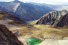
Lake Lucidus
Photograph
•
Distance: 3.0km away
Located beneath Mt Caster and Apollo Peak, Lucidus is a great example of a lateral morain lake.
More ▶︎
View SE along the Meta Range March 2011
Photograph
•
Distance: 3.0km away
This picture was taken from near the summit of Mt Inframeta & looks along the Meta Range toward the Southern ...
More ▶︎
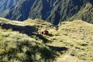
Blue Duck Bivvy Setting Feb 2016
Photograph
•
Distance: 3.0km away
Blue Duck Bivvy is a derelict B-49 style NZ Forest Service hunters bivvy that was built in the late 1950's ...
More ▶︎
Blue Duck Bivvy
Hut
•
Basic Hut/Bivvy (DOC).
•
Distance: 3.0km away
A derelict B-49 NZ Forest Service hunters bivvy that was built in the late 1950's and is still on site. ...
More ▶︎
Browning Range Biv - almost ...
Photograph
•
Distance: 3.0km away
Browning Range Biv - almost there ...
More ▶︎
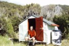
Browning Range Bivouac
Photograph
•
Distance: 3.0km away
Browning Range Bivouac, on the bush-line in the Browning Range - the hut overlooks the Styx Valley and Grassy Flat, ...
More ▶︎
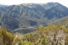
Grassy Flats
Photograph
•
Distance: 3.0km away
Grassy Flats, in the upper Styx Valley (Westland). Taken fron Browning Range Biv, 600m above.
More ▶︎
Browning Range Bivouac
Hut
•
Basic Hut/Bivvy (DOC). Capacity: 2.
•
Distance: 3.0km away
'If you're just about buggered, you're just about at Browning Biv'. The sign below the biv says it all: it's ...
More ▶︎
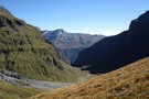
View from Pearson Saddle
Photograph
•
Distance: 3.1km away
Looking West into the Pearson River valley with a distant glimpse of the Waiatoto valley.
More ▶︎
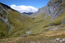
Rabbit Pass from Pearson Saddle
Photograph
•
Distance: 3.1km away
Looking from a great spot for lunch on the saddle towards the pass.
More ▶︎
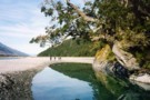
Young and Makarora Rivers
Photograph
•
Distance: 3.1km away
Confluence of the Young and Makarora Rivers near Haast Pass
More ▶︎
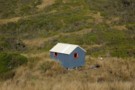
Yeats Ridge hut April 2008
Photograph
•
Distance: 3.1km away
This hut is located on a flattish area of moss & tussock amidst the scrub zone of the Toaroha catchment. ...
More ▶︎
Yeats Ridge hut
Hut
•
Basic Hut/Bivvy (DOC). Capacity: 4.
•
Distance: 3.1km away
This hut is located on a flattish area of moss & tussock amidst the scrub zone of the Toaroha catchment. ...
More ▶︎
canada goose eggs
Photograph
•
Distance: 3.1km away
Canada goose eggs. Pussy stream, just inside the trees. She left in a hurry when I stumbled across her. Photo ...
More ▶︎
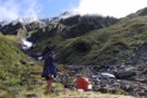
Western flanks of Mt Ross
Photograph
•
Distance: 3.1km away
This pic was taken when MM & I stopped to boil the billy having descended from Mt Ross(1770m) en route ...
More ▶︎
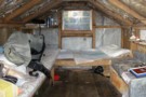
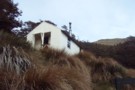
Mt. Fell Hut (Richmond Ranges)
Photograph
•
Distance: 3.1km away
Mt Fell Hut in the Richmond Ranges, with Mount Fell summit behind.
More ▶︎
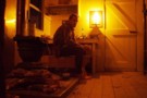
Mt Fell Hut
Hut
•
Standard Hut (DOC). Capacity: 6.
•
Distance: 3.1km away
Mount Fell Hut (sleeps 6, wood-burning stove, firewood available, tank water). The hut lies just inside the bush below Mt ...
More ▶︎
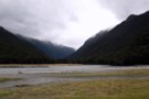
The Young River/Makarora River Confluence
Photograph
•
Distance: 3.1km away
This is looking West up the Young Valley. The Gillespie Pass Circuit starts here at the other side of the ...
More ▶︎
Cannibal Gorge Hut
Hut
•
Serviced Hut (DOC). Capacity: 20.
•
Distance: 3.1km away
The first hut on the western end of the St James Walkway.
More ▶︎
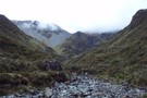
Butler Saddle
Photograph
•
Distance: 3.2km away
Butler Saddle from Reischek Stream. The saddle is the scree-covered col to the left of the ridge in the centre.
More ▶︎
Murchinson Valley / Rutherford Pass
Photograph
•
Distance: 3.2km away
The Murchinson Valley from Rutherford Pass. This is a a tough 2272m pass between the Murchinson and Cass. Access is ...
More ▶︎
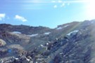
Rutherford Pass
Photograph
•
Distance: 3.2km away
Rutherford Pass (Cass side), a 2272m pass between the Murchinson and Cass. The ascent zig-zags up scree between bluffs to ...
More ▶︎
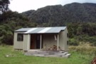
Dillons Hut (new)
Photograph
•
Distance: 3.2km away
Dillons Hut (new), Taipo Valley, Westland
More ▶︎
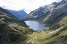
Lake Constance
Photograph
•
Distance: 3.2km away
Lake Constance, Nelson Lakes National Park. taken part way up to Waiau pass March 2003.
More ▶︎
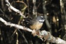
Fantail
Photograph
•
Distance: 3.2km away
Fantail near Cannibal Gorge Hut on the Saint James Walkway
More ▶︎
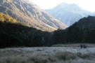
Frosty Morning Maruia River
Photograph
•
Distance: 3.2km away
Trampers on a frosty morning in the upper Maruia River near Cannibal Gorge.
More ▶︎
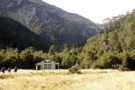
Cannibal Gorge Hut
Photograph
•
Distance: 3.2km away
Cannibal Gorge Hut is the first hut on the St James walkway from the Lewis Pass end
More ▶︎
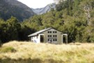
Cannibal Gorge Hut
Photograph
•
Distance: 3.2km away
Cannibal Gorge Hut is the first hut on the St James walkway from the Lewis Pass end. Sleeps 20. Nice ...
More ▶︎
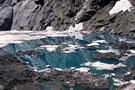
Gillespie Pass Circuit
Track
•
3 – 4 days. Medium. Loop track.
•
Distance: 3.2km away
This is a 3-4 day track that is located near Makarora at the head of Lake Wanaka. Being a loop ...
More ▶︎
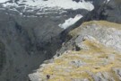
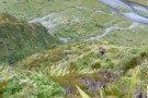
Gillespie Pass
Photograph
•
Distance: 3.2km away
Looking down at the Young side of the Pass.
More ▶︎
In and Out of the Jollie River
Article
•
Distance: 3.2km away
An easy 3 day sojourn up the Jollie to bag 2 huts.
More ▶︎
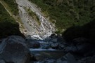
Kokatahi River
Photograph
•
Distance: 3.2km away
Kokatahi River, between Crawford Junction Hut and Top Kokatahi Hut.
More ▶︎
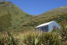
Scottys biv Jan 2010
Photograph
•
Distance: 3.2km away
A seldom walked to biv in a nice spot in the head basin of Scottys Creek a Taipo River tributary. ...
More ▶︎
Scottys biv
Hut
•
Basic Hut/Bivvy (DOC). Capacity: 2.
•
Distance: 3.2km away
A seldom walked to biv in a nice spot in the head basin of Scottys Creek a Taipo River tributary. ...
More ▶︎
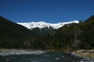
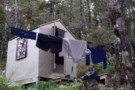
Upper D'Urville bivi
Hut
•
Basic Hut/Bivvy (DOC). Capacity: 2.
•
Distance: 3.2km away
2 bunk no toilet just a shovel. good base for hunting welcome shelter or last stop before david saddle before ...
More ▶︎
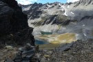
3 Tarns Pass
Photograph
•
Distance: 3.3km away
from the Pass, looking back to the 3 tarns
the better camping is on the south side of the pass
Feb 2013
More ▶︎
Red Hut
Hut
•
Standard Hut (DOC). Capacity: 12.
•
Distance: 3.3km away
Historic hut in the Hopkins Valley north of Lake Ohau. Constructed in 1916 for commercial tourism, and recently restored.
More ▶︎
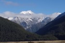
Huxley Valley, Anita Peak from Red Hut
Photograph
•
Distance: 3.3km away
Huxley Valley, Anita Peak from Red Hut in the Hopkins
More ▶︎
Ruataniwha Conservation Park
Place
•
Conservation Park. 368.00km2.
•
Distance: 3.3km away
The Ruataniwha Conservation Park occupies a mountainous landscape, and includes the valleys of the Dobson, Hopkins, Huxley, Temple and Maitland ...
More ▶︎
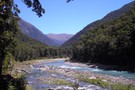
Wilkin River
Track
•
3 days. Medium. Return via same track.
•
Distance: 3.3km away
A 3 day tramp from Kerin Forks hut to the Wonderland Valley. Following the Wilkin River upstream. We took a ...
More ▶︎
Cockayne Nature Walk
GPX file
•
Distance: 3.4km away
Short walk in rich forest near Kellys Creek, Arthur's Pass National Park.
More ▶︎
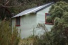
Frisco hut Jan 2009
Photograph
•
Distance: 3.4km away
Frisco hut is on the TR of the Hokitika River less than 2kms below the junction with the Mungo River. ...
More ▶︎
Frisco hut
Hut
•
Basic Hut/Bivvy (DOC). Capacity: 4.
•
Distance: 3.4km away
Frisco hut is on the TR of the Hokitika River less than 2kms below the junction with the Mungo River. ...
More ▶︎
Cockayne Nature Walk
Track
•
Easy. Loop track.
•
Distance: 3.4km away
A short loop in forest near Kelly's Creek, Otira.
More ▶︎
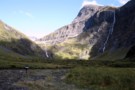
Tramping in the Wilkin Waterfall valley
Photograph
•
Distance: 3.4km away
Approaching the dreaded 200m Wilkin Waterfall face, we're dwarfed by the 400m waterfall tumbling off the North slopes of Mt ...
More ▶︎
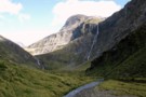
Waterfall Flat
Photograph
•
Distance: 3.4km away
Looking over the South branch of the Wilkin towards the Wilkin Waterfall Face and Mt Taurus.
More ▶︎
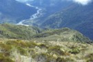
Descent to the Taipo Valley
Photograph
•
Distance: 3.4km away
Descent to the Taipo Valley from the Kelly Range, above Dillons Homestead / Hut
More ▶︎
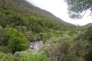
Below Kelly-Hunt Saddle
Photograph
•
Distance: 3.4km away
The Kelly below the Kelly-Hunt Saddle
More ▶︎
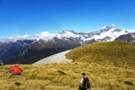
A camp with a view over the East Matukituki
Photograph
•
Distance: 3.5km away
Kathryn returns from Dragonfly Peak to her camp on the ridge to South AlbertBurn saddle from the East Matukituki.
More ▶︎
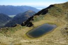
Tarn on Tara Tama Range
Photograph
•
Distance: 3.5km away
This Westland range has many nice tarns. This is one of the nicer ones IMO. It is situated on the ...
More ▶︎
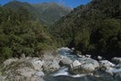
Crawford Creek
Photograph
•
Distance: 3.5km away
Crawford Creek, Westland. Between Top Crawford Hut and Crawford Junction Hut.
More ▶︎
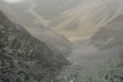
East Matakitaki Valley from David Saddle
Photograph
•
Distance: 3.5km away
East Matakitaki Valley from David Saddle, Nelson Lakes
More ▶︎
Gunnera densiflora
Photograph
•
Distance: 3.6km away
Growing on old river flats near the hot springs.
More ▶︎
Browning Pass etc from Mt Browning Nov 2017
Photograph
•
Distance: 3.6km away
Looking toward Browning Pass etc from high on Mt Browning.
I climbed up from the Styx Saddle and enjoyed great ...
More ▶︎
Travers Waterfall
Photograph
•
Distance: 3.6km away
a 15m fall - just a few minutes off the main Travers track (sign-posted) - Apr 2011
More ▶︎
Travers Falls
Place
•
Place.
•
Distance: 3.6km away
The whole of the Travers River funnels through this narrow slit - must be awesome after heavy rain.
About 1km upstream ...
More ▶︎
Closeup of the Wilkin Waterfall Route
Photograph
•
Distance: 3.6km away
Hard to get a good angle of this! The route initially goes up the middle of the 2nd to the ...
More ▶︎
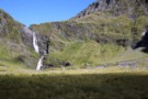
The Wilkin Waterfall Face
Photograph
•
Distance: 3.6km away
The route to Rabbit Pass climbs up the cliff to the right of the falls.
More ▶︎
Richmond Range (pt 1424)
Photograph
•
Distance: 3.6km away
Richmond Range between Richmond Saddle and Ada Flats. A rough, but interesting route from Richmond Saddle Hut to Old Man ...
More ▶︎
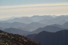
Mt Fell from the North Bank
Track
•
2 days. Medium.
•
Distance: 3.6km away
A steady climb which rewards your efforts with fabulous views of the Wairau Plains, Nelson/Tasman Bay and beyond.
More ▶︎
(Pihoihoi) - Pipit
Photograph
•
Distance: 3.6km away
Moaris used to mimick the pipits movements and use a tactic called Manukawhaki (decoy bird). They would pretend to retreat ...
More ▶︎
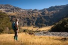
Temple Stream North Branch
Photograph
•
Distance: 3.6km away
View of the spectacular cirque at the end of Temple Stream North Branch.
More ▶︎
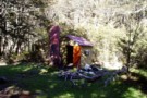
Caroline Creek Bivvy
Hut
•
Basic Hut/Bivvy (DOC). Capacity: 2.
•
Distance: 3.7km away
A nice little bivvy with 2 canvas bunks and an open fire
More ▶︎
Thompson Pass
GPX file
•
Distance: 3.7km away
Caroline Creek Hut, Upper Waiau Valley to East Matakitaki Hut via Thompson Pass & Unamed Pass
More ▶︎
Thompson Pass
GPX file
•
Distance: 3.7km away
Caroline Creek Hut, Upper Waiau Valley to East Matakitaki Hut via Thompson Pass & Unamed Pass
More ▶︎
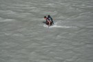
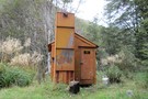
Upper Nina Biv
Hut
•
Basic Hut/Bivvy (DOC). Capacity: 2.
•
Distance: 3.7km away
Small hut on the Nina River. Two canvas bunks.
More ▶︎
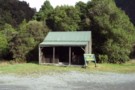
Kelly Shelter (Removed)
Hut
•
Removed!
•
Distance: 3.7km away
Kelly shelter is a roadside shelter on the Arthur's Pass road, at the base of Kelly's Creek and the track ...
More ▶︎
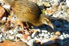
Three Tarns, Three Tarns Pass
Photograph
•
Distance: 3.7km away
Three Tarns, Three Tarns Pass - at the head of the West Matakitaki Valley
More ▶︎
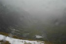
Waterfall Flat from above
Photograph
•
Distance: 3.7km away
Scungy weather continues to obscure the views, topped by a raging wind....
More ▶︎
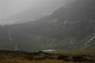
Waterfall Face, Wilkin River
Photograph
•
Distance: 3.7km away
Misty rain obscures the infamous Waterfall Face
More ▶︎
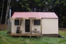
Gunsight Pass
Article
•
Distance: 3.7km away
With a couple of spare days in South Canterbury the forecast gale nor'westerlies and heavy rain on the main divide ...
More ▶︎
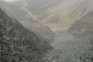
East Matakitaki from David Saddle
Photograph
•
Distance: 3.7km away
East Matakitaki valley from David Saddle
More ▶︎
Newton Creek hut Dec 2011
Photograph
•
Distance: 3.8km away
This view of the hut looks SW. The hill in the background is Mt Newton which is on the opposite ...
More ▶︎
Newton Creek Hut
Hut
•
Basic Hut/Bivvy (DOC). Capacity: 4.
•
Distance: 3.8km away
Newton Creek Hut (4 bunk, mattresses, stove, firewood, water) is a pleasant forestry hut beside Newton creek. It's drier and ...
More ▶︎
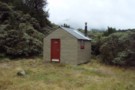
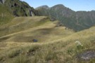
Scottys Saddle Jan 2010
Photograph
•
Distance: 3.8km away
You can see this saddle from Scottys biv. It is about a 20 - 30 minute climb to the west.
More ▶︎
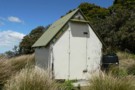
Mt Sunday Biv
Hut
•
Basic Hut/Bivvy (DOC). Capacity: 2.
•
Distance: 3.8km away
Mt Sunday biv
More ▶︎
Mt Sunday Bivy
Photograph
•
Distance: 3.8km away
Small 2 bunk bivy on the Mt Sunday - Mt Riley track, Mt Richmond Forest Park.
More ▶︎
Newton Creek Hut from Arahura Pack track
Article
•
Distance: 3.8km away
Formerly overgrown forest service track that could have led to underuse of lovely hut in magical setting.
More ▶︎
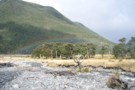
Hope River / Pussy Stream confluence
Photograph
•
Distance: 3.8km away
Hope River / Pussy Stream confluence, St Jacob's Flat
More ▶︎
Paddy's Pinchgut circuit
Track
•
Easy. Loop track.
•
Distance: 3.8km away
Mt Robert carpark to carpark via Paddy Track, Bushline hut, Relax Shelter and Pinchgut track - 4 hours. 575m up ...
More ▶︎
Paddy's Pinchgut circuit
Photograph
•
Distance: 3.8km away
Great morning or afternoon walk with great lake and mountain views.
More ▶︎
Source of the springs
Photograph
•
Distance: 3.9km away
The source of the Hurunui Hot Springs on a bank above the river.
More ▶︎
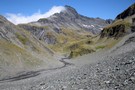
Upper Wilkin South Branch
Photograph
•
Distance: 3.9km away
Taken from above the Waterfall Face looking South West towards Pickelhaube. Pearson Saddle is the low grassy bit beneath Pickelhaube ...
More ▶︎
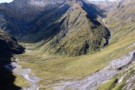
Waterfall Flat from ontop of the Waterfall Face
Photograph
•
Distance: 3.9km away
Having made it to the top you are gifted views such as this.
More ▶︎
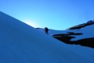
A visit to South AlbertBurn saddle
Photograph
•
Distance: 4.0km away
Michael crosses the snow slopes above Hester Pinney Creek. The sun has only just risen over the saddle and the ...
More ▶︎
Frew Creek
Photograph
•
Distance: 4.0km away
Frew Creek, flowing into the Whitcombe, Westland
More ▶︎
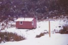
Harman hut August 1975
Photograph
•
Distance: 4.0km away
This pic was taken after having come down from Browning Pass. Shortly after I snapped the pic it started snowing ...
More ▶︎
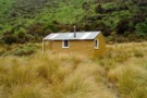
Harman Hut
Hut
•
Standard Hut (DOC). Capacity: 6.
•
Distance: 4.0km away
Standard DOC hut at the confluence of the Harman & Arahura rivers. This hut is on the popular "3 passes" ...
More ▶︎
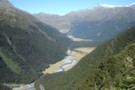
packrafting trip from upper Rakia to Erewhon Station
Video
•
Distance: 4.0km away
Climbing over Butler Saddle and packrafting down Lawrrence and Clyde Rivers to Erwehon Station in December 2008
More ▶︎
Temple Stream - North Branch
Track
•
1 day. Easy/medium. Return by the same track.
•
Distance: 4.0km away
North Temple Track.
Cross North Temple Stream and follow the track up North Temple valley. The track has been washed out ...
More ▶︎
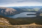
St Arnaud Range Track
Track
•
1 day. Medium. Return by the same track.
•
Distance: 4.0km away
This walk climbs steadily through beech forest to a height of over 1650 metres.
Above the bushline (at 1400 m), ...
More ▶︎
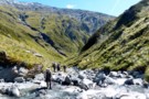
West Matakitaki Valley
Photograph
•
Distance: 4.1km away
traveling up the valley to 3 Tarns, it's easiest to keep to the river until the last push to the ...
More ▶︎
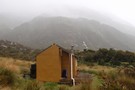
Harman Hut
Photograph
•
Distance: 4.1km away
Harman Hut on a typical West Coast summer day. Pretty basic hut that comes with its own family of weka!
More ▶︎
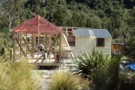
Building extensions Cedar Flat hut 9.03.12
Photograph
•
Distance: 4.1km away
This pic shows the progress on the extensions to the newer of the two Cedar Flat huts. The DOC building ...
More ▶︎
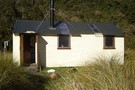
Cedar Flat Hut
Hut
•
Standard Hut (DOC). Capacity: 12.
•
Distance: 4.1km away
Double hut at the edge of a frost flat beneath the Toaroha Range. Used to be a six bunker. A ...
More ▶︎
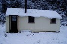
Cedar Flat Hut August 2008
Photograph
•
Distance: 4.1km away
Cedar Flat Hut during the big snowfall, August 2008
More ▶︎
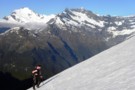
Approaching the South AlbertBurn saddle and the sun
Photograph
•
Distance: 4.1km away
An early start made it easier to cross the slopes above Hester Pinney Ck. We were pleased to make it ...
More ▶︎
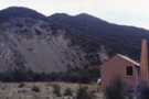
Maitland Hut
Hut
•
Basic Hut/Bivvy (DOC). Capacity: 4.
•
Distance: 4.2km away
A basic four bunk hut situated on the banks of the Right Branch Motueka River in the Mt Richmond Forest ...
More ▶︎
Maitland Hut
Photograph
•
Distance: 4.2km away
Not sure what happened to this hut. But it was in a great possy amongst the ultra mafic rocks with ...
More ▶︎
Kelly Range from Hunts Creek Track
Photograph
•
Distance: 4.2km away
The route from the tops of the Kelly Range to Hunts Saddle drops through thick scrub to a small bog ...
More ▶︎
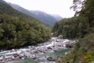
The Young River
Photograph
•
Distance: 4.2km away
The lower Young River passes through beech forest as the Gillespie Pass Circuit heads up its true left bank.
More ▶︎
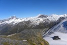
Dragonfly slopes
Photograph
•
Distance: 4.2km away
From a short distance above South AlbertBurn saddle. Whare-Kea Lodge can be seen below in the saddle. Note: The saddle ...
More ▶︎
Cedar Flat Hut (Historic)
Hut
•
Basic Hut/Bivvy (DOC). Capacity: 2.
•
Distance: 4.2km away
Older hut at Cedar Flat now adjacent to the newer hut. This hut features hand-adzed timber. It was constructed in ...
More ▶︎
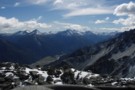
Hunter Valley from Little Canyon Col
Photograph
•
Distance: 4.2km away
Hunter Valley from Little Canyon Col: a tough pass between the Ahuriri and Hunter valleys (Shamrock Hut -> Scrubby Hut)
More ▶︎
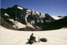
Observation Col
Photograph
•
Distance: 4.3km away
Technically easy, but does require crampons and axe. Approached from South Mathias Biv, bivvied under Col, went down Cattle Stream ...
More ▶︎
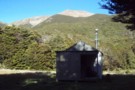
Old Man Hut
Hut
•
Standard Hut (DOC). Capacity: 6.
•
Distance: 4.3km away
Old Man Hut (sleeps 6, wood-burning stove, firewood available, tank & stream water) sits in a large grassy clearing between ...
More ▶︎
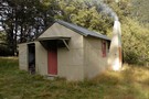
Begley Hut
Photograph
•
Distance: 4.3km away
An old NZ Forest Service hut up the Begley Valley. Fire doesn't draw well and door has to be left ...
More ▶︎
Begley Hut
Hut
•
Standard Hut (DOC). Capacity: 8.
•
Distance: 4.3km away
An old NZ Forest Service hut up the Begley Valley. Fire doesn't draw well and door has to be left ...
More ▶︎
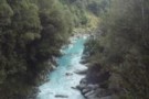
Whitcombe River gorge
Photograph
•
Distance: 4.3km away
Whitcombe River gorge, upstream from Frew Hut
More ▶︎
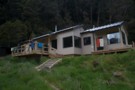
New Siberia Hut
Photograph
•
Distance: 4.3km away
The new hut was built and completed by the end of November 2011. It's a lovely little hut and after ...
More ▶︎
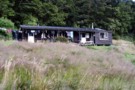
Siberia Hut
Photograph
•
Distance: 4.3km away
This is a popular hut on the Gillespie Pass circuit from the Young to the Wilkin.
More ▶︎
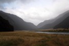
Siberia Hut
Hut
•
Serviced Hut (DOC). Capacity: 20.
•
Distance: 4.3km away
Popular hut in the Siberia Valley. Part of the Gillespie Pass circuit.
More ▶︎
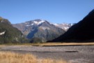
Mt Betsy Jane
Photograph
•
Distance: 4.3km away
The Top Flats of the Wilkin valley are dominated by this mountain which towers about Top Forks hut. Named after ...
More ▶︎
The Siberia Valley
Photograph
•
Distance: 4.3km away
This is looking downvalley from just below the Siberia hut. The Siberia airstrip is located right of frame across the ...
More ▶︎
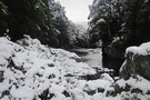
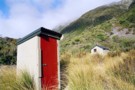
Parachute Rocks Track
Photograph
•
Distance: 4.4km away
View of Lake Rotoiti from point 1738
More ▶︎
Whitcombe Pass
Photograph
•
Distance: 4.4km away
Whitcombe Pass - between the Whitcombe and Raikaia catchments. The Louper Stream descends 7km from this point to the flats ...
More ▶︎
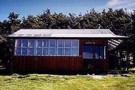
Bushline Hut
Hut
•
Standard Hut (DOC). Capacity: 14.
•
Distance: 4.4km away
A cute hut with a grand outlook over Lake Rotoiti and down to St Arnaud. Loo with a view!
More ▶︎
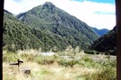
Crawford Junction
Photograph
•
Distance: 4.4km away
Crawford Junction, the confluence of Crawford Creek and Kokatahi River in Westland. Photo taken from the doorway of Crawford Junction ...
More ▶︎
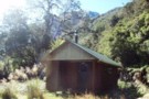
Crawford Junction Hut
Photograph
•
Distance: 4.4km away
Crawford Junction Hut, at the confluence of Crawford Creek and Kokatahi River in Westland
More ▶︎
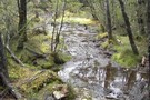
Other Part of trail to Carrington Hut
Photograph
•
Distance: 4.4km away
the trail after a nice rain
More ▶︎
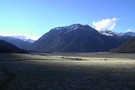
The Trail Klondyke Corner to Carrington Hu
Photograph
•
Distance: 4.4km away
view of the grassy trail before the riverbed becomes the trail.
The hut is still far here but it is behind ...
More ▶︎
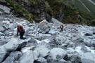
Track Descent
Photograph
•
Distance: 4.4km away
The map shows the track crossing two small tributaries before heading sharply down to meet the main river. You may ...
More ▶︎
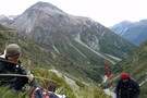
The Track Starts
Photograph
•
Distance: 4.4km away
After three or four scree/shrub combinations, where the gorge below opens out a little, keep an eye out for the ...
More ▶︎
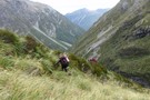
Grass my Arse
Photograph
•
Distance: 4.4km away
Sections of alpine "herbs" break up the scree slopes high above the Rolleston River. There is no track through these ...
More ▶︎
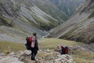
Pick Your Path
Photograph
•
Distance: 4.4km away
Try to stay reasonably high above the river on the true left for the easiest route down and to avoid ...
More ▶︎
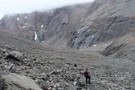
Top of Rolleston Valley
Photograph
•
Distance: 4.4km away
There are sporadic cairns down into the Rolleston Valley, but they can be difficult to pick out against the scree. ...
More ▶︎
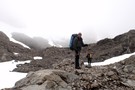
At the top
Photograph
•
Distance: 4.4km away
If intending to cross over into the Rolleston from the Waimak, DON'T go over the actual Waimak Col (you'll see ...
More ▶︎
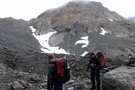
Route Planning
Photograph
•
Distance: 4.4km away
Checking the map for a route over the head of the Waimakariri Valley into the Rolleston Valley. Be aware in ...
More ▶︎
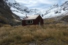
Waimakariri River-Rolleston River
Track
•
2 – 3 days. Hard. One way.
•
Distance: 4.4km away
Alpine tramp over Waimakariri Col.
More ▶︎
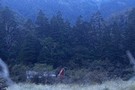
Cedar Flat
Track
•
2 days. Easy/medium. Return via same track.
•
Distance: 4.4km away
An easy and pleasant walk into a secluded valley near Hokitika. Rudimentary hot pools.
More ▶︎
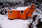
Cedar Flat Historic Hut
Photograph
•
Distance: 4.4km away
The Cedar Flat Historic hut after renovations and the picture taken during the big snow of August 2008.
More ▶︎
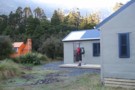
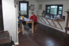
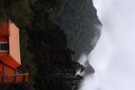
Historic Cedar Flats Hut
Photograph
•
Distance: 4.4km away
A well maintained old hut. 2 bunks
More ▶︎
Cedar Flats Hot Springs
Photograph
•
Distance: 4.4km away
Perfect hot springs in a secluded hokitika valley. Holds upto 6 people.
More ▶︎
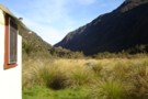
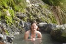
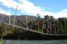
Peak a chamois - Townsend Tops
Photograph
•
Distance: 4.4km away
Occasionally when walking between Townsend hut and Minchin pass you may play peak a boo with the wildlife.
More ▶︎
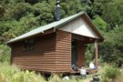
Crawford Junction hut Feb 2012
Photograph
•
Distance: 4.4km away
This hut sits near the edge of a low terrace on the TL of the Crawford River and overlooks the ...
More ▶︎
Crawford Junction Hut
Hut
•
Basic Hut/Bivvy (DOC). Capacity: 6.
•
Distance: 4.4km away
Crawford Junction Hut (6 bunks, matresses, tank water, stove) is by far the nicest hut in the valley. It's of ...
More ▶︎
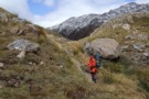
Trent Saddle Nov 2010
Photograph
•
Distance: 4.5km away
This pic shows Trent Saddle looking from the Haupiri side through to the Trent side. JH is in the pic. ...
More ▶︎
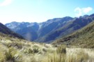
Styx Saddle
Photograph
•
Distance: 4.5km away
Styx Saddle - between the Styx and Arahura valleys in Westland. The Campbell Range forms a backdrop beyond the upper ...
More ▶︎
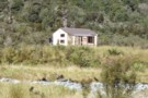
Grassy Flats Hut
Photograph
•
Distance: 4.5km away
Grassy Flats Hut in the upper Styx Valley, Westland. The hut lies on the easy, benched Arahura-Styx track, and is ...
More ▶︎
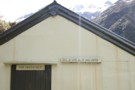
Signs on Top Trent hut
Photograph
•
Distance: 4.5km away
"Give up hope all ye who enter"
Thought I'd record the quirky sign on the hut.
I've a strong idea on ...
More ▶︎
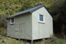
Top Trent aka Lagoon hut Nov 2010
Photograph
•
Distance: 4.5km away
An old Forest Service four bunker in the head of the Trent River. The hut is getting minimal maintenance from ...
More ▶︎
Top Trent aka Lagoon hut
Hut
•
Basic Hut/Bivvy (DOC). Capacity: 4.
•
Distance: 4.5km away
An old Forest Service four bunker in the head of the Trent River. The hut is getting minimal maintenance from ...
More ▶︎
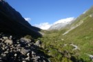
Upper Taipo towards Pope Pass
Photograph
•
Distance: 4.5km away
Upper Taipo towards Pope Pass - boulderfields through the last of the scrub-layer
More ▶︎
Queen Charlotte Track
GPX file
•
Distance: 4.5km away
Queen Charlotte Track over 4 days.
Slight detour to Punga cove accommodation
More ▶︎
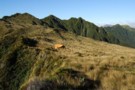
Mt Brown hut & Newton Range April 2013
Photograph
•
Distance: 4.5km away
This photo shows how the popular Mt Brown hut sits in relation to the Newton Range.
As well as tramps to ...
More ▶︎
Grassy Flat Hut
Hut
•
Standard Hut (DOC). Capacity: 12.
•
Distance: 4.5km away
Grassy Flat Hut (sleeps 12 on 2 platforms, matresses, water, stove) is a modern tramping hut with a large covered ...
More ▶︎
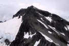
Mt Armstrong from Peak 2023
Photograph
•
Distance: 4.5km away
After visiting the Brewster Glacier it is straight forward to climb the stream that flows from beneath Peak 1951 and ...
More ▶︎
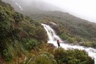
West Coast Streams
Photograph
•
Distance: 4.6km away
En-route from Harman Hut to Grassy Flat Hut. Be mindful that during heavy rain in the New Zealand bush, small ...
More ▶︎
Nina River First Swing Bridge ~ Snowy
Photograph
•
Distance: 4.6km away
The first swing bridge, in winter, gorgeous
More ▶︎
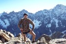
Jamieson Saddle
Photograph
•
Distance: 4.6km away
Jamieson Saddle summit, 2187m - looking west across the upper Dobson towards the Sealy Range. Jamieson saddle is an unmarked ...
More ▶︎
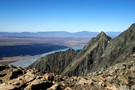
Tasman valley from Jamieson Saddle
Photograph
•
Distance: 4.6km away
A look back towards the coast from Jamieson Saddle: views over the Tasman Valley, Lake Pukaki, Burkes Pass and the ...
More ▶︎
Little Canyon Col
Photograph
•
Distance: 4.6km away
Little Canyon Col - an alpine route over a tough pass from the Ahuriri to the Hunter (are there any ...
More ▶︎
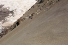
Rankin Pass
Photograph
•
Distance: 4.6km away
Technically easy, few hours from Rankin Hut in Godley. Few more hours down to Cass Memorial Hut.
More ▶︎
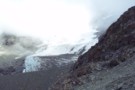
Huxley Glacier
Photograph
•
Distance: 4.6km away
The Huxley Glacier, in the upper Cass River - seen from Rankin Pass.
More ▶︎
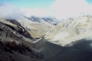
Cass River, East Branch
Photograph
•
Distance: 4.6km away
The head of the Cass river from Rankin Saddle. The Huxlrey glacier descends into the western half of the valley ...
More ▶︎
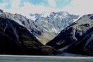
Rankin Stream / Rankin Pass
Photograph
•
Distance: 4.6km away
Rankin Stream from the Godley River flats. The notch on the left of the valley is the Rankin Pass, a ...
More ▶︎

Arthur's Pass National Park
Place
•
National Park. 1145.00km2.
•
Distance: 4.6km away
This alpine park straddles the Main Divide of the Southern Alps, with dry beech forests in the east and damp ...
More ▶︎
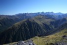
Kelly Tops, Dry Creek, Taipo Circuit
Article
•
Distance: 4.6km away
A 3 day circuit from 7 Mile Creek to the Kelly Tops, down to Hunts Saddle and then over Hunts ...
More ▶︎
Queen Charlotte Track
Track
•
3 – 5 days. Easy. One way.
•
Distance: 4.6km away
A long but easy walk along Queen Charlotte Sound. This track offers hostel and resort accommodation as well as basic ...
More ▶︎
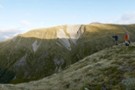
Zampa panorama
Photograph
•
Distance: 4.6km away
180 panorama from the tarn below Zampa
(click the photo to see the whole thing)
(L to R) : Zampa tops, Philosophers ...
More ▶︎
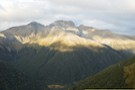
Philosophers Knob
Photograph
•
Distance: 4.6km away
from the tarn below Zampa Peak (March 2020).
Main access route is up (500m) an unnamed stream from Maruia River (right ...
More ▶︎
Rangi-Taipo Traverse from Taipo Access 4WD track
Article
•
Distance: 4.6km away
10 hour untracked traverse though unpleasant nearly impenetrable vegetation culminating in glorious ascent to Rangi-Taipo and descent via overgrown but ...
More ▶︎
Hunts Creek Hut
Hut
•
Standard Hut (DOC). Capacity: 4.
•
Distance: 4.6km away
A small hut handsomely located at the edge of a tussock clearing on Hunts Creek, west of Otira.
Hunts Creek takes ...
More ▶︎
Hunts Hut
Photograph
•
Distance: 4.6km away
A small but tidy hut located at the edge of a tussock clearing near Hunts Creek.
More ▶︎
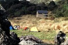
Hunts Creek Hut
Photograph
•
Distance: 4.6km away
5-7 hours slog up Kellys Creek from the Otira highway, this little abode is welcome site after mud-jumping across Hunts ...
More ▶︎
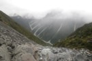
Dry Creek
Photograph
•
Distance: 4.7km away
Dry Creek - descending into the Taipo from it's 1700m saddle off Hunts Creek
More ▶︎
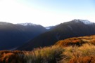
Catching the dawn on the Kelly range
Photograph
•
Distance: 4.7km away
The morning light on the Kelly range before it reaches the valley with Arthurs Pass
More ▶︎
Kelly Range
Track
•
1 – 2 days. Medium. Return by the same track.
•
Distance: 4.7km away
A brief climb up to Carroll Hut on the tops at the northern edge of Arthur's Pass National Park. Magnificent ...
More ▶︎
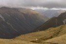
Carroll Hut
Photograph
•
Distance: 4.7km away
This newly renovated hut sits on a pretty tussock plateau on the Kelly Range.
More ▶︎
Carroll Hut
Hut
•
Standard Hut (DOC). Capacity: 10.
•
Distance: 4.7km away
A small, tidy hut just above the treeline on the Kelly Range. Recently renovated with new cladding and new windows. ...
More ▶︎
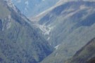
Arthur's Pass
Photograph
•
Distance: 4.7km away
Arthiur's pass and the viaduct viewed from the Kelly Creek to Carroll's Hut track.
More ▶︎
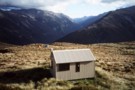
Carroll Memorial Hut
Photograph
•
Distance: 4.7km away
Situated on Kelly Saddle, Carroll Hut has stunning views across to Arthur's Pass.
More ▶︎
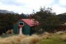
Kea hut Nov 2012
Photograph
•
Distance: 4.7km away
An older but lovingly restored hut in the Mt Robert area of Nelson Lakes National Park. This hut is only ...
More ▶︎
Kea hut
Hut
•
Private hut (NA).
•
Distance: 4.7km away
An older but lovingly restored hut in the Mt Robert area of Nelson Lakes National Park. This hut is only ...
More ▶︎
Butler Saddle and the Lawrence Valley
Photograph
•
Distance: 4.7km away
The view down the Lawrence Valley from Butler Saddle. This is an alpine route from The Raikaia into the Lawrence, ...
More ▶︎
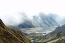
Raikaia from the Butler Saddle
Photograph
•
Distance: 4.7km away
Raikaia River flats, from the Butler Saddle. This is an alpine route from the Raikaia to the Lawrence / Clyde ...
More ▶︎
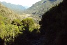
Upper Styx valley
Photograph
•
Distance: 4.7km away
Upper Styx valley and Grassy Flats, from the track over Styx Saddle.
More ▶︎
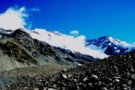
Huxley Glacier
Photograph
•
Distance: 4.7km away
The Huxley Glacier, descending from Mt Hutton into the upper Cass Valley. The private Rankin and Memorial Huts nearby provide ...
More ▶︎
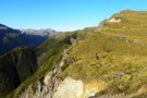
Kelly Range views over Kelly Ck
Photograph
•
Distance: 4.7km away
Moving southward above Carroll hut on the Kelly Range.
Descending the range to Hunts saddle and returning by Kellys Creek resulted ...
More ▶︎
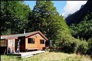
Waiau - Clarence Pass Lake Tennyson Circuit
Track
•
4 – 5 days. Medium/hard. Loop track.
•
Distance: 4.7km away
A challenging 4-5 day circuit in the St. James Conservation Area / Nelson Lakes National Park featuring two alpine pass ...
More ▶︎
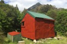
Old Julia Hut
Photograph
•
Distance: 4.7km away
Old Julia Hut after refurbishment in February 2014.
More ▶︎
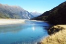
Wilkin River flats
Photograph
•
Distance: 4.8km away
Wilkin River flats, below Kevin Forks Hut.
More ▶︎
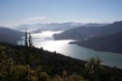
Kenepuru Sound.
Photograph
•
Distance: 4.8km away
Heading south along the track in the afternoon.Photo of Kenepuru Sound.
More ▶︎
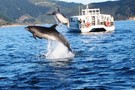
Water taxi on route to Ship Cove
Photograph
•
Distance: 4.8km away
Water taxi on way from Picton to the start of track at Ship Cove, came across some wildlife
More ▶︎
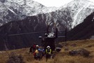
Otago rescue chopper, Huxley Valley
Photograph
•
Distance: 4.8km away
The Otago rescue chopper up the Huxley, called using an EPIRB (beacon) upon finding a party with an injured member ...
More ▶︎
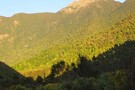
Mt Royal
Track
•
1 day. Easy/medium. Return by the same track.
•
Distance: 4.9km away
Park at camp ground, walk Quartz Creek to track start, follow spur up to saddle, then above the tree line ...
More ▶︎
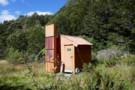
Lucretia biv
Photograph
•
Distance: 4.9km away
a good lunch stop on the route to the tops - Feb 2018
More ▶︎
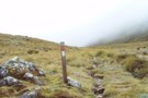
Kellys Saddle
Photograph
•
Distance: 4.9km away
Kellys Saddle - a tussock saddle between the Otira and Taipo near Carroll Hut
More ▶︎
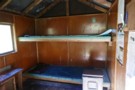
Lucretia biv
Photograph
•
Distance: 4.9km away
inside the biv - basic but welcome in bad weather - Feb 2018
More ▶︎
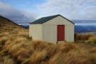
Relax Shelter
Hut
•
Shelter (DOC).
•
Distance: 4.9km away
Basic shelter on Robert Ridge (Mt Robert, Nelson Lakes National Park)
More ▶︎
Relax Shelter Nov 2012
Photograph
•
Distance: 4.9km away
On the Pinchgut track Mt Robert close to the junction with Paddys track and the Robert Ridge route.
More ▶︎
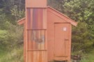
Lucretia Hut Route
Track
•
1 day. Easy/medium. Return by the same track.
•
Distance: 4.9km away
Lucretia biv via Nina Valley
More ▶︎
Lyell Hut
Hut
•
Club hut (Canterbury Mountaineering Club). Capacity: 8.
•
Distance: 4.9km away
This hut is located high on the Rakaia River near the foot of the Lyell Glacier.
More ▶︎
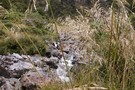
Lucretia Hut
Hut
•
Basic Hut/Bivvy (DOC). Capacity: 2.
•
Distance: 4.9km away
Very basic 2 bunk hut with open fire in the head of Lucretia Stream, Lewis Pass area
More ▶︎
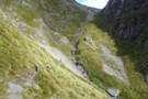
descent to the head of Lake Constance
Photograph
•
Distance: 4.9km away
after sidling across tussock grass, the descent from the bluff above the lake is pretty much tracked - and poled ...
More ▶︎
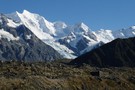
Tasman Valley from the Murchinson
Photograph
•
Distance: 4.9km away
Views across the Tasman to Mt.s Cook and Tasman from the Murchinson
More ▶︎
Mid Styx Hut painting March 2014
Photograph
•
Distance: 4.9km away
Volunteers have prepared & painted the hut exterior. This is just the second paint job this 1960 built hut has ...
More ▶︎
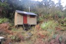
serpentine hut
Photograph
•
Distance: 4.9km away
Flew into hut to drop a group of 6 off they were going to stay the night and walk out
More ▶︎
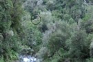
Serpentine hut setting March 2011
Photograph
•
Distance: 4.9km away
This picture from approx 300 metres away across the Hoki River shows Serpentine huts location on an overgrowing clearing on ...
More ▶︎
Serpentine hut
Hut
•
Basic Hut/Bivvy (DOC). Capacity: 4.
•
Distance: 4.9km away
This hut is located on a small bush terrace on the TR of the Hokitika River and the TL of ...
More ▶︎
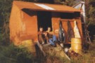
Serpentine Hut 1977
Photograph
•
Distance: 4.9km away
This photo of Serpentine hut was taken summer time 1977 by friend & sometimes tramping companion Neil Bradley.
The access route ...
More ▶︎
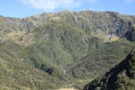
Mullins Basin April 2008
Photograph
•
Distance: 4.9km away
This pic shows the huts location in the basin and shows part of the imposing Diedrich Range behind.
More ▶︎
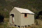
Mullins Basin hut April 2008
Photograph
•
Distance: 4.9km away
Mullins Basin hut is a four bunk hut situated in the head basin of Mullins Creek a TL tributary of ...
More ▶︎
Mullins Basin hut
Hut
•
Basic Hut/Bivvy (DOC). Capacity: 4.
•
Distance: 4.9km away
A four bunk hut situated in the head basin of Mullins Creek a TL tributary of the Toaroha River. The ...
More ▶︎
Barron Saddle Hut
Hut
•
Serviced Alpine Hut (DOC). Capacity: 8.
•
Distance: 4.9km away
An iron cylinder near Barron Saddle.
More ▶︎
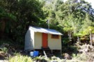
Serpentine Hut March 2015
Photograph
•
Distance: 4.9km away
Here is a recent photo of this survivor built in 1957 for deer culler accomodation. Andrew Buglass and "Permolat" helpers ...
More ▶︎
Hopkins/Dobson confluence
Photograph
•
Distance: 5.0km away
Hopkins and Dobson Valley, from Huxley Lodge. Note that Huxley Lodge (at the roadend) is a private school lodge. The ...
More ▶︎
Rapid Creek hut May 1975
Photograph
•
Distance: 5.0km away
An older pic of the hut after it had got its first replacement chimney. These days the hut has a ...
More ▶︎
Rapid Creek hut June 2008
Photograph
•
Distance: 5.0km away
This is a four bunker on the TL of the Hokitika River not far below the junction with the Whitcombe ...
More ▶︎
Rapid Creek hut
Hut
•
Basic Hut/Bivvy (DOC). Capacity: 4.
•
Distance: 5.0km away
This is a four bunker on the TL of the Hokitika River not far below the junction with the Whitcombe ...
More ▶︎
Looking NW over Frew biv April 2011
Photograph
•
Distance: 5.0km away
This pic looks over top of the biv down Frew Creek to the Whitcombe and on out to the coast. ...
More ▶︎
Frew Saddle Bivouac / Frew's Biv
Hut
•
Basic Hut/Bivvy (DOC). Capacity: 2.
•
Distance: 5.0km away
The Frew Saddle Bivouac (sleeps 2, matresses, stream water 100m distant, no fire) is a well maintained alpine bivouac 200m ...
More ▶︎
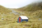
Frew Saddle Bivouac
Photograph
•
Distance: 5.0km away
Frew Saddle Bivouac, between the Whitcombe and Hokitika valleys in Westland.
More ▶︎
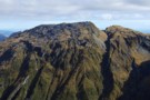
Faultline on Mt Olson May 2013
Photograph
•
Distance: 5.0km away
This picture shows a fault line on the eastern side of Mt Olson (1603m)
Mt Olson is a hill in ...
More ▶︎
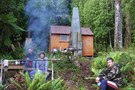
Mid Styx hut Feb 2009
Photograph
•
Distance: 5.0km away
This photo of Mid Styx hut was taken during a "Permolat" working bee when a group of volunteers worked on ...
More ▶︎
Track to Mid Styx Hut
Track
•
Easy. Loop track.
•
Distance: 5.0km away
Recently recut 40 minute track to this front country hut renovated by volunteers from the Permolat on-line community.
More ▶︎
Mid Styx Hut
Article
•
Distance: 5.0km away
Our trip in to check out this hut restored by the Permolat Community
More ▶︎
Mid Styx Hut
Hut
•
Basic Hut/Bivvy (NA). Capacity: 4.
•
Distance: 5.0km away
4 person ex-NZFS hut with open fireplace on north facing terrace high above the Styx River. Renovated extensively and maintained ...
More ▶︎
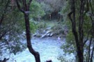
Short cut to Mid Styx hut
Photograph
•
Distance: 5.0km away
This photo shows the turnoff to Mid Styx hut as described below.
Easiest access to Mid Styx hut is the Styx ...
More ▶︎
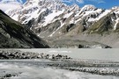
Cloudmaker
Photograph
•
Distance: 5.0km away
Mount Cook (Aoraki) forms a large cloud, seen from the Hooker Lake.
More ▶︎
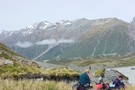
Sitting above the Hooker Glacier enroute from Ball Pass
Photograph
•
Distance: 5.0km away
Looking southward toward MtCook Village you've got a clear view of the route leading up to Mueller Hut
More ▶︎
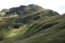
Genoa Peak March 2009
Photograph
•
Distance: 5.0km away
This pic is of the eastern side of Genoa Peak and was taken from just above Pinnacle biv on the ...
More ▶︎
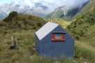
Pinnacle biv (aka Crinkle Top biv) March 2009
Photograph
•
Distance: 5.0km away
A survivor from the deer culling days before helicopters! This biv gave shooters access to hundreds of hectares of tussock ...
More ▶︎
Davies Bay campsite
Campsite
•
Backcountry Campsite (DOC). 40 spaces.
•
Distance: 5.0km away
Coastal campsite located in Umungata Bay, in the Grove Arm of Queen Charlotte Sound. This campsite is the last on ...
More ▶︎
Pinnacle biv (aka Crinkle Top biv)
Hut
•
Basic Hut/Bivvy (DOC). Capacity: 2.
•
Distance: 5.0km away
An old late 1950's NZFS cullers biv situated up in the tussock near the top of Mt Crinkle Top. This ...
More ▶︎
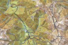
Map of Toaroha Valley to Pinnacle Biv via Adventure Ridge routes
Photograph
•
Distance: 5.0km away
This map is to illustrate the route info provided under the Comments section of the Pinnacle biv hut page.
The ...
More ▶︎
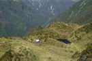
Setting of Pinnacle biv (aka Crinkle Top biv) March 2012
Photograph
•
Distance: 5.0km away
This pic shows the replacement biv which was moved to this site in 2011. It is the same design & ...
More ▶︎
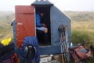
Frews Biv
Photograph
•
Distance: 5.0km away
little (officially anyway) two man job on Frews Saddle
More ▶︎
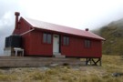
Brewster hut Jan 2009
Photograph
•
Distance: 5.0km away
An alpine hut in the Haast Pass area between Mt Armstrong and the highway. This hut is only a few ...
More ▶︎
Brewster Hut
Hut
•
Serviced Alpine Hut (DOC). Capacity: 12.Bookings required.
•
Distance: 5.0km away
An alpine hut in the Haast Pass area between Mt Armstrong and the highway. This hut is only a few ...
More ▶︎
Price Basin hut
Hut
•
Basic Hut/Bivvy (DOC). Capacity: 4.
•
Distance: 5.1km away
This hut, which is usually known as Price(s) Basin, is located on the TL of the TR branch of the ...
More ▶︎
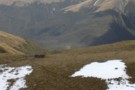
Brewster Hut
Photograph
•
Distance: 5.1km away
On the side of Mt Armstrong looking down at Brewster Hut and Haast Pass further still
More ▶︎
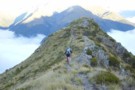
Returning to Haast Pass
Photograph
•
Distance: 5.1km away
Leaving Brewster hut for Haast pass 900M below
More ▶︎
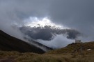
Brewster track to Mt.Armstrong
Track
•
1 – 2 days. Hard. Return via same track.
•
Distance: 5.1km away
An ascent from the state hwy(SH6),just west of Haast Pass,of over 1700m to a summit on the main divide of ...
More ▶︎
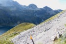
Sidling above Lake Constance
Photograph
•
Distance: 5.1km away
recent discussion about the track above Lake Constance (Campfire forum, Lake Constance - Waiau Pass Safety topic) has prompted me ...
More ▶︎
Whitcombe/Frews Saddle/Bluff Hut/Homeward Spur/Toaroha Saddle/Crystal Biv/Cedar Flats
Article
•
Distance: 5.1km away
a five day circuit
More ▶︎
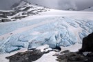
Blue ice on the snout of the Brewster Glacier
Photograph
•
Distance: 5.1km away
The ice visible at the face of the Brewster Glacier is an incredible shade of blue.
More ▶︎
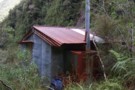
Jade Prospectors hut at Olderog/Jade Ck confluence Feb 2009
Photograph
•
Distance: 5.1km away
This hut is known by the names of both the creeks it is at the confluence of. We used to ...
More ▶︎
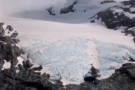
Brewster Glacier
Photograph
•
Distance: 5.1km away
Located only a 90 minute scramble away from Brewster hut, Brewster Glacier is well worth the visit especially if Mt ...
More ▶︎
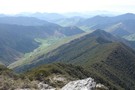
Mount Riley, Marlborough
Photograph
•
Distance: 5.1km away
From the Summit of Mount Riley, looking northeast. 15-10-09
More ▶︎
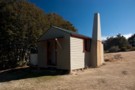
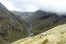
Upper Hokitika River from Frew Saddle
Photograph
•
Distance: 5.1km away
Tussock hides the ubiquitous speargrass in the upper reaches of the Hokitika, giving the illusion of an easy, pleasant tramp.
More ▶︎
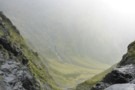
Halfway up to Gunsight Pass
Photograph
•
Distance: 5.1km away
Climbing up the gut from Temple Stream North Branch to Gunsight Pass. Looking back to the cirque at the head ...
More ▶︎
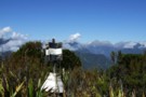
Mt Misery & beyond February 2013
Photograph
•
Distance: 5.1km away
Last month I decided to climb a hill that can be seen from home that I'd never got around to ...
More ▶︎
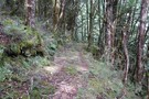
Old track near Amuri Pass
Photograph
•
Distance: 5.1km away
Amuri Pass was once a walking and stock droving route between Canterbury and the West Coast. It was first walked ...
More ▶︎
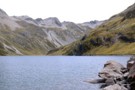
Lake Constance
Photograph
•
Distance: 5.1km away
Looking south across the lake to Waiau Pass. The southern end of the lake is dammed by an ancient, massive ...
More ▶︎
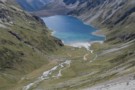
Lake Constance
Photograph
•
Distance: 5.1km away
From the ascent to Waiau Pass.
Looking down the West Sabine valley.
More ▶︎
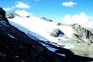
Ridge Glacier, Rutherford Pass
Photograph
•
Distance: 5.2km away
Ridge Glacier from the Rutherford Pass. This is a tough, unmarked alpine route from the Cass to the Murchinson Valley. ...
More ▶︎
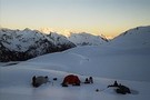
Mingha River-Deception River
Track
•
2 days. Medium. One way.
•
Distance: 5.2km away
Goat Pass Track. Alpine track over a pass between two river valleys.
More ▶︎
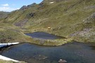
Tarns and Brass Monkey biv Dec 2011
Photograph
•
Distance: 5.2km away
This pic shows a couple of the tarns near the biv. The biv, an ex NZFS one, is in a ...
More ▶︎
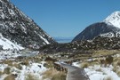
Hooker Valley Track
Track
•
Easy. Return by the same track.
•
Distance: 5.2km away
Mostly flat, easy and touristy track along the Hooker River from White Horse campground to the Hooker Glacier. Great views.
More ▶︎
Hooker Valley Track
Photograph
•
Distance: 5.2km away
Hooker Valley Track walkboard, looking towards the valley
More ▶︎
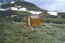
Brass Monkey Bivouac
Hut
•
Basic Hut/Bivvy (DOC). Capacity: 2.
•
Distance: 5.2km away
A basic 2 bunk bivvy on the Lewis Tops
More ▶︎
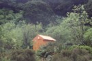
Harper Pass Bivouac
Photograph
•
Distance: 5.2km away
Harper Pass Bivouac, in the upper Hurunui valley
More ▶︎
Harper Pass Biv
Hut
•
Basic Hut/Bivvy (DOC). Capacity: 2.
•
Distance: 5.2km away
Harpers Pass Biv (2 bed, matresses, stream water, no fire) is a small bivvy 1.5km below the Harper Pass. Weather-tight ...
More ▶︎
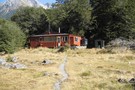
John Tait Hut
Photograph
•
Distance: 5.2km away
April 2010 - there is a large area of avalanche debris to the immediate right of this photo (out of ...
More ▶︎
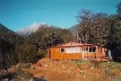
John Tait Hut
Hut
•
Serviced Hut (DOC). Capacity: 30.
•
Distance: 5.2km away
A good hut situated 5 hours easy walk from the head of Lake Rotoiti. Good views of Mt. Travers up ...
More ▶︎
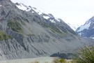
Hooker glacier and Hooker Hut
Photograph
•
Distance: 5.2km away
On the west side of Ball Pass it is easy to view the Hooker hut and the beginning of the ...
More ▶︎
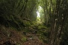
Taipo River track to Julia Hut
Photograph
•
Distance: 5.2km away
Taipo River track to Julia Hut - above Dry Creek
More ▶︎
Plata Col / Balaclava Saddle
Photograph
•
Distance: 5.3km away
Plata Col from Balaclava Saddle. Balaclava saddle is a good route from the Havelock into the McCauley. To the south, ...
More ▶︎
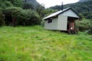
Julia Hut
Hut
•
Standard Hut (DOC). Capacity: 6.
•
Distance: 5.3km away
Standard DOC hut at the confluence of Julia and Mary Creeks where they meet the Taipo River. Good hot pools ...
More ▶︎
Julia Hut
Photograph
•
Distance: 5.3km away
Standard DOC hut at the confluence of the Julia & Taipo rivers.
More ▶︎
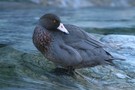
Griffin Creek - Rocky Creek
Track
•
2 – 3 days. Medium. Return by the same track.
•
Distance: 5.3km away
An isolated circuit west of Arthur's Pass along lightly used tracks and rocky riverbeds that are home to blue ducks.
More ▶︎
Griffin Creek Hut
Hut
•
Basic Hut/Bivvy (DOC). Capacity: 5.
•
Distance: 5.3km away
A small but lovingly maintained DOC hut in an isolated valley that is home to a number of blue ducks. ...
More ▶︎

Griffin Creek Hut
Photograph
•
Distance: 5.3km away
This homely hut is well maintained but not often visited.
More ▶︎
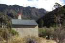
Griffin Creek hut August 2010
Photograph
•
Distance: 5.3km away
Here is another pic of the hut but this one shows Razorback Ridge in the headwaters of Griffin Creek as ...
More ▶︎
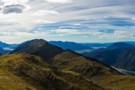
Kellys Hill
Photograph
•
Distance: 5.3km away
1400m above, looking NW from Kellys Hill, APNP.
More ▶︎
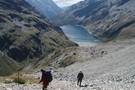
Lake Constance
Photograph
•
Distance: 5.3km away
View down to Lake Constance from Waiau Pass
More ▶︎
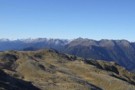
Mt Pfeifer etc from Kellys Hill July 2011
Photograph
•
Distance: 5.3km away
This photo was taken from near the broadcasting repeaters on top of Kellys Hill which is the hill immediately north ...
More ▶︎
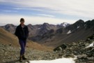
Alma Col
Photograph
•
Distance: 5.3km away
Technically easy but long pass between Rangitata and Macauley watersheds.
More ▶︎
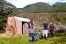
Doubtful Hut
Photograph
•
Distance: 5.3km away
A good spot for a snack on the way up to Lake Man!
More ▶︎
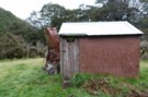
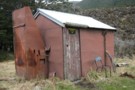
Doubtful Hut
Hut
•
Basic Hut/Bivvy (DOC). Capacity: 2.
•
Distance: 5.3km away
This hut sits just outside of Lake Sumner Conservation Park in the Doubtful River valley. Rather old and unappealing. Plenty ...
More ▶︎
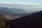
Havelock, from pt1045
Photograph
•
Distance: 5.3km away
Havelock, from pt1045 in the eastern Richmond Ranges
More ▶︎
SI Bush Robin in Old Julia hut April 2013
Photograph
•
Distance: 5.4km away
For the second time in about a month a bush robin has spent time in a hut that I've been ...
More ▶︎
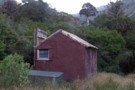
"Old" Julia hut Feb 2009
Photograph
•
Distance: 5.4km away
Close to the "New" Julia hut near the confluence of Julia & Mary Creeks where they join to form the ...
More ▶︎
"Old" Julia hut
Hut
•
Basic Hut/Bivvy (DOC). Capacity: 4.
•
Distance: 5.4km away
Close to the "New" Julia hut near the confluence of Julia & Mary Creeks where they join to form the ...
More ▶︎
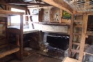
inside old julia
Photograph
•
Distance: 5.4km away
a classic view of the interior of a classic hut. Note the hand hewn locally sourced timbers.
More ▶︎
Griffin Creek
GPX file
•
Distance: 5.4km away
The route in to Griffin Creek Hut from the highway.
More ▶︎
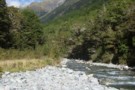
West Sabine River
Photograph
•
Distance: 5.4km away
West Sabine River, below West Sabine Hut, Nelson lakes
More ▶︎
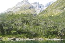
Blue Lake Jan 2007
Photograph
•
Distance: 5.4km away
This was a 'rite-of-passage' tramp for my 13 year old son. We helicoptered in to the Waiau Pass and then ...
More ▶︎
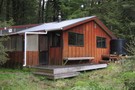
West Sabine Hut
Photograph
•
Distance: 5.4km away
April 2010 - small wood burner inside....but sufficient
More ▶︎
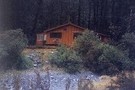
West Sabine Hut
Hut
•
Serviced Hut (DOC). Capacity: 34.
•
Distance: 5.4km away
Located in the West Branch of the Sabine River, south of Lake Rotoroa.
More ▶︎
Sabine Valley - Blue Lake - D'Urville Valley
Track
•
4 – 5 days. Medium. Circuit.
•
Distance: 5.4km away
A circuit along neighbouring valleys at the hear of Lake Rotoroa, passing the picturesque Blue Lake, and crossing Moss Pass. ...
More ▶︎
Blue Lake
Track
•
2 – 4 days. Easy/medium. Return via same track.
•
Distance: 5.4km away
Blue Lake is a small, pretty lake dammed by boulders at the head of the Sabine Valley. Beyond is Lake ...
More ▶︎
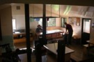
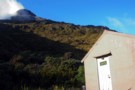
Townsend Hut
Photograph
•
Distance: 5.5km away
Early morning, heading for Lake Minchin to meet the 'Chuzzman' aka 'chuzz'.
More ▶︎
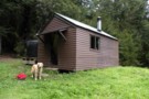
Devils Creek Hut
Hut
•
Standard Hut (DOC). Capacity: 6.
•
Distance: 5.5km away
A tidy hut on the Wakamarina Track. Has wood-burner.
More ▶︎
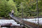
previous West Sabine bridge
Photograph
•
Distance: 5.5km away
washed away in 2012 and replaced with one just upstream of West Sabine hut
More ▶︎
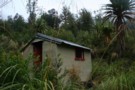
Rocky Creek Bivvy
Hut
•
Basic Hut/Bivvy (DOC). Capacity: 2.
•
Distance: 5.5km away
Located on a small forested flat on Rocky Creek, north of the Tara Tama Range. This hut is very easily ...
More ▶︎
Rocky Creek / Griffin Creek
Track
•
2 – 3 days. Medium. Loop track with a road section.
•
Distance: 5.5km away
2 day circuit in luxurious west coast bush with short above the bushline tussock section. 2 huts, Griffin Hut is ...
More ▶︎
Rocky Creek Biv
Photograph
•
Distance: 5.5km away
A little hut situated on a discreet terrace.
More ▶︎
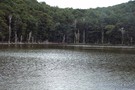
Tarn, Richmond Ranges
Photograph
•
Distance: 5.5km away
The tarn at Tarn Hut, in the Richmond Ranges
More ▶︎
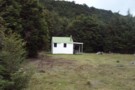
Tarn Hut
Hut
•
Standard Hut (DOC). Capacity: 5.
•
Distance: 5.5km away
Tarn Hut (5 bunks, matresses, stove, tank & stream water) is located in a clearing at the south end of ...
More ▶︎
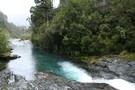
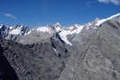
Mad Pom's latest adventure. Part 2
Article
•
Distance: 5.5km away
A trip to the head on the landsborough, and all that ensues. Part two.
More ▶︎
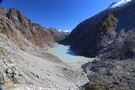
Mad Pom's latest adventure
Article
•
Distance: 5.5km away
A trip to the heads of the Landsborough ... and all that ensues.
More ▶︎
Carney's Bivvy No. 2
Hut
•
Basic Hut/Bivvy (DOC). Capacity: 2.
•
Distance: 5.5km away
One of two side-by-side huts in the Two Thumb Range.
More ▶︎
Mad Pom's latest Adventure - Part 5
Article
•
Distance: 5.5km away
A trip to the head of the Landsborough - and all that ensues.
Part 5 - Heroes and Angels.
More ▶︎
Mad Pom's latest Adventure - part 4
Article
•
Distance: 5.5km away
A trip to the head of the Landsborough - and all that ensues.
Part 4: the longest walk.
More ▶︎
Carney's Bivvy No. 1
Hut
•
Basic Hut/Bivvy (DOC). Capacity: 2.
•
Distance: 5.5km away
One of two side-by-side huts in the Two Thumb Range.
More ▶︎
Penny Pass
Track
•
3 – 4 days. Medium. Loop track.
•
Distance: 5.5km away
3 day trip from upper Poulter River over Penny Pass between Minchin and Thompson Streams.
More ▶︎
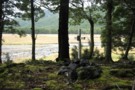
Nola Ogle memorial
Photograph
•
Distance: 5.6km away
Memorial to Nola Ogle. In the Hurunui valley between No. 3 hut and the hot spring. Nola was a NSTC ...
More ▶︎
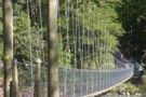
West Sabine Bridge
Photograph
•
Distance: 5.6km away
Feb 2013 - Just upstream from the hut, the new bridge was a pleasant surprise as the DOC website didn't ...
More ▶︎
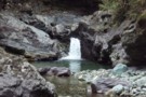
Waterfall, Wairoa left branch.
Photograph
•
Distance: 5.6km away
The waterfall and pool at the 1st creek crossing of the Wairoa above Mid Wairoa Hut, Richmond Ranges.
More ▶︎
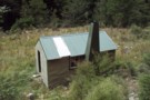
Mid Wairoa Hut
Hut
•
Standard Hut (DOC). Capacity: 6.
•
Distance: 5.6km away
Mid Wairoa Hut (6 bunks, matresses, tank & river water, stove) sits on flats 20m above the Left Branch of ...
More ▶︎
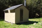
Mid Trent hut Nov 2010
Photograph
•
Distance: 5.6km away
A tidy four bunker on the TR of the Trent River. As the name suggests it is in the middle ...
More ▶︎
Mid Trent hut
Hut
•
Standard Hut (DOC). Capacity: 4.
•
Distance: 5.6km away
A tidy four bunker on the TR of the Trent River. As the name suggests it is in the middle ...
More ▶︎
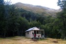
Hāwea Conservation Park
Place
•
Conservation Park. 1050.00km2.
•
Distance: 5.6km away
A large park at the head of Lake Hāwea between Mount Aspiring National Park and Ahuriri Conservation Park.
More ▶︎
Mount Richmond Forest Park
Place
•
Conservation Park. 1660.00km2.
•
Distance: 5.6km away
A wedge of land at the base of the Marlborough Sounds, south of Nelson and north of the Wairau River, ...
More ▶︎
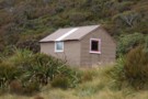
Townsend hut March 2009
Photograph
•
Distance: 5.6km away
Townsend hut which is perched high above the TL of the Taramakau River in the scrub - tussock transition zone ...
More ▶︎
Townsend hut
Hut
•
Basic Hut/Bivvy (DOC). Capacity: 4.
•
Distance: 5.6km away
Townsend hut which is perched high above the TL of the Taramakau River in the scrub - tussock transition zone ...
More ▶︎
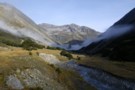
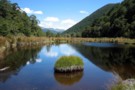
McMillan tarn
Photograph
•
Distance: 5.6km away
Tarn on the saddle between McMillan stream and Three Mile stream. taken Feb 2009.
More ▶︎
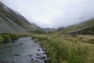
Upper Hunts Creek
Photograph
•
Distance: 5.6km away
Upper Hunts Creek - valley head above the hut. Te pass to Dry Creek in the Taipo is up scree ...
More ▶︎
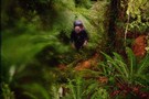
Griffin Creek Hut
Photograph
•
Distance: 5.6km away
Yes I am sure this is the track.. I think.....
More ▶︎
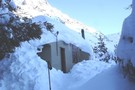
Cupola basin Hut
Photograph
•
Distance: 5.7km away
A snow covered Cupola Basin Hut visited on 6th and 7th July 2008.Stunning views of the surrounding mountains make the ...
More ▶︎
Cupola basin Hut
Hut
•
Standard Hut (DOC). Capacity: 8.
•
Distance: 5.7km away
A hut on the bushline with great views, well worth the up-hill grunt to get there.Even more spectacular when visited ...
More ▶︎
Cupola Basin Hut
Photograph
•
Distance: 5.7km away
Walked in from St. Arnaud and stayed overnight April 2002, as part of the popular Travers/Sabine circuit. I must have ...
More ▶︎
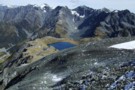
Tops SW of Lake Browning April 2013
Photograph
•
Distance: 5.7km away
I'm sharing this photo of the area near Browning Pass. I guess it must be one of my favoured areas ...
More ▶︎
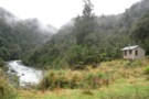
Lower Arahura Hut
Photograph
•
Distance: 5.7km away
A nice new 6 bunk hut in the Arahura valley.
More ▶︎
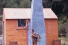
"Old" Lower Arahura hut (removed)
Photograph
•
Distance: 5.7km away
This photo shows the "old" Lower Arahura hut as it was in January 1976 when it had recently received a ...
More ▶︎
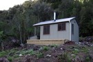
"New" Lower Arahura hut June 2010
Photograph
•
Distance: 5.7km away
A replacement DOC 6 bunk hut for the old NZFS 4 bunk hut that used to sit 30m to the ...
More ▶︎
Lower Arahura hut
Hut
•
Standard Hut (DOC). Capacity: 6.
•
Distance: 5.7km away
A new DOC 6 bunk hut that replaces the old 4 bunk NZFS hut. The new hut is 30m east ...
More ▶︎
Huxley Forks Hut
Hut
•
Standard Hut (DOC). Capacity: 6.
•
Distance: 5.7km away
Huxley Forks Hut (6-bunk, matresses, stove, firewood, tank/creek water) is an old, homely forestry-style hut at the forks of the ...
More ▶︎
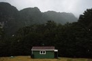
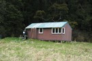
Evans Hut
Hut
•
Basic Hut/Bivvy (NZDA). Capacity: 6.
•
Distance: 5.8km away
Hut located at Cattle Stream on the Rakaia River.
More ▶︎
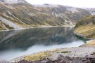
Lake Constance
Photograph
•
Distance: 5.8km away
from the bolder field above the lake, near the track to Waiau Pass - Apr 2011
More ▶︎
Hooker Hut
Hut
•
Standard Hut (DOC). Capacity: 12.
•
Distance: 5.8km away
Historic hut built in 1909/10 and situated near the moraine wall of the Hooker Glacier. It has been shifted twice ...
More ▶︎
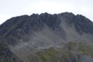
Mt Technical
Photograph
•
Distance: 5.8km away
south-west face, from the saddle SW of Lucretia - Feb 2018
More ▶︎
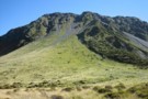
Browning Pass zig-zag
Photograph
•
Distance: 5.9km away
The zig-zag trail going up to Browning Pass on the 3 passes route. taken February 2007
More ▶︎
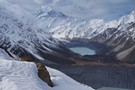
view from mueller hut route
Photograph
•
Distance: 5.9km away
In winter there is usually little sign of a track after passing Sealy Tarns, the hill is covered in snow, ...
More ▶︎
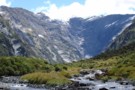
Head wall of Wonderland Valley
Photograph
•
Distance: 5.9km away
Taken in Mar 2006 after bush bashing up the true right of Wonderland stream. No trail just picking a way ...
More ▶︎
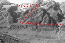
Ball Pass
Track
•
2 – 3 days. Hard. One way.
•
Distance: 5.9km away
A challenging crossing of the Kirikirikatata / Mount Cook Range between the Hooker and Tasman Glaciers just 5km south of ...
More ▶︎
Ball pass route 1996
Photograph
•
Distance: 5.9km away
The route over Ball Pass looking across the Hooker Glacier.
May have changed somewhat considering the date taken.
More ▶︎
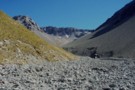
Cass River and Rutherford Pass
Photograph
•
Distance: 5.9km away
The west branch of the Cass River with Rutherford Pass in the distance
More ▶︎
Hunters Hut
Hut
•
Standard Hut (DOC). Capacity: 8.
•
Distance: 6.0km away
Standard 8 bunk hut on the Te Araroa trail.
More ▶︎
Hagens Hut
Hut
•
Standard Hut (DOC). Capacity: 4.
•
Distance: 6.0km away
Small iron hut on the Ahuriri River flats.
More ▶︎
Mt Egmont/ Mt Taranaki
Photograph
•
Distance: 6.0km away
Summit in Summer. Still a bit chilly.
More ▶︎
Copeland Pass
Photograph
•
Distance: 6.0km away
Looking West down to the West Coast from Copeland Pass. 1995
More ▶︎
Coober Pedey
Photograph
•
Distance: 6.0km away
Landscape outside Coober Pedy, Central Australia.
More ▶︎
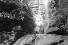
Blue Mounatins
Photograph
•
Distance: 6.0km away
Waterfall in Upper Blue Mountains, Sydney 1999
More ▶︎
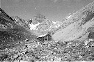
Beetham Hut
Photograph
•
Distance: 6.0km away
Beetham Hut, Tasman Glacier, Mt Cook. 1995
Demolished soon after by avalanche :-(
More ▶︎
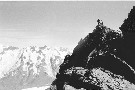
Aiguilles Rouge
Photograph
•
Distance: 6.0km away
Aiguilles Rouge summit looking West. Mt Cook National Park 1996
More ▶︎
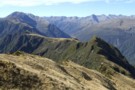
Looking eastward along the Newton Range April 2012
Photograph
•
Distance: 6.0km away
This picture was taken from a spot on the range a bit over an hour west of the bivvy. The ...
More ▶︎
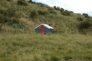
Newton Range biv
Hut
•
Basic Hut/Bivvy (DOC). Capacity: 2.
•
Distance: 6.0km away
This NZFS biv built in 1962 is perched near the crest of the Newton Range. This range seperates the Arahura ...
More ▶︎
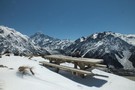
Sealy Tarns
Track
•
Easy/medium. Return by the same track.
•
Distance: 6.0km away
Steep track with lots of steps, but easy and well-maintained. The tarns are roughly half-way to Mueller Hut. From the ...
More ▶︎
St. Jacobs Hut
Hut
•
Standard Hut (DOC). Capacity: 6.
•
Distance: 6.0km away
St Jacob's Hut (6 bunks, matresses, stove, river water) is a standard DOC hut on grassy river flats in the ...
More ▶︎
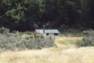
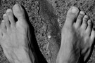
Munted Feet
Photograph
•
Distance: 6.0km away
May my thoughts be like at evening an Otago sky where detonated clouds in calm confusion lie - Glover
More ▶︎
South Huxley Bivvy
Hut
•
Basic Hut/Bivvy (DOC). Capacity: 2.
•
Distance: 6.0km away
Small hut on the Huxley River South Branch.
More ▶︎
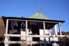
Hunters hut (Mt Richmond)
Hut
•
Standard Hut (DOC). Capacity: 8.
•
Distance: 6.0km away
cosy 8 bunk hut on ridge left branch motueka river not that easy to find on old maps
More ▶︎
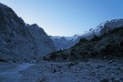
Olivine Wilderness Area
Place
•
Wilderness Area. 830.00km2.
•
Distance: 6.0km away
Remote country in the Olivine Range. The wilderness area includes the Red Hills, the Olivine Ice Plateau, and the Joe ...
More ▶︎
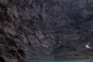
Lake Castalia
Photograph
•
Distance: 6.0km away
Completely ringed by rock walls, numerous waterfalls tumble off the towering Mercury Peak glaciers to feed Lake Castalia, the North ...
More ▶︎
Newton Range biv Jan 2008
Photograph
•
Distance: 6.1km away
This biv is perched near the crest of the Newton Range. This range seperates the Arahura River to the north ...
More ▶︎
Three Passes
Track
•
4 – 5 days. Medium/hard. One way.
•
Distance: 6.1km away
A classic trip from Arthur's Pass across Browning, Whitehorn and Harman Passes, emerging near Lake Kaniere on the West Coast.
More ▶︎
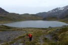
Lake Browning
Photograph
•
Distance: 6.1km away
Lake Browning, behind Browning Pass. Officially the West Coast after crossing Browning Pass, now the rain starts.
More ▶︎
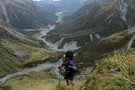
Climbing Browning Pass
Photograph
•
Distance: 6.1km away
Ascending the zig-zag tracked part of Browning Pass. It's a steep scramble up the scree at the top, probably better ...
More ▶︎
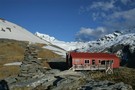
French Ridge
Track
•
2 – 4 days. Medium. Return via same track.
•
Distance: 6.1km away
A steep climb to the snowline in the West Matukituki.
More ▶︎
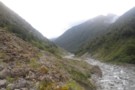
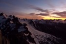
Sunrise from Mt Armstrong
Photograph
•
Distance: 6.1km away
lookin over at the backside of brewster. Well worth the alpine start
More ▶︎
Jumble Tops Traverse
Photograph
•
Distance: 6.1km away
A GPS track of Doug Forster's traverse of Jumble Tops in pink. 3 of us did a more direct version ...
More ▶︎
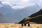
Aspiring - Rees
GPX file
•
Distance: 6.1km away
Starting at Raspberry Flat, this track passes Mt Aspiring Hut in the West Matukituki Valley and then climbs steeply to ...
More ▶︎
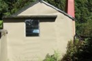
Boo Boo Hut
Hut
•
Basic Hut/Bivvy (DOC). Capacity: 4.
•
Distance: 6.1km away
Located on the Kokatahi River track just south of where a branch leads up onto the Toaroha Range.
More ▶︎
Boo Boo hut & woodshed March 2009
Photograph
•
Distance: 6.1km away
TL of the Kokatahi valley. High on a ridge well above the river gorges.
More ▶︎
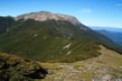
Mt Rintoul from Old Man
Photograph
•
Distance: 6.1km away
Looking back towards Rintoul From Old Man. Old Man Hut lies 1km off ridge to the left of the saddle.
More ▶︎
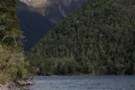
Head of Lake Christabel August 2010
Photograph
•
Distance: 6.1km away
Lake Christabel is a large boomerang shaped lake approx 3km long. The lake was caused centuries ago by a slip ...
More ▶︎
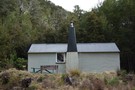
Lake Christabel hut August 2010
Photograph
•
Distance: 6.1km away
A tidy hut situated on the TL bank of the Blue Grey River about 20 minutes above Lake Christabel near ...
More ▶︎
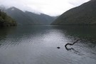
Robinson Saddle
Track
•
3 days. Easy/medium. One way.
•
Distance: 6.1km away
Forest and tops walk in Victoria Forest Park, visiting Lake Christabel.
More ▶︎
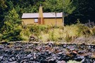
Lake Christabel Hut
Hut
•
Standard Hut (DOC). Capacity: 8.
•
Distance: 6.1km away
A tidy hut situated on the TL bank of the Blue Grey River about 20 minutes above Lake Christabel near ...
More ▶︎
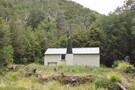
Matukituki to Paradise by roads less travelled
GPX file
•
Distance: 6.1km away
A rough, tough crossing from Raspberry Flat (Aspiring Road, Wanaka) to the Earnslaw Burn (Glenorchy-Paradise road) via Shotover Saddle, Lochnagar, ...
More ▶︎