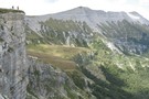
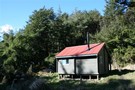
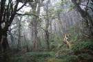
Alpine tops
Blowhard Track
Track.
Easy/medium. One way.
Updated
23 February 202123 February 2021.
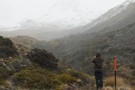
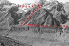
Alternative route to the summit of Mount Richardson (1047m) in the Canterbury foothills.
More ▶︎
Waipakihi Hut to Middle Range
Track.
Medium. One way.
Updated
19 May 201119 May 2011.
DOC have re cut an old track that gives access to the Middle Range from Waipakihi Hut. The usual route via Junction Top crosses private land and requires a permit. Going by this route avoids the Private land altogether.
More ▶︎
Cass Saddle
Track.
1 day. Easy/medium. One way.
Updated
30 May 201130 May 2011.
From the car park at the east end of the Cass road bridge, follow the vehicle track next to the row of pine trees until it meets Cass River. Follow the riverbed upstream, you will need to cross the river ...
More ▶︎
Jane Peak 2022m
Track.
1 – 2 days. Medium. Return via same track.
Updated
12 April 200912 April 2009.
A brilliant day trip up the highest peak in the Eyre Mountains.
More ▶︎
Lake Gunn to Falls Creek.
Track.
1 – 2 days. Hard. One way.
Updated
12 April 200912 April 2009.
A challenging day trip or overnight trip in Fiordland.
More ▶︎
Mount Morris Track, Raglan Range
Track.
1 day. Medium. One way.
Created
9 April 20099 April 2009.
This hike begins at Greig's Hut in the Branch River Valley, Upper Marlborough. A great day trip, it can be driven part way or walked entirely. The track is fairly well marked and makes itself evident as one pushes through ...
More ▶︎
Daly's Clearing Loop Track
Track.
1 day. Easy. Loop track.
Updated
4 January 20114 January 2011.
A quick and easy weekend getaway. Leaves from Franklin Rd and loops around past Dalys Clearing Hut to join the Waitawheta track back to Franklin Rd. Can stop for a night at the hut.
More ▶︎
Thousand Acres Plateau
Track.
3 – 4 days. Medium. Return via same track.
Updated
20 January 200920 January 2009.
Explore a cliff-edged tussock plateau near Murchison.
More ▶︎
Bealey Spur - Jordan Saddle - Waimakariri River
Track.
1 – 2 days. Medium/hard. Loop track with a road section.
Updated
17 January 201717 January 2017.
A long day trip with great views from open tops travel, a descent down a stream and beginning and ending with beautiful beech forest.
More ▶︎
Lochnagar/Shotover Saddle/Matukituki Valley
Track.
2 days. Medium/hard. One way.
Updated
6 April 20196 April 2019.
An alpine crossing of a saddle between 2 major river valleys. Usually done as part of a circuit of saddle crossings.
More ▶︎
Dart/Lochnagar
Track.
1 – 2 days. Hard. One way.
Created
2 January 20092 January 2009.
10 hour trip from Dart Hut to Lochnagar via Snowy Saddle
More ▶︎
Penny Pass
Track.
3 – 4 days. Medium. Loop track.
Updated
28 May 201128 May 2011.
3 day trip from upper Poulter River over Penny Pass between Minchin and Thompson Streams.
More ▶︎
Mount Somers summit (from Woolshed Creek)
Track.
2 days. Easy/medium. Return by the same track.
Updated
27 May 201327 May 2013.
A gentle climb over untracked tussock land to this easy summit.
More ▶︎

Te Araroa Trail
Track.
95 days. Medium. One way.
Updated
19 July 201719 July 2017.
Te Araroa is a walking trail running the entire length of the North and South Islands. The trail opened 3 December 2011.
More ▶︎
Pinchgut Hut via Mount Thomas summit, Forrestdale Road, and Whare Stream
Track.
2 days. Medium. Loop track.
Updated
5 October 20145 October 2014.
A circuit route following the original track that goes to Pinchgut Hut from the Forestry block on the north face of Mt Thomas.
More ▶︎

Scotts Saddle Track
Track.
Easy/medium. Return by the same track.
Updated
27 August 201427 August 2014.
A short climb from the Awa Awa Rata Reserve to Scotts Saddle on the Mt Hutt Skifield road.
More ▶︎
Tararua main ridge
Track.
4 – 8 days. Medium. One way.
Updated
11 June 201411 June 2014.
The length of the tracked Tararuas along the main ridge from Mangahao (behind Shannon) to Kaitoke.
For a 'Total Tararua Traverse from Woodville to the Rimutaka Hill Rd summit, see the separate article under that name.
More ▶︎
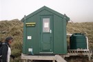
Barker Hut
Track.
2 – 3 days. Medium. Return by the same track.
Updated
5 July 20145 July 2014.
Surrounded by glaciers at the head of the White River, this is the highest hut in Arthur's Pass National Park.
More ▶︎

Kelly Range - Hunts Saddle Circuit
Track.
2 – 3 days. Medium/hard. Loop track.
Updated
1 April 20231 April 2023.
A challenging circuit route traversing the Kelly Range and returning along Kelly's Creek. The direction described is the easiest option.
More ▶︎
Mt Arthur
Track.
1 – 2 days. Easy/medium. Return by the same track.
Updated
18 March 201418 March 2014.
Straightforward climb to the summit of Mt Arthur (1795m) on the Arthur Range.
More ▶︎
Freehold Creek
Track.
1 day. Medium. Return by the same track.
Updated
11 August 201311 August 2013.
Climb the mountains behind Lake Ohau into a basin of tarns and waterfalls.
More ▶︎
Mount Haast
Track.
Medium. Return via same route.
Updated
25 February 200925 February 2009.
Short but steep clamber up a prominent peak near Springs Junction.
More ▶︎
Mount Fyffe
Track.
1 – 2 days. Medium. Return by the same track.
Updated
25 February 201425 February 2014.
A steep 4WD track to a hut overlooking Kaikoura Peninsula, and on to the summit, with panoramic views of the Kaikoura Ranges.
More ▶︎
Foleys Creek Track - Travers Peak
Track.
1 day. Medium. Return via same track.
Updated
21 March 201021 March 2010.
A poled route to the summit of Travers Peak near Lewis Pass
More ▶︎
Lewis Tops
Track.
1 – 2 days. Medium. Return by the same track.
Updated
27 August 201427 August 2014.
A short climb onto the tops at Lewis Pass, providing panoramic views of the area. With camping on the valley floor nearby, the Lewis Tops are ideal for both day and overnight adventures.
More ▶︎
Cass-Lagoon Saddle
Track.
2 days. Medium. One way.
Updated
22 October 201422 October 2014.
This classic route from Cass to Cora Lynn Road circles the Black Range to form an open loop, and a grand tour of Craigieburn Forest Park.
More ▶︎
Avalanche Peak-Crow River
Track.
1 – 2 days. Medium. One way.
Updated
14 September 201414 September 2014.
A route over Avalanche Peak dropping to the Crow River and exiting down the Waimakariri River.
More ▶︎
Tongariro Alpine Crossing
Track.
1 day. Medium. One way.
Updated
19 June 201419 June 2014.
A popular but crowded alpine route through a spectacular volcanic landscape.
More ▶︎
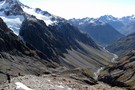
Ball Pass
Track.
2 – 3 days. Hard. One way.
Updated
14 June 201814 June 2018.
A challenging crossing of the Kirikirikatata / Mount Cook Range between the Hooker and Tasman Glaciers just 5km south of Aoraki.
More ▶︎
Milford Track
Track.
4 days. Easy/medium. One way.
Updated
5 February 20195 February 2019.
The Milford Track is an alpine journey through Fiordland National Park, and New Zealand's most renowned walking track, visited by approximately 6 500 walkers during the Summer Season each year. Almost half of this number are New Zealanders.
More ▶︎