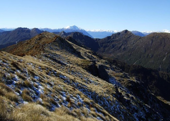
Hohonu Range tops August 2013

This photo was taken from the knob just SE of Mt Smart and looks eastward through part of the Hohonu Range to Mt Alexander.
There is access to the tops about 600m west of Mt Smart from an overgrowing forestry road. This route/track is only lightly cut & unmarked for the first 200m through sparse gorse and young Douglas Fir plantings but is well cut & marked with tape once inside the native bush. Your leave the forestry road at E1460399, N5273353. An old track that hasn't been maintained for a long time hits the above mentioned track on the SW side of point 713m. It comes from Deep Creek at Taramakau Settlement. I managed to follow it along the dividing ridge between the Taramakau and Greenstone catchments ok. It is blazed & has old reddy coloured plastic bait stations on it many of which have popped off their nails due to tree growth.
There are lovely views from the Hohonu tops. I'll head back up there for another look this summer. Will camp up there & do some exploring.
Comments
-
 glennj I've been back in this area a few times since this 2013 post. There is a good rock bivvy in the head of the basin to the right of the foreground ridge. Near the rock biv there are both tarns and flowing water. It took me 45 mins to get down to the rock biv from the ridge line.
5 March 2017
 -
 glennj Near Mt Smart I only spied one tarn up near the ridge line that is accessible without a big loss of altitude. I topped up my water bottle there & will probably camp there at some stage. It is at NZTM2000 E1461922, N5271466 & is not marked on the map.
6 September 2013
 -
 Honora HI Glenn. Is there much water up there?
5 September 2013