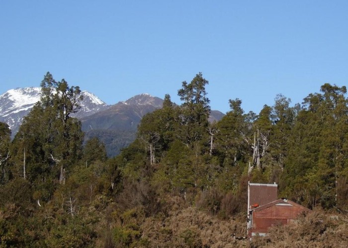
Black Hut Totara Valley & beyond

This July shot taken from beside the Totara Valley road shows Black Hut. The higher country in the back ground is Dickie Spur dropping toward the Tuke River and Dickie Ridge leading back toward the Tusk (2046m) on the dividing ridge with a Waitaha River headwater tributary.
Black Hut used to be semi derelict but as of 2017 it is tidied up & worth using again. It is beside the road that goes through the Totara Saddle to Gribben Flat on the Mikonui River.
There are lots of old mining relics and unmaintained miners pack tracks in the vicinity of Black Hut. I've made use of these tracks to get up on to Mt Greenland on the TL of the Totara Valley and on to the Bald Hill Range on the TR of the Totara Valley. The section of miners track that starts a little way down the Totara on the TR of Weir Creek has been reopened in to Farmers Creek headwaters as has the cullers track that branches off it that leads to the Bald Hill Range tussock. The two routes to Mt Greenland Hut are unmarked.
