Toaroha/Zit Saddle/Kokatahi/Lathrop Saddle/Styx River Route
- 3 – 5 days loop track with a road section
- Medium/hard
Loop track across 2 Westland saddles, taking in some remote huts
|
Walking time
|
3 – 5 days
30 hr – 40 hr
|
|---|---|
|
Distance
|
60.0km |
|
Type
|
Loop track with a road section
|
|
Grade
|
Medium/hard
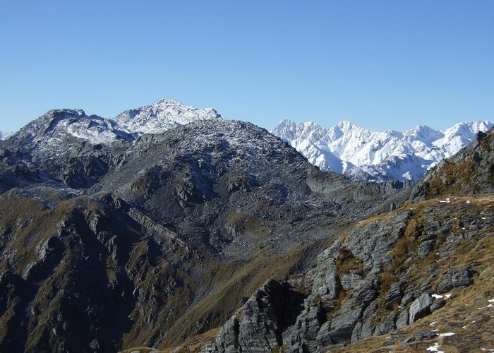
Some sections impassable in bad weather. Ice axes required in winter Grades explained
|
|
Bookings
|
No bookings — open access
No — open access
|
|
Starts
|
Styx River near Lake Kaniere |
|---|---|
|
Maps
|
NZTopo50-BV19
|
|
Altitude
|
500m
–
1,500m
Altitude change 1,000m
|
|
Link
|
fastforwardlife.wordpress.com/2012/04/13/styx-river-lathrop-saddle-kokatahi-zit-saddle-cedar-flat-tramp/http://fastforwardlife.wordpress.com/2012/04/13/styx-river-lathrop-saddle-kokatahi-zit-saddle-cedar-flat-tramp/ |
|---|
Road-End to Cedar Flat Hut Time: 3 - 4 hours Follow the rough farm track and then orange triangular markers across the open flats to the start of the track leading over a low terrace to the Toaroha River. The track which initially follows an old logging tramline, exits onto the river bed and follows the true right for a further 1 km before regaining the benched track formation. On this river bed section watch out for boulders tumbling from the steep gravel faces above. If the river is running high a sign posted flood route travels high above the gravel faces commencing some distance before the riverbed is reached. he benched route recommences 200 metres upstream from an unnamed creek then climbs steadily above the Toaroha Canyon. It descends gradually to the lower end of Cedar flat where a short rock hop and track leads to the Cedar Flat Bridge which is crossed to the Cedar Flat Huts. There are various small hot springs a short distance up Wren Creek. These seem to alternate in hottest temperature and best output. It is a matter of sorting out the best at the time of your visit. Cedar Flat to Adventure Ridge Bivouac Time: 3 - 4 hours From Cedar Flat Hut follow the short section of track to the upstream swing bridge and cross to the true right. The track to Adventure Ridge Bivouac begins between Median and Esma Creeks and is a typical West Coast ridge track climbing steeply up a 'root ladder'. Adventure Ridge Bivouac to Top Kokatahi Hut Time: 3 - 4 hours From the bivouac follow the track through the tussock and alpine scrub. It climbs and sidles before dropping into, crossing and climbing from a deeply cut tributary of Zit Creek. Once in the open tussock the route is marked with poles (orange triangles mounted on thin fibreglass stakes) and climbs a spur (steeply in places) directly to the ridgeline of the Toaroha Range about 500 metres north of Zit Saddle. The poles guide you directly over the ridgeline down to and across a tussock terrace before dropping steeply down a scree slope to an un-named tributary of the Kokatahi River. Follow this creek down to near its confluence with the Kokatahi. The Top Kokatahi Hut has been relocated to the site of the old bivouac just upstream of this confluence. In misty conditions good route finding skills are required as the marker poles are difficult to see from one to the next. Top Kokatahi Hut to Crawford Junction Hut Time: 4 - 5 hours From the hut travel to the confluence of the Kokatahi River and the unnamed stream from Zit Saddle. Cross the Kokatahi to pick up the cut track on the true right. The route alternates between sections of cut track and riverbed travel, crossing the Kokatahi three times before ending up on the true left above the Top Kokatahi Swing Bridge. BV19 shows the track as being on the true right until the swing bridge - this is wrong. If the river is above normal flow crossing can be difficult to impossible. Even a day's steady rain can be too much. From the swing bridge the track remains on the true left until the cableway is reached. Cross this cableway to the true right and continue down along river edge for 200-300 metres. About 60 metres up an un-named side stream pick up the track through the forest and follow this to Crawford Junction Hut which is sited on a low terrace overlooking the Crawford/Kokatahi confluence. Crawford Junction Hut to Top Crawford Hut Time: 3.5 - 4 hours From the hut follow the track off the terrace down to the Crawford Creek bed. Boulder-hop up the river. Crawford Creek Swing Bridge has been removed and won't be replaced. Pick up the track to Farquharson Creek. Cross Farquharson Creek and pick up the track again almost directly opposite. This track leads to the edge of Crawford Creek which is followed a short distance before the track again leaves the creek bed to climb and sidle high, bypassing the old Top Crawford Hut site. The track continues to sidle around the hillside dropping down into Crawford Creek about 750 - 800 metres below the hut. It's been recently recut and marked and is reasonably easy to follow. Farquharson Creek can be difficult to cross if in above normal flow. A good crossing place is upstream at the mouth of the gorge. Top Crawford Hut to Browning Bivouac Time: 3.5 - 4.5 hours From the hut, travel downstream until almost at the convergence of the two branches of the Crawford Creek. Cross to the true right bank and pick up the large orange triangle and then follow the orange markers through a tussock/scrub covered gut. After some 200-300 metres the track begins to climb steeply, climbing through scrub covered bluffs until it tops out on a small terrace. From here a few poles mark the route which climbs and sidles in a north/north-easterly direction to Lathrop Saddle, sidling diagonally up and across steep scree slopes. In the winter/spring these slopes are snow covered and because it's the shady side of the hill the slopes are often icy. Ice-axes and crampons are essential tools at these times. Lathrop Saddle is a starkly attractive U shape with huge boulders and turquoise tarns. Marker poles from the northern end of the saddle lead the way down a steep spur to Browning Bivouac. It is easy to miss these poles in misty conditions. Browning Bivouac to Grassy Flats Hut Time: 1.5 - 2 hours The track from the bivouac drops steeply down the hillside to an un-named creek feeding into the Styx River. Once in this creek travel varies between boulder hopping (very carefully on slippery boulders) and sections of track. After about 800 metres the track veers away from the creek on the true left before ultimately joining with the main valley track on the Styx river valley floor. From the track intersection it's about a 5-minute walk upstream to the Grassy Flats Hut. Grassy Flats Hut to Styx Road-end Time: 3.5 - 5 hours Follow the track through the tussock flats downstream to cross to the true right near the bottom end of the flats. Follow the orange markers and pick up the old benched formation. The track remains on the true right until the road-end is reached, crossing numerous side streams on the way.