Top Hut (Te Kahui Kaupeka)
Te Kahui Kaupeka Conservation Park
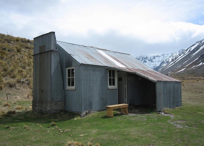
Top hut in the upper South Branch of the Ashburton River.
10 bunk hut built 1958 by Mt Arrowsmith Station. Taken over by DoC and refurbished. Still canvas bunks but now with DoC mattresses, concrete floor, walls lined with reflective material, fireplace, benches and a lovely big table.
1 member favourited
1 member checked in
|
Owner
|
Owner: DOC |
|---|---|
|
Category
|
Basic Hut/Bivvy |
|
Sleeps
|
Sleeps 10
10
|
|
Facilities
|
Toilet, Open fireplace |
|
Water supply
|
Natural water source
Small /pipe creek 50m south or main river
|
|
Getting there
|
Via Paddle Hill Creek (Boundary Hut), or Cameron River over various saddles into the South Ashburton. Also via the Potts River and a 1700m saddle into Stumpy Stream, or the other way via the Dogs Range. Close to Te Araroa. From the Lawrence via a saddle north of Pito Pk for the keen folks. |
|---|---|
|
Unlocked
|
This hut is unlocked and open to access. |
|
Bookings
|
No bookings — open access
No — open access
|
|
Mobile phone coverage
|
No coverage |
|---|---|
|
Maps
|
NZTopo50-BW18
|
|
Link
|
www.doc.govt.nz/p...http://www.doc.govt.nz/parks-and-recreation/places-to-stay/backcountry-huts-by-region/canterbury/mid-and-south-canterbury/top-hut/ |
ID 7427
About this hut
110 views in the past year (9 per month).