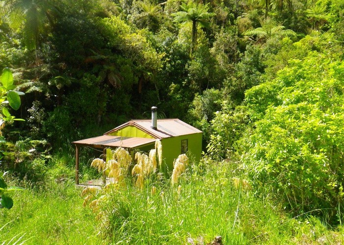
Forks Hut (Ruahine)
Ruahine Forest Park
A 6 bunker in regenrating bush in the Southern Ruahines. Wood burner and stream water.
Not so widely visited - probably due to access not being readily granted across farmland. 3 other options exist though:
Te Ekaou Creek: Up creek banks to park boundary. 3km on grassy banks, then last 1km in river. Up 1st ridge inside park. Steep climb out of creek, but reasonable going on part-cut ridge route. Intersect Te Ekaou-Forks Hut track and follow to hut.
Makawakawa Creek: Riverbed travel all the way from the bridge to the hut. Reportedly gorgey and some pools/falls above forks to Diggers, but fine below in low-moderate flows.
Takapari Rd: Track starts 200m beyond end of gravel at top end of Takapari Road. First 30m not maintained, but good beyond that. Cut track down ridge Nth of hut to bushedge, marked route beyond. May go all way down ridge to hut, but dropping to creek and following also a good option.
|
Owner
|
Owner: DOC |
|---|---|
|
Category
|
Standard Hut |
|
Sleeps
|
Sleeps 6
6
|
|
Facilities
|
Toilet, Enclosed wood/coal burner |
|
Water supply
|
Tap or tank water |
|
Getting there
|
Pohongina East Rd (via Te Ekaou Crk): 2-4hrs, river / ridgeline route. Pohongina East Rd (via Makawakawa Crk): 5km, river route. Pohongina East Rd (via farm track): 3km. Permission required - see DOC website Takapari Rd: 5km, 2.5-5hrs, track + river / ridgeline route. Track down from Takapari Roadend through leatherleaf. River or ridgeline route from bushedge to hut. |
|---|---|
|
Unlocked
|
This hut is unlocked and open to access. |
|
Bookings
|
No bookings — open access
No — open access
|
|
Mobile phone coverage
|
No coverage |
|---|---|
|
Maps
|
NZTopo50-BL35
|
|
Link
|
www.doc.govt.nz/p...http://www.doc.govt.nz/parks-and-recreation/places-to-stay/backcountry-huts-by-region/manawatu-whanganui/manawatu/forks-hut/ |