Hauhungatahi Track
Hauhungatahi Wilderness Area, Tongariro National Park, National Park Villiage
- 5 hr – 7 hr return by the same track
- Easy/medium
Hauhungatahi, also called Baldy, is the prominent hill just outside National Park. It is in a remote experience zone so this track is not officially maintained.
|
Walking time
|
1 day
5 hr – 7 hr
|
|---|---|
|
Distance
|
10.0km |
|
Type
|
Return by the same track
|
|
Grade
|
Easy/medium
rough and damp underfoot. Grades explained
|
|
Bookings
|
No bookings — open access
No — open access
|
|
Starts
|
Erua |
|---|---|
|
Ends
|
Erua |
|
Maps
|
NZTopo50-BJ34
|
|
Altitude
|
755m
–
1,520m
Altitude change 765m
|
Hauhungatahi is a remote experience zone within Tongariro National Park, so in theory, there are no tracks. However the old track from Erua is still easy to follow.
From Erua, park your vehicle up by the railway line and walk south along the service track next to the railway. 300m along, one of the poles holding up the overhead powerlines is held up by a stay. It is the only pole with a stay on this section of line. The track begins where the stay is fastened to the ground
Follow a padded track up through scrub and flax to the bush. Once in the bush, follow the pad on the ground. There are a few informal markers along the way, but in general you are following the pad. The track climbs steadily for an hour before coming out at bushline beside a small stream.
Don’t be fooled into thinking you are almost there. You are still a long way from the top, though the climb is now quite gentle.
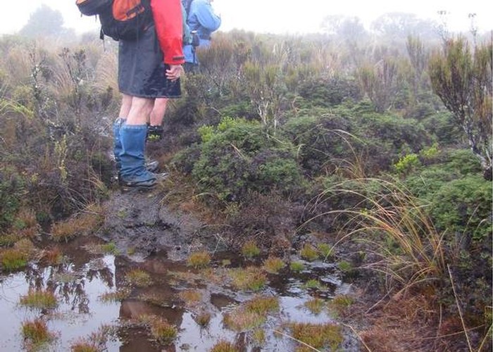
A short way along you will pass an established camp site. The track wanders through the scrub. Sometimes there are alternative routes but they all tend to come back together again. The going is rough and, as this is a wetland, tends to be damp underfoot.
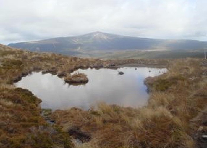
After just over another hour, the track steepens a little bit for the last climb to the summit. If you are lucky enough to have clear day you will get great views of Mt Ruapehu to the east and across towards the Whanganui National Park and Mt Taranaki to the west. I have often thought it would be nice to camp up here on a nice night, as there is plenty of water around and the sunset and sunrise are sure to be supurb.
A traverse of Hauhungatahi is possible, making your way long the tops to the north east, dropping down through bush to the boggy flats to the east and then across to the Whakapapaiti Hut track. I also believe it is possible to descend a large slip to the south into the Makatote and then follow that river to Highway 4 at the viaduct. Neither of these routes are tracked.
*Note (09/01/18). The land between Erua Road and the Railway tracks is privately owned, and the current occupiers have refused to grant anyone access through it to the National Park.
DOC will update their website to mention there is NO access to the NP through Erua Rd. They will also put a sign on Erua Rd to make sure no more run-ins between public and occupiers take place.
DOC aas advised that alternative access to Hauhungatahi is through the Round the Mountain or Whakapapanui tracks.***