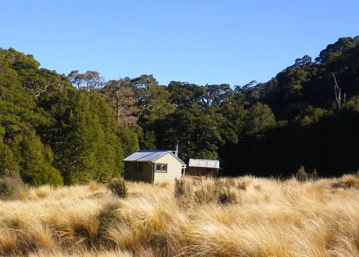
Aparima Huts
Two huts situated at the bushedge in the Aparima Valley, Takatimus.
The newer hut's an old but standard tramping hut - sleeping 8 on two platforms. There's a woodburner with hotplates on top, and plenty of good firewood around. Tank water is provided. The hut is getting a little run-down, and gaps in windows / door allow easy access for sandflies. The other hut is older - 3 bunks and an open fire - more character, less comfort. Take your pick.
The huts can be reached by 4wd track with the cockey's consent - otherwise it's a 1-2 hour walk up the banks of the Apurima River from the end of the legal Dunrobin Road. There's also access down the Prichester Valley via Beckett's But (Te Araroa walkway) and onwards south over marshy manuka flats to Wairaki Hut.
Continuing upriver leads to either Aprarima Forks Hut (and a pass to Whare Creek & Hut) or Spence Hut (and a pass to Redcliff valley & hut). Both give access to the western side of the park.
|
Owner
|
Owner: DOC |
|---|---|
|
Category
|
Standard Hut |
|
Sleeps
|
Sleeps 11
11
|
|
Facilities
|
Toilet, Enclosed wood/coal burner, Open fireplace |
|
Water supply
|
Tap or tank water |
|
Getting there
|
Dunrobin Rd: 6km walk up river flats on cut, marked track. Prichecter Rd: Here -> Beckets Hut (7km), -> Roadend (+9km) - old farm tracks Lower Wairaki Hut: 14km, poled route / track Tower Peak Road: Here -> Aparima Forks Hut (6km, 2-4hrs, track) -> Whare Creek Hut (14km, route) -> Roadend (8km, route) Redcliff Rd (SH99): Here -> Spence Crk Hut (9km, 3-6hrs, track) -> Redcliff Hut (6km, alpine route) -> SH99 via Windy Col, Windy Creek (16km, route) |
|---|---|
|
Unlocked
|
This hut is unlocked and open to access. |
|
Bookings
|
No bookings — open access
No — open access
|
|
Altitude
|
460m |
|---|---|
|
Mobile phone coverage
|
No coverage |
|
Maps
|
NZTopo50-CE09
|