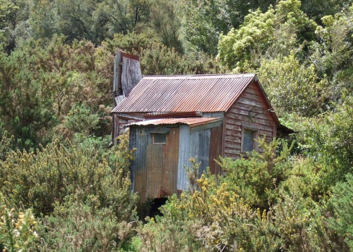
Hamers Flat
Derelict hut from the days when gold miners walked & stock were driven from Canterbury through the Amuri Pass and down to the once thriving gold mining town of Ahaura. Pryce Hamer had a farm on the flat that bears his name in the early 1900's but there was occupation there pre 1900. There was once an impressive swing bridge for stock crossing the Ahaura River just below the flat at Starvation Point but it was pulled down in DOC times as they considered it unsafe.
|
Owner
|
Owner: NA |
|---|---|
|
Category
|
Basic Hut/Bivvy |
|
Sleeps
|
Sleeps 2
2
|
|
Facilities
|
None |
|
Water supply
|
No water |
|
Getting there
|
Follow the Ahaura-Kopara Road approx 20km until an old logging road heads off to the SW. (NZTM E1498446 N5301390) If you emerge from the beech forest on to farmland you have overshot by 1.5km Walk or 4x4 drive about 2km down the old logging road to where a benched track leaves on the left just past a parking bay. The track start is not sign posted but quite obvious. It winds its way a short distance down through tall forest to the grassy Hamers Flat. |
|---|---|
|
Unlocked
|
This hut is unlocked and open to access. |
|
Bookings
|
No bookings — open access
No — open access
|
|
Altitude
|
120m |
|---|---|
|
Mobile phone coverage
|
No coverage |
|
Maps
|
NZTopo50-BT21
|
ID 5645
About this hut
91 views in the past year (8 per month).