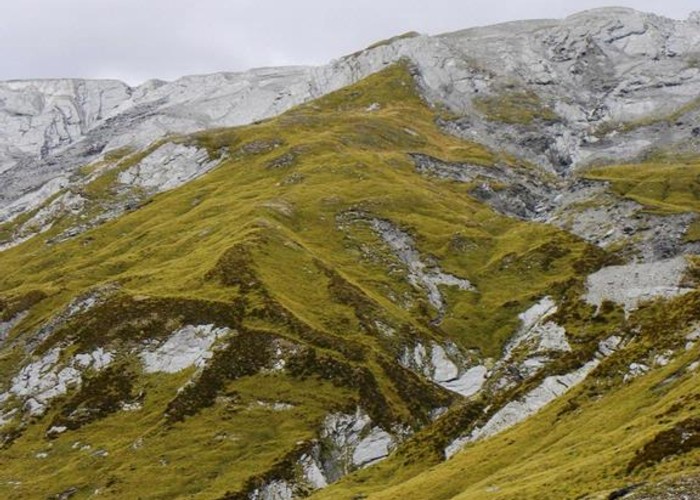
The spur between Snowy Ck and Pine Ck basin - Lochnagar route

The book at Tummel Burn hut in the upper Shotover would have you believe nine out of ten people descend this spur as part of the route via Lochnagar (Goat Lake) to Snowy Ck and onto the Rees or Dart valleys. Moirs Guide describes the route in both directions. Top of the pass - 1950m. Snowy Ck (foreground) appx 1420m. The rock band near to the top is bypassed to the left on descent.
Comments
-
 aardvark A hut was built in 1982 and burnt down in 1988. It was rebuilt in 1990 as part of a NZ 150th Anniversary project.
8 April 2010
 -
 Honora Hi Aardvark
The photo icon is marked on the wrong spur on the silvery grey map piccy thing on the left side of the screen. I only mention this so people aren't led astray. The icon needs to be shifted to one spur south. This is the broad spur that ends up narrow at the top.
I checked my 1950 Moir's Guide (inherited from Dad). They only mention Snowy Saddle to serve as a warning not to go that way!
8 April 2010
 -
 pmcke Back in about 1974 a friend and I went up to Lochnagar and camped near the outlet. I don't think there was a hut then. At that time we believed it was virtually impossible to go any further towards the Rees or the Dart.
We had an explore and climbed to the ridge overlooking Pine Creek and then traversed on very good animal trails to the pass at the head of the valley. Much to our suprise we could see no obsticals to getting down into the Snowey. As were were only on a day jaunt we didn't go any further.
We thought we had found a new route but I think it was known before that, just not to us.
8 April 2010
ID 5278
About this photograph
59 views in the past year (5 per month).