Lonely Lake to Adelaide Tarn - High Route
- 5 hr – 8 hr one way
- Hard
single day traverse including 2 exposed sections involving non-technical rock climbing or descents dependent on direction of travel
1 member favourited
1 member checked in
|
Walking time
|
1 – 2 days
5 hr – 8 hr
|
|---|---|
|
Distance
|
6.0km |
|
Type
|
One way
|
|
Grade
|
Hard
Hazardous exposed travel with some markers en route Grades explained
|
|
Bookings
|
No bookings — open access
No — open access
|
|
Starts
|
Lonely Lake |
|---|---|
|
Ends
|
Adelaide Tarn |
|
Maps
|
NZTopo50-BP23
|
|
Altitude
|
1,270m
–
1,663m
Altitude change 393m
|
|
Link
|
www.tristanriley.co.nz/blog/archives/261http://www.tristanriley.co.nz/blog/archives/261 |
|---|
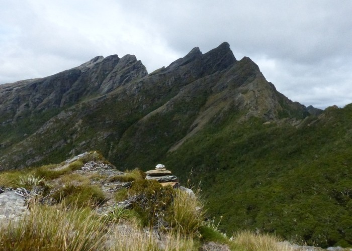
Apparently some guy has done some track work on the high route so you may get on to the start of it from the saddle south of Adelaide Tarn between Mt Douglas and the high point just south of the tarn. I’ve very crudely marked the high route in blue from a very old (1990) map but be warned it is as rough as guts as the map is very crude and simplistic. I think in actual fact people travel along the ridge from the pass above Lonely Lake to AnatokiPeak. There is a route description on the net by a guy called Tristan Riley about the high route. There used to be a wire but it was nasty and was removed in 1990.
ID 5273
About this track
56 views in the past year (5 per month).