Mount Morris Track, Raglan Range
- 5 hr – 8 hr one way
- Medium
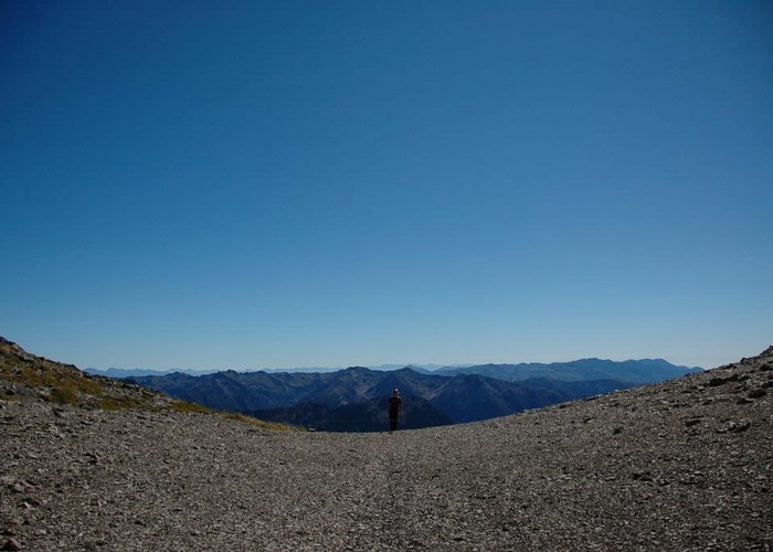
This hike begins at Greig's Hut in the Branch River Valley, Upper Marlborough. A great day trip, it can be driven part way or walked entirely. The track is fairly well marked and makes itself evident as one pushes through the pines. Encased in forestry, the lower 2/3 of the tramp are less than exciting. The view of the Raglan Range upon emerging from the trees is, however, very worthwhile. Even the tip of Golden Bay can be seen from this far distance.
1 member favourited
1 member checked in
|
Walking time
|
1 day
5 hr – 8 hr
|
|---|---|
|
Distance
|
10.0km |
|
Type
|
One way
|
|
Grade
|
Medium
steep scree slope to reach summit Grades explained
|
|
Bookings
|
No bookings — open access
No — open access
|
|
Starts
|
Greig's Hut |
|---|---|
|
Ends
|
Summit, Mount Morris |
|
Maps
|
NZTopo50-BS25
|
|
Altitude
|
600m
–
1,930m
Altitude change 1,330m
|
ID 3618
About this track
Added 9 April 2009 by touristikotouristiko.
No revisions.
143 views in the past year (12 per month).