Mt Hiwiroa
Kaimai-Mamaku Forest Park
- 6 hr – 8 hr return by the same track
- Medium
An energetic return day trip. The first half follows relatively easy tracks but the second half is overgrown and more challenging.
|
Walking time
|
1 day
6 hr – 8 hr
|
|---|---|
|
Distance
|
14.0km |
|
Type
|
Return by the same track
|
|
Grade
|
Medium
Some parts of track overgrown, good route finding skills needed Grades explained
|
|
Bookings
|
No bookings — open access
No — open access
|
|
Starts
|
State Highway 5, |
|---|---|
|
Maps
|
NZTopo50-BE36
|
|
Altitude
|
380m
–
700m
Altitude change 320m
|
This track begins at a rather uninviting layby beside State Highway 5 between Rotorua and Tirau. After navigating past the old car part, bottles, used toilet paper and other rubbish you soon enter the Forest Park where an old overgrown DOC sign announces the presence of the long disused Wood's Mill 5 min Loop Track.
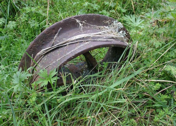
Continue following more recent orange triangles and the track leads to the old road that used to lead into the sawmill that was here until the 1940s. After about 15 mins you enter a clearing and can see remnants of the old mill.
The track continues, following an old tramline, making easy walking through regenerating scrub and small clearings. You pass through a second mill site further along though there is little remaining here apart from some old wire rope buried by the side of the track.
The track now descends into the Waiomou Stream which you can hear from some distance off. While the Waiomou Stream seems pristine, a look at the map shows that it drains a large area of farmland. I would be careful of drinking water from this stream.
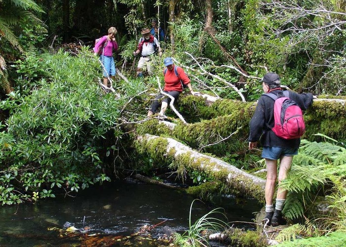
The track approaches the stream next to a small waterfall entering a picturesque pool. From this point on the standard of the track deteriorates considerably.
Follow up the true left bank of the stream for about 50m to where the stream gradient flattens out and is easily crossed on a series of flat slabs. The stream is easily forded under normal conditions and you might even be lucky enough to do so with dry feet..
A rough track continues from the opposite bank, at first doubling back down the true right bank and then passing a Rimu tree on small shoulder before heading away from the stream. The track is overgrown and sometimes obscured, however there are plenty of markers in the form of white permolats and plastic ties of various colours. Just proceed with care.
The track climbs very steeply from the stream and you will soon be aware that the bush here is of a very different nature. On this side of the stream it has not been milled and there are some beautiful stands of ancient Rimu. One gets the feeling of being in a very remote part of the Mamuku Plateau.
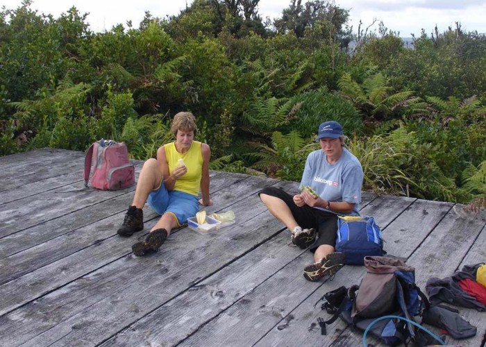
Pick your way carefully along, firstly through undulating country past a couple of dry stream beds and then the route climbs gently but steadily to the top of Hiwiroa. One does not get feeling of climbing a hill and the only indication of arriving at the top is when you suddenly arrive at the helicopter pad. Just on your right there is a small clearing where there used to be a small hut. This has now been removed.
On a nice sunny day, the helicopter pad is the best place around to stop for lunch. There are good views out to the west towards Mangatautari and east towards Ngongotaha. On a clear day Mt Ruapehu and Ngauruhoe are visible as well.
The top of the hill is dominated by a large communication mast, alongside which is a rock that marks the true summit of Hiwiroa. The purists can risk life and limb by climbing a rickarty wooden ladder placed on the rock.
Return is by the same route, allow a good 7 hours for the return trip.