Otawa Trig - Otanewainuku
- 1 day one way
- Easy/medium
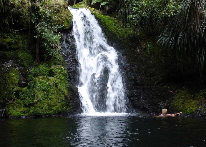
This is quite a long day trip, in bush, without a lot of views beyond the immediate track. At one stage you come out onto farm land and then there is the Whataroa Falls where you can stop for a swim before the last half hour or so to the road.
1 member favourited
3 members checked in
|
Walking time
|
1 day
7 hr – 10 hr
|
|---|---|
|
Distance
|
17.7km |
|
Type
|
One way
|
|
Grade
|
Easy/medium |
|
Bookings
|
No bookings — open access
No — open access
|
|
Starts
|
Manoeka Rd |
|---|---|
|
Ends
|
Mountain Rd |
|
Maps
|
NZTopo50-BD37
NZTopo50-BE37 |
|
Altitude
|
50m
–
530m
Altitude change 480m
|
ID 2972
About this track
Added 23 May 2008 by pmckepmcke.
No revisions.
47 views in the past year (4 per month).