Hauhungaroa Track (Southern Section)
Pureora Forest Park
- 2 – 3 days one way
- Easy
A two to three day trip in the Pureora Forest. Well worth doing because there are two new huts and the bird life is fantastic
|
Walking time
|
2 – 3 days
12 hr – 20 hr
|
|---|---|
|
Distance
|
32.0km |
|
Type
|
One way
|
|
Grade
|
Easy |
|
Bookings
|
No bookings — open access
No — open access
|
|
Starts
|
State Highway 32 at the Waihaha Bridge |
|---|---|
|
Ends
|
Mangakahu Valley Rd |
|
Maps
|
NZTopo50-BG35
NZTopo50-BG34 |
|
Altitude
|
500m
–
1,000m
Altitude change 500m
|
A nice easy trip and well worth doing. The main problem is coordinating transport at each end.
Start at the Bridge where Highway 32 crosses the Waihaha River. The track begins at the northern end of the bridge. The Waihaha Valley is one of the more interesting parts of this trip with the river alternating between fast rapids and picturesque areas of slow flowing water. Also much of this first part of the trip is out of the bush and there are good views of the surrounding countryside.
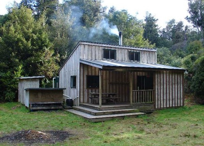
Waihaha Hut is reached in about 3 hours. This is a very well appointed hut with a large verandah which is very welcome in heavy rain.
From the hut the track enters the bush and follows up beside the Waihaha Stream. After about 2 hours a series of small river flats is reached. If you are considering doing the trip in 2 days then this is a good place to camp.
After the flats the track climbs away from the stream, steeply at first but then it is a long gentle climb up a broad bush covered ridge to the main Hauhungaroa Range.
Once on the range the track continues south past a swampy area where there are good streams crossing the track and is a good source for water.
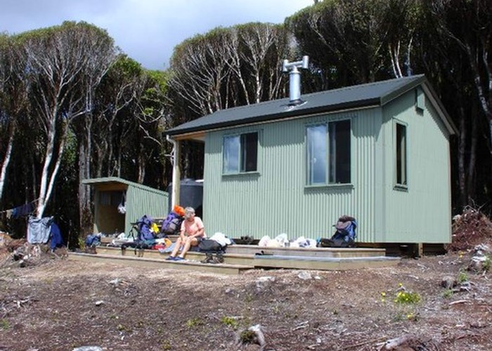
After passing a trig station on the ridge it is about 1km to the Hauhungaroa Hut which is about 100 off the main track to the west. The hut is sited in a sunny clearing with a good view towards the Waikato.
From the hut it is a futrther 2.5 km south to the Motere trig. The track then descends sharply down into the Mangakahu Valley. The track follows old logging roads down the valley to a large clearing which was the old mill site. The large timbers which provided the foundations for the mill are still visible.
On this site was an old hut called Nuffield Lodge. It has now been completely removed.
Continue along old logging roads until you get to the gate on Mangakahu Valley Rd which is the furthest point that you can bring a car to,