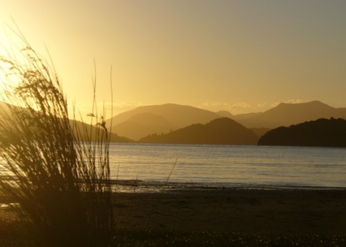
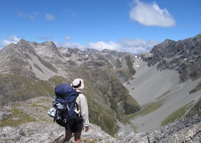
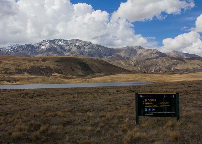
Te Araroa Trail
Hakatere Conservation Park, Ruataniwha Conservation Park, Lake Sumner Conservation Park, Pureora Forest Park, St James Conservation Area, Te Kahui Kaupeka Conservation Park, Mount Richmond Forest Park, Arthur's Pass National Park, Tongariro National Park, Hunua Ranges Regional Park, Pirongia Forest Park, Lewis Pass National Reserve, Craigieburn Forest Park, Whanganui National Park, Nelson Lakes National Park, Tongariro National Park World Heritage Area
- 95 days one way
- Medium
- Bookings required
- Cape Reinga to Ahipara
- The Northland Forests
- Mangakaretu to Kerikeri
- Kerikeri to Waitangi
- Paihia to Opua Coastal Walkway
- Waikare Connection
- Russell Forest to Whangarei Heads
- Bream Bay Walk
- Cullen Brynderwyn Walkway
- Bream Tail Mangawhai Walkway
- Mangawhai to Pakiri
- Mt Tamahunga (Te Hikoi O Te Kiri) Track
- Govan Wilson to Puhoi Valley
- Puhoi Track
- Puhoi to Wenderholm Kayak
- Wenderholm to Stillwater
- Okura to Long Bay
- North Shore Coastal Walk
- Coast to Coast Walkway
- Onehunga to Puhinui
- Puhinui Stream Track
- Totara Park to Clevedon
- Hunua Ranges
- Mangatawhiri to Mercer
- Mercer to Rangiriri
- Rangiriri to Huntly
- Hakarimata Walkway
- Ngaruawahia to Hamilton
- Hamilton City
- Waipa Walk
- Pirongia Traverse
- Pirongia to Waitomo
- Pehitawa Track
- Te Kuiti to Pureora
- Hauhungaroa Track
- 42 Traverse
- Tongariro Alpine Crossing
- Mangatepopo to National Park
- National Park to Whanganui River
- Whanganui River
- Wanganui to Bulls
- Bulls to Feilding
- Feilding to Palmerston North
- Palmerston North
- Massey to Levin
- Tararua Ranges
- Pukeatua
- Kapiti Coast
- Paekakariki Escarpment Track
- Ara Harakeke
- Colonial Knob
- Ngaio
- Wellington City
- Wellington South
- Queen Charlotte Track
- Anakiwa to Pelorus Bridge
- Pelorus River Track
- Richmond Alpine Track
- Waiau Pass Track
- Boyle to Arthur's Pass
- Arthur's Pass to Rakaia River
- Rakaia River Hazard Zone
- Rakaia River to Rangitata River
- Rangitata River Hazard Zone
- Two Thumb Track
- Tekapo to Lake Ohau
- East Ahuriri Track
- Breast Hill Track
- Gladstone to Wanaka
- Glendhu Bay Track
- Motatapu Alpine Track
- Wakatipu Track
- Lake Wakatipu Hazard Zone
- Mavora Walkway
- Mararoa River Track
- Takitimu Track
- Birchwood to Merrivale
- Longwood Forest Track
- Long Hilly Track
- Tihaka Beach Track
- Oreti Beach Track
- Invercargill to Bluff
Te Araroa is a walking trail running the entire length of the North and South Islands. The trail opened 3 December 2011.
|
Walking time
|
95 days |
|---|---|
|
Distance
|
3,000.0km |
|
Type
|
One way
|
|
Grade
|
Medium
Alpine passes with alpine weather conditions, several rivers that should be bypassed using transport. Grade reflects the Tararua Ranges and Waiau Pass. Grades explained
|
|
Bookings
|
Bookings required
Required
Huts, campsites, and transport must be booked in advance at various points.
|
|
Starts
|
Cape Reinga / Te Rerenga Wairua, Cape Reinga Road SH1 |
|---|---|
|
Ends
|
Stirling Point, Marine Parade, Bluff |
|
Maps
|
NZTopo50-CC09
NZTopo50-AZ31 NZTopo50-CG09 NZTopo50-BN32 NZTopo50-BY17 NZTopo50-CE08 NZTopo50-BQ28 NZTopo50-BC33 NZTopo50-BD33 NZTopo50-BP31 NZTopo50-AY32 NZTopo50-BR24 NZTopo50-BU23 NZTopo50-CB12 NZTopo50-BM34 NZTopo50-CH10 NZTopo50-BQ27 NZTopo50-BL32 NZTopo50-BH34 NZTopo50-BX18 NZTopo50-BP29 NZTopo50-BQ31 NZTopo50-CF09 NZTopo50-BA32 NZTopo50-BZ15 NZTopo50-AV29 NZTopo50-BF33 NZTopo50-AV25 NZTopo50-CC11 NZTopo50-AX30 NZTopo50-BL33 NZTopo50-AT24 NZTopo50-CG10 NZTopo50-CA13 NZTopo50-BX21 NZTopo50-BV20 NZTopo50-BJ32 NZTopo50-BX20 |
|
Altitude
|
Sea level
–
1,870m
Altitude change 1,870m
|
|
Link
|
www.teararoa.org.nz/http://www.teararoa.org.nz/ |
|---|
The idea of a walk the length of New Zealand has been circulating since the 1970s, when the New Zealand Walkway Commission was established. It soon abandoned the goal of producing a single trail, and opted to establish shorter trails throughout the country. These trails still exist today, often near urban centres, and commonly crossing private land.
The Te Araroa Trust was founded in 1994 to revisit the original idea, and it is working with local organisations and land owners to incorporate existing tracks and establish new tracks as needed.
The best source of information about this trail at present is the Te Araroa Trust website, where there are guides and maps, as well as reports from people who have walked the trail.
The trail is divided into a series of shorter tracks that may be walked individually or as a whole. Individual tracks are closed or rerouted from time to time: the Te Araroa website shows which tracks are open. The tracks are as follows:
Northland
Auckland
Waikato / King Country
Whanganui
Manawatu
Wellington
Nelson / Marlborough
Canterbury
Otago
Southland