Ben Nevis
Mount Richmond Forest Park
- 4 hr – 5 hr 30 min return via same track
- Easy/medium
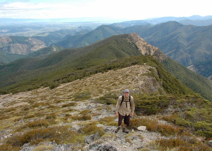
Relatively steep climb to the summit of Ben Nevis (1619m), a prominent peak in the Mt Richmond Forest Park South-East of Nelson
5 members favourited
2 members checked in
|
Walking time
|
1 day
4 hr – 5 hr 30 min
|
|---|---|
|
Distance
|
9.0km |
|
Type
|
Return via same track
|
|
Grade
|
Easy/medium |
|
Bookings
|
No bookings — open access
No — open access
|
|
Starts
|
Carpark at end of Ben Nevis Rd. To get there, go up the Wairoa Gorge, East of Wakefield. Turn left at Old Mill Rd and follow the signs up the forestry roads to the roadend. |
|---|---|
|
Maps
|
NZTopo50-BR25
|
|
Altitude
|
820m
–
1,619m
Altitude change 799m
|
From the trig point at the summit, a sometimes vague track continues along the open tops to Mt. Ellis where a poled route crosses beneath Red Hill from Top Wairoa Hut to Hunters Hut. In good conditions travel along the tops is relatively straightfoward even without a worn track to follow, but in poor visibility good navigational skills may be required.
ID 2459
About this track
Added 1 December 2007 by JordanmJordanm.
No revisions.
158 views in the past year (13 per month).