Browns Island (Motukorea)
- 30 min return via same track
- Easy
A young, grass-covered island volcano near Auckland.
|
Walking time
|
30 min |
|---|---|
|
Type
|
Return via same track
|
|
Grade
|
Easy |
|
Bookings
|
No bookings — open access
No — open access
|
|
Starts
|
Browns Island shoreline (various points) |
|---|---|
|
Maps
|
NZTopo50-BA32
|
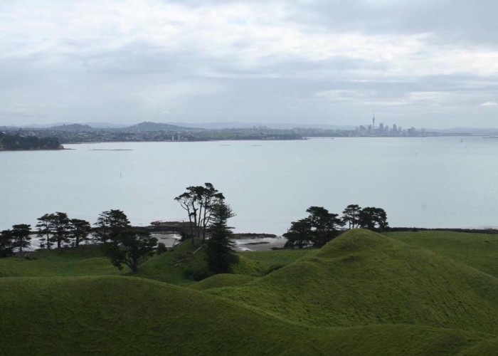
With an age of just 10-20,000 years, Browns Island is a well-preserved scoria cinder cone, notably different in shape from its younger neighbour, Rangitoto (a shield volcano). The crater is still perfectly formed, with panoramic views from the summit trig of the Hauraki Gulf, Rangitoto, and the eastern suburbs of Auckland.
The island is kept as pasture grassland in order to preserve the archaeological remnants, including three pa sites ans several European sites, so it is possible to walk anywhere, and there are no real tracks.
Beach landing is at Crater Bay in the northeast, while kayaks can pull in along the long beach to the southwest (time from Mission Bay is around 1 hour). The easy walk to the summit takes around 10 minutes.
A map highlighting the island features is available from DOC: http://www.doc.govt.nz/upload/documents/parks-and-recreation/places-to-visit/auckland/rangitoto-map.pdf .