Montana Heritage Trail- Waitakere Ranges
Waitakere Ranges Regional Park
- 3 hr – 4 hr loop track
- Easy
A beaut walk in kauri forest, from the Cascades carpark. A good introductory tramp in a half day. Take your niece or nephew. Hug a kauri tree, ogle a dam. There's some interpretation info along the way

5 members favourited
18 members checked in
|
Walking time
|
3 hr – 4 hr |
|---|---|
|
Distance
|
8.0km |
|
Type
|
Loop track
|
|
Grade
|
Easy |
|
Bookings
|
No bookings — open access
No — open access
|
|
Starts
|
Cascades Kauri Park, off Falls Rd, off Te Henga Rd on the way to Bethells |
|---|---|
|
Maps
|
NZTopo50-BA31
|
|
Altitude
|
60m
–
320m
Altitude change 260m
|
Either way is good; the loop takes you via the Cascade track, Fenceline Track, Long Road track and Upper Kauri Track.
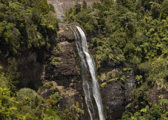
Nice view of a dam along the way. You can make it longer by extending down to include the RGB, Chateau Mosquito and Sissam tracks (extra 6k all up) if you like.
http://www.arc.govt.nz/arc/auckland-regional-parks/western-parks/cascade.cfm
ID 2323
About this track
Added 14 October 2007 by CarenCaren.
No revisions.
516 views in the past year (43 per month).