Ryde Falls from Coopers Creek
- 3 hr 30 min return via same track
- Easy
Easy forest walk to a pretty waterfall with a nearby campsite.
|
Walking time
|
3 hr 30 min |
|---|---|
|
Distance
|
12.0km |
|
Type
|
Return via same track
|
|
Grade
|
Easy |
|
Bookings
|
No bookings — open access
No — open access
|
|
Starts
|
Coopers Creek car park, Mountain Road, 8.5km west of Coopers Creek |
|---|---|
|
Maps
|
NZTopo50-BW22
|
|
Altitude
|
360m
–
560m
Altitude change 200m
|
This is an easy walk through pretty forest, although parts of the track are muddy. Ryde Falls can be visited from the View Hill or Coopers Creek car parks. This track would make for a very quick and easy overnight camping spot near Christchurch. The route is described here from Coopers Creek.
The turn off to Coopers Creek is on the right at the western outskirts of Oxford. Beyond Coopers Creek, turn right onto Mountain Road and continue to the road end car park.
Follow the marked track along the true right bank of the river, over a scrubby hillside and into beech forest. The waterfall track turns off to the right after 1 hour. There are a variety of podocarps labelled at this junction. Across a creek, the track reaches the top of Rydes Tramway. This was a horse-drawn tramway used in the timber extraction from the area. There is no remnant of the tramway visible.
The track passes through steadily dampening forest, with a handsome understorey of crown ferns and horopito. Soon, the track reaches a junction where a linking track leads westward to the Wharfedale Track (1 hour 30 minutes from the car park). Take the eastward track, which drops after a few minutes and crosses the creek to a pleasant picnic and camp spot (toilet here).
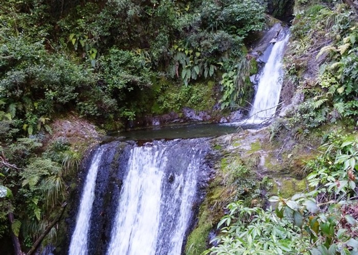
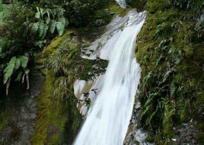
The falls are just a few minutes further. They are surprisingly impressive: a series of five steps, of which three are visible from the bottom. It is possible to climb to the top of the last fall, and a rough scramble leads all the way to the top but this is rather exposed and dangerous, and also the views are very poor.
Other than retracing your steps, return options are limited. You can easily loop back via the Wharfedale Track to extend the walk a little (take the track west, turn left onto the Wharfedale and left again at the Coopers Creek sign). The route on the map that follows Ryde's Tramway is very overgrown, although you can follow it down to Coopers Creek quite easily. From here, it takes up on the other bank where it can be followed for some time. However, it is pointlessly swampy and unpleasant. A realistic option is to follow the creek bed out. This is a very different view of the landscape with some pretty little waterfalls along the way. You must have proper boots though, and allow a little more time, perhaps another half hour.