Lawrence Hut
Hakatere Conservation Park
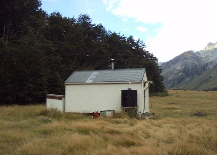
Lawrence Hut (6 bunks, matresses, stove, tank water) is a pleasent forestry-style hut on river terraces in the lower reaches of the Lawrence River. It is NOT in the location shown on topomap J35 (1999). The hut is above the escarpment shown on the true right of the river on the map. It's tucked out of sight on the bushedge, to the NE of the spur of bush at J35 387518 - 500m upstream and out of sight from the marked location, and also out of sight from the valley floor.
The hut is accessible by 4WD track via Erwhon Downs Station (ask first for vehicular access). 4WD access up the valley continues as far as the private Hermitage Hut, beynd which it's a riverbed walk to Lawrence Biv.
|
Owner
|
Owner: DOC |
|---|---|
|
Category
|
Standard Hut |
|
Sleeps
|
Sleeps 6
6
|
|
Facilities
|
Toilet, Enclosed wood/coal burner |
|
Water supply
|
Tap or tank water |
|
Getting there
|
Raikaia roadend (Glenfalloch Station): 37km unmarked alpine route. Hut -> Lawrence Biv (9km,3-5hrs) -> Reischek Hut via Butler Saddle (10km,6-12hrs)-> roadend (18km on river flats) Erewhon Stn (Havelock River): 10km - route / 4WD track down river flats. Hut -> roadend (10km,2-3hrs) |
|---|---|
|
Unlocked
|
This hut is unlocked and open to access. |
|
Bookings
|
No bookings — open access
No — open access
|
|
Altitude
|
740m |
|---|---|
|
Mobile phone coverage
|
No coverage |
|
Maps
|
NZTopo50-BW18
|