
Beyond Casey Saddle to Castle Hill
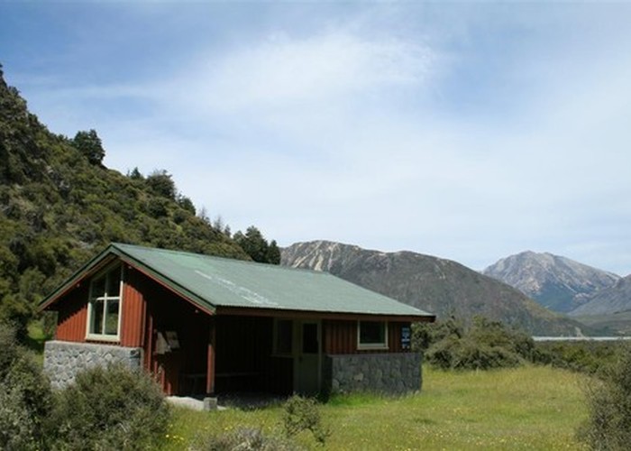
This trip came up on the PTC trip programme. I’d long been keen to summit Castle Hill and Green Hill. Castle Hill is rendered in lurid vertiginous bluffs on the old Arthurs Pass park map. Merv offered a high camp at 1400m by a cluster of tarns, 160 vertical metres below the summit of Castle Hill. The weather forecast was for a mild night of 5 degrees with minimal westerly wind, gentle enough for our flimsy wee single pole tent, south east of the summit ridge. Merv predicted we’d be at the campsite by around 5.30pm.
We were picked up at 7.30am, reduced to a small team of 4, including Helen Binnie, a very keen and active lady. On the preceding Thursday she’d spent a nine and a half hour day climbing Mt Cheeseman and going on to summit Mt Olympus. Merv however hadn’t done any tramping since our long and hard Thesis Pk trip 6 weeks prior. However we exited the car at Andrews Stream and he plunged up the hill setting a pace that I wouldn’t have liked to follow any faster.
We had lunch on Hallelujah Flat in a spot with mixed sun and shade, sheltered from an increasing westerly which had me concerned about our tent flapping throughout the night. We carried on to Surprise Stream and then it was a red line for Frank as we entered the surprise of a narrow, quietly descending dark gorge that met with the open junction of Casey Stream after half an hour’s travel. I’d come up this way from a descent of the Casey many years before and didn’t recall any of this.
People used to miss the track turning off from Surprise Stream which goes up the flank on the true right of these streams to the old Casey Hut site. This includes Emma, who even though she’d done the trip before, carried on down Surprise Stream until she’d hit the gorge on a trip in 2006 with me. I’d stopped at the track sign for lunch and diving in my pack had failed to realize she was erroneously traveling downstream. Frank and I were puzzled how people managed to continue as there was no track past the sign. We’d re-routed the track to the true right where the sign was to help reduce this mistake happening.
Anyway back to now, the way up the slope to the open tops and our campsite was guarded by vertical bluffs. All Merv could recall from 20 years before was that they’d crossed the Casey and gone straight up the slope. We cast about. I went up a short way up a slope from a gully and was called back by Frank who told me where I was heading was very steep though I couldn’t see evidence of this. He continued up the shallow gully that ended in a steep ring of bluff. I reccied up a wee spur on the edge of this bluff and above this was very nasty-looking.
Frank asked what I’d think of a slope going up to the ridgeline and I said it was similar to what he’d called me down from but he persevered and pronounced it good. I came down from my perch, having to execute a frightening maneuvre of subtle weight-bearing around a dead log loosely anchored only by its own weight propped lightly against the slope. Luckily no one was around to witness my challenge, with zero run-out if I lost balance or the log shifted!
I joined the group and Frank marked where we’d reached the spur by bending the tips of live vegetation. He asked me if I’d been doing the same but I thought it wouldn’t be required if he and Helen were running their GPS’s. I cursed having left my own phone behind at home. It would have been good to have tracked our route which we’d be relying on as a handrail on our journey back the next day.
We continued up the spur until Frank was halted by bush lawyer. I noted a parallel couloir a metre to the right and bridged into this with good effect while the rest of the team jousted with the bush lawyer. Helen was wearing short sleeves which she soon regretted. Eventually I was leading the group through unpleasant obstructing coprosma propinqua and the like. Frank explained the soil was too depleted to generate the expected understory of beech regen. I wondered if it’s being on the south side had also caused this annoying understory of short scrubby growth.
We arrived at a band of bush lawyer and I got out my secateurs I’d discovered left on the outside pocket of my pack from the previous week’s track-cutting. I cut a strand and then handed them to Frank who announced he couldn’t get them to work. Neither could I and I suspect he’d tried to force the jaws open and done something to them. He disparaged them as lady’s secateurs and wished he’d brought his own.
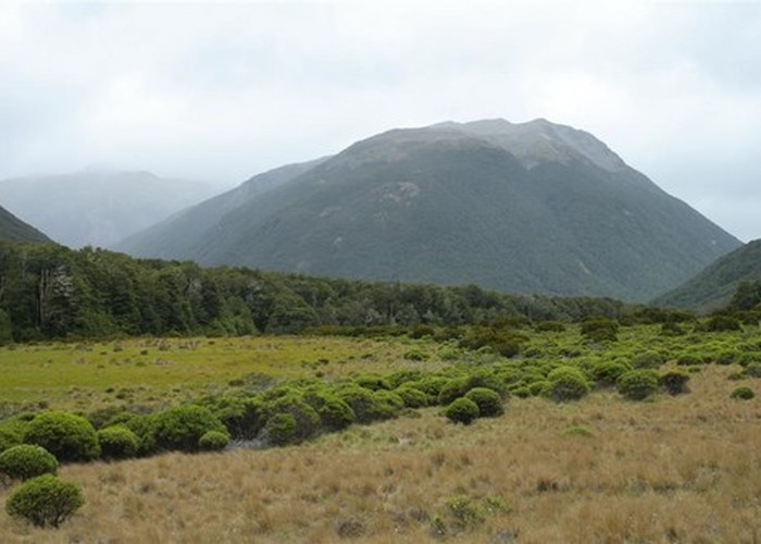
Fortunately this was the only band of bush lawyer. We needed to stop quite a few times for rests for Merv who was getting tired as the day wore on. Along the way up the slope I noticed a clearing to our left and upon investigating found it was an open boggy tussocked area, marked on the map as scrub. We moved onto this much easier travel for a 100m or so. I skirted the upper boundary for a lead further up but that was the extent so we reentered the forest and shortly after were at the foot of a rocky outcrop – possibly the reason for this open area which had running water.
A tantalizing slope ran across the outcrop but I ignored this rock scramble and skirted the base of the outcrop to its eastern side and climbed up onto the top of the rock. Others followed, with Frank and Merv having less of a challenge than Helen and I, having found better holds. We could see the bushline and I led via open areas along rocky leads till Frank told me to leave off the strategic zig-zagging and just to go there directly so I did. He went in front through reasonable vegetation to the bushline and the welcome of the open tops.
We skirted scrubby basins, sticking to lovely outcrops. The wind was still concerningly present and I checked lee areas for possible campsites though the water source was only from the tarns. I checked the outlet of one marked on the map and it was dry, being autumn now. Lower tarns were mainly dried out too. Frank and the others stayed higher while I tested potentially sheltered areas and decided one flat spot with carpet grass would be acceptable.
But they’d stopped at the eastern end of a bigger tarn which turned out to be reasonably sheltered. The former level of the tarn had created a foot-high dip to shelter the stoves from the wind and sit on the edge of it if desired. I found a spot with the least wind and Frank put the tent up while I started making a hot drink and dinner. Merv had taken his MSR whisperlite and with all the mucking around trying to prime it, it was no quicker than our little gas canister stove and a lot heavier to boot though cheaper to run perhaps though we don’t sit and let our stove boil away interminably unlike most people.
On that note, I observed that the other tent, a Macpac Minaret, flapped more than ours as it was pitched broadside to the wind. I stuffed anything spare e.g. my pack and boots, between our fly and inner to hold the walls apart as much as possible as it was a cloudless night so there would be condensation if the wind dropped. Which it did. My side was more sheltered from the wind too but flapping wasn’t an issue. We were plenty warm enough.
In the morning Frank woke as Merv and Helen began conversing and noted there was quite a bit of condensation affecting his gear on his side of the tent. I got up and made a brew and he joined us. Helen and I were keen to go to the summit of Castle Hill but the lads opted to stay with the damp tents and finish packing up in our absence.
Helen and I scooted up the hill, just carrying jackets. We got to the summit ridge via tussock and a pleasant completely consolidated talus slope. Helen took photos and we carried on to the high point, marked by a cairn. However her phone hadn’t updated our location and told her we were still short of the summit. As we were on the highest point I said she’d make a good pilot as she trusted her instruments over what her eyes were telling her. She got an update of our location which now informed her indeed we were on the summit!
We descended to the campsite and waited for Frank to finish packing as he’d had to wait for the tent to dry from all the condensation. We set off with Frank in front from the bushline, following his GPS line to the outcrop. I remembered most of the features such as the point of entry into the forest and how we descended from the outcrop. While sidling, Frank’s GPS dropped off his pack due to a carabiner’s getting damaged from all the bush-bashing the day before. Luckily I was right behind him and noticed it sitting on a wee hand-high ledge.
We followed Frank down through the open tussocky and boggy lead which he took advantage of by descending even lower than the day before. Then he sidled to the left and took us down to the festooning bush lawyer. He tussled through this lot but I skirted it as much as possible. We got down to the flat area and shoved our way through more open scrubby country and eventually to the spur we’d taken up initially from the river. Frank kept an eye out for where he’d broken the tips of beech saplings, indicating where we needed to leave the spur and take the steep route down to the shallow gully which we then followed to the river bank.
We settled in the sun for lunch but as we were finishing this, the sun moved on, and we realized we should have had lunch on the other side of the river though it would have been in wet boots. Then it was back up the reasonably pleasant gorge of Surprise Stream, onward to Casey Saddle, Hallelujah Flats and out to the car with nil of note.
Camping above the bushline at the tarns and summiting Castle Hill had been a magical experience with further hopes of returning to camp south of Green Hill and summiting that sometime in the future but from the shoulder of Mt Valiant with a less scrubby descent to Trust Poulter Hut instead.