Edwards River, Lake Guyon, Fowler Pass circuit
St James Conservation Area
- 3 days loop track with a road section
- Easy/medium
- Edwards River - McArthur Track, 2 days from Tophouse Road at Edwards River to the Lake Guyon junction
- Lake Guyon - Fowler Pass, 1 day from Lake Guyon junction to Fowler Hut on Tophouse Road
- Maling Pass - Moki Track, 1 day from Tophouse Road at Lake Tennyson to Lake Guyon junction
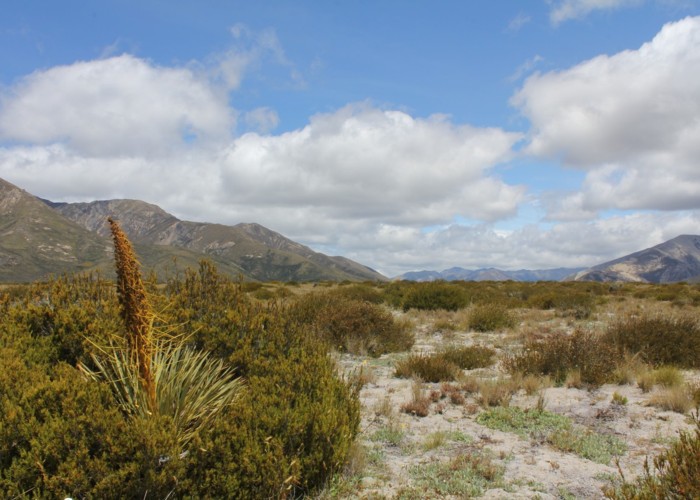
This circuit explores the southern portion of the St James Cycle Trail, explores the historic farm country around Lake Guyon and Stanley Vale, and skipping back to Tophouse Road over the rougher terrain of Fowler Pass.
|
Walking time
|
3 days
16 hr 30 min
|
|---|---|
|
Distance
|
58.8km |
|
Type
|
Loop track with a road section
|
|
Grade
|
Easy/medium |
|
Bookings
|
No bookings — open access
No — open access
|
|
Starts
|
Edwards River Track car park, Tophouse Road, north of St James Homestead |
|---|---|
|
Ends
|
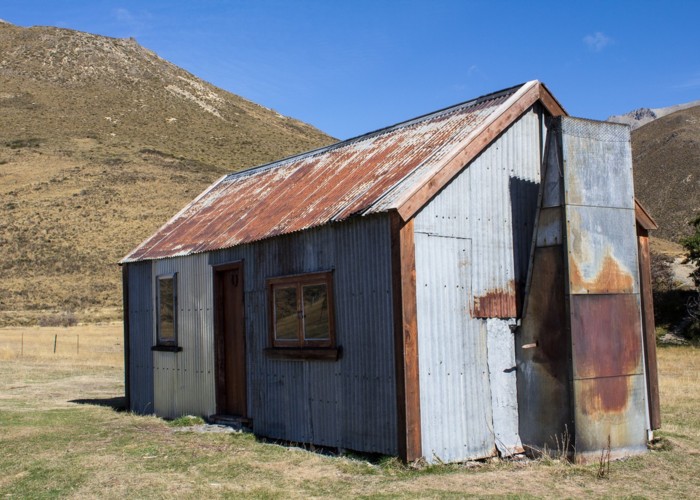
Fowlers Hut, Tophouse Road |
|
Maps
|
NZTopo50-BT24
|
|
Altitude
|
610m
–
1,289m
Altitude change 679m
|
This long circuit is dominated by cyclists on the first two days of the St James Cycle Trail. But the third day heads into rougher country where fewer cyclists venture. The circuit connects the river systems of the Waiau Uwha and Waiau Toa (Clarence).
This route has track ends that are 11km apart along the Tophouse Road. Close the loop by stowing a bicycle at one end, by swapping cars, or by hitchhiking along the road (north in the morning or south in the evening).
Access
Take the road out of Hanmer Springs over Jacks Pass. Turn off at the Clarence River and take Tophouse Road. The road is dirt and suitable for regular vehicles. However, it may be corrugated, and slow going. The St James Cycle Trail starts at the St James Homestead, which is nearby. The Edwards River car park is a little farther along, while Fowlers Hut is farther still, and obvious from the road.
The route
The track sections are described separately: