Green Lake / Lake Monowai Circuit
Fiordland National Park
- 3 – 5 days loop track
- Medium
This is a 3 to 5 day circuit from the Lake Monowai roadend to Green Lake and the western end of Lake Monowai. The circuit take in the shores of both lakes as well as climbing to the tops north of Lake Monowai providing beutiful views of the lake and the Fiorland Mountains to the west.
Sections of the circuit are unmarked routes or badly marked tracks so some route finding ability is required.
|
Walking time
|
3 – 5 days |
|---|---|
|
Distance
|
50.0km |
|
Type
|
Loop track
|
|
Grade
|
Medium |
|
Bookings
|
No bookings — open access
No — open access
|
|
Starts
|
Lake Monowai roadend |
|---|---|
|
Maps
|
NZTopo50-CE07
|
|
Altitude
|
200m
–
1,316m
Altitude change 1,116m
|
Lake Monowai roadend to Green Lake Hut
12.5km (4 - 6 hours)
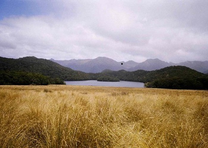
The track to Green Lake is signposted 500m before the Lake Monowai campground. The track is gentle at first, and desceptvely well maintained as far as the turnoff for Rodger Inlet after about 3.5km. Taking the right-hand fork to Green Lake, the track climbs increasingly steeply to the 974m pass below Mt Cuthbert with views of Green Lake. Green Lake Hut is at the far end of the lake, 4.5km beyond the pass.
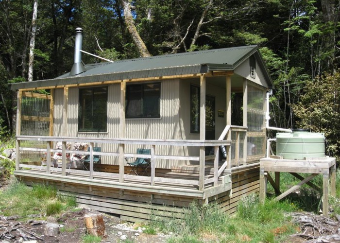
Green Lake Hut to Clark Huts
8km (2.5 - 5 hours)
From Green Lake the track climbs slightly, dropping to the clearing at Island Lake, and the junction with the track to the Borland Shelter roadend afyter about 1.5km. From this junction, the track becomes indistinct and continues about 150m inside the bushedge to an easy crossing of creek flowing out of Island Lake. Following the grassy flats is possible, but on reaching the stream, cut 80m downriver to pick up the track markers again.
From Island Lake the track is well maintained, and follows the river valley sides, crossing flats with copious deer-sign, before returning to the bush for the descent to the Grebe Valley. The track stays inside the bushedge alongside the Grebe until just before the Clark A-Frame, where the stream must be crossed. The hut gives good views down the tussock and marsh of the Grebe flats.
For those wishing to visit Historic Clark Hut, the turnoff is indistinct, but the easiest route is to leave the main track where the valley starts to flatten out 300m before reaching the Grebe flats. Follow the bearing indicated on the map of 190o: This will cross the stream, skirt the base of the hill on the true right, and recross the stream just on the bushedge, from where the hut is visible 1km across the flats on the same bearing.
Clark Hut to Monowai Hut
6.5km (2 - 4 hours)
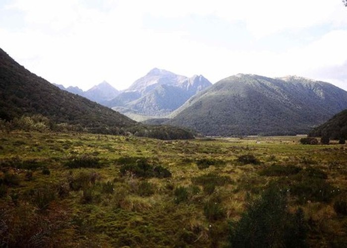
From Clark Hut, a well marked track runs through beech forest along the valley floor all the way to Lake Monowai. The track leaves Clark Hut, continuing up the valley to the south. It crosses a low, barely descernable saddle after about 1km before dropping steadily for the remainder to the walk to Monowai Hut on the shores of Lake Monowai.
Monowai Hut to Rodgers Inlet Huts
12km (5 - 10 hours)
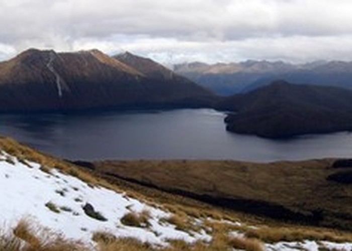
The section of the walk from Monowai Hut to Rodgers Inlet huts in mainly untracked, though good clear ridges make this a relatively easy route. The route below is a suggestion only: earlier ridges may provide good routes to the tops from Monowai Hut, and would avoid the tough sidle to Rough Point.
From Monowai Hut, follow the lakeshore east to the eastern side of the valley. Continue south on or above the lakeshore a further 1km to Rough Point (this sidle is the hardest part of the walk due to frequent fallen trees). At the stream crossing at Rough Point, a good ridge can be picked up by heading due east. This is the first ridge shown on the map on the true left of the side-stream. This ridge runs all the way to the bushline, swinging slowly east-south-east and proivides an easy route over first old scree, later mossy forest floor, and then tussock to the summit at pt1316 (2074500,5469250).
From the summit, the range heads south, skirting a large tarn on its eastern flank, before swinging south-east. Cairns and poles are picked up heading due east from pt1315 (2075250,5468250), and lead down the ridge to the bushedge, and a cut track to Rodger Inlet Huts. The first 100m of this track in the scrubby bushedge is hard to follow, but beyond this it is well marked as far as the hut.
Rodgers Inlet Huts to Lake Monowai roadend
11.5km (3 - 6 hours)
The track from Rodger Inlet Hut is at first well marked, as it follows the base of the hill beside the inlet. However, after about 1.5km it enters flats and intermittently follows the lakeshore and cuts through the grass / scrub / marshland beside it. On this section it is easy to miss the track as it leaves the lakeshore.
After leaving the lake the track is a clearly defined muddy trench through knee-deep grassy marshes and beech forest as far as the crossing of the Walker River. From the crossing, the track follows the eastern side of the Walker river for about 1km before swinging NE through marshes. This section of the track is very badly defined. A variety of old trail markers can be found heading along different routes, but none seem to be continuous or related. If, like me, you lose the track after leaving the river, head for the base of the hill shown on the map to the north of the track, which provides better going than the marshy valley floor. Following the base of this hill you will eventually pick up the track markers where it exits the marsh.
After leaving the marshy valley floor, the track is well defined and climbs slowly to the ridgeline and the junction with the Green lake track. The roadend is 3.5km easy walking beyond the track junction.