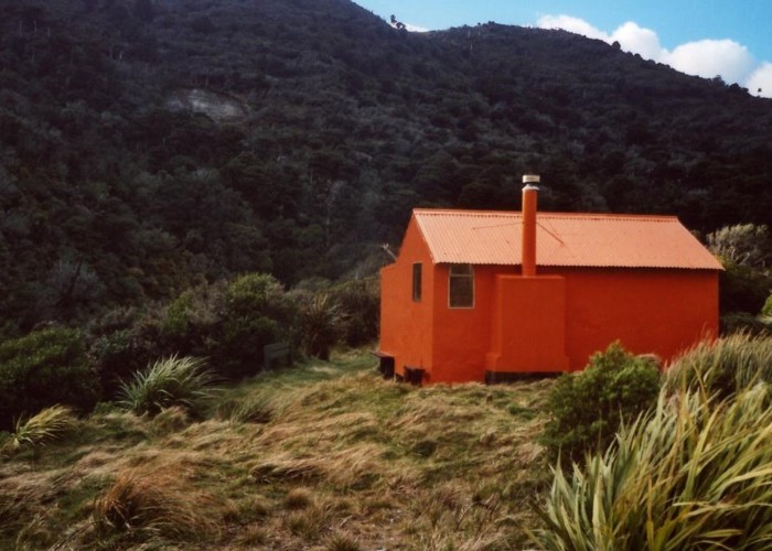
Cattle Creek Hut
Ruahine Forest Park
On river flats in the upper reaches of Cattle Creek lies Cattle Creek Hut (6 beds, wood-burning stove, firewood available in locality, tank water).
The hut lies about 200m (15 mins) below the ridgeline upon which the Tamaki West/Smithfield Hut to Makaretu track runs, so makes for a warming climb out in the morning! But a lovely, ocmfortable hut makes it all worthwhile.
Cattle Creek valley also provides access down to the Pohongina River and Mid Pohongina Hut.
Supposedly, the name of the creek comes from the fact that cattle farmers in the Dannevirke region used to drive cattle over the Ruahines via cattle creek and the Pohongina to reach markets in Palmerston. Think of that as you pick your way over boulders downstream!
|
Owner
|
Owner: DOC |
|---|---|
|
Category
|
Standard Hut |
|
Sleeps
|
Sleeps 6
6
|
|
Facilities
|
Toilet, Enclosed wood/coal burner |
|
Water supply
|
Tap or tank water |
|
Getting there
|
Tamaki West roadend (276820,611620): 9km track / river route(4-8 hours). Standfield Hut: 4km (2-4 hours) track Mid Pohongina Hut: 4km (2-4 hours) river route Makaretu Hut: 11km (5-10 hours) track with river xings Longview Hut: 20km (8-16 hours) track with river xings Leon Kirvig Hut: 13km (time unknown) track with river xings |
|---|---|
|
Unlocked
|
This hut is unlocked and open to access. |
|
Bookings
|
No bookings — open access
No — open access
|
|
Altitude
|
600m |
|---|---|
|
Mobile phone coverage
|
No coverage |
|
Maps
|
NZTopo50-BL36
|