Benmore Track
Korowai/Torlesse Tussocklands Park
- 3 hr return by the same track
- Easy/medium
- Car park to 4WD car park: 30 minutes
- 4WD car park to Benmore Hut: 1 hour 15 minutes
A short walk in Thirteen Mile Bush near Porters Pass, leading up to an NZDA hut.
|
Walking time
|
0 – 2 days
3 hr
|
|---|---|
|
Distance
|
11.7km |
|
Type
|
Return by the same track
|
|
Grade
|
Easy/medium |
|
Bookings
|
No bookings — open access
No — open access
|
|
Starts
|
Benmore Road off SH73 just west of the Kowai River Bridge. |
|---|---|
|
Maps
|
NZTopo50-BW21
|
|
Altitude
|
526m
–
859m
Altitude change 333m
|
Benmore Hut is one of the closest backcountry huts to Christchurch. It's a short walk in to an easily overlooked pocket of bush beneath Ben More, next to Porters Pass. This walk would make a good introductory trip, although the track is not maintained to the standard of tracks around Craigieburn Forest. It is quite muddy in parts: boots and waterproof pants for small children would be a good idea. The hut is owned by the NZDA but is free to use. There is also some space for a tent outside.
To find the start of the track, head toward Porters Pass from Springfield and cross the single lane Kowai Bridge. The road is on the left about 4km on. It is marked by a few trees and looks like a farm driveway, which indeed it is. There is a small DOC access sign here. Follow the road to Ben More farm, turn right and follow signs past farm buildings to a muddy car park. The drive is suitable for regular vehicles.
From the car park, a 4WD track heads off along the scrubby terraces of Thirteen Mile Bush Stream. After 30 minutes of farm walking, you cross the Kowai River at a shallow ford, and come to the second car park, where 4WD vehicles stop.
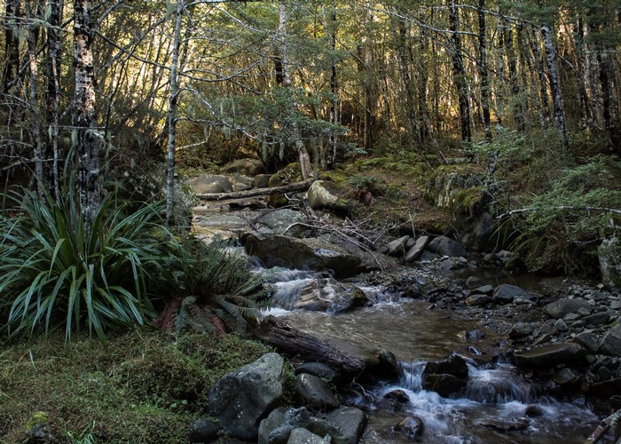
Over a stile, a poled track leads up the stream and along a fenceline. A tongue of beech forest starts up over the stream: this is the edge of Thirteen Mile Bush, part of Korowai / Torlesse Tussocklands Park. The track crosses the dwindling stream a couple of times, pushing under a fence and into into beech forest. It starts an earnest climb through forest sprinkled with totara trees. Bellbirds and flocks of brown creepers move around the branches.
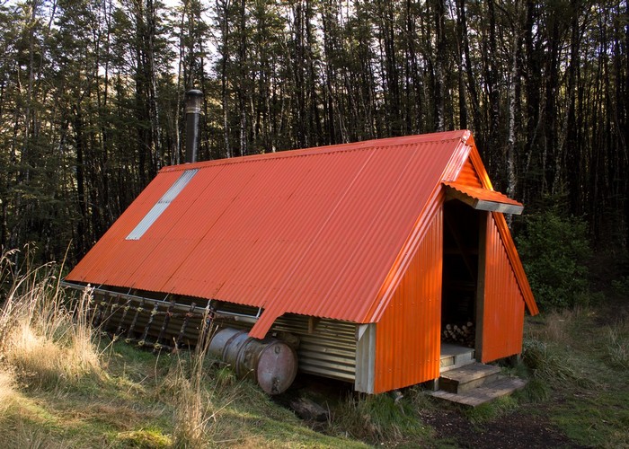
The hut is situated on a forested saddle, with a very slim view down the valley toward Mount Oxford. The hut is freshly painted safety orange, with a steeply pitched roof and a small rain barrel. Inside are two sacking bunks and a wooden platform bunk, all with mattresses.
Two distinct tracks lead away form here. One on the south side of the hut leads up a spur toward Ben More, while another behind the hut leads straight down to the head of the northern tributary of the Selwyn River.