
If you ignore the brutal desolation of the forestry carrying on in the foreground, the views from the summit are very good. A longer circuit, which passes through beech forest, is possible from the Grey River Picnic Area. The route described here is less scenic but considerably shorter, an easy walk onto tops conveniently near Christchurch. It would serve as a good introduction to the tops environment for beginning trampers.

Access
Ashley Forest is largely plantation pine forest with active forestry occuring. Sometimes there may be no access, while at other times logging vehicles may be present on roads — exercise caution! There have also been occasions of cars being inadvertently locked in, so it might be wise to pack a cellphone.
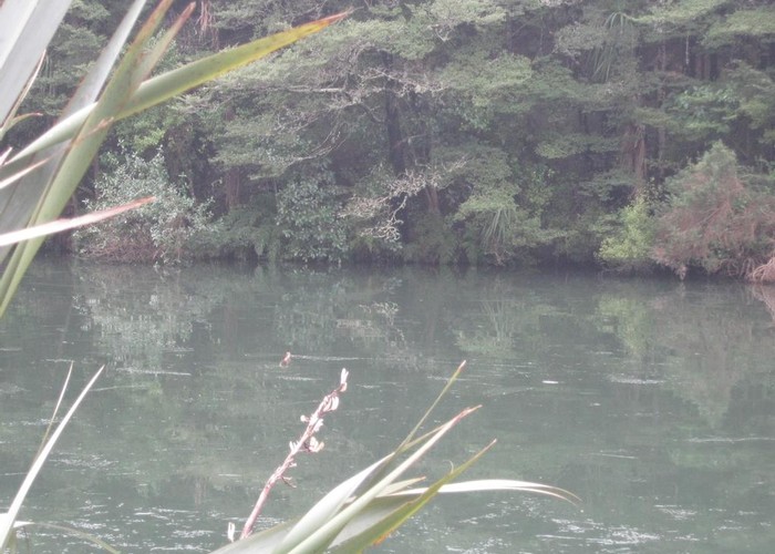
From Amberley, take Douglas Road west. It becomes unsealed and enters the forest, merging into Cramptons Bush Road. The road winds through ugly pine plantations and uglier clearfelled hillsides, climbing eventually to the tiny Lake Janet. The lake (well, pond) is an oasis of native bush alongside silver birches and other exotics. Bellbirds, fantails, and tits are all common around its edges. A walking track (marked charitably as "5 minutes" — it's more like two) encircles the lake. Short, but worthwhile.
Lookout Track: 45 minutes, easy-medium
Take the marked Lookout Track to the left of Lake Janet into tall Oregon pine forest. The trail soon crosses (as at 2003) a clearfell clearing and proceeds to climb directly up the hillside. This is the only steep section, however. The track flattens off and passes a side track to the Grey River Picnic Area. Switching back on itself, the track continues as a very gentle benched zigzag through pine forest, then broom-covered hillside, merging into alpine vegetation as it nears the fire lookout. At 795m, the lookout building looks rather like a budget model airport control tower. Good views from here.
Lookout to Mount Grey summit: 45 minutes, easy-medium + tops
Beyond here, there are three ways to proceed:
- Follow the road which winds along the western slopes up to the transmitter complex near the summit.
- Follow the poles along the ridge line. This is probably the best route.
- Follow the rather poorly marked but perhaps once-upon-a-time official route. Here's how: Locate the track on the rise behind the lookout. Follow it until you lose it, then keep on a minute or so until you meet the road. A set of steps climbs up off the road on the other side. Follow these into a wilderness of broom until lost and confused. Sidle more or less level along the hillside. If you lose the track you might be better off to clamber up to the ridge. Further along, the track passes through some very pretty pockets of beech forest. The northern end of this track is much easier to locate, so it would be a better choice for the return journey.
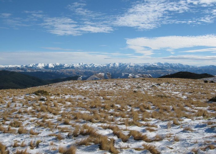
One way or another, you soon pass the large transmitter station. The next small saddle marks a track junction, with the track from the Grey River rising to meet the ridge line. It's a short climb up to the summit and trig (933m), where the views open out into a full 360 degrees. North is the pastoral landscape around Harwarden. Just ahead and to the northeast is the Waipara River. Beyond are the high peaks of the Kaikoura Ranges. Amberley is to the east, while back to the southeast is the curve of Pegasus Bay and the eroded caldera of Banks Peninsula. Inland is the long white line of the Puketeraki Range, and in the foreground the golden top of Mount Thomas.
The return journey is about one hour.