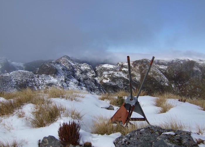
Mount Bovis
Paparoa National Park
- 6 hr – 8 hr return by the same track
- Medium/hard
Day trip to a 1252m summit off the Paparoa Range behind Bullock Creek farm.
|
Walking time
|
1 day
6 hr – 8 hr
|
|---|---|
|
Type
|
Return by the same track
|
|
Grade
|
Medium/hard
Multiple uncut treefalls down length of track as of early 2016.
Jan.2022 still treefalls in lower part of track but lots of new orange triangles and some pink tape to assist. Grades explained
|
|
Bookings
|
No bookings — open access
No — open access
|
|
Starts
|
Track begins at the last paddock along Bullock Creek |
|---|---|
|
Maps
|
NZTopo50-BS20
|
|
Altitude
|
120m
–
1,252m
Altitude change 1,132m
|
Jan 2022: Topomap shows tarn at 1020 contour due south of main peak; great spot for camping. We've reached it by leatherwood-basing around south side of Mt Bovis around 900m contour., whch made it a 10h day from roadend. If you're keen, you might want to try at 800m contour to avoid most of the leatherwood.
Have also placed some cairns from tarn of to saddle east of Mt Bovis (allow 30-45min), but unfortunately not found a safe route up east ridge of Mt Bovis. Some steep scrambling seems required.
Note lower end of Mt Bovis track has much regrowth (ferns etc) obscuring track, so watch for orange markers around treefalls. Sometimes pink tape is used, but occassionally this appears to indicate pest monitoring locations.
There's no water on main track after crossing first stream (10-15 minutes into bush from grasslands) but there is a small tarn 50m south of last ridge before peak (around 1150m elevation)