Table Ridge
- 4 hr – 5 hr 30 min one way
- Medium
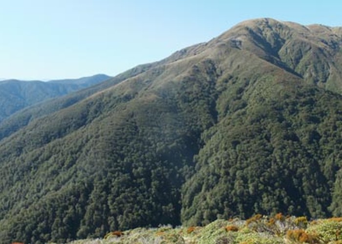
Located in the upper Waingawa valley - Tararua Forest Park. Route over the Table Ridge tops between Cow creek and Arete Forks. From the ridge top Table Ridge can be easily traversed to Brockett and then over Mitre of west to Tarn Ridge Hut over Girdlestone. The photo shows the route down from Table Top to Arete Forks hut.
|
Walking time
|
1 day
4 hr – 5 hr 30 min
|
|---|---|
|
Distance
|
8.5km |
|
Type
|
One way
|
|
Grade
|
Medium
Steady climb from Cow creek or Arete Forks to the top of Table Top Grades explained
|
|
Bookings
|
No bookings — open access
No — open access
|
|
Starts
|
Cow Creek Hut |
|---|---|
|
Ends
|
Arete Forks Hut |
|
Maps
|
-
|
|
Altitude
|
500m
–
1,478m
Altitude change 978m
|
The route is an alternative to using the Arete Gorge Sidle track between Cow Creek hut and Arete Forks hut.
Climb the spur leading up to Table Top that the Arete sidle track follows until it begins sidling upriver. (about 30 - 45 minutes climb) A well marked track follows the ridge to the bush line. Climb the tussock spur to the ridge top and then along to Table Top. (This can take 3-4 hours steady walk from Cow Creek) There is a small saddle on the way. At the Table Top Summit there is a cairn. The spur down to Arete Forks leads northwards down a long open spur to the bush line. A few cairns on the way. Inside the bush edge, the route is marked down to Arete Forks. Follow the white permolat markers down to where it joins the Arete Gorge Sidle track up from Cow Creek. The hut is a further 5 minutes on a well marked track down to a bush terrace at the junction of the Waingawa and Arete Stream.