Red Hill
Korowai/Torlesse Tussocklands Park
- 5 hr loop track
- Medium
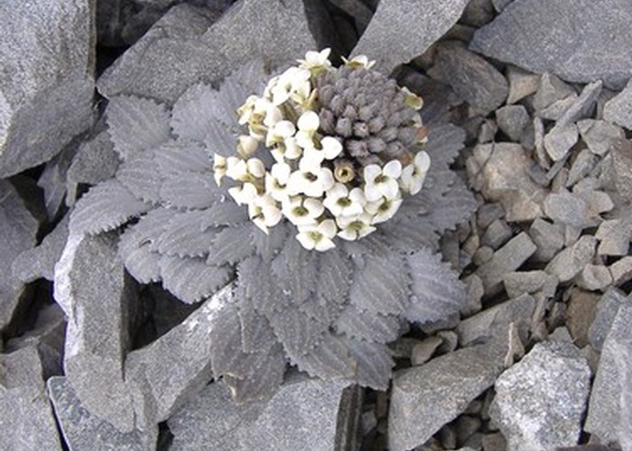
A largely untracked route up Red Hill (1,641m), with magnificent views of Lake Coleridge, and the surrounding foothills. This loop is notable for the variety of alpine flora.
|
Walking time
|
1 day
5 hr
|
|---|---|
|
Distance
|
10.0km |
|
Type
|
Loop track
|
|
Grade
|
Medium |
|
Bookings
|
No bookings — open access
No — open access
|
|
Starts
|
Lyndon Road, 4.9km west of SH73 |
|---|---|
|
Maps
|
NZTopo50-BW20
NZTopo50-BW21 |
|
Altitude
|
815m
–
1,641m
Altitude change 826m
|
Beyond Porter's Pass, turn off SH73 at Lake Lyndon onto the Lyndon Road. Follow the road around the lake and past a small hill. Turn off into the field on the right immediately after the hill (this is the first open space on the right 4.9km from the highway turn off).
From here, the route is not marked, so is somewhat improvised. There are several return options including back the way you came. The route here forms a small loop. Allow 3 hours up and 2 hours down.
A 4WD track leads up the valley alongside a small stream. Follow it, taking the northern branch where another stream meets from the left, and watching for the patch of forest in the distance. Cross a fenceline on the left, dodging matagouri and head into the dry basin toward the patch of forest east of Red Hill. The dry beech forest is encountered about 40 minutes from the car park; locate a vague trail leading up the true left side of the valley floor. Beyond the forest, a trail remains on the valley floor, passing through turpentine scrub.
Beyond a forested gully, a large scree basin opens out on the left. Look for a rocky outcrop on the skyline and climb up towards it. The climbing is easy, with snow totara, celmisias, cushion plants, gentians, as well as alpine cicadas, grasshoppers, kea and pipits to keep you company. From the outcrop, it's a few minutes' climb to the saddle (2 hours from the car park), with nice views down to Coleridge Pass.
The scree of the saddle features distinctive "sorted stripes" with smaller and larger stones forming bands that lead down the hillside. This pattern is caused by frost heaving, with ice forming under the scree forming mounds; the larger stones topple off to the sides, while the smaller stones remain in place.
Sidle toward Red Hill to the southwest and climb the scree to the summit (3 hours from the car park). The black daisy flowsers of Leptinella atrata are notable on the way up, along with the pretty pink foliage of Epilobium pycnostachyum.
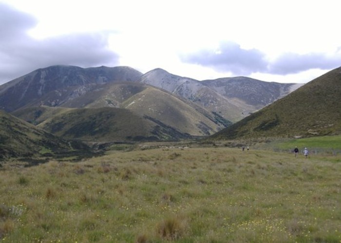
From the summit, there are sweeping views down to Lake Coleridge and the Rakaia River, along with a complex glacier-sculpted landscape of moraine, kettle lakes and roches moutonnée. To the northeast, the valley of the Porter River leads toward Castle Hill visible on the valley floor far balow. Foggy Peak (1,741m) is visible on the Torlesse Range further east, and Ben More (1,655m) on the Big Ben Range is to the southeast.
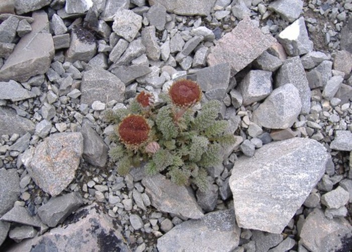
To descend, follow the ridge southward for a few minutes before dropping down a scree (or picking your way down through tussock and spaniard) to the spur at 1,321m. Look for penwiper plant, Stellaria roughii, and Lobelia roughii on screes near here. Follow the ridge of the spur, which soon becomes an easy amble. Eventually it steepens, and a scree on the right leads downward easily. Head across the tussockland to the main route up the valley, trying to avoid the matagouri and the remaining spaniards. The final clamber over little streams, fences and gullies seems to take too long. Time down is about 2 hours.