Pudding Hill Stream Route
Hakatere Conservation Park
- 3 hr 15 min one way
- Medium
- Scotts Saddle to Pudding Hill Stream: 45 minutes
- Pudding Hill Stream section: 2 hours
- Pudding Hill Stream to Awa Awa Rata Reserve: 30 minutes
Unmarked route along Pudding Hill Stream in Mount Hutt Forest. Combine this route with the Scotts Saddle Track for an interesting circuit.
|
Walking time
|
1 day
3 hr 15 min
|
|---|---|
|
Distance
|
7.0km |
|
Type
|
One way
|
|
Grade
|
Medium
The route downstream is unmarked, with many river crossings, perhaps thigh deep. These crossings may be challenging in spring melt, or in rain. Grades explained
|
|
Bookings
|
No bookings — open access
No — open access
|
|
Starts
|
Near Scotts Saddle, Mount Hutt Skifield Road. |
|---|---|
|
Ends
|
Awa Awa Rata Reserve, McLennans Bush Road, Pudding Hill. |
|
Maps
|
NZTopo50-BX20
|
|
Altitude
|
520m
–
1,080m
Altitude change 560m
|
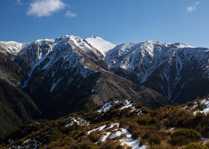
This shady and untracked stream drains the slopes of the Mount Hutt Skifield. For a day walk at the edge of the foothills, it feels surprisingly remote. While the lower reaches of the stream are relatively easy walking, the upper sections involve some straightforward clambering.
The top and bottom of the streambed route are both marked by discreet cairns. If you are walking downstream, this won't be a problem as the stream leads out onto farmland if you miss the turn off.
Starting out
Take the Scotts Saddle Track from Awa Awa Rata Reserve up to Scotts Saddle on the Mount Hutt Skifield Road. From here, cut across to the next rightward bend just up the road. Look for the track on the spur here. It is not signposted, but there are marker poles.
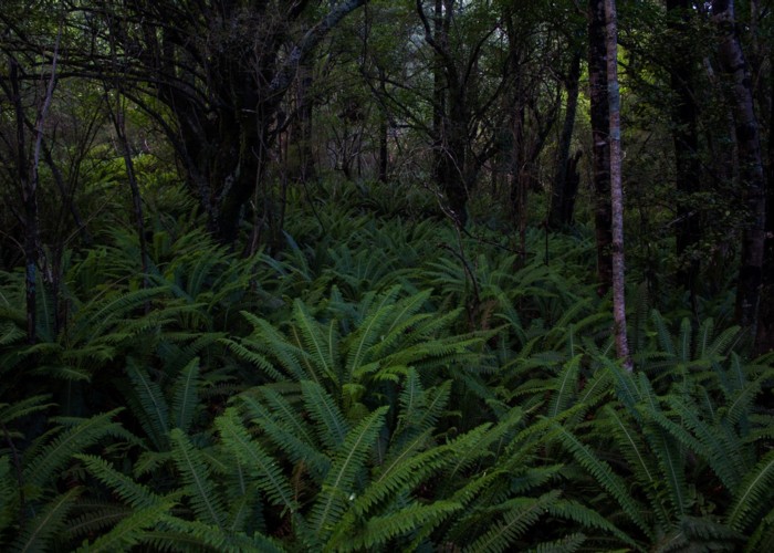
Dry section
A very pleasant track drops along the scrubby spur to the forest edge in about 10 minutes. It plunges into beech forest on a slightly overgrown but surprisingly tidy track. There are occasional steps and markers along the way. after 25 minutes, the track crosses a small stream, and fumbles around for a bit in some grasses. Look for the triangular markers. It soon opens up again to an easy descending sidle before dropping quickly to Pudding Hill Stream. A discreet cairn and small orange marker marks this point on the true left bank.
Wet section
Pick your way downstream for about 30 minutes, over rocks, with several crossings, to a gorged section. This ends where two side streams meet from opposite banks. There are grassy terraces here on both banks, with the true right terrace featuring a small stone fireplace.
After another brief narrowing, the stream opens out, and some larches are visible on the ridge to the true left. From here, the river is easy, with good flats.
Look for a stream on the true right, followed by forested flats on the left. A couple small cairns here mark the exit point. An inordinately well benched forest track leads up and over the low ridge to meet the Alder Track. From here it's a 20 minute stroll to the car park.