Mount Herbert: Monument Track approach
- 2 hr 45 min return by the same track
- Easy
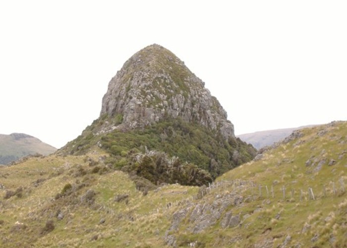
A farm trail past an historic hut and a lava dome, up to the summit of Mount Herbert / Te Ahu Patiki (919m).
2 members favourited
|
Walking time
|
2 hr 45 min |
|---|---|
|
Distance
|
10.0km |
|
Type
|
Return by the same track
|
|
Grade
|
Easy |
|
Bookings
|
No bookings — open access
No — open access
|
|
Starts
|
Saddle, Purau Port Levy Road |
|---|---|
|
Maps
|
NZTopo50-BX24
|
|
Altitude
|
420m
–
920m
Altitude change 500m
|
Note: this track is closed for lambing from 1 August to end October.

From the 420m saddle between Port Levy and Purau, take an old farm road past the striking "Monument" lava dome. Nearby is the little Monument Hut emblazoned with the letters "YHA."
Onward, the ill-defined route climbs to Trig zz (913m) before continuing on to Mount Herbert.
The shelter is located about 1km past the summit on a saddle to the southwest.
ID 1128
About this track
135 views in the past year (11 per month).