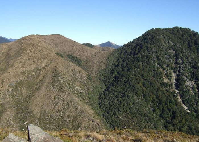
Edge of Nelson Mineral Belt May 2014

This photo taken from Windy Point on the Dun Mountain Walk/Cycleway looks South West. It was taken to illustrate the edge of the mineral belt reflected by the change in vegetation cover. The almost straight line boundary runs through the saddle between Blue Knob which is covered in beech forest and the 30m lower Mount Claude which is treeless. Soil toxicity in the mineral belt causes an absence of trees or stunted growth.
I think the summit in the distance showing through the saddle is Mt Malita.
Comments
-
 glennj The satellite view of the attached map gives a clear view of the mineral belt in this area represented by the lack of tree cover.
15 May 2014
ID 10173
About this photograph
License
All rights reserved
30 views in the past year (3 per month).