Old Ghost Road
- 4 – 5 days one way
- Medium
- Bookings required
A four or five day tramp from the Lyell Campsite(off SH6 in the Buller Gorge) to the Mokihinui road end (off SH67 near Seddonville). This trip uses the Mokihinui-Lyell-Backcountry-Trust (MLBT) cycle trail and at the time of writing (end of Nov 2013) includes about 24km of unformed marked route (suitable for experienced trampers with route-finding skills). Over the next 12-18 months this section will be upgraded to cycle trail standards, which will alter the estimated tramping times given. DOC has information on their website (refer links below) but the most up-to-date information on track conditions will be on the MLBT website.
|
Walking time
|
4 – 5 days
22 hr – 35 hr
|
|---|---|
|
Distance
|
80.0km |
|
Type
|
One way
|
|
Grade
|
Medium
The cycle trail sections at either end are easy.
The 'completely unfinished' middle section is difficult. Grades explained
|
|
Bookings
|
Bookings required
Required
There are four Trust huts on the track that need to be booked. Three of them have separate 4-bunk sleep-outs.
|
|
Starts
|
Lyell Campsite off SH6 in the Buller Gorge. OR... |
|---|---|
|
Ends
|
Mokihinui Road-end off SH67 near Seddonville |
|
Maps
|
NZTopo50-BR22
|
|
Altitude
|
100m
–
1,350m
Altitude change 1,250m
|
|
Link
|
www.oldghostroad.org.nzwww.oldghostroad.org.nz |
|---|
Day 1: Lyell Campsite to Lyell Saddle Hut. 18km 4-6 hours
Gentle uphill all the way to the Hut. One narrow section of the track traverses a slip and the Trust has erected gates at either end as a warning to cyclists to dismount. An attempt has been made by the track makers to achieve a very comfortable 1 in 5 gradient with 10% variation. Over the course of the mountain bike track most likely the hardest thing for tampers will be the hard metal (rock/gravel) underfoot.
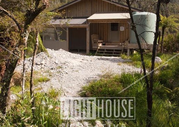
Lyell Saddle Hut(s) comprise a the main hut with 6+4 single bunks and two smaller huts with two twin bunks. The smaller huts are cosy without heating.
{{Lyell Saddle Hut}}
Day 2: Lyell Saddle Hut to Ghost Lake Hut 12km 3-5 hours. Ghost Lake to Stern Valley Hut 11km 4-6 hours
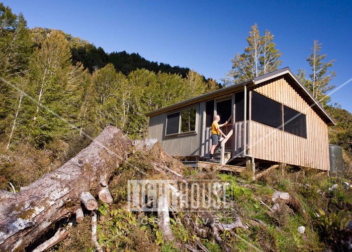
Continue the gentle climb to Ghost Lake Hut (bunk numbers with two smaller chalets similar to Lyell) which is situated in an outstanding position above the small lake with features great views North to the Lyell Range and beyond.
{{Ghost Lake Hut}}
From here, there is only a roughly 'marked route' which descends sharply down a steep spur then climbs back up to the ridge with easy travel through scrub before descending again steeply to Stern Creek. Although it is well-marked, the route here is through bush that is quite thick at times. Minimal clearing of the unformed route has been undertaken so keeping sight of the track markers is essential. One cannot yet ride or carry cycles through this middle section.
{{Stern Valley Hut}}
Day 3: Stern Valley Hut - Goat Creek Hut 13km 4-7 hours - Mokihinui Forks Hut 8.5km 2-3 hours.
Travel up-valley heading North on a tributary towards aptly-named Solemn Saddle. Trampers can take the marked route in a direct line to the saddle (to the West of Lakes Grim and Cheerful (the proposed cycle trail alignment is to the East and marked with poles (avoid following this direction). There is a poled route which will eventually cross the slip face to the east of the trampers route which will also lead to the Saddle.
Steep climbing and sidling in heavy brush will achieve the Saddle. From there the route descends to Goat Creek after a traverse, sidle, and descent through bush lawyer. (Long pants and long sleeves, plus gaitors are recommended.) Watch out for dozens of goats!
From crossing Goat Creek, an old permolat spur track is tarversed through open beech to meet the formed cycle trail in the valley. (Do NOT follow pink tape, which is probably marking a possible cycle trail alignment. Stick religiously to the orange triangle markers.)
About 1.5km brings you to the rustic, 4-bunk Goat Creek Hut (DOC) which is sited off the cleared cycle trail across Goat Creek about 500m before the junction with the Mokihinui River.
Note that the hut’s position is not sign posted. Following the cycle-way from Goat Creek about 1km, cross the Mokihinui River. Until the bridge is built here, it is not obvious how to connect onto the cycle trail on the west bank. It's downstream some 20m.
Follow this cycle trail to Mokihinui Forks Hut (DOC). The hut has been extended and now accommodates 10. (During late 2013 it is being used by the track builders.)
{{Mokihinui Forks Hut}}
Day 4: Mokihinui Forks Hut - Mokihinui Road end 19.5km 5 - 7.5 hours
An easy day following the Mokihinui River gorge, first to the remarkably-sited Specimen Point Hut (MLBT) (10) plus Red Queen (4) and Rising Star (4) sleep-outs.
{{Specimen Point Hut}}
Onward, to the end of the cycle trail at Mokihinui Road, traversing spectacular gorged river walls with bridged crossings of brutal gullies and spectacular views.