Cave Creek / Kotihotiho Track
Paparoa National Park
- 3 hr 30 min return by the same track
- Easy
Scenic walk to the resurgence of Cave Creek.
|
Walking time
|
3 hr 30 min |
|---|---|
|
Distance
|
2.0km |
|
Type
|
Return by the same track
|
|
Grade
|
Easy
Sinkholes near track. Take care with children. Grades explained
|
|
Bookings
|
No bookings — open access
No — open access
|
|
Starts
|
Car park, Bullock Creek Road, Punakaiki |
|---|---|
|
Maps
|
NZTopo50-BS20
|
|
Altitude
|
40m
–
120m
Altitude change 80m
|
This track explores the diverse karst landscape inland from Punakaiki. Cross the Pororari River and take Bullock Creek Road under beautiful limestone cliffs to the start of the track in a boggy clearing dotted with rimu trees. The road is gravelled, and suitable for standard cars. If you are on foot, it is a pleasant and scenic walk along the road, with a return option via the Inland Pack Track and the Pororari River.
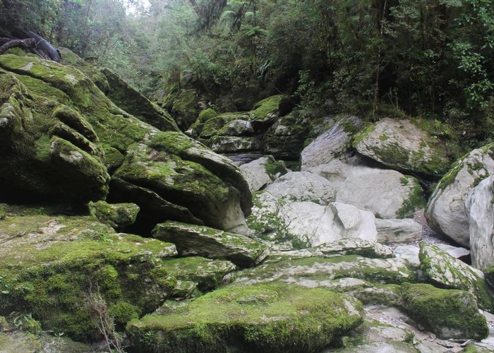
From the clearing, a marked track meets the Inland Pack Track, following it through scrub for awhile then bending off to the left, past young rimu and kanuka. Soon the track drops down some steps into the gorge of Cave Creek itself. Up the creek are some warning signs, a large pile of boulders, and just beyond, the cave entrance itself. This is the Xanadu cave system, connecting with the sinks along Bullock Creek. It is not safe for general entry.
Here on 28 April 1995 a viewing platform over Cave Creek collapsed, leading to the deaths of 14 staff and students of a local polytechnic. The platform was found to have been faulty in construction, and this led to an overhaul of standards of practice inside the Department of Conservation.
Further reading: