Lake Wilson and the Valley of the Trolls
- 2 – 3 days return by the same track
- Medium
An overnight or multiday scenic diversion from the Routeburn Great Walk. The Valley of the Trolls is easily accessed from Harris Saddle and provides overnight camping for those wanting to get away from the crowds, while Lake Wison provides stunning alpine lake vistas with numerous peaks to climb.
|
Walking time
|
2 – 3 days
5 hr – 9 hr
|
|---|---|
|
Distance
|
13.0km |
|
Type
|
Return by the same track
|
|
Grade
|
Medium
Snow may be present into Summer in the south facing gut used to climb to Lake Wilson. An iceaxe and crampons/bootchains should be carried. Any attempt to climb Mt Erebus will require iceaxe/crampons late into summer. Grades explained
|
|
Bookings
|
No bookings — open access
No — open access
|
|
Starts
|
Routeburn Shelter, Queesntown end of the Routeburn track. But you could also add this trip onto a South-North walk of the Routeburn from The Divide, or from the Caples/Greenstone circuit, or even from the Five Passes route if coming over North Col. |
|---|---|
|
Ends
|
Harris Saddle. Which direction you take from here is up to you and your plans. It is also possible for experienced parties to head north from Lake Wilson to North Col via the Serpentine Range, but that is not covered here. |
|
Maps
|
NZTopo50-CB09
|
|
Altitude
|
1,434m
–
480m
Altitude change -954m
|
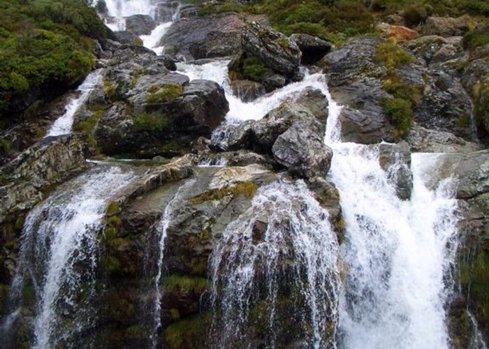
From the Routeburn Shelter the Routeburn track is followed all the way to Harris Saddle. Being a Great Walk highway, speedy travel can be achieved. It takes about 2 hours to reach Routeburn Flats where the Routeburn Flats hut is located a short detour of the main track. There is a picnic table here which is a great spot for lunch looking up the north branch of the Route Burn. The track now climbs up to Routeburn Falls which are reached in another hour. If this is your first time on the Routeburn it is well worth dropping off your packs and admiring the waterfall. The southern most falls can be accessed in their gorge for a chilly swim by climbing down to the river behind the helicopter pad.
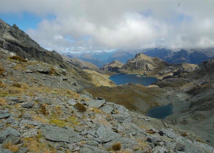
Continuing on, the track climbs steeply up past the falls and then climbs up and around a large alpine valley, at the top of which lies Lake Harris. It takes about an hour and a half to reach here and travel through the bluffs over looking the lake. At the top of the lake a low valley is clearly visible, this is the Valley of the Trolls.
To reach the Valley of the Trolls you need to be just past the Lake Harris bluffs where the ground just starts to open up on the southern side. You wont have reached the Harris Shelter yet, which is a couple of hundred metres away just out of site. Instead leave the track and head northwest, straight for the southeastern flank of Conical Hill. At the edge of the hill you'll be looking down a steeply sloping bank which drops all the way down to Lake Harris. Descend down this bank, near the bottom of which you might find a blue DOC triangle and a pest trap. This is the start of a DOC trapping line which runs right around the western shore of Lake Harris and on into the Valley of the Trolls. A light ground trail marks the trapping line, generally at or close to the waters edge, and it is this you follow around the lake. Travel is slow but not difficult, it takes about 45-60 minutes to get around the lake to the entrance of the valley. Theres flat ground for camping here by the Route Burn river mouth as it flows into Lake Harris.
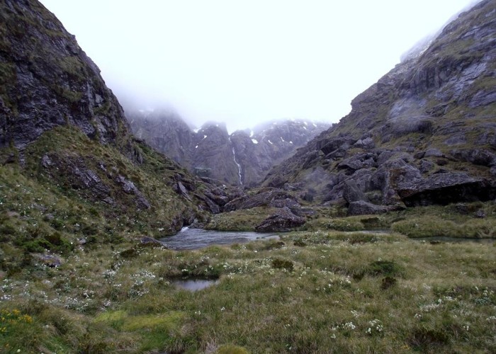
To carry on into the Valley of the Trolls, stay on the True Right of the Route Burn and climb up and through the boulders that guard the valley entrance. There is a small rock bivy located in among the boulders, it might hold 3 people somewhat uncomfortably. Once around the last boulder the valley opens up as a swampy grassland which is squelchy underfoot but not difficult to cross. Despite the abundance of boulders around there is precious little shelter from where to camp in the valley if theres a cold northerly wind blowing down from above. The flat land is boggy, the valley head is rough underfoot. There is a good bivy located about halfway up the valley on the western side, about 40 metres above the valley floor. You would fit about a dozen people under the overhanging cliff here in various degrees of shelter from a down valley wind, and theres room to pitch a couple of tents. Theres no water source here though so carry all the water you'll need for the night with you before the steep climb up! It takes about 30 minutes to reach this bivy from the entrance to the Valley of the Trolls.
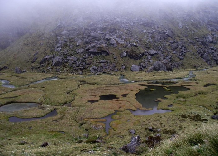
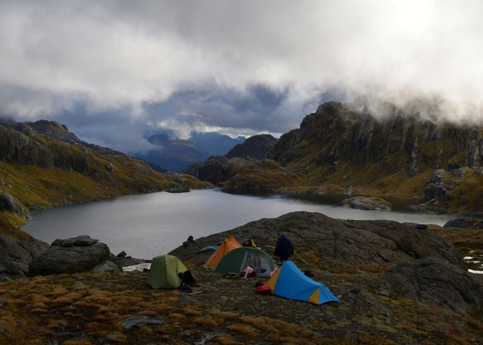
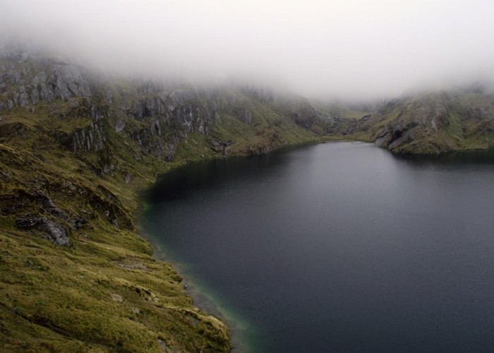
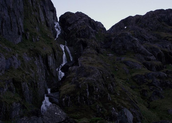
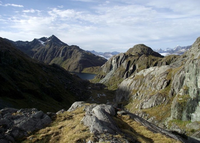
To reach Lake Wilson, make your way up to the head of the valley, crossing over to the True Left of the Route Burn a short distance from the falls. An obvious grassy glass climbs up the hill parallel to the falls, which is the route to lake Wilson. The gut is steep but not too difficult. About half way up a nasty rocky step is required to be climbed up. The upper reaches of the gut were snowbound in early January and probably stays this way into February, I used an ice axe and boot chains to navigate my way up this. At the top of the gut a rocky shelf runs south-north, its southern end providing a magnificent view over the Valley of the Trolls towards Harris Saddle and the peaks around, while at the northern end of the shelf lies Lake Wilson. There is camping here above the lake outlet with a fine view up the lake if somewhat exposed to northerly winds blasting down the lake. It takes about 60-90 minutes to reach here from the Valley of the Trolls.
Another possible route for reaching Lake Wilson would be to follow the stream which flows down to the Valley of the Trolls from the north flank of Mt Xenicus on the topo map. At about the 1400m contour leave the stream and climb northwards to gain the ridge line running southeast from point 1578. There is camping on flat patches along this grassy ridge but locating water might be a problem. The views from here are outstanding.
What to do at Lake Wilson? The two obvious suggestions are a tour of the lake, and a climb of Mt Erebus. Summiting Mt Xenicus is also a possibility but it looks a much more serious challenge then Erebus.
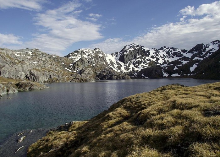
The outlet is easily forded, its barely over the tops of your boots, and from the western shore of Lake Wilson Peak 1647 is easily climbed and the ridge line north as far as Peak 1680 followed. There is flat ground fro camping near the small island on the western shore and also near the small lake that lies northwest of 1647. The ever changing vista of Lake Wilson remains superb throughout.
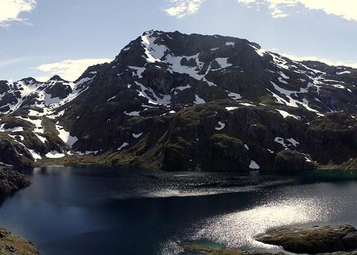
The southern approach of Peak 1680 is rocky and tricky, some route finding trial and error is required, but the view from the top is rewarding. Drop down the steep northern flank of the peak to the saddle between 1680 and 1772, from which a steep slope provides a short glacade (you brought your iceaxe along, right?) to the flat ground at the head of the lake. In January 2013 there was a lot of snow around up here but it looks quite different later in summer and there appeared to be pleasant camping near two streams which flow into the lake at CB09 180389 and CB09 182388. Pass under the western flank of Mt Erebus at about 1550 metres to gain the flatish land at point 1578. From here the ridge line that runs southeast is easily followed back down the lake outlet. A circuit of the lake takes at least 3 hours and could last all day depending on how many of the peaks you feel like climbing. Theres good swimming in the lake near the outlet.

Climbing Erebus can be done by at lest 3 different routes. Two go up the western flank from point 1578, the third route goes up the stream that runs down from the north side of Mt Xenicus. This stream goes all the way up to just below Peak 1829 from where you'll follow the ridge line around the east flank of Peak 1821 and then all the way up to Erebus. I went up the west flank and down via this stream route, but again snow makes things difficult. You'll almost certainly need an iceaxe. The views from the top are splendid You'll need about 4 hours for the climb up and down.
To leave Lake Wilson, follow the route you took to get up here via the Valley of the Trolls to reach Harris Saddle. It takes about 5-8 hours to return to Routeburn Shelter.